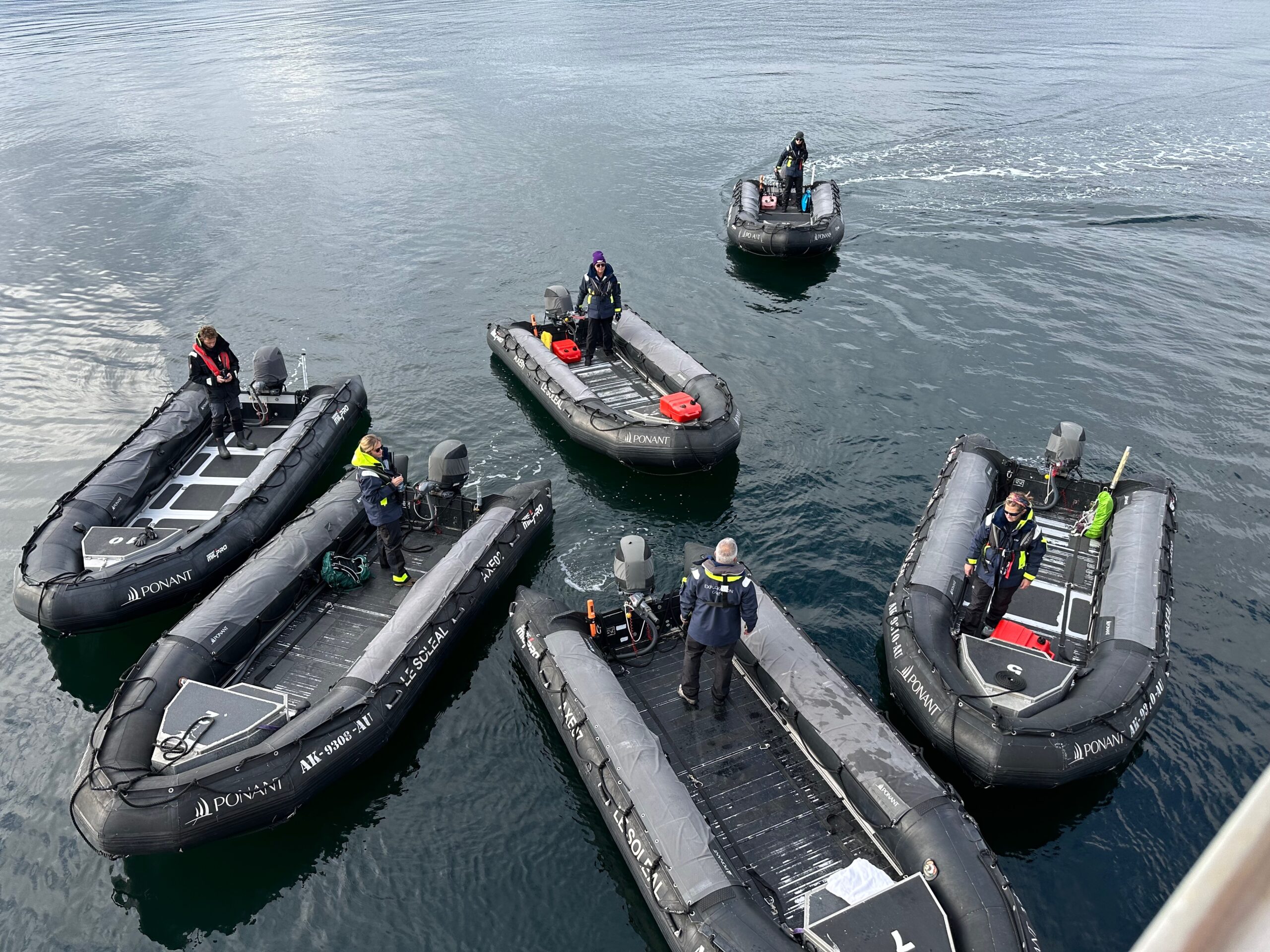
We awoke this morning as our ship sauntered into Alert Bay, a thriving first nation community. Since we are now in Canadian waters, excursions today are via zodiacs, the first time on the cruise (regulations prohibited their use in the US).
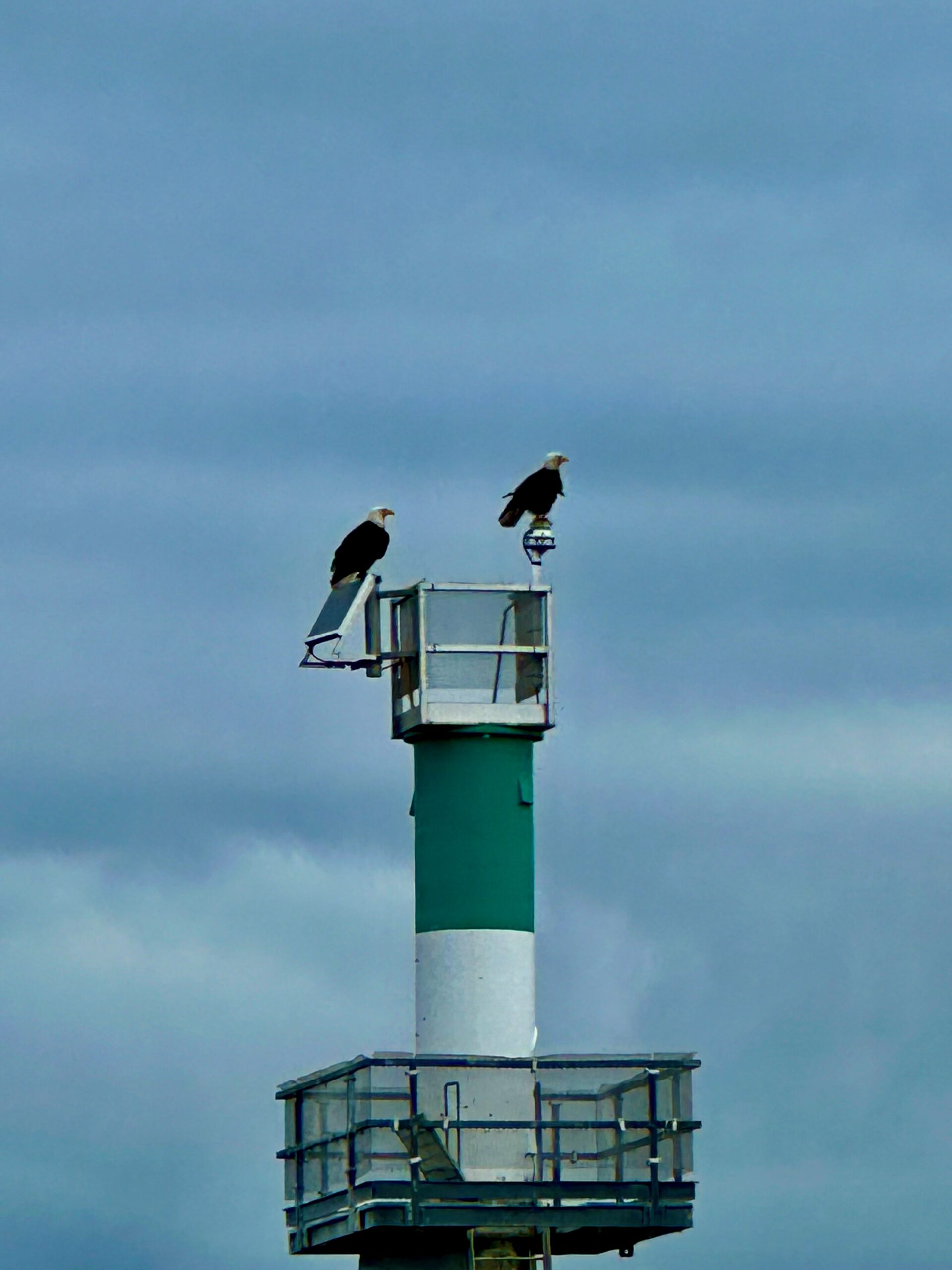
We did a 40 minute tour of the bay and caught some bald eagles taking a break as they were fishing for breakfast.
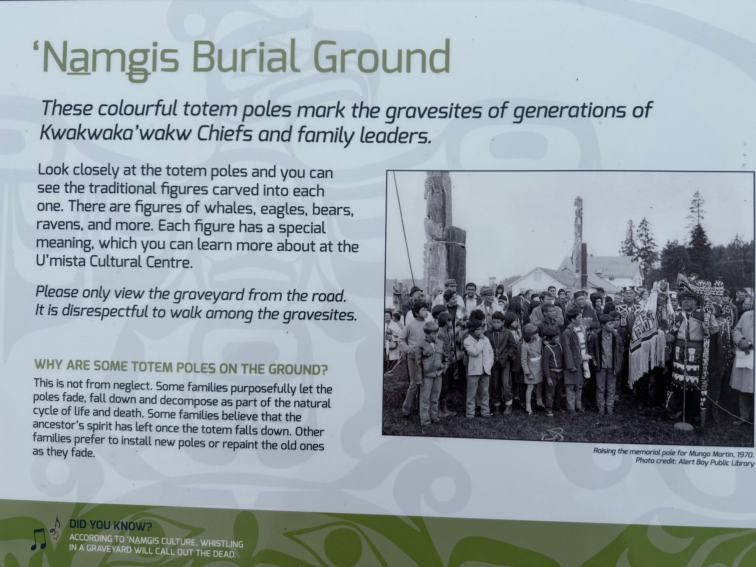
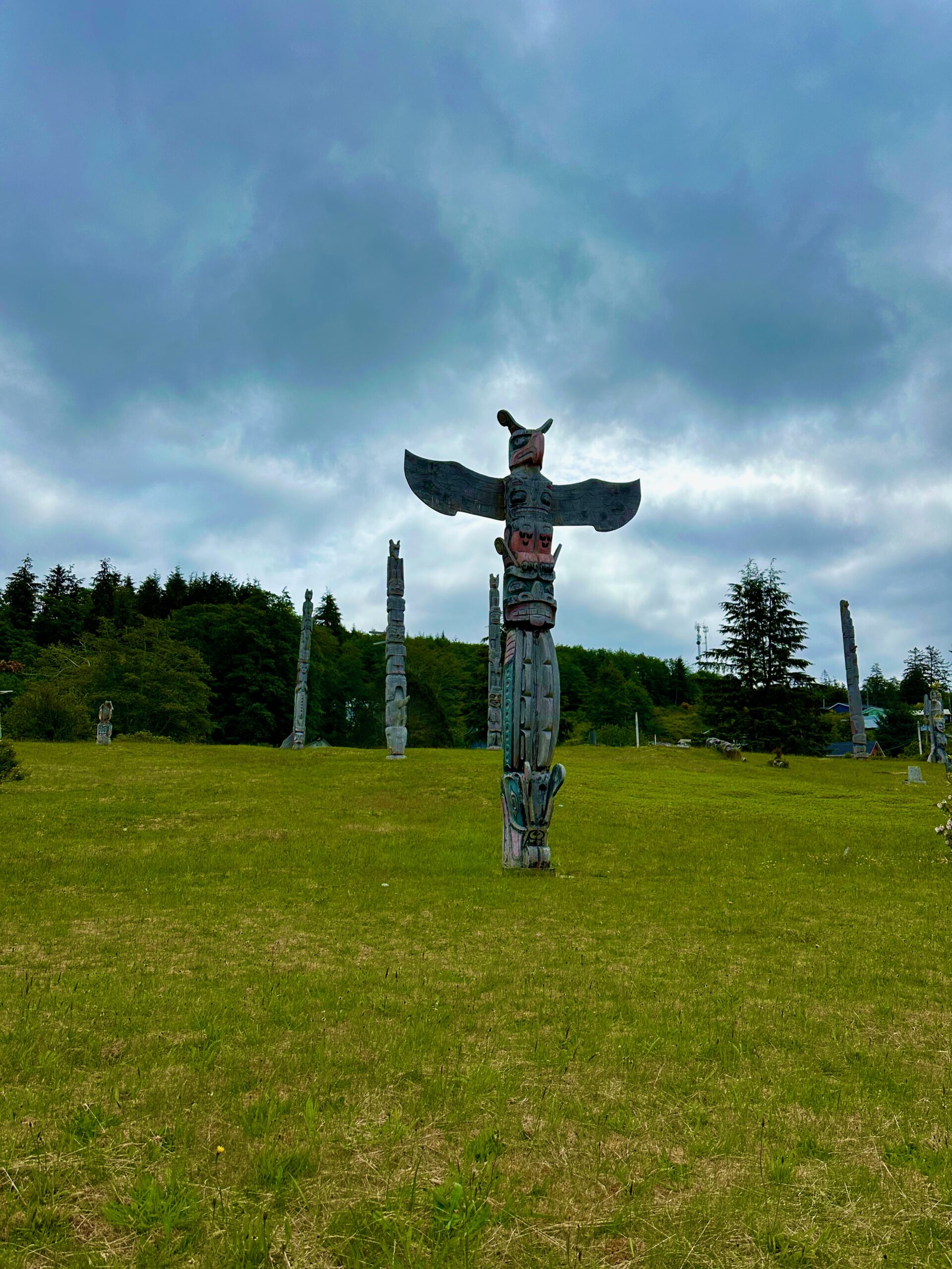
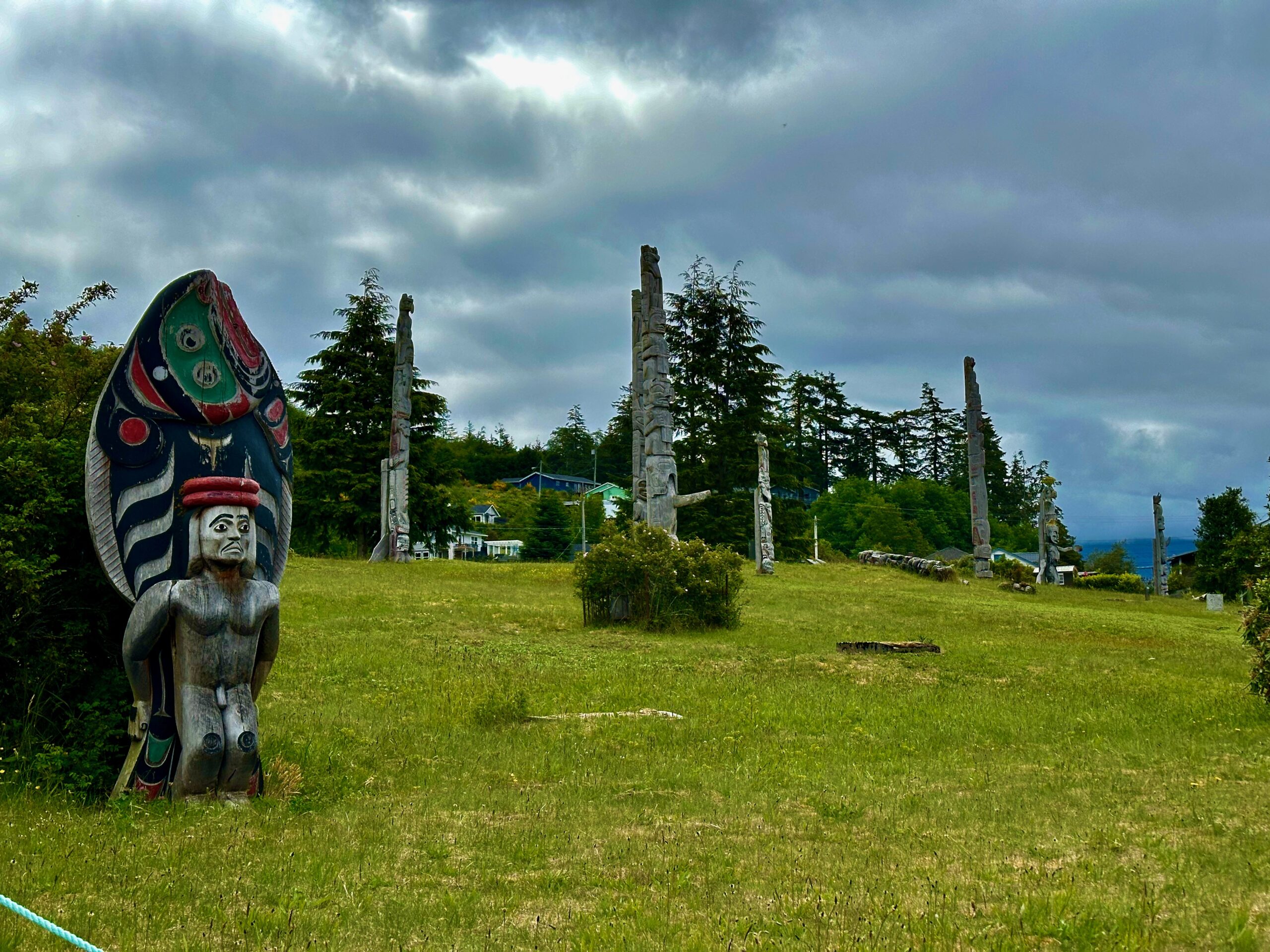
After touring the bay, the zodiacs deposited us in the village. While waiting for the shuttle bus we were able to take in a burial ground. We are both very grateful the expedition guides gave us opportunities to see these communities.
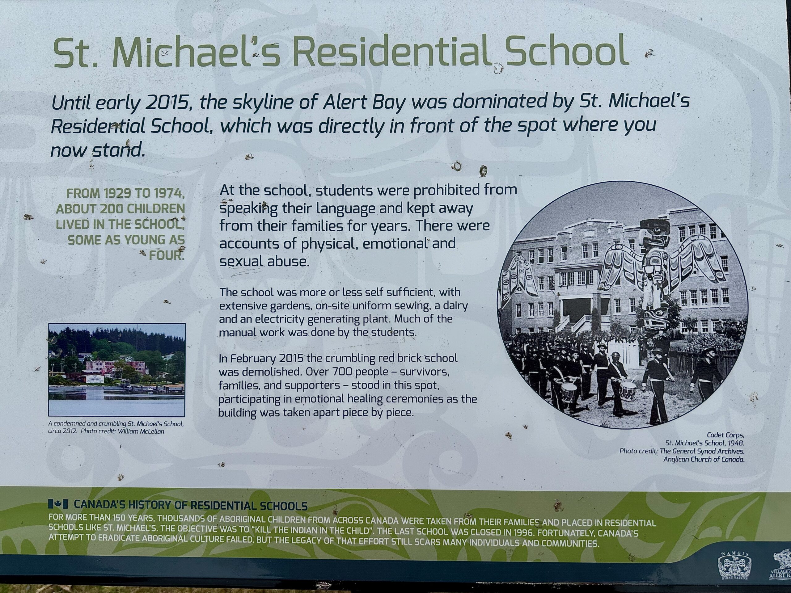
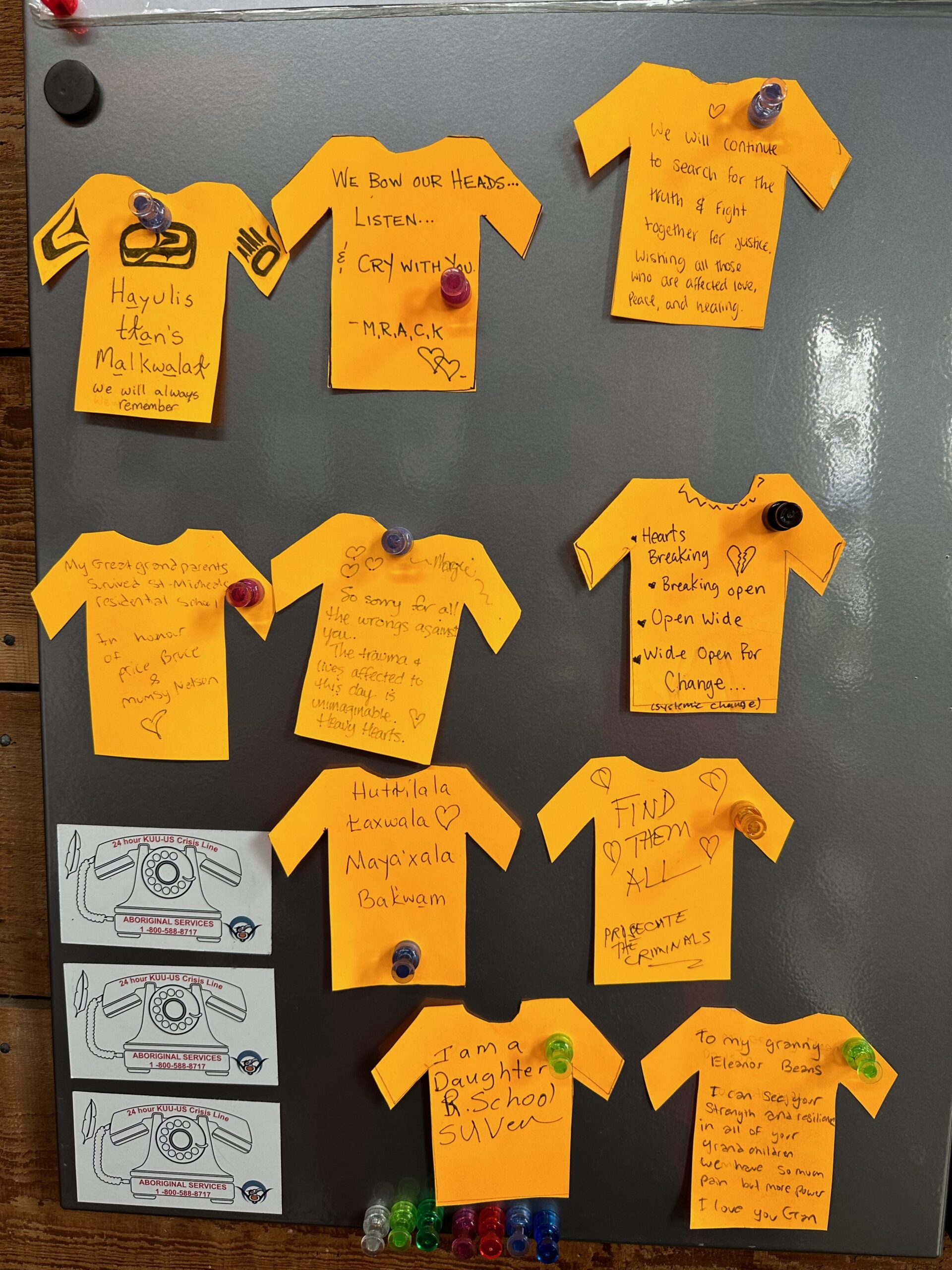
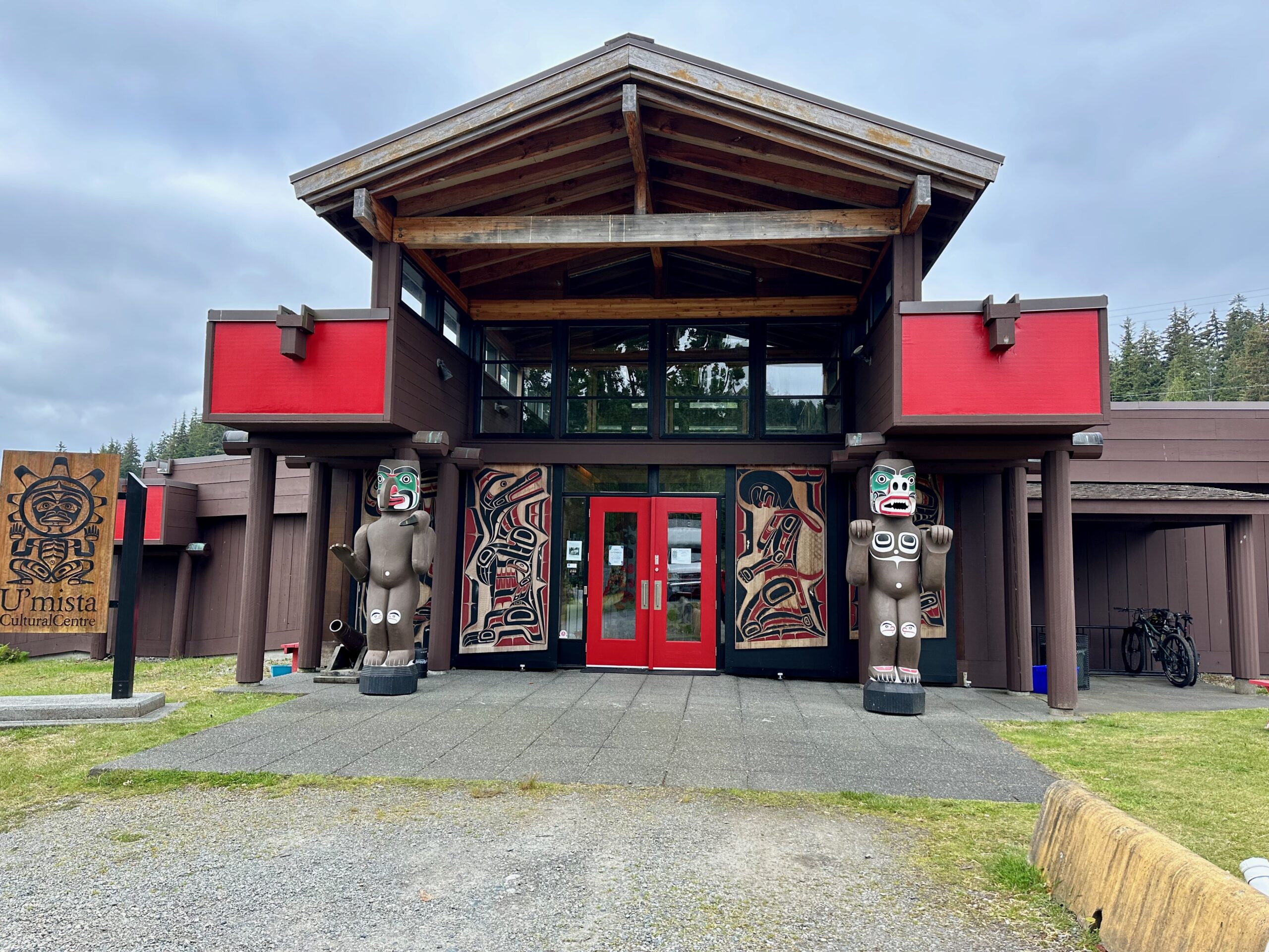
The shuttle took us to the cultural center which was a very moving experience,
I spoke with a volunteer at the cultural center whose relatives were at the school. She was proud of her heritage and the beautiful center that currently stands adjacent to the site of the former school. “My journey will be completed when we build the language school on this very ground. It will be built within two years.”
I had a zodiac all to myself heading back to the ship.
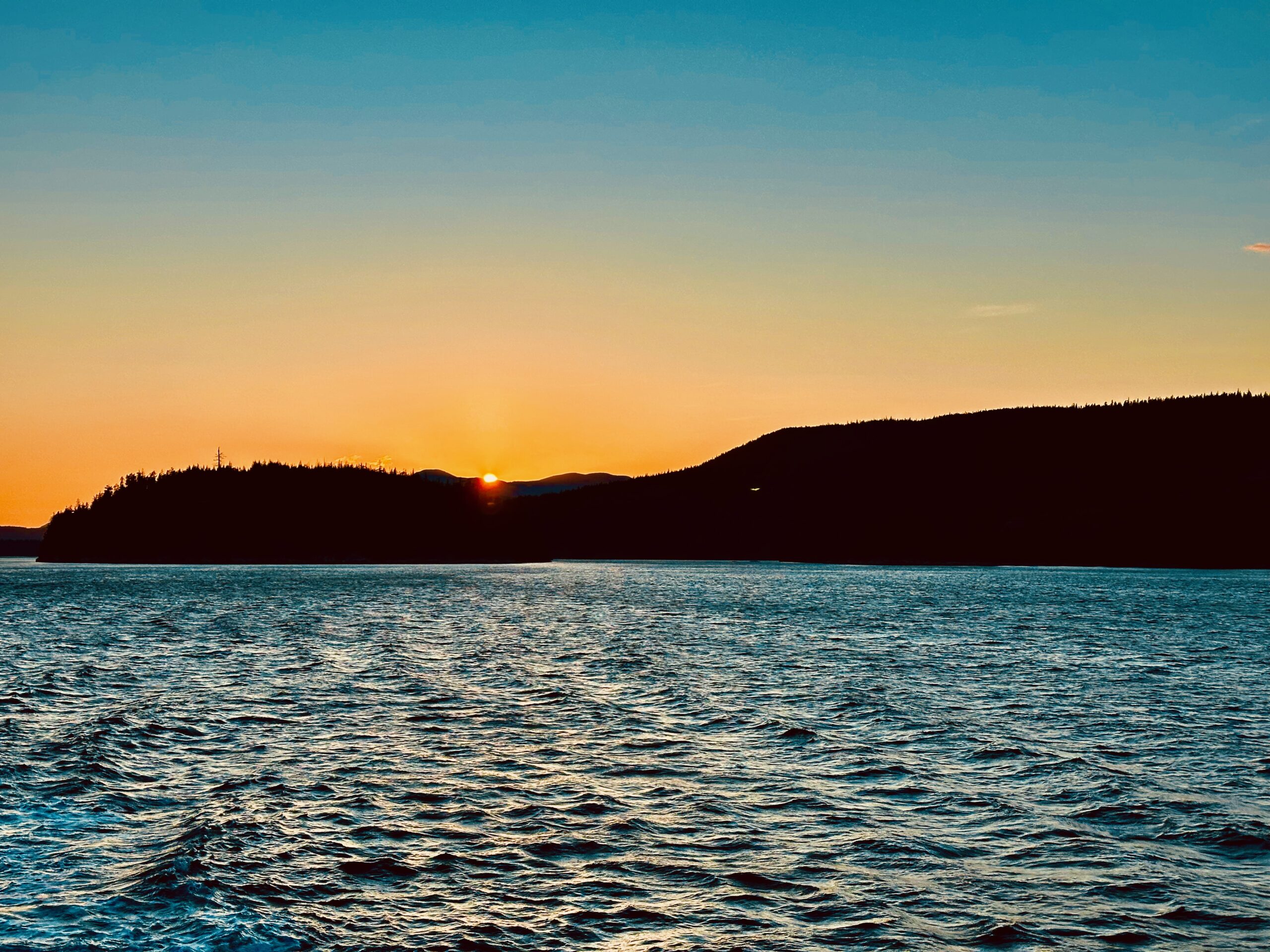
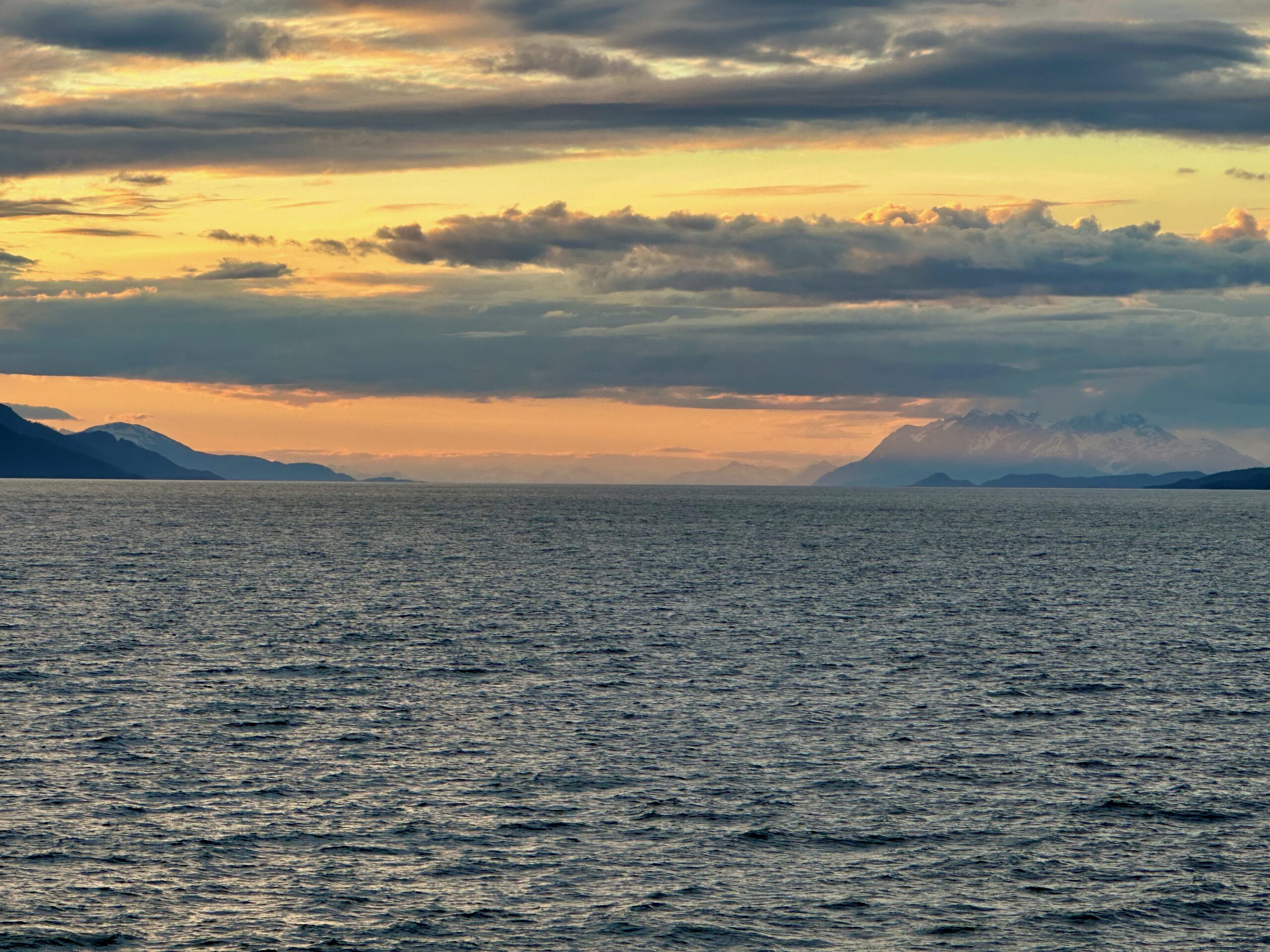
The sunset of our trip.
We are spending two days in Vancouver before flying back to Chicago, but I’ll sign off for now. Thanks for taking the journey.
Moon river, wider than a mile I’m crossing you in style some day Oh, dream maker, you heart breaker Wherever you’re goin’, I’m goin’ your way Two drifters, off to see the world There’s such a lot of world to see We’re after the same rainbow’s end Waitin’ ’round the bend My huckleberry friend Moon river and me
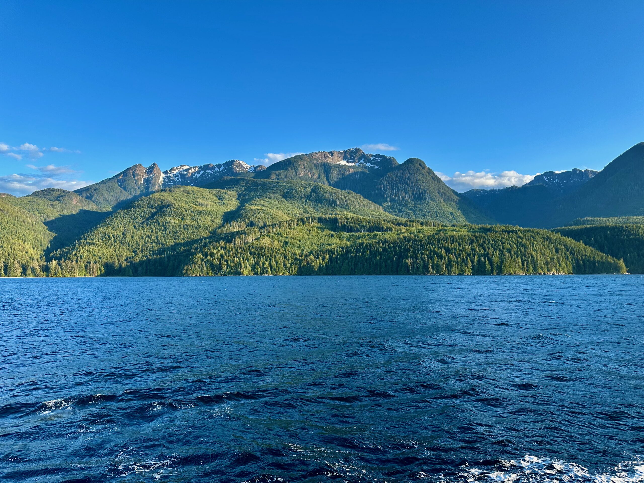
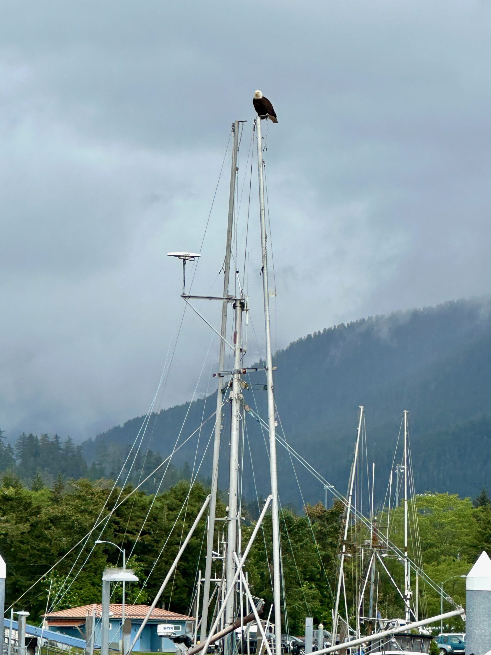
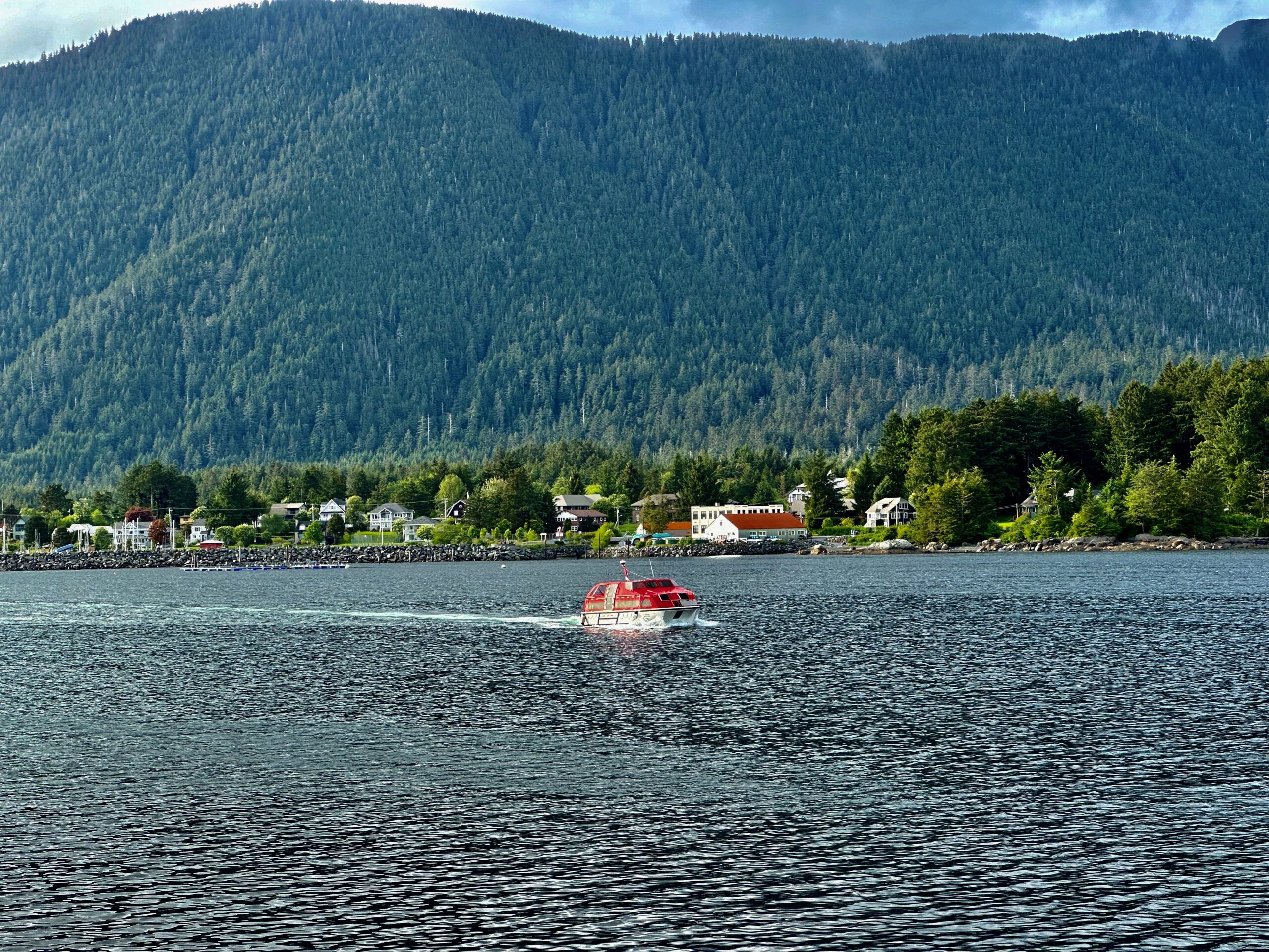
Late yesterday evening we crossed over to Canadian waters. A small, yet powerful boat, came out of the blue headed straight for the ship. It pulled up alongside while going full throttle. The American pilot jumped off the ship and the Canadian pilot jumped on. . . at some point. We awoke in Prince Rupert, British Columbia. It is the land, air, and water transportation hub of British Columbia’s North Coast, and has a population of 12,220 people as of 2016. These pics may look like I touched them up but it is testament to the changing light throughout the day, another feature of the Inside Passage.
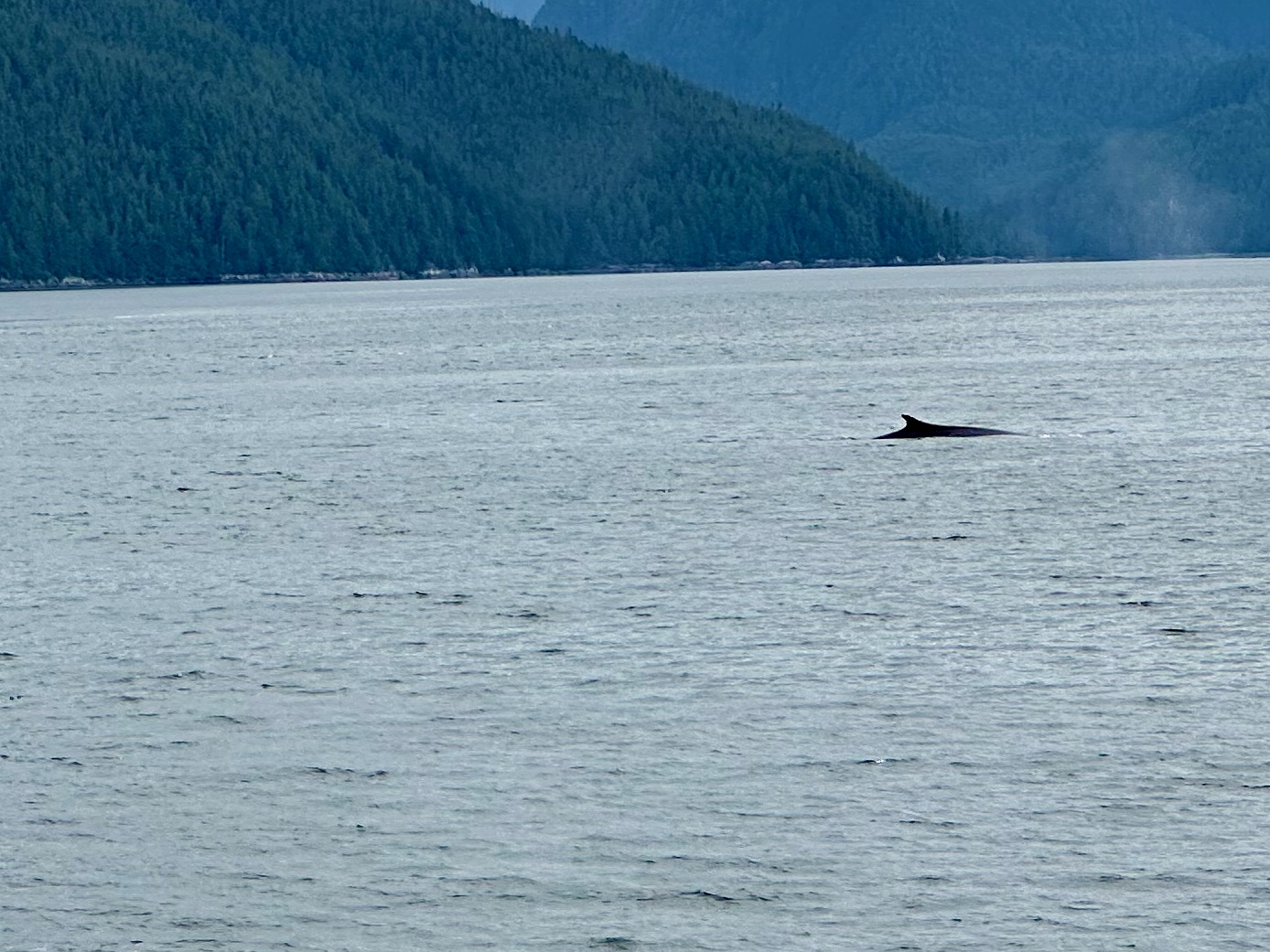
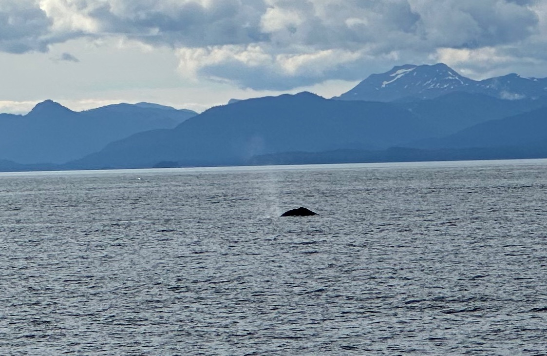
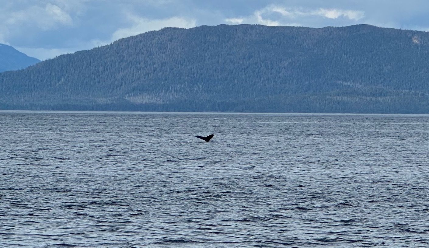
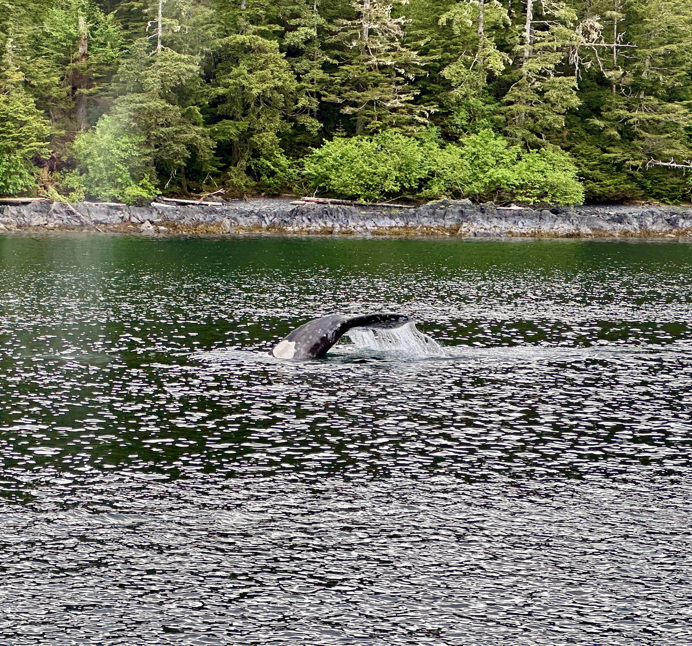
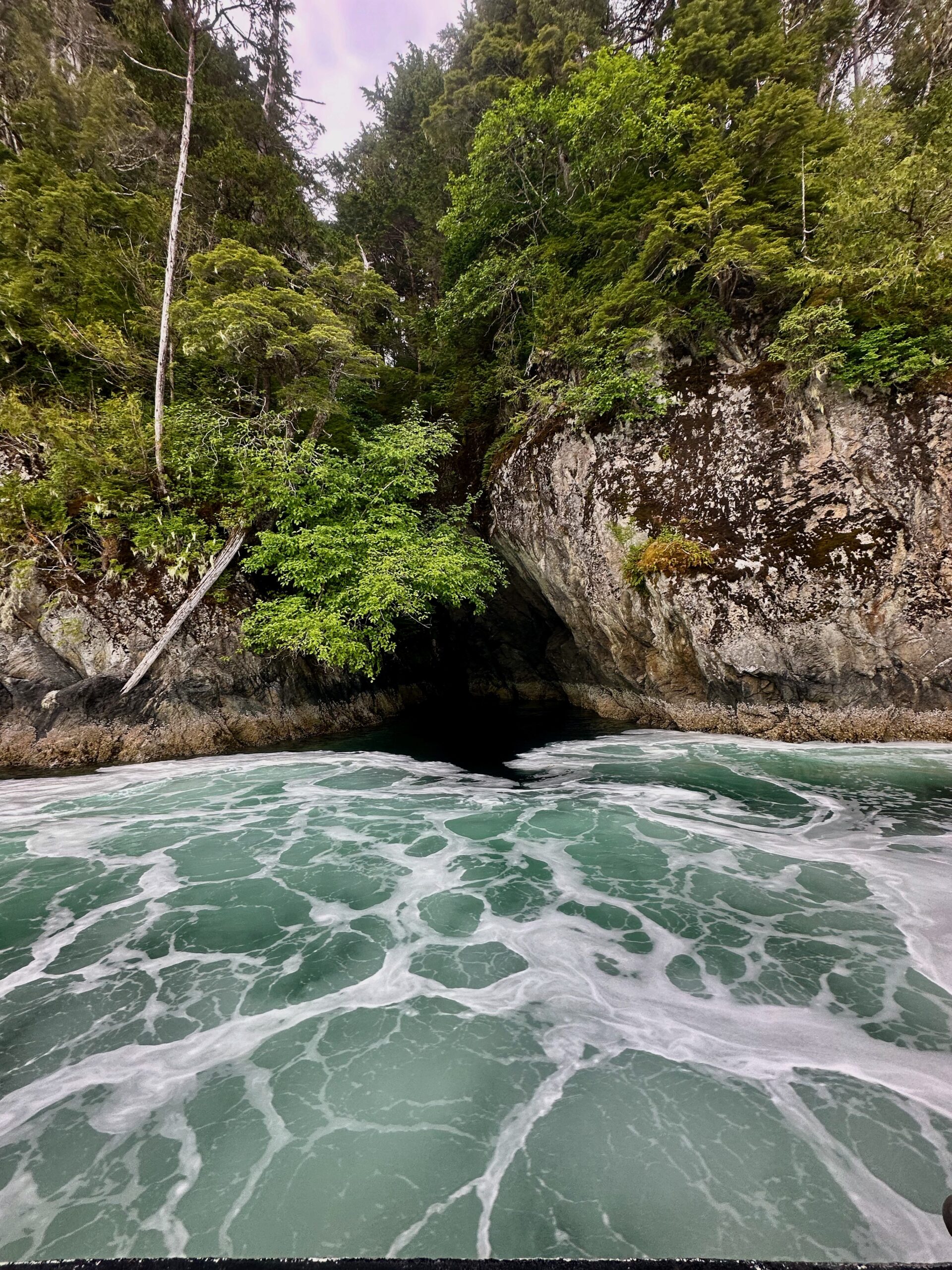
We were only in port for 45 minutes while immigration came on board and checked all the documents. Then we headed out for a day aboard cruising the Inside Passage. We often think we have to do something different every day of a vacation. I could cruise through the Inside Passage for three, four, five days and never be tired of it. And yes, we saw the obligatory whales.
Yesterday, our main excursion was to the town of Kake, home to the Tlingit Peoples. We awoke to breathtaking scenery once again.
As we awaited the tender to go ashore, a seaplane took off and buzzed the ship. It was unexpected but a little exciting.
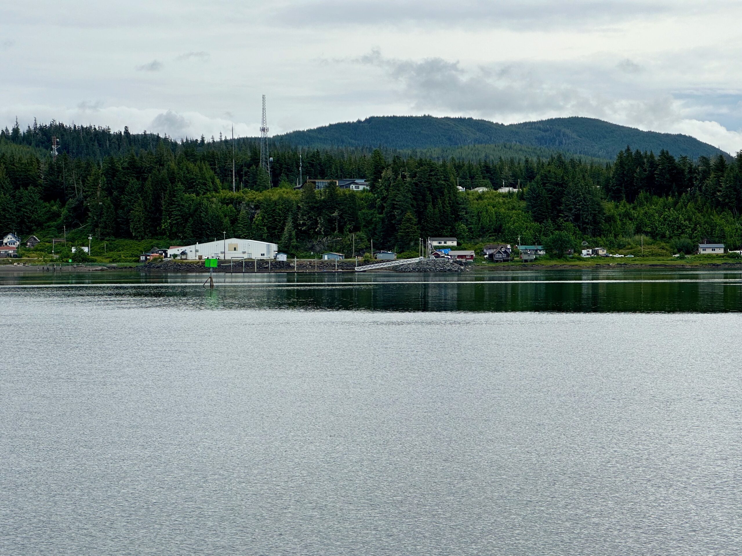
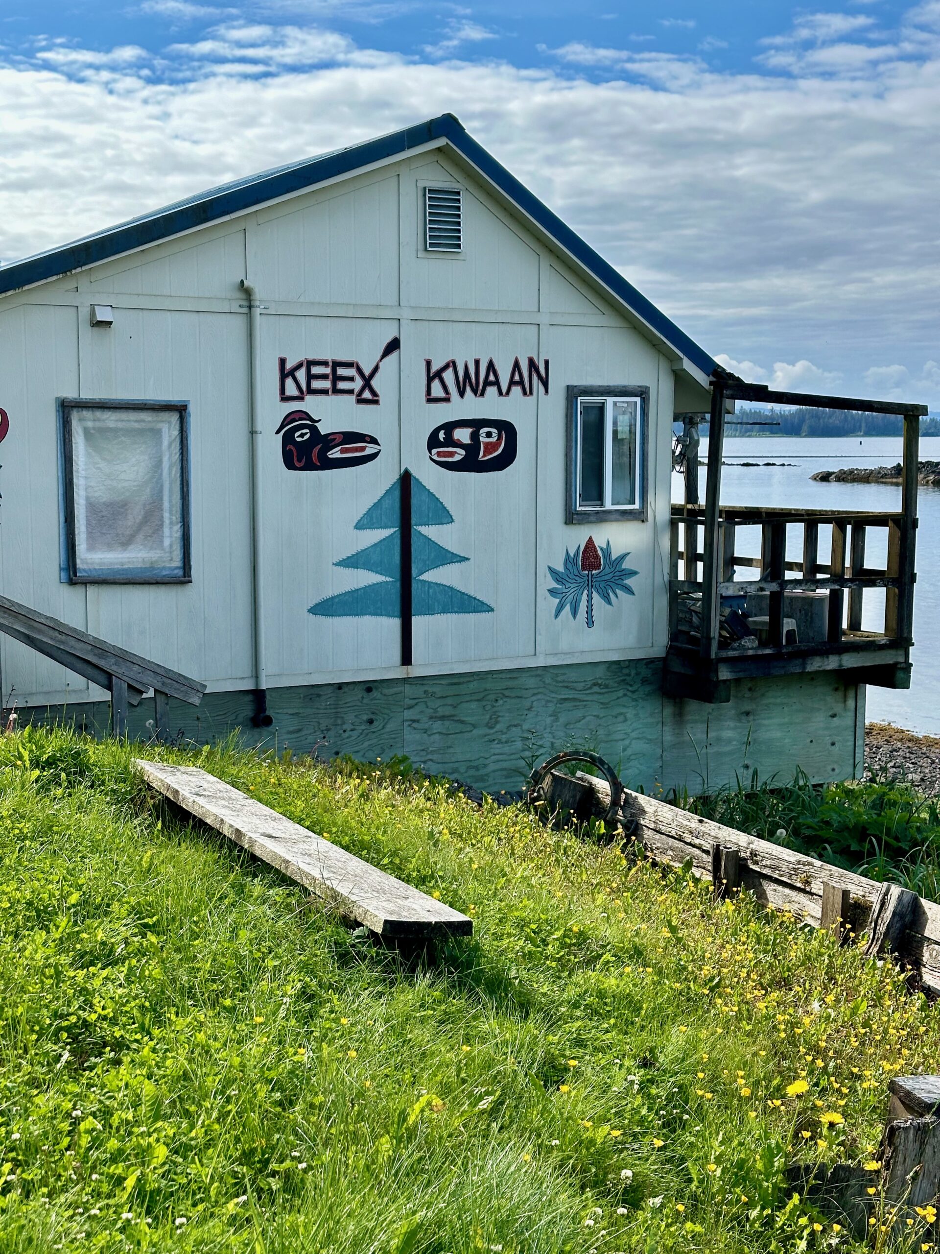
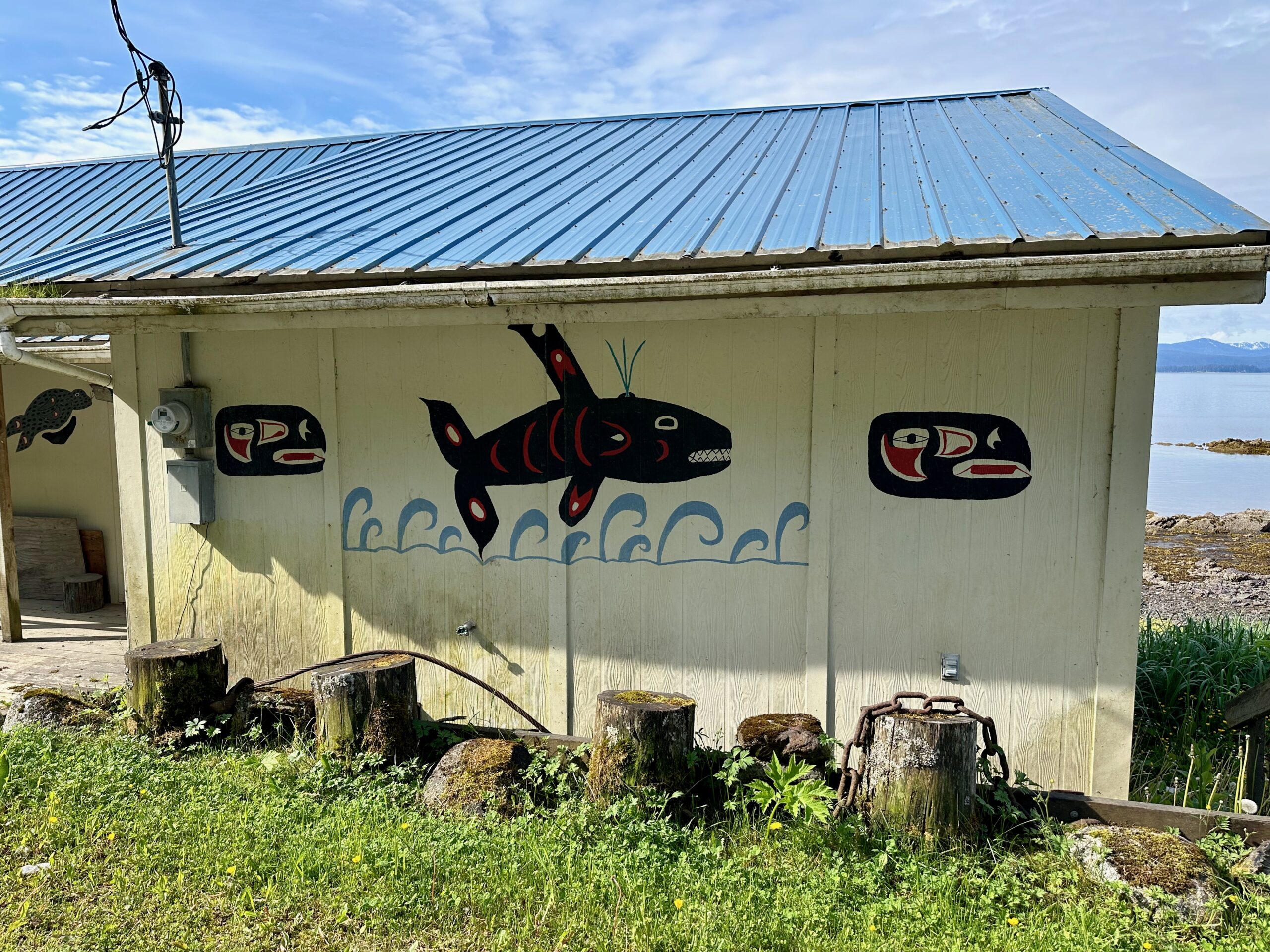
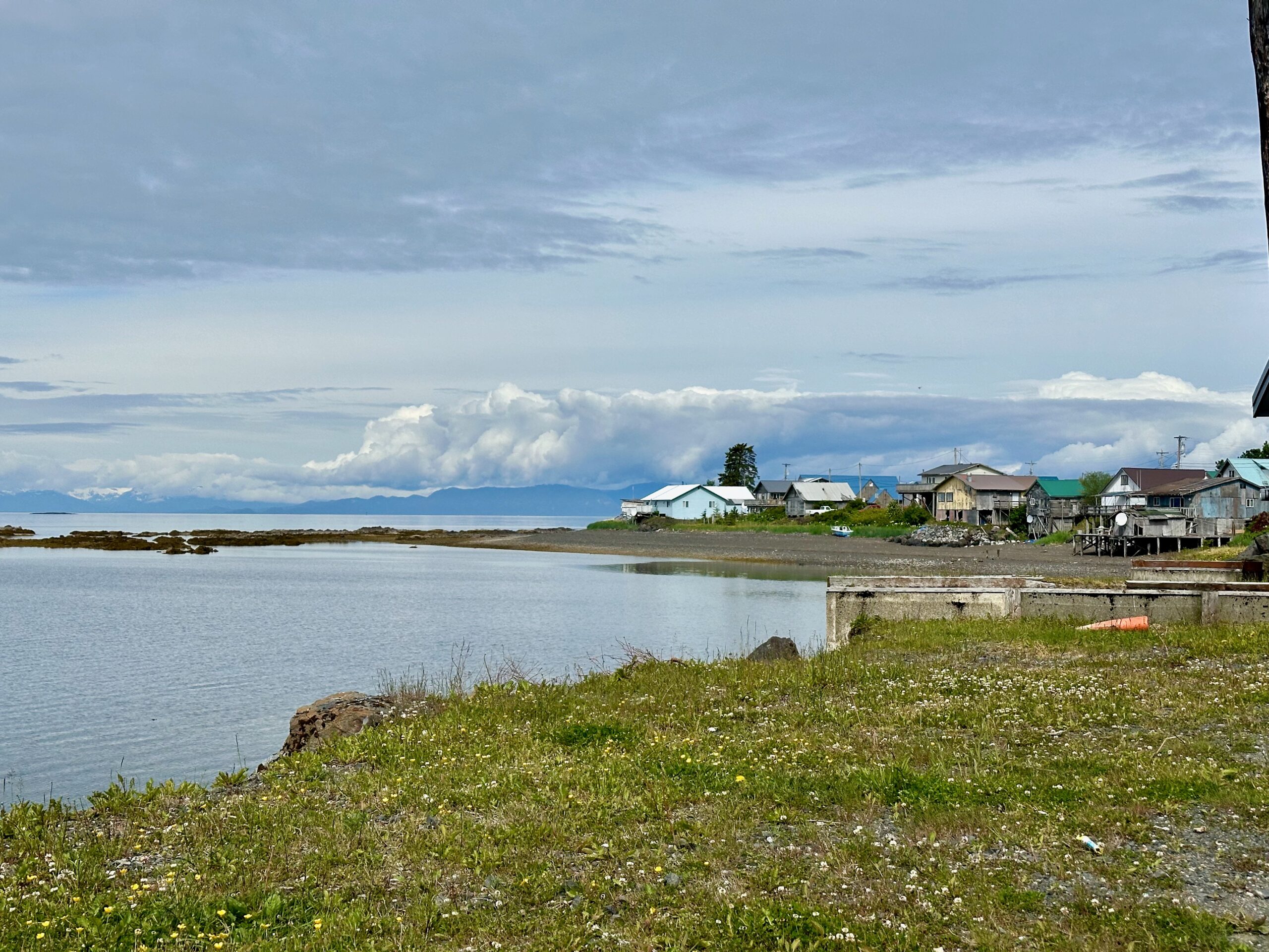
Kake is a first-class city (a community must have at least 400 permanent residents to form a first class city in Alaska) located on the northwest coast of Kupreanof Island in Southeast Alaska, about 95 air miles southwest of Juneau. It is a Tlingit village rich in cultural history and tradition, with the region having been inhabited by the Tlingit people for thousands of years.
Key Facts about Kake
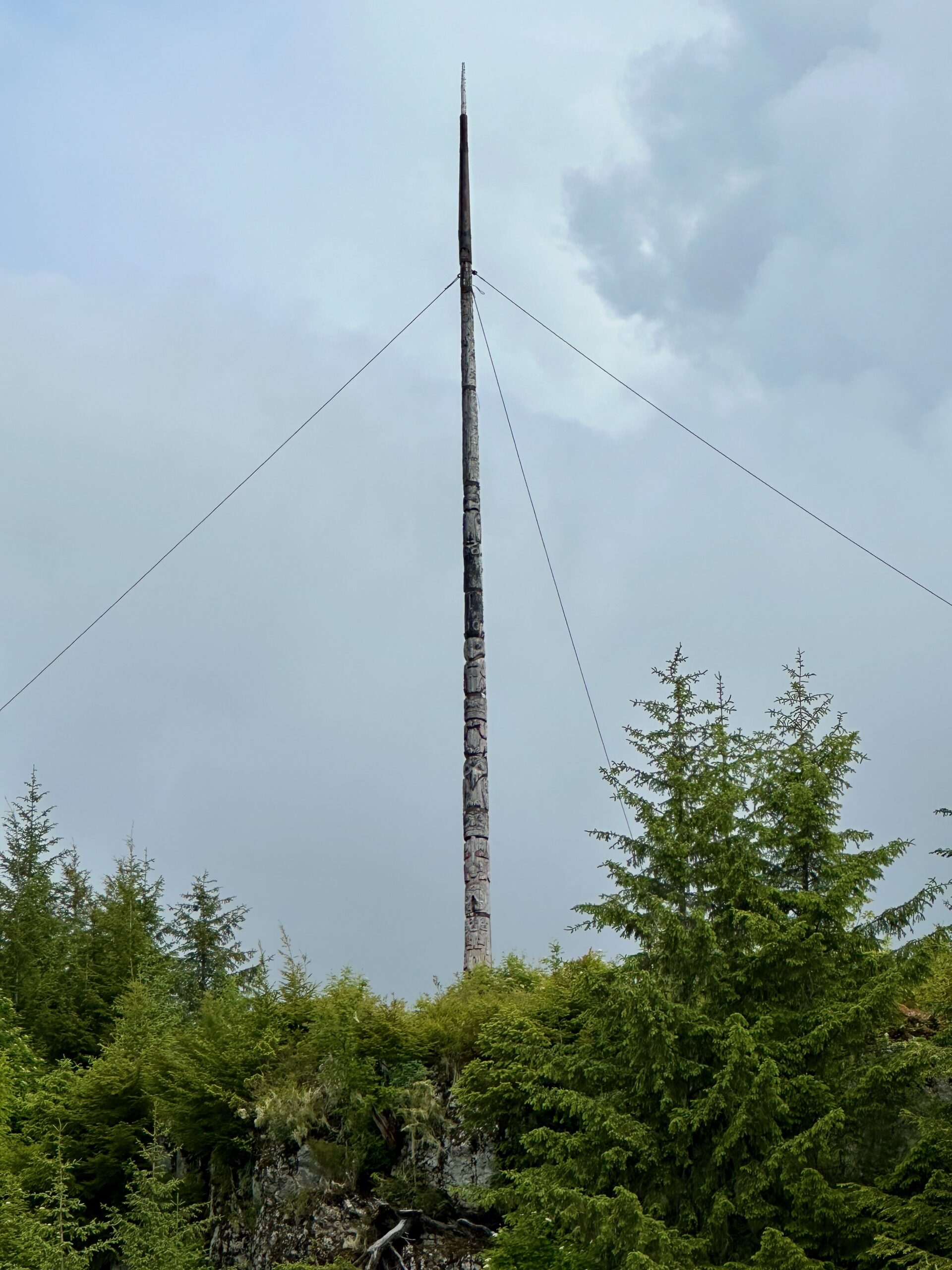
• The name “Kake” comes from the Tlingit word “Ḵéex̱ʼ” or “Ḵéix̱ʼ,” meaning “opening of daylight” or “mouth of dawn.” • As of 2020, Kake had a population of 543 residents. • Kake is home to the third tallest totem pole in the world, standing at 132 feet tall. It was carved in 1967 for the Alaska Purchase centennial. • Nearly 70% of Kake’s residents are of Tlingit heritage, and many Tlingit traditions like dancing, storytelling, basket weaving, and carving remain integral to the community. • Popular activities in Kake include fishing for salmon and halibut, whale watching, bear viewing, and exploring the surrounding Tongass National Forest. • Kake hosts several annual festivals like the Fourth of July celebration, Kake Day in January, and the Dog Salmon Festival celebrating the salmon harvest.
Kake is accessible by air via regular flights from Juneau on small aircraft or floatplanes, as well as by the Alaska Marine Highway ferry system from ports like Juneau and Prince Rupert, Canada. Some cruise ships also make stops in Kake during the summer season.
I appreciate the naturalists on our ship for choosing to include excursions like Elfin Cove and Kake. These are sides of Alaska that many tourists would never see. Just as in Elfin Cove, we had Tlingit residents aboard the ship before and after our visit to inform us of their history, culture, and the unique nature of their town. Kake is not a dazzling place, but I found it very meaningful and helpful to understand life in Alaska. I didn’t feel comfortable taking many pictures, so here are just a few.
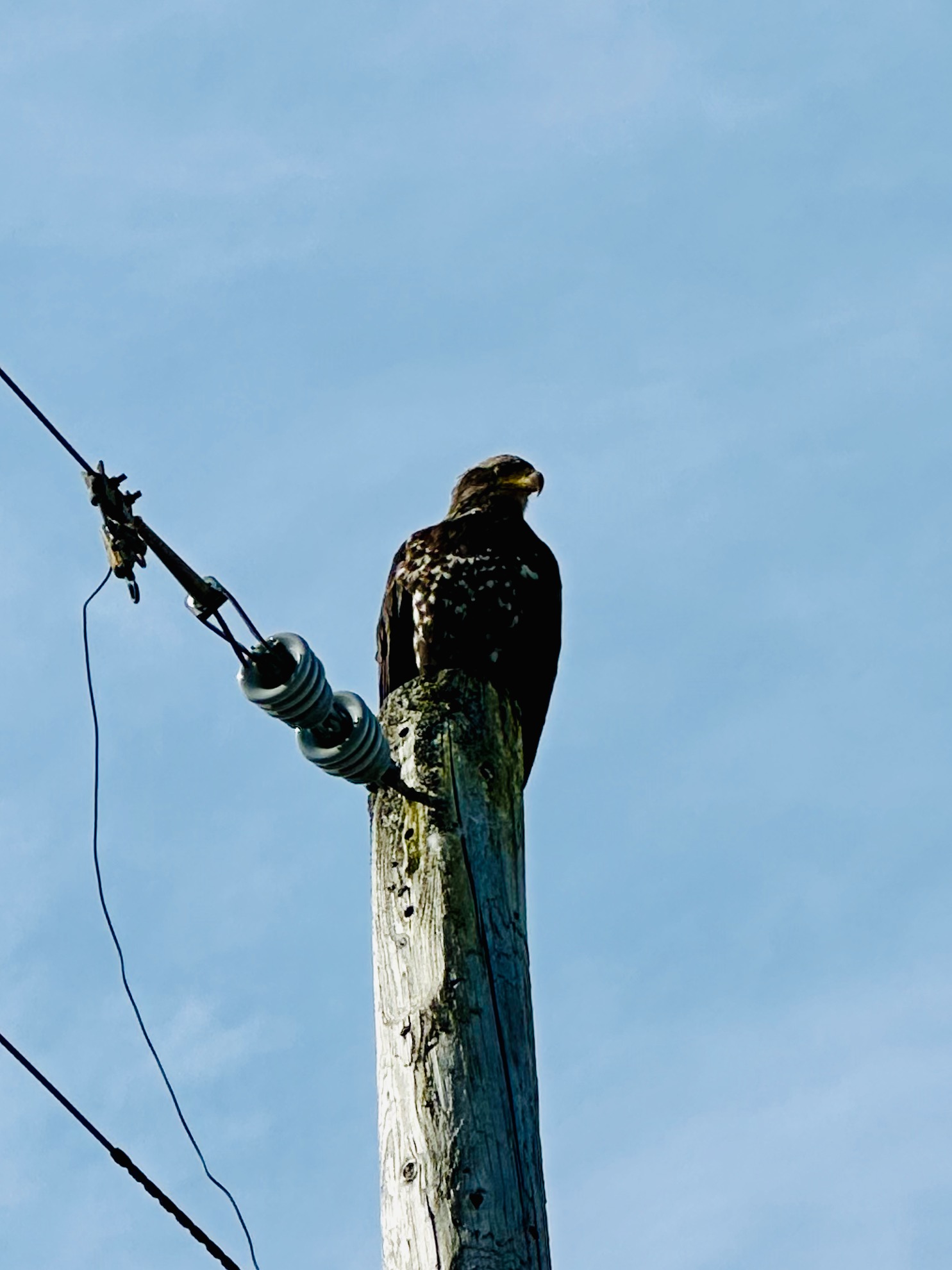
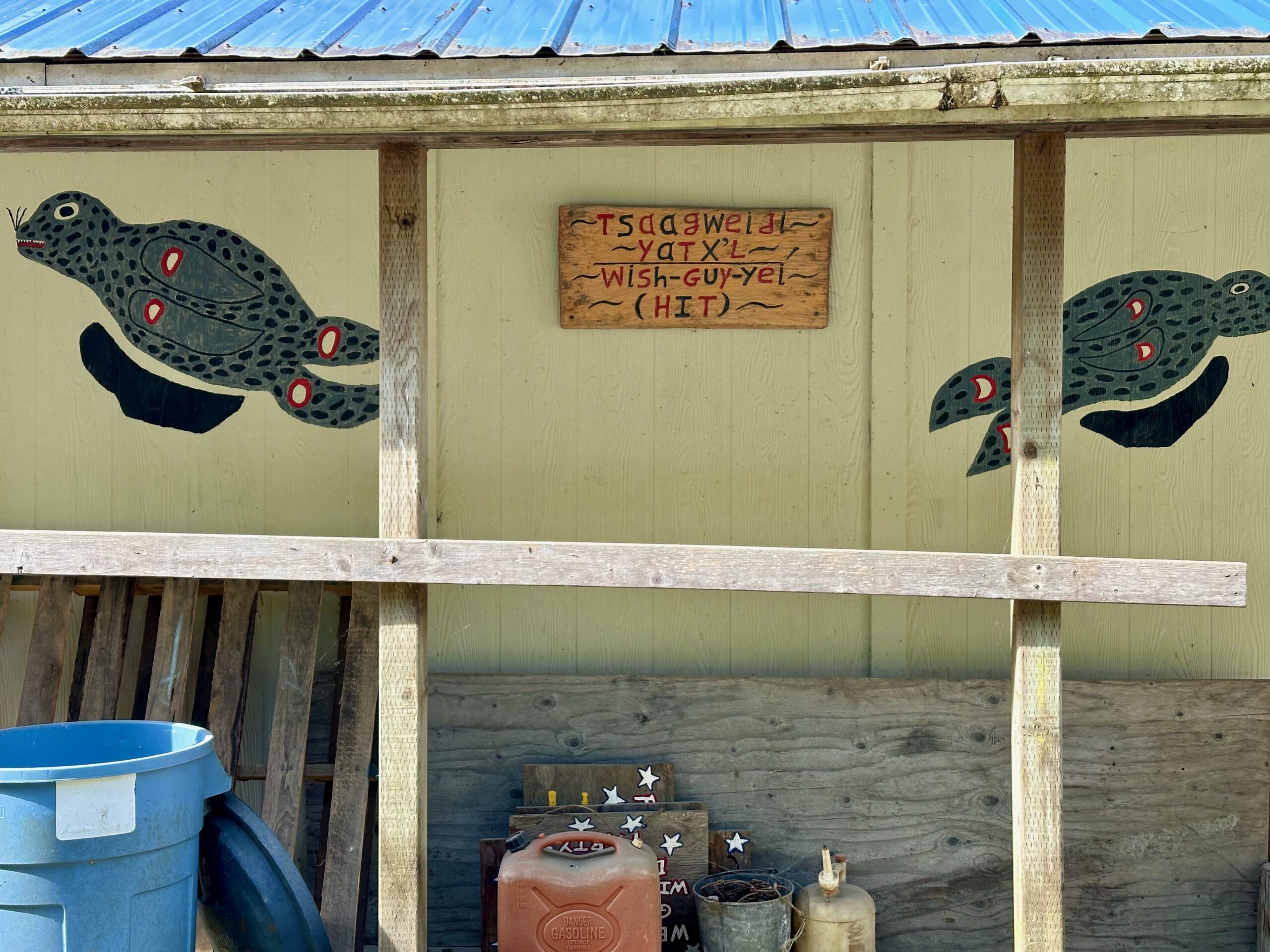
A young bald eagle was holding sentry right at the end of the harbor street. There were quite a few structures that had fallen into disrepair, and others with clear expressions of heritage pride. I don’t know the reasons for this disparity, so I’ll leave it at that and not attempt any inference.
The pride of the town is their totem pole.
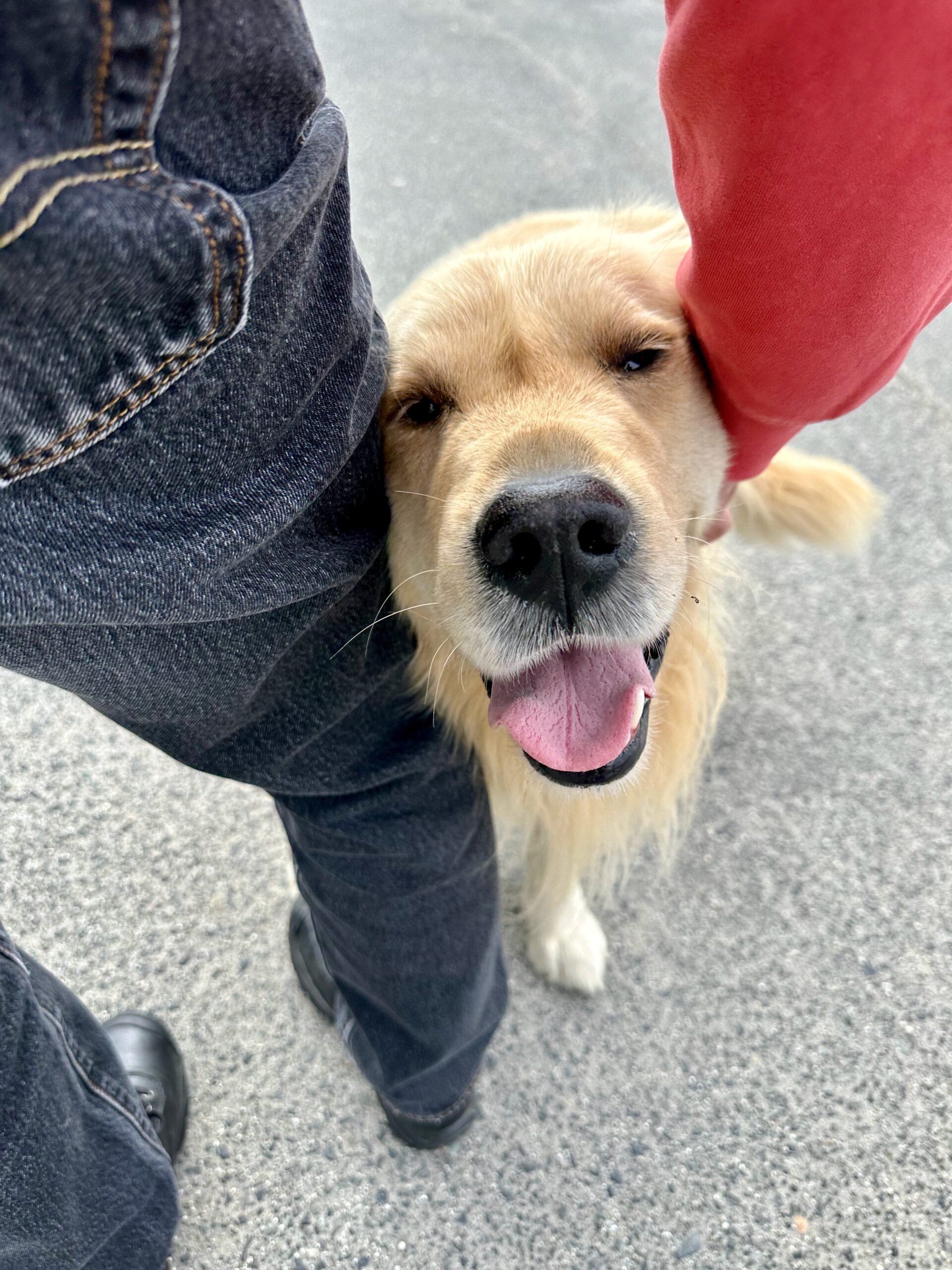
Alaska dogs are happy dogs.
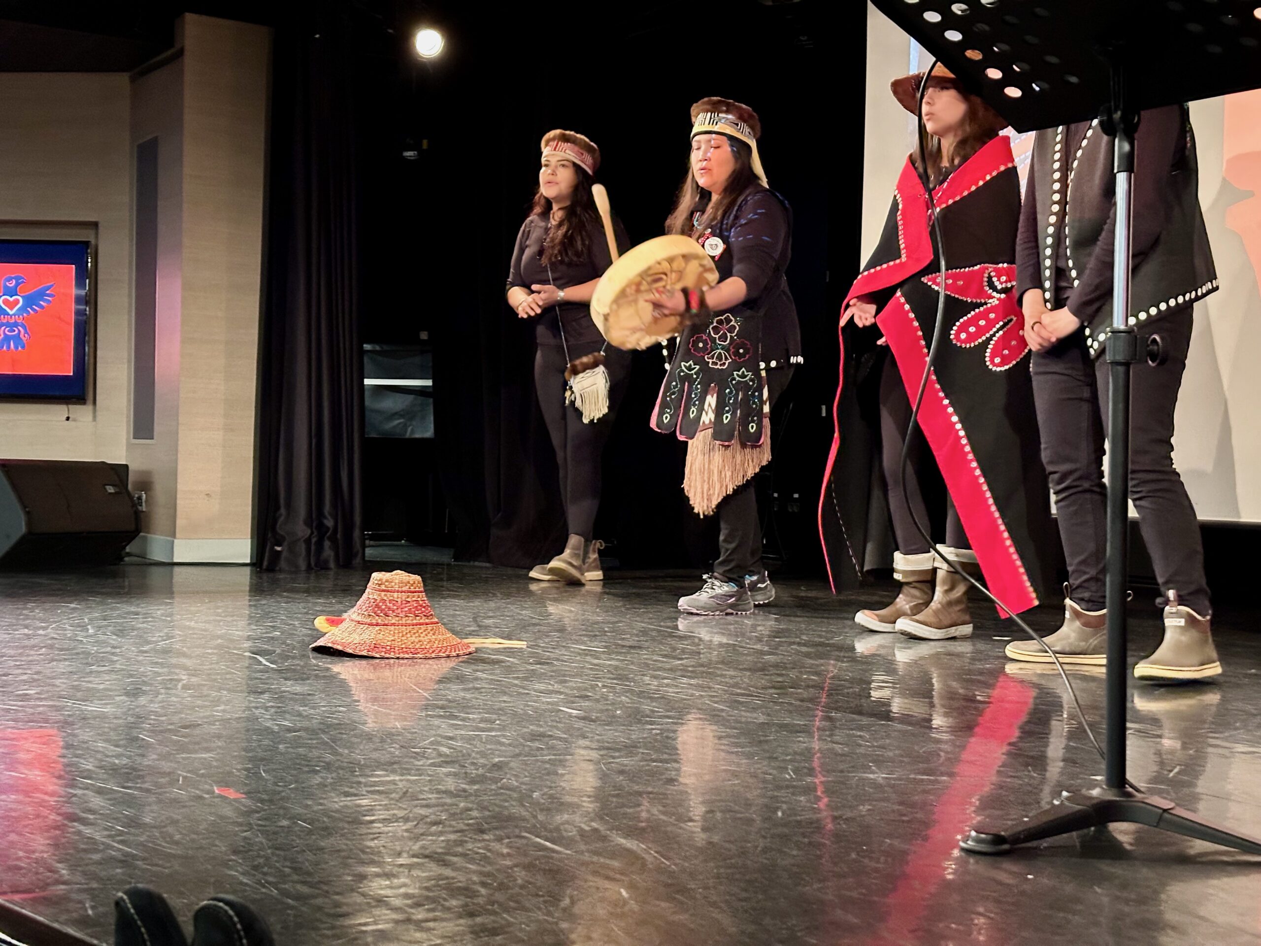
These four women talked about their lives and their Tlingit history.
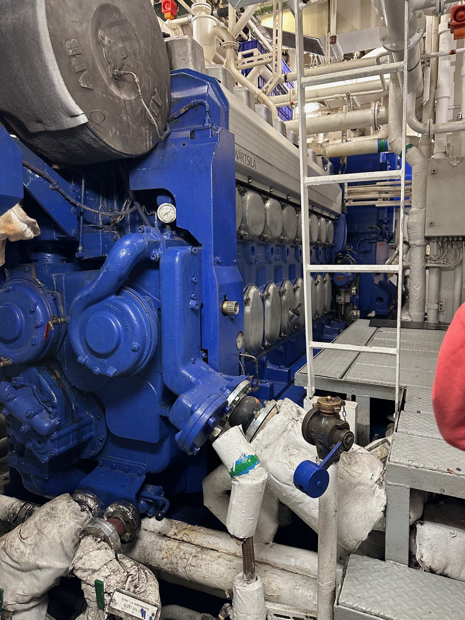
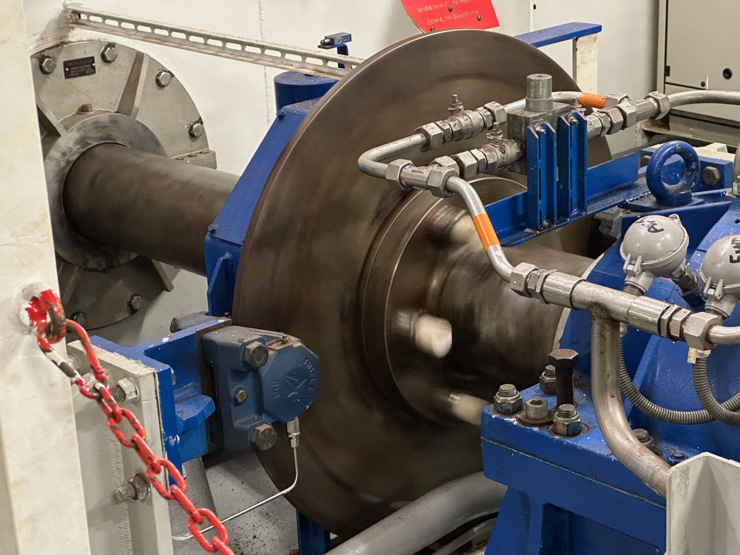
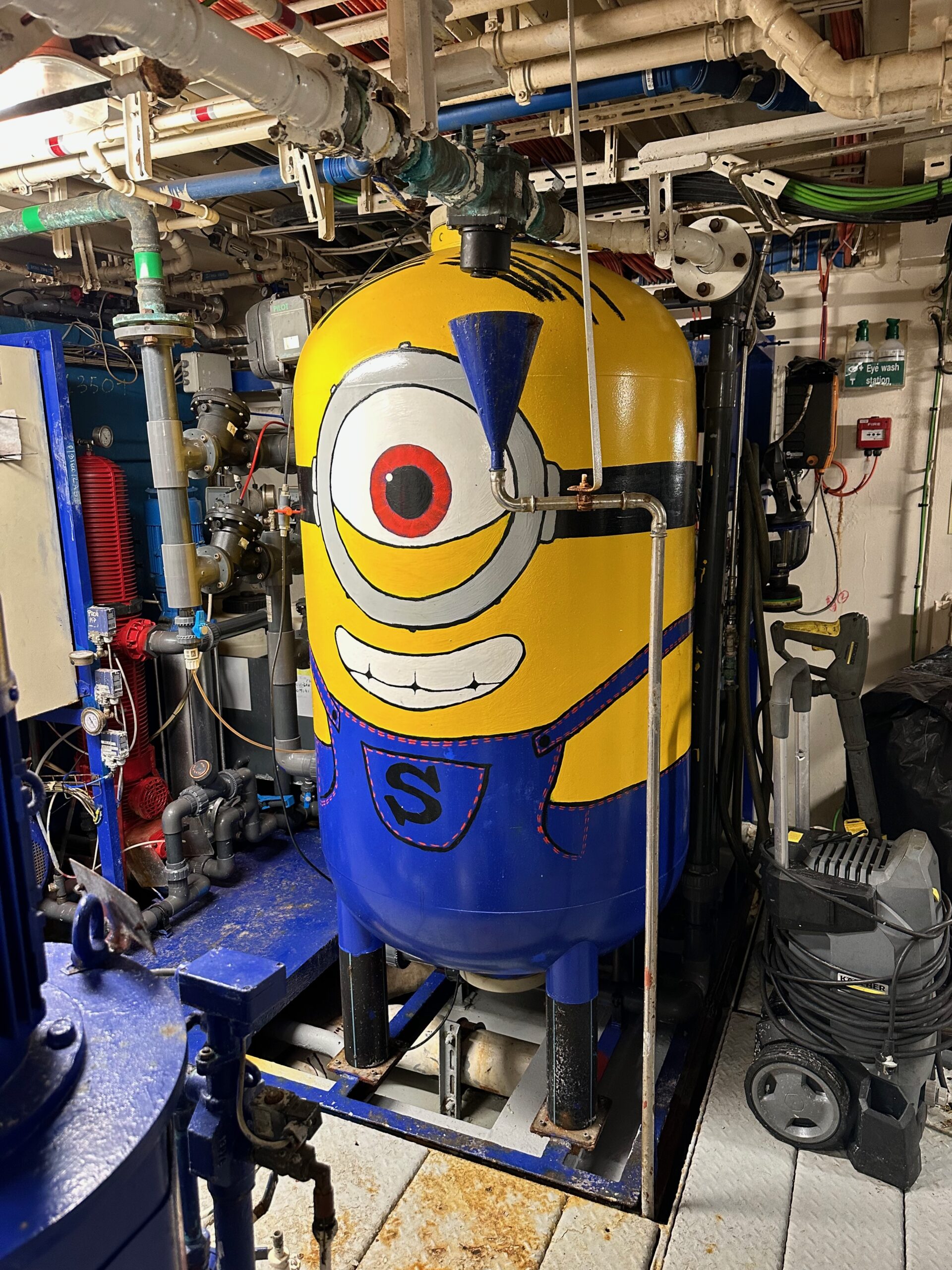
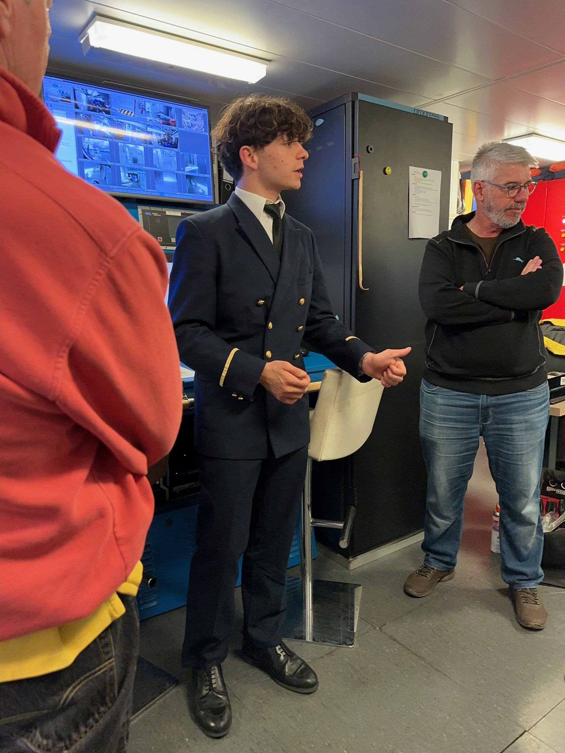
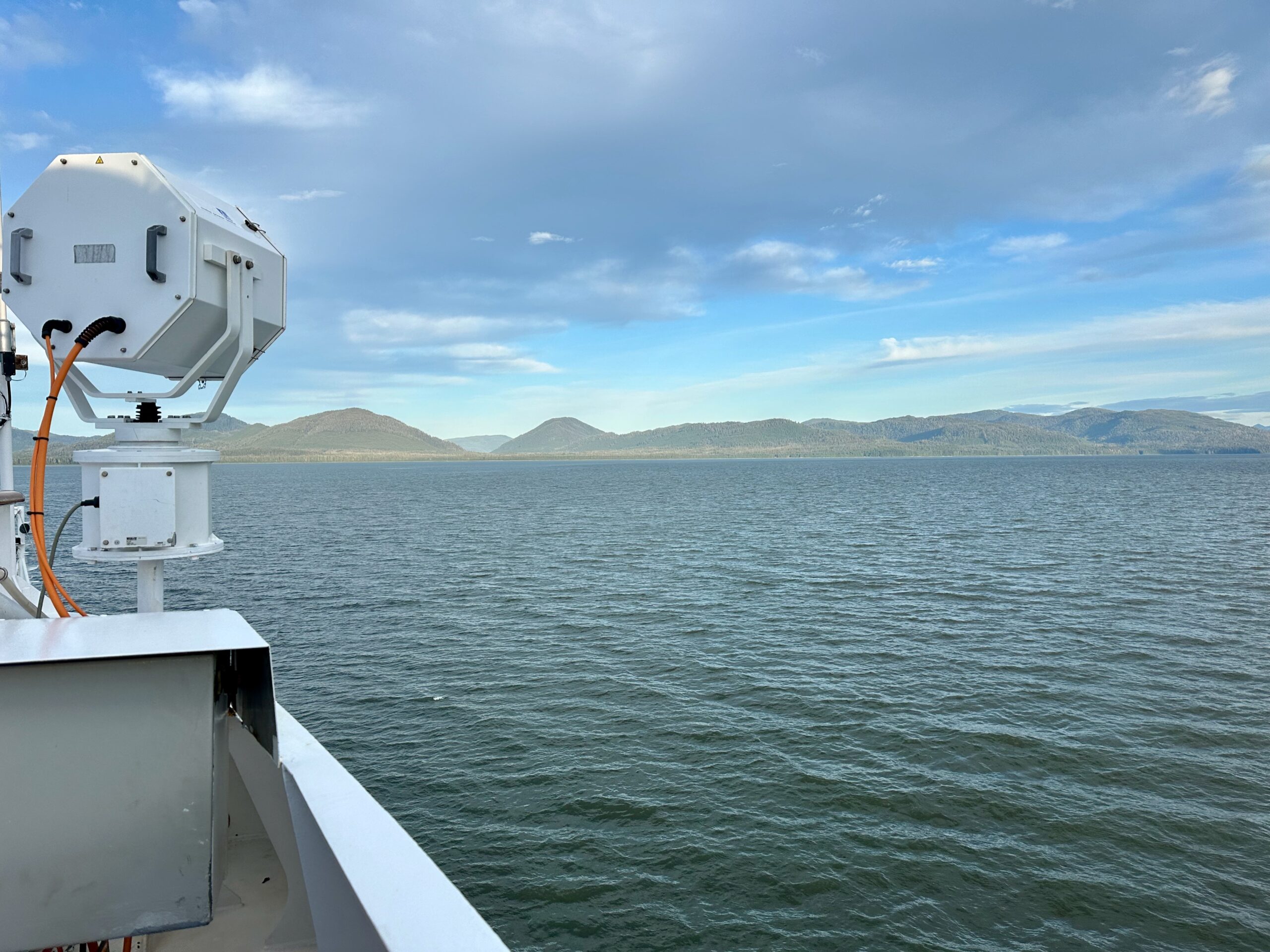
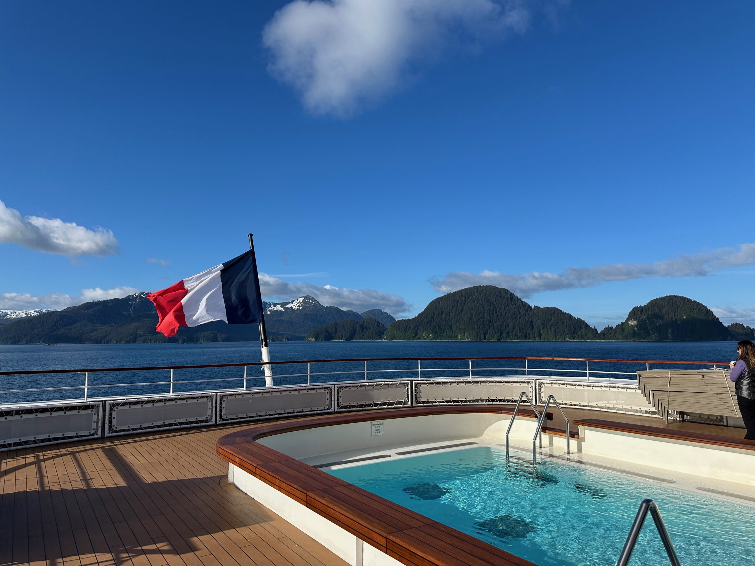
In the afternoon, we got to tour the engine room on the ship—a highlight for a systems nerd like me. There are five generators on the ship producing electricity that run all the systems, including propulsion. The ship has two osmosis systems for drinking water. Our tour guide was an intern from a French maritime school, where he is studying for five years.
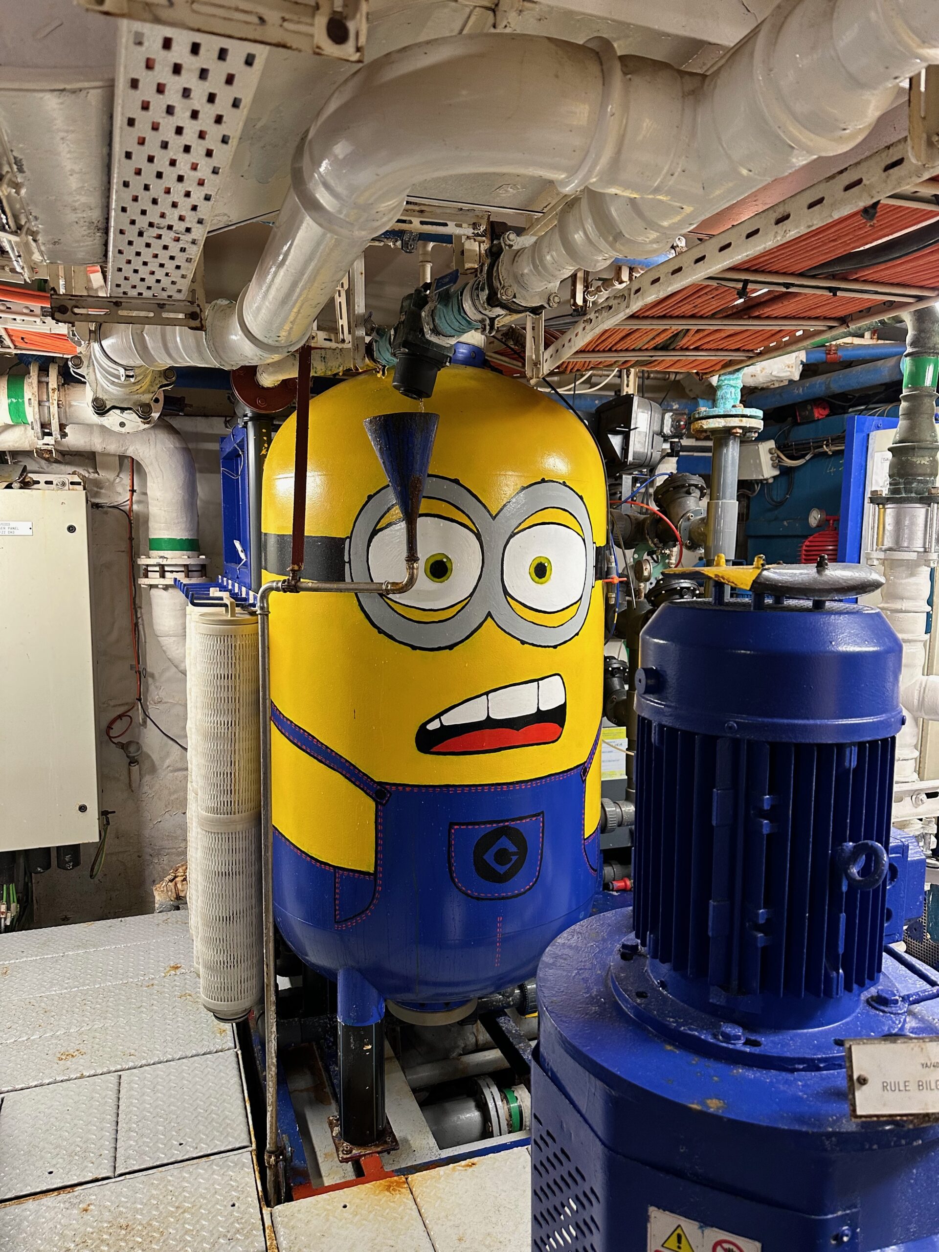
Signs and labels always tell a story.
We soon headed out to cruise through the night. I’ve learned one thing—when the ship is going full speed ahead and slams on the brakes, it means one thing: whales. We had quite a few humpbacks just off the ship.
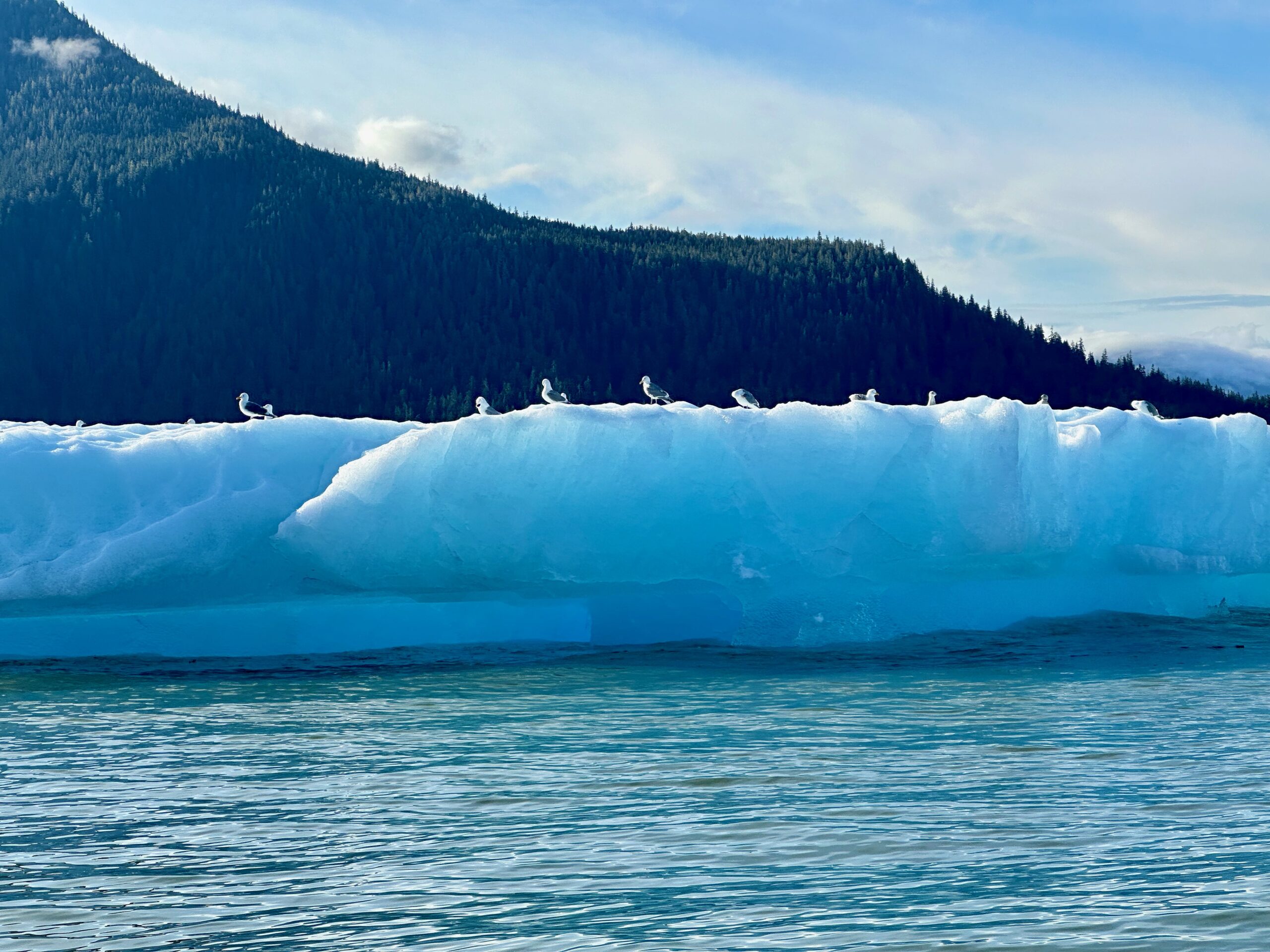
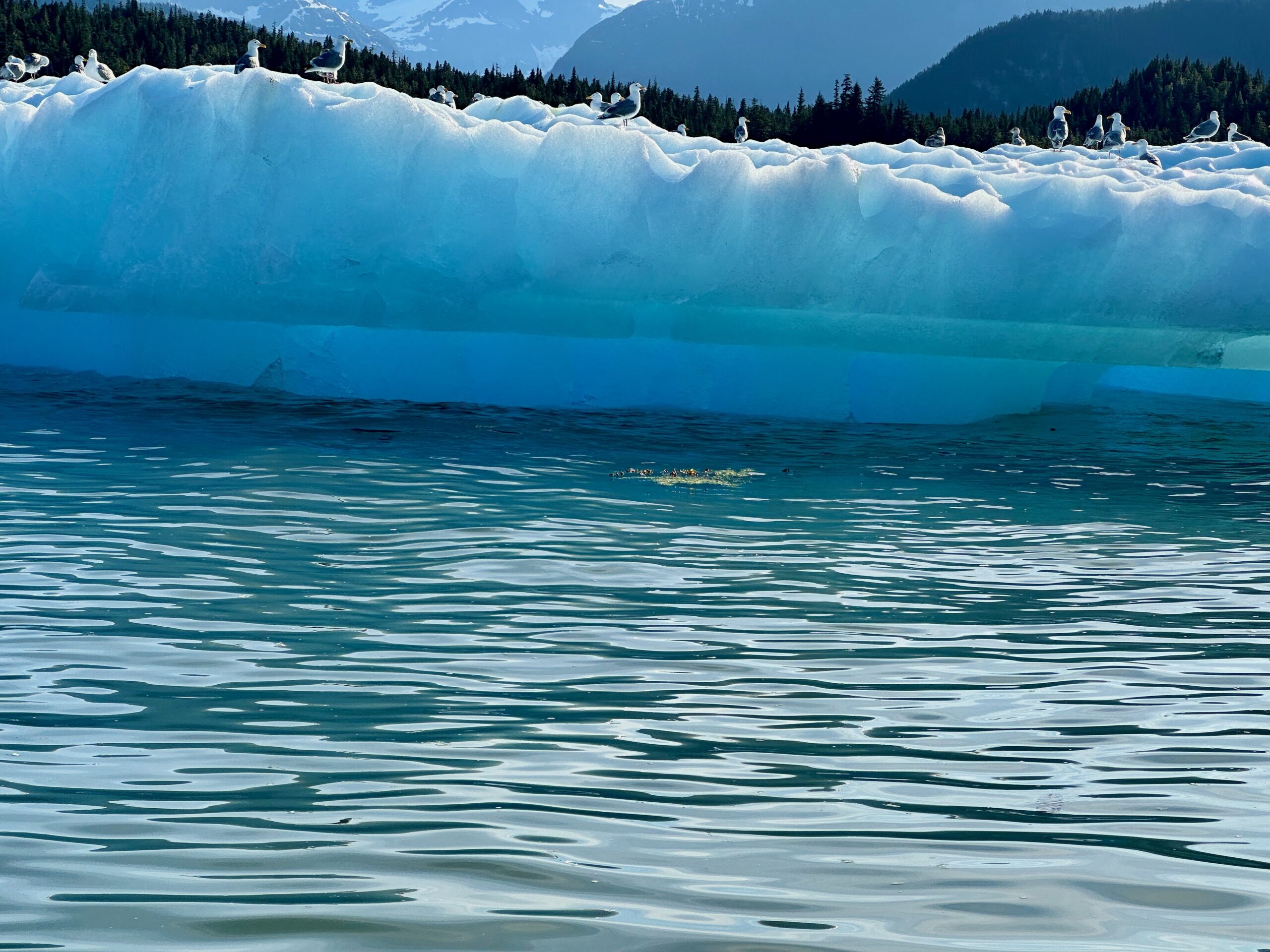
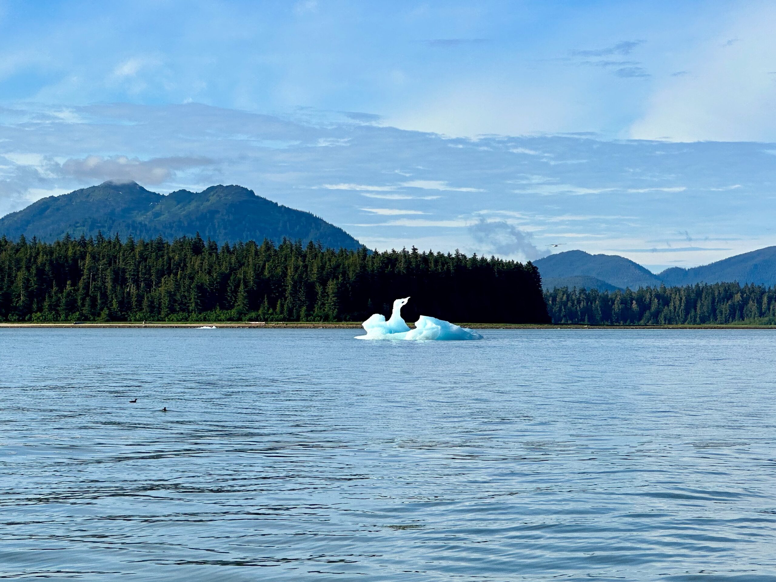
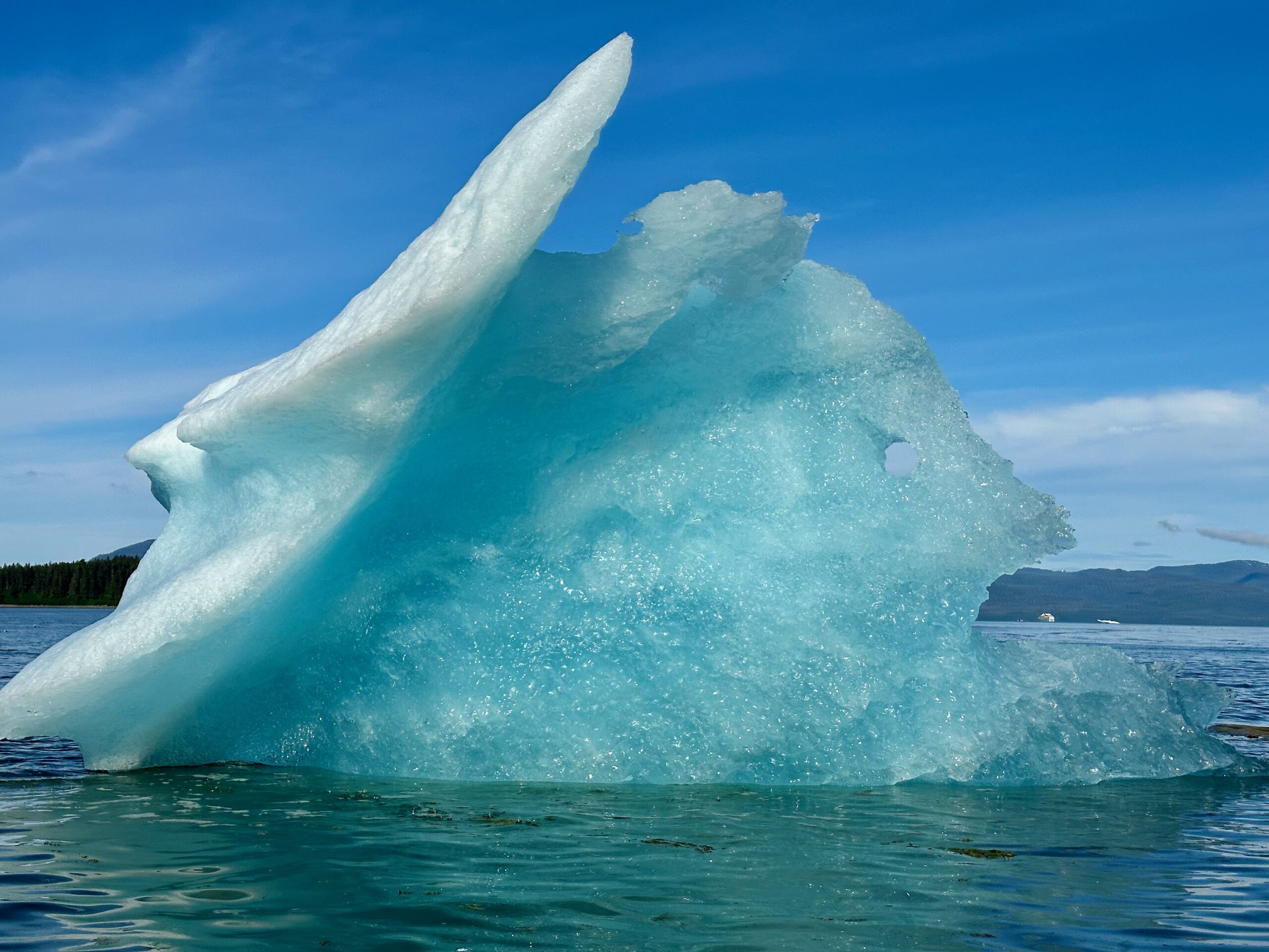
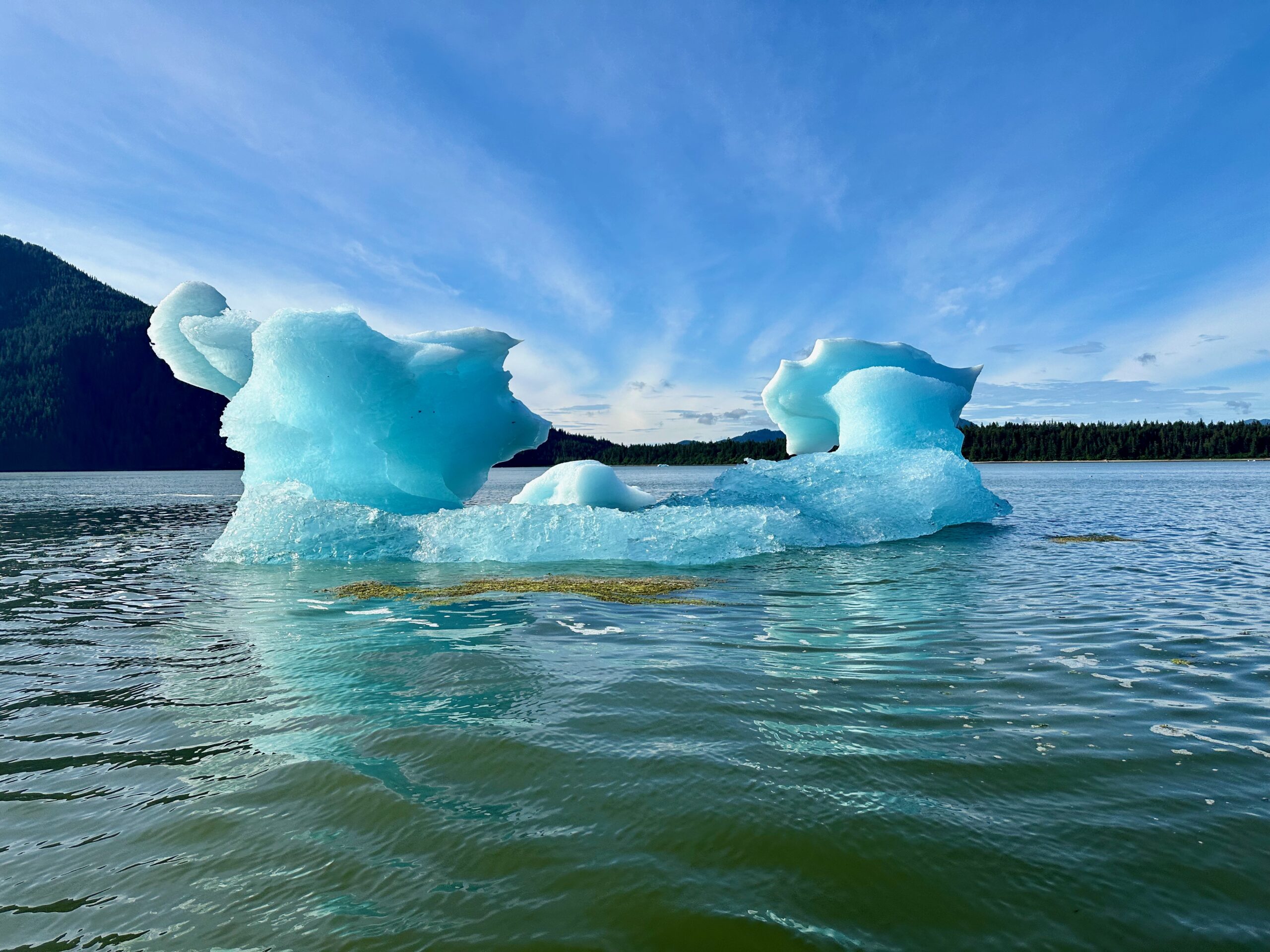
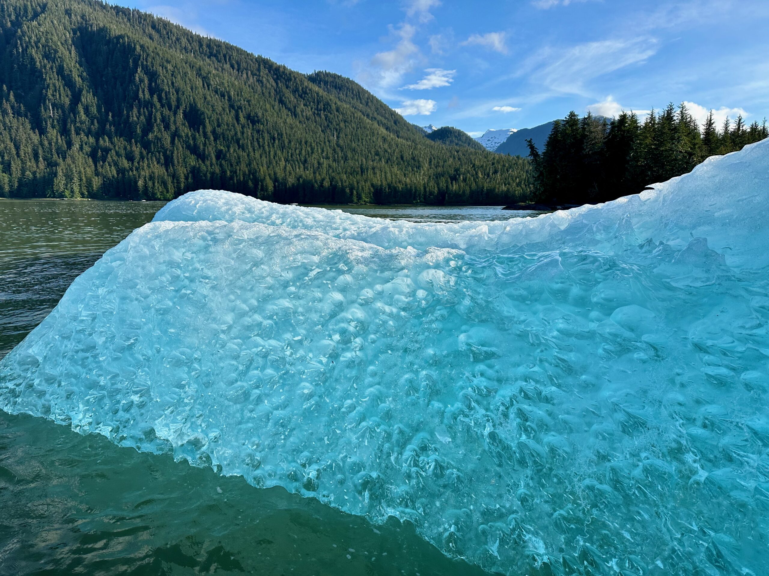
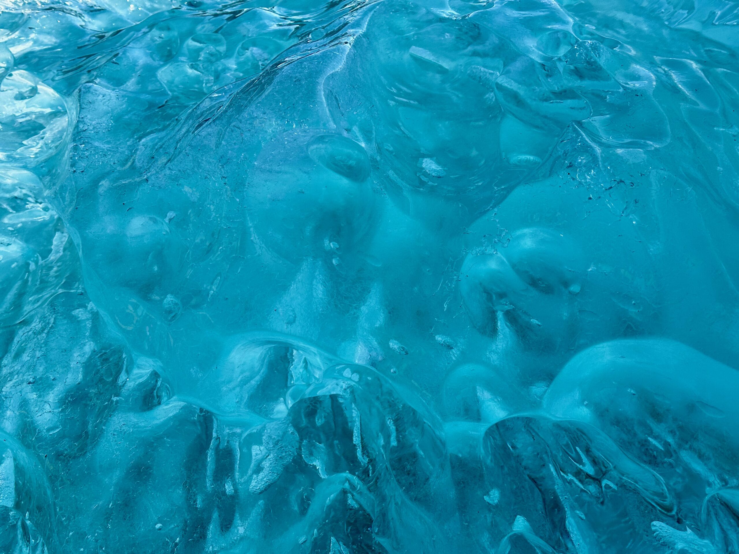
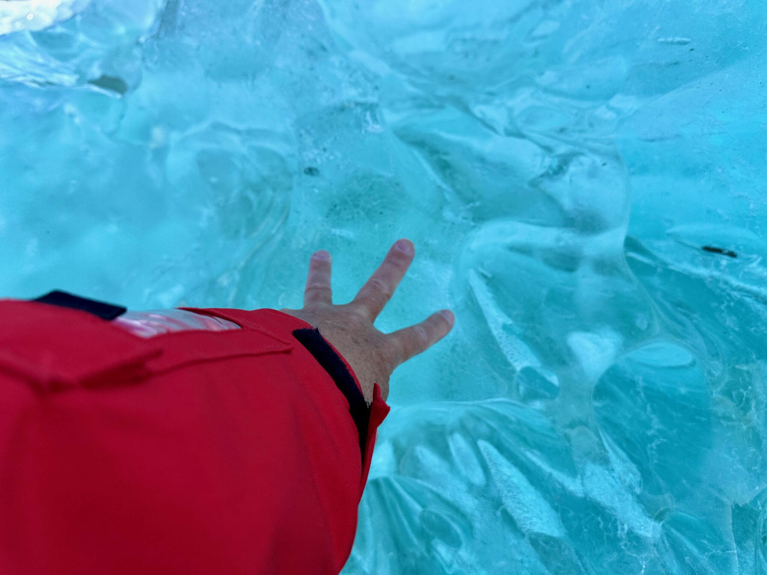
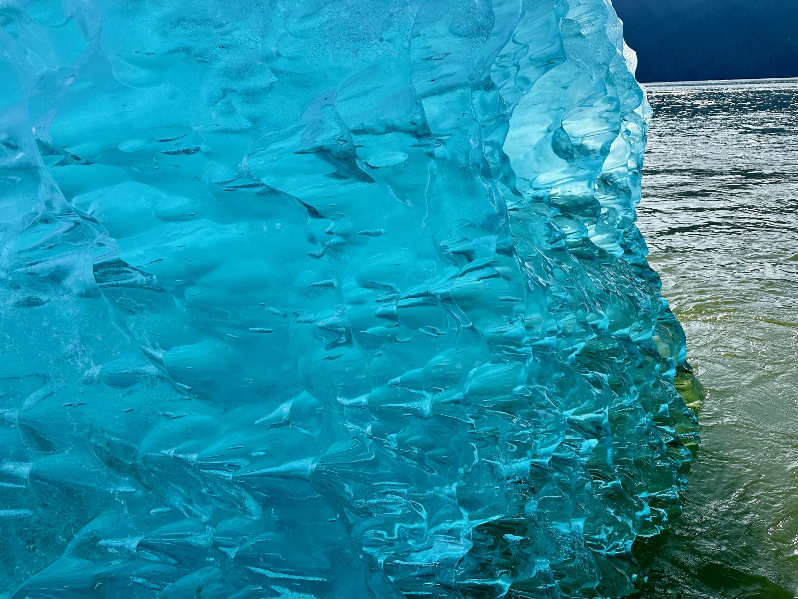
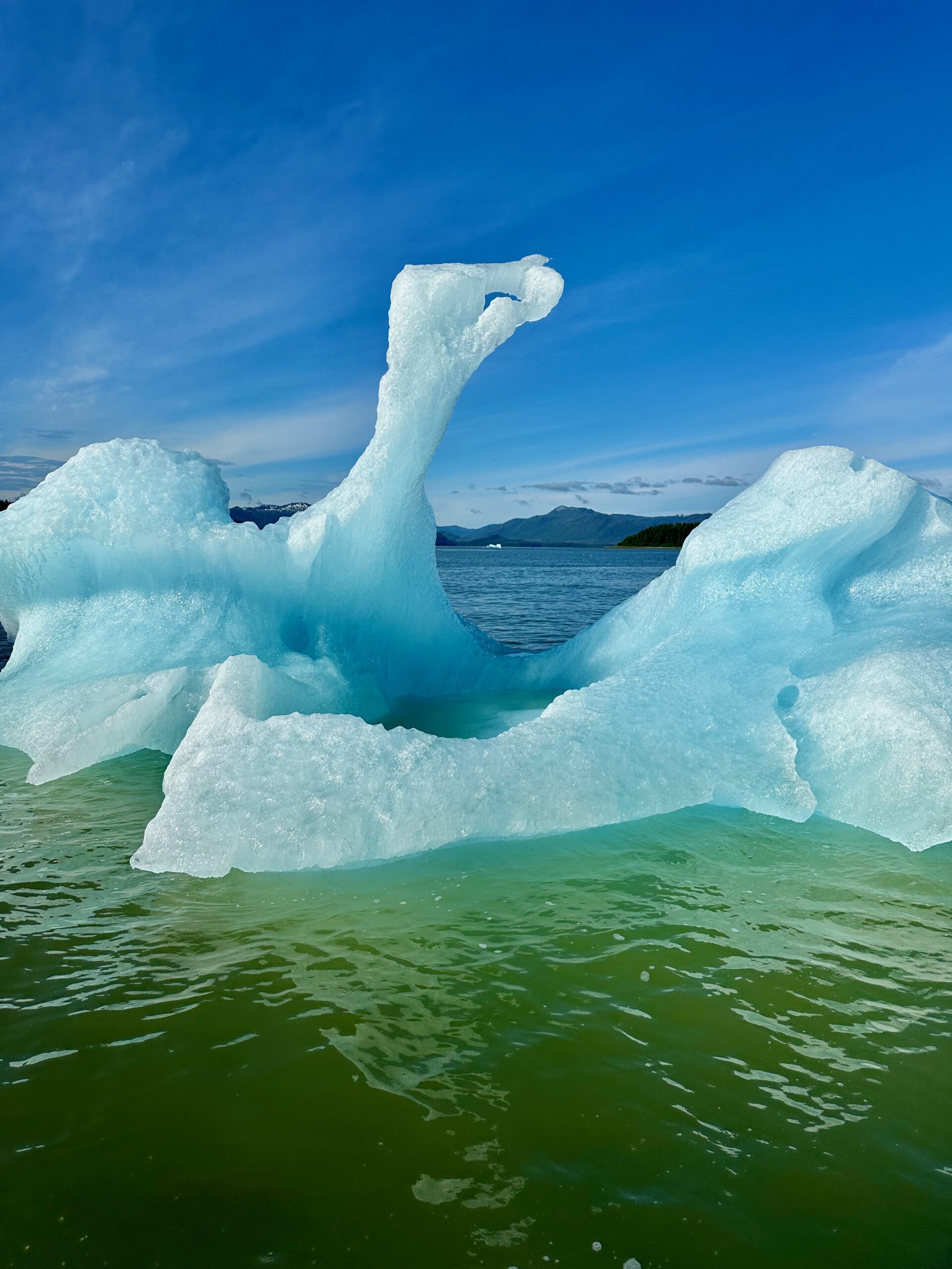
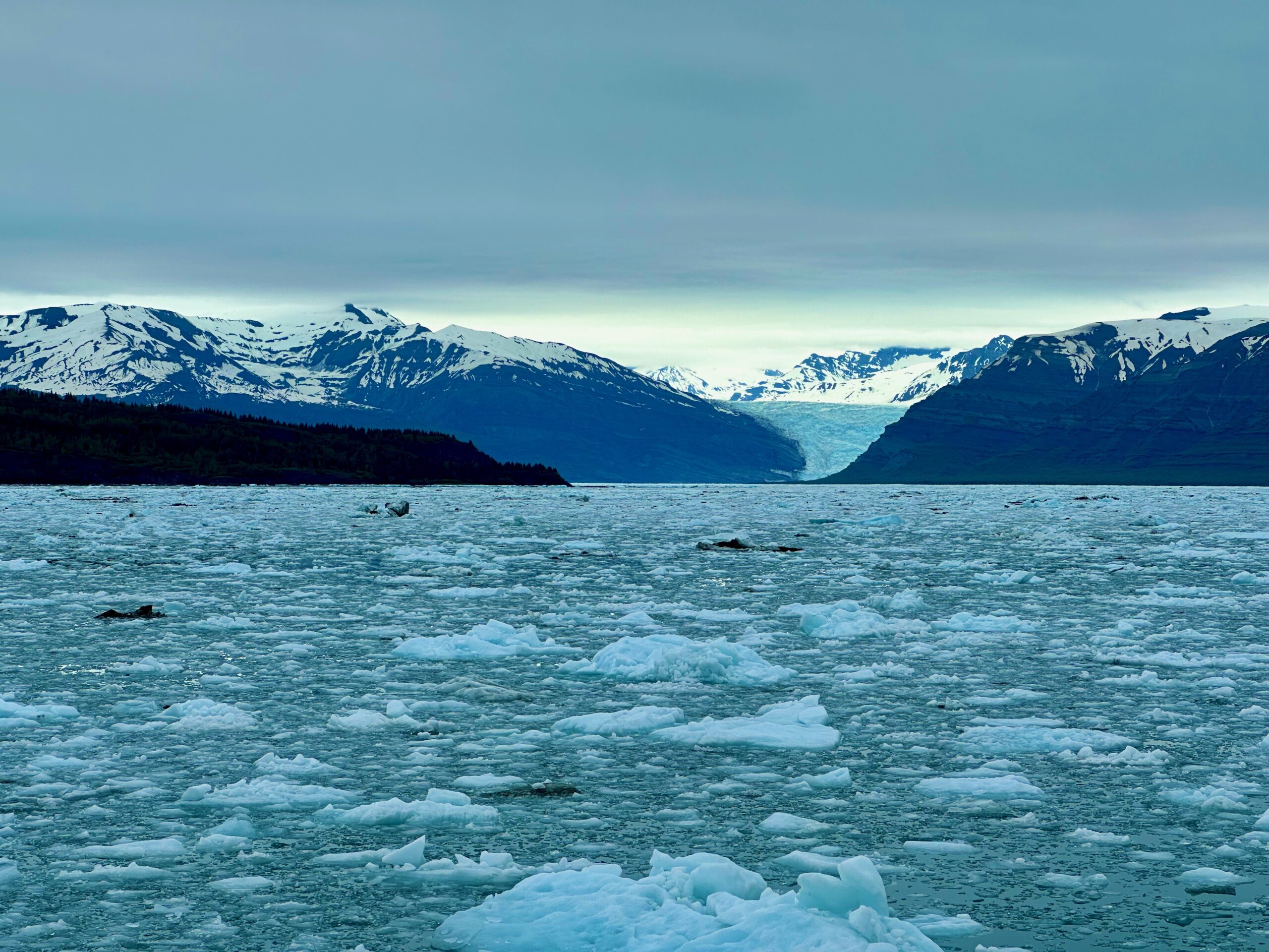
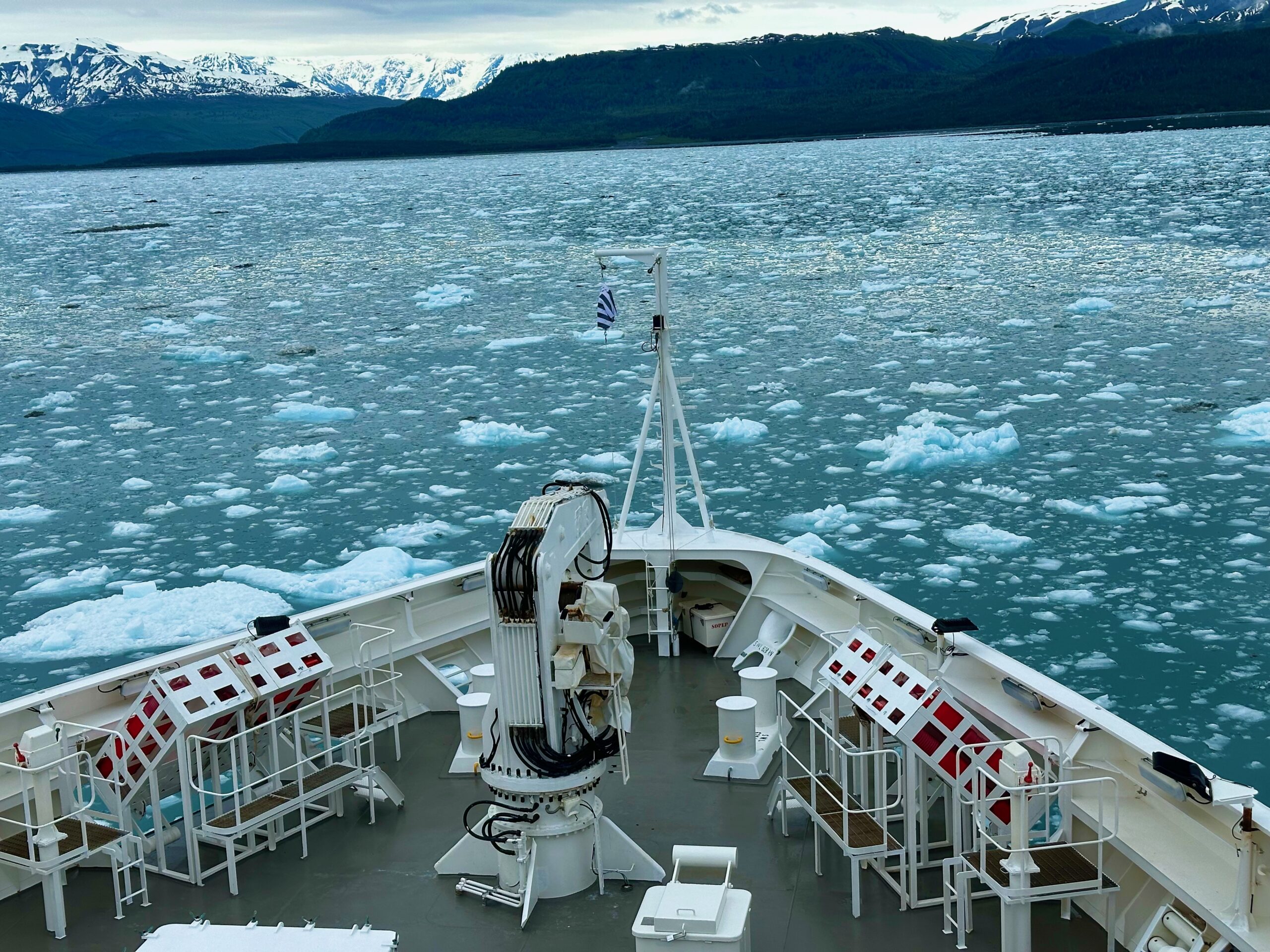
This morning was, yet again, beautiful. Although we had to set an alarm for 5:00 AM to be awake and fully conscious for our 6:40 AM excursion to an ice field, it was worth it.
The boats taking us to the iceberg field appeared as an invasion.
The field was mind-boggling, other worldly. Touching an iceberg is something I’ll never forget. Mother Nature is an expert ice sculptress, and pictures tell the story better than words.
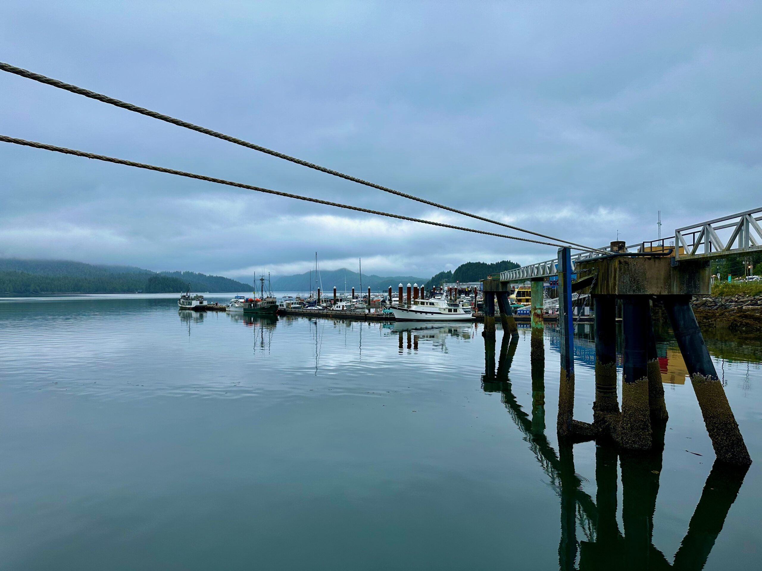
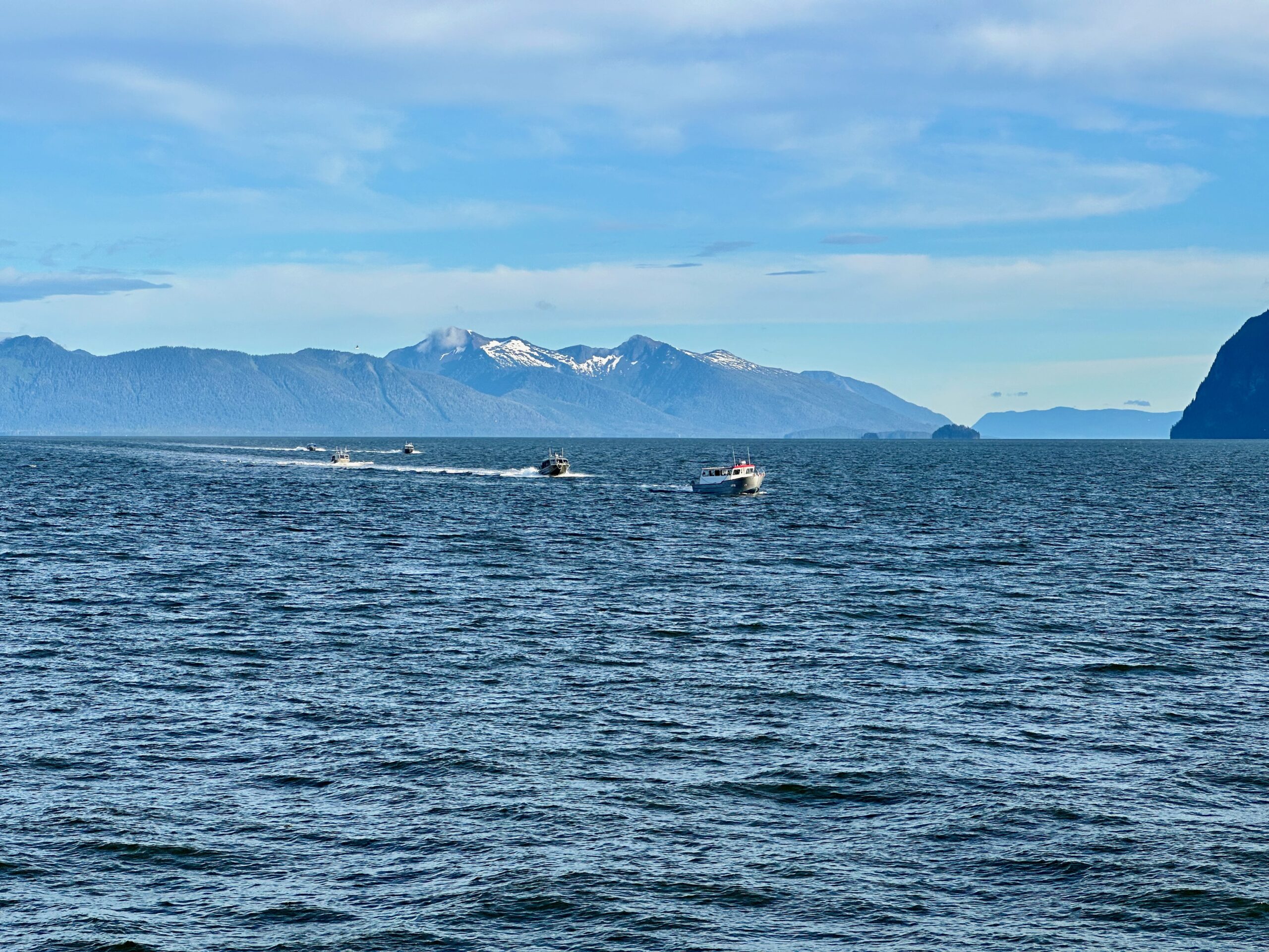
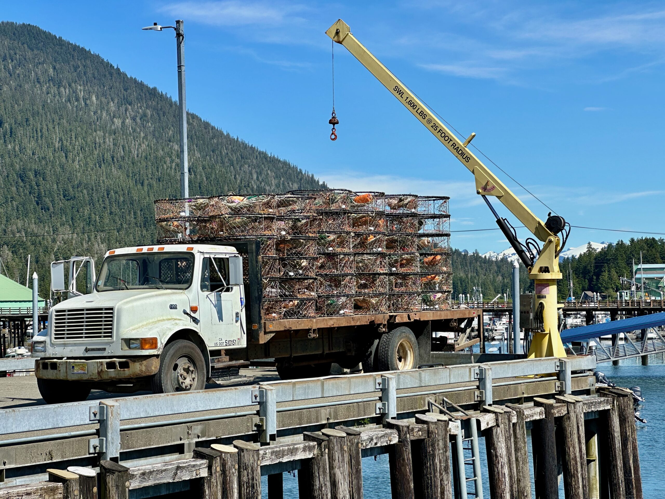
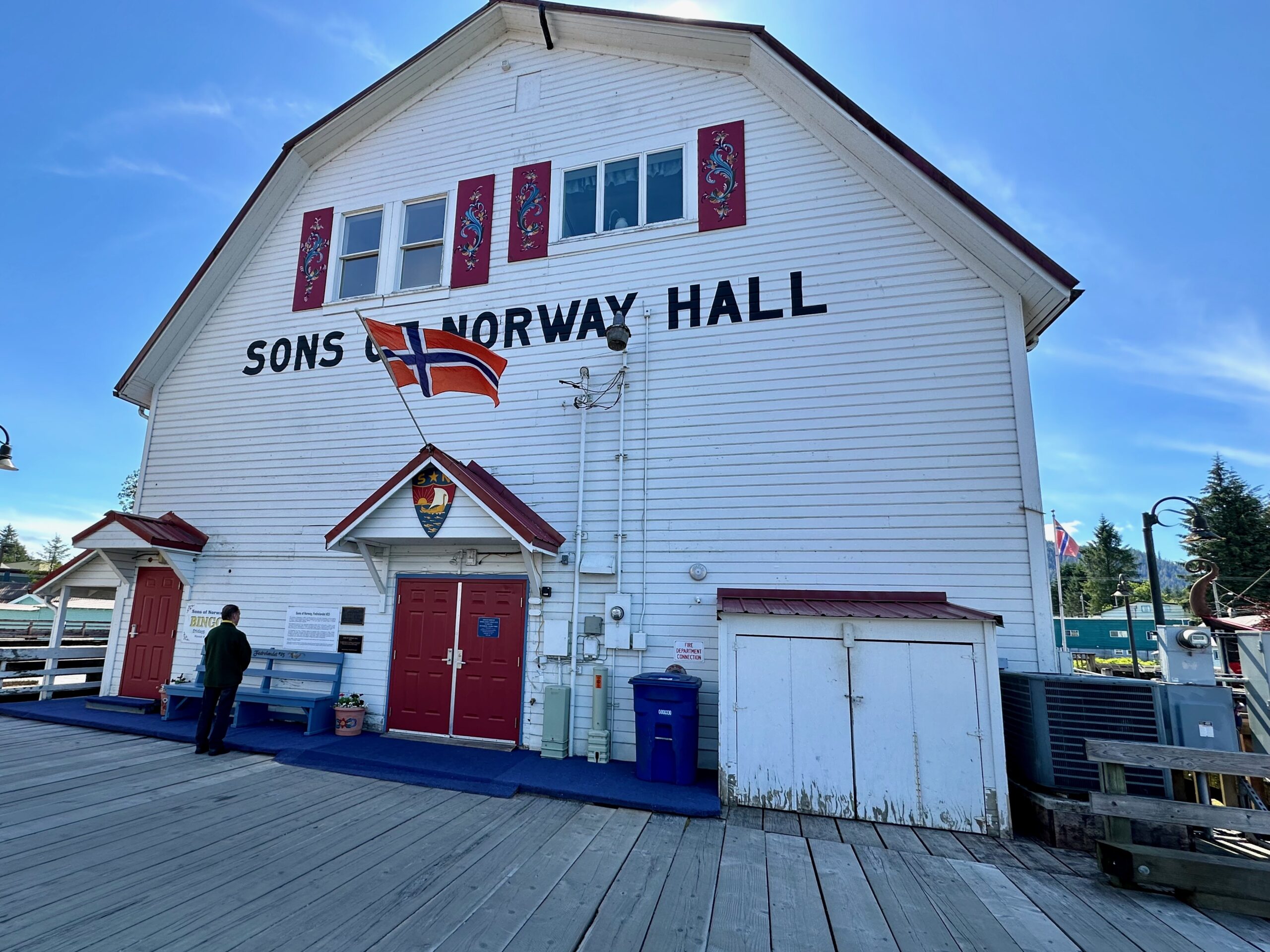
Late in the morning, we took the tender into Petersburg, originally a Tlingit settlement. White men came from Norway in the nineteenth century and gave it the name. They started a cannery, which remains the main economic engine of the town to this day. Today is the first day of crab season, so there were truckloads of traps being loaded onto fishing vessels.
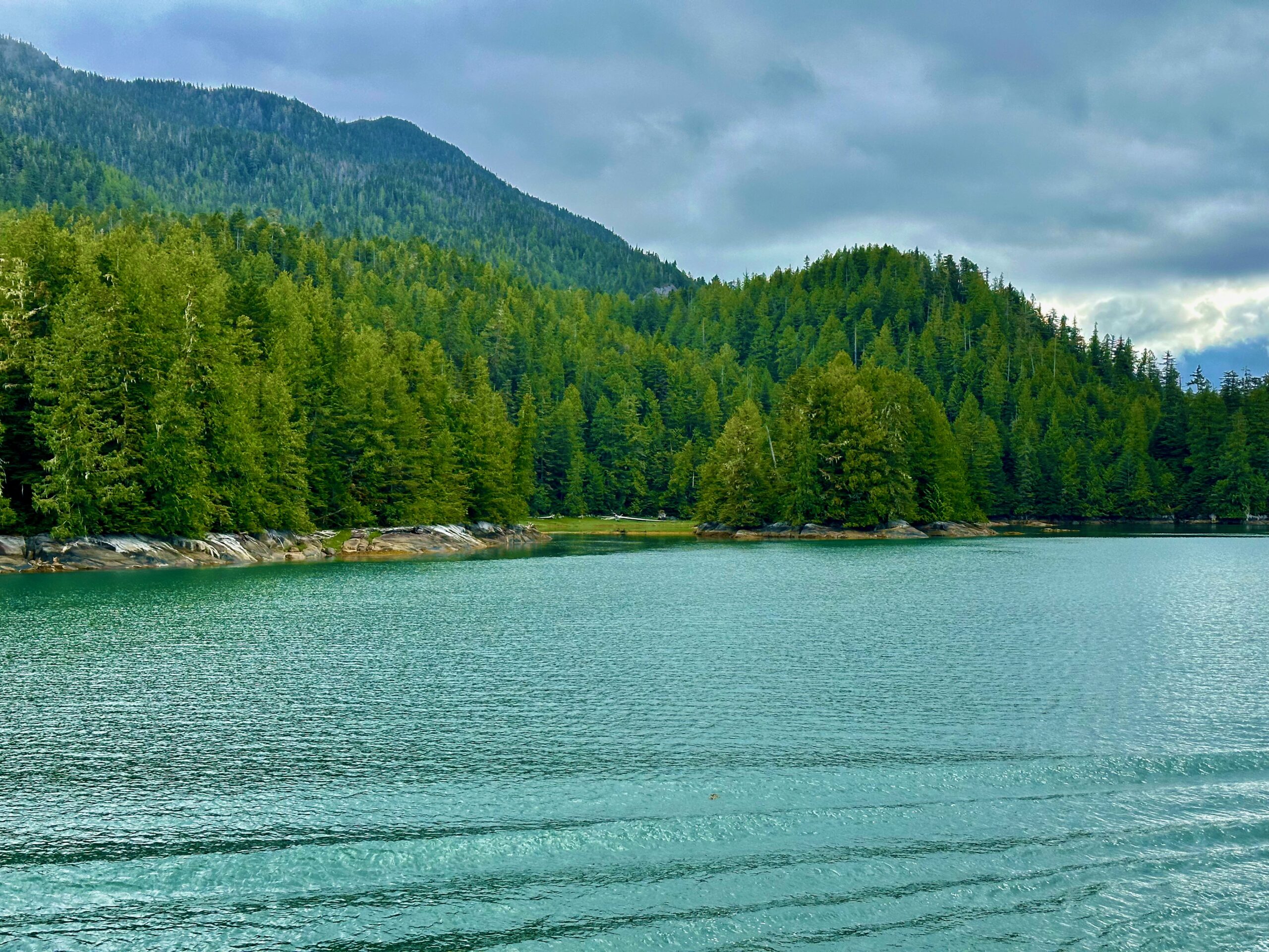
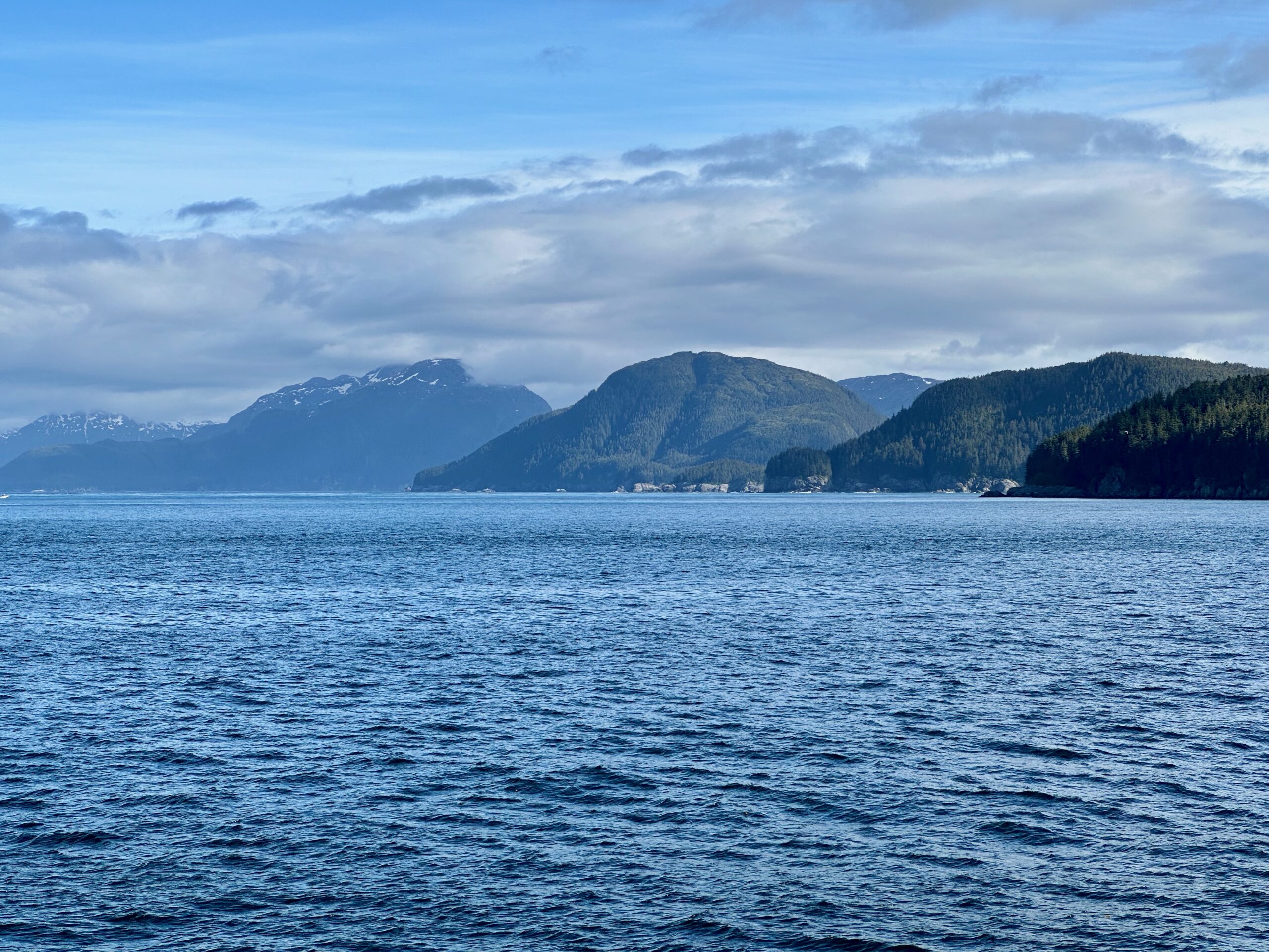
For the rest of the day, we are cruising to our next destination through luscious vistas.
Gotta go, they just announced humpbacks breaching in the direction of eleven o’clock.
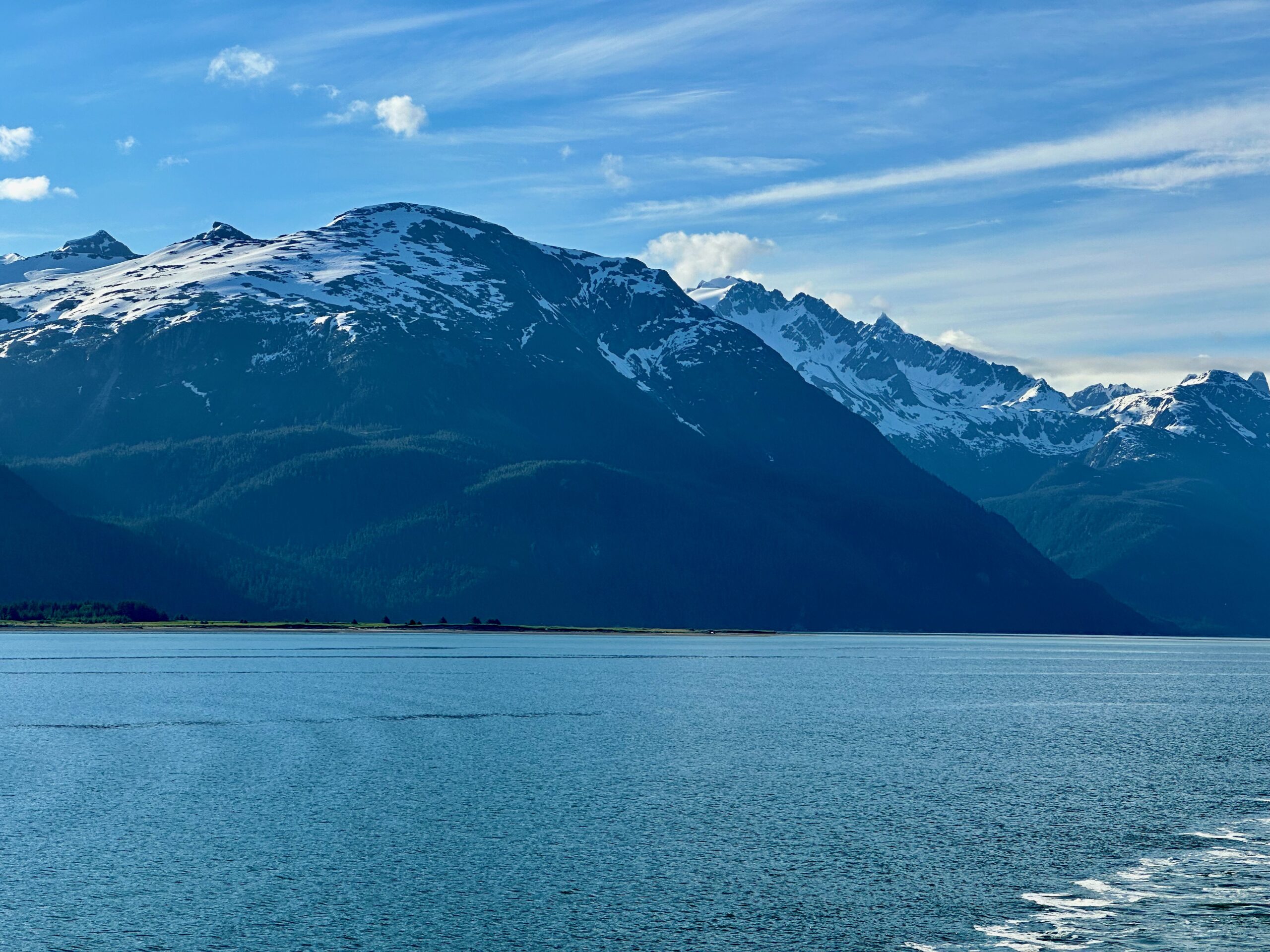
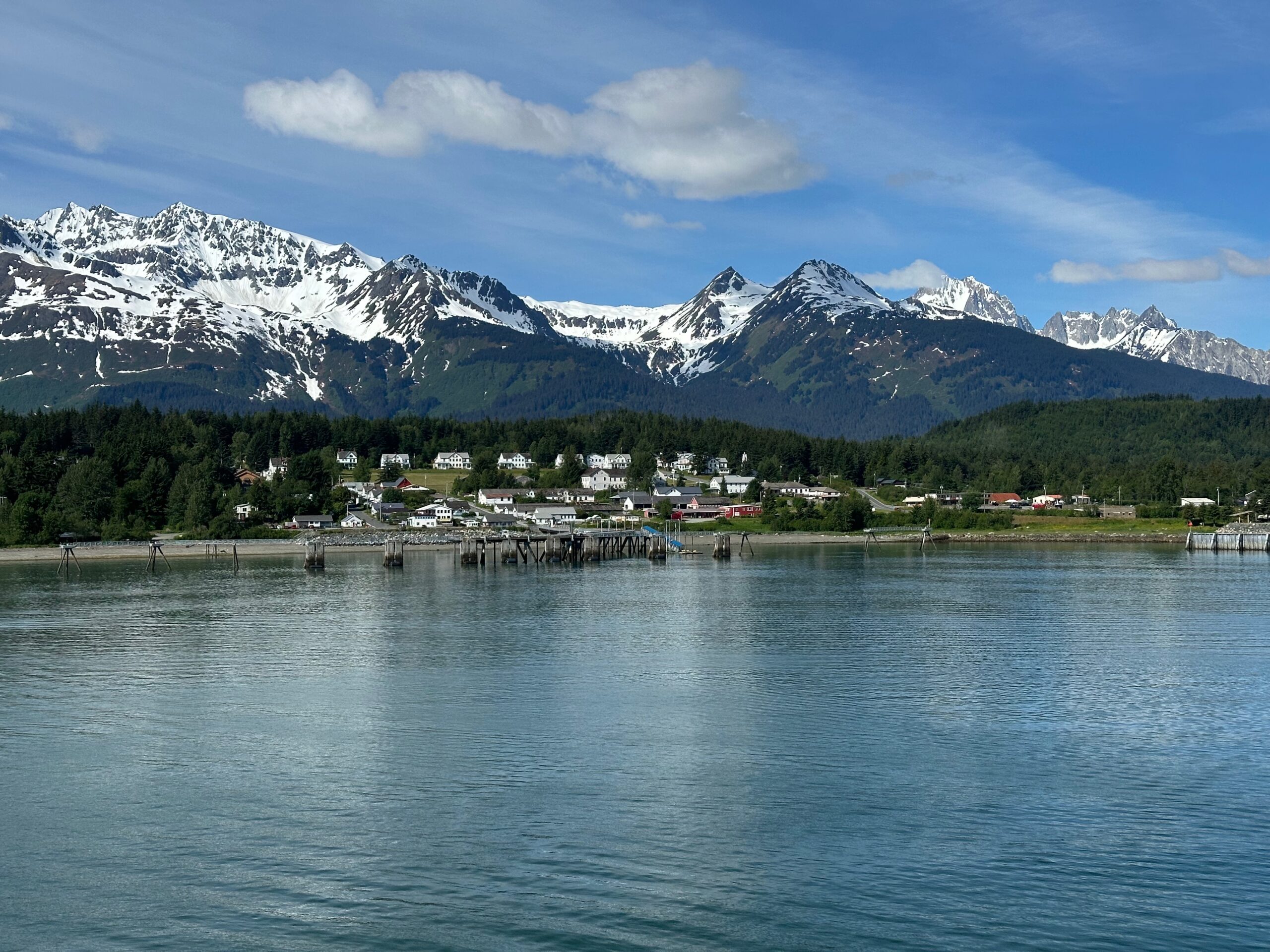
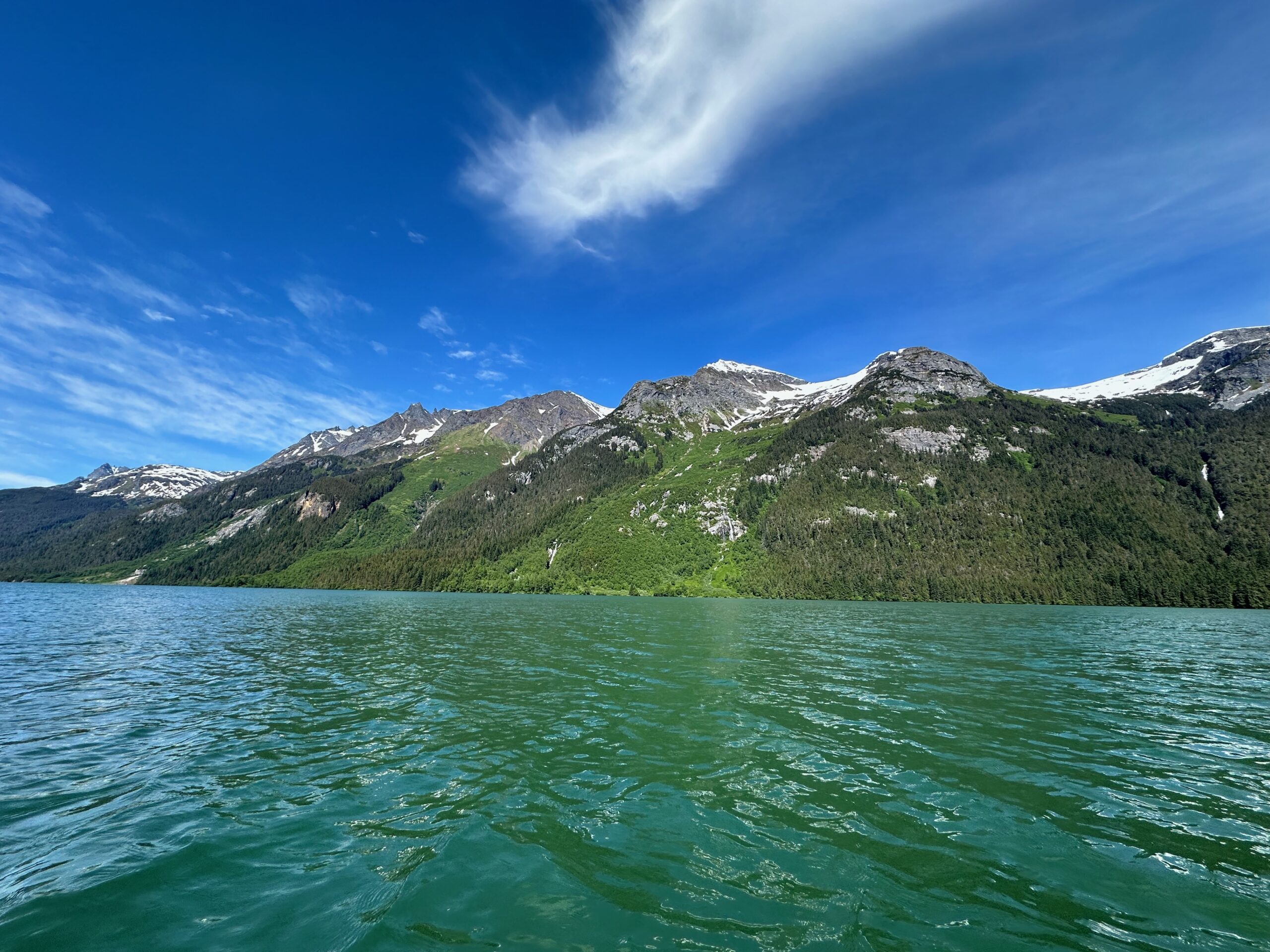
Again, we woke to an amazing panorama of Alaska’s mountains and waters.
We cruised until 7:30 AM, when we arrived in Haines, population 1,657 as of the 2020 census.
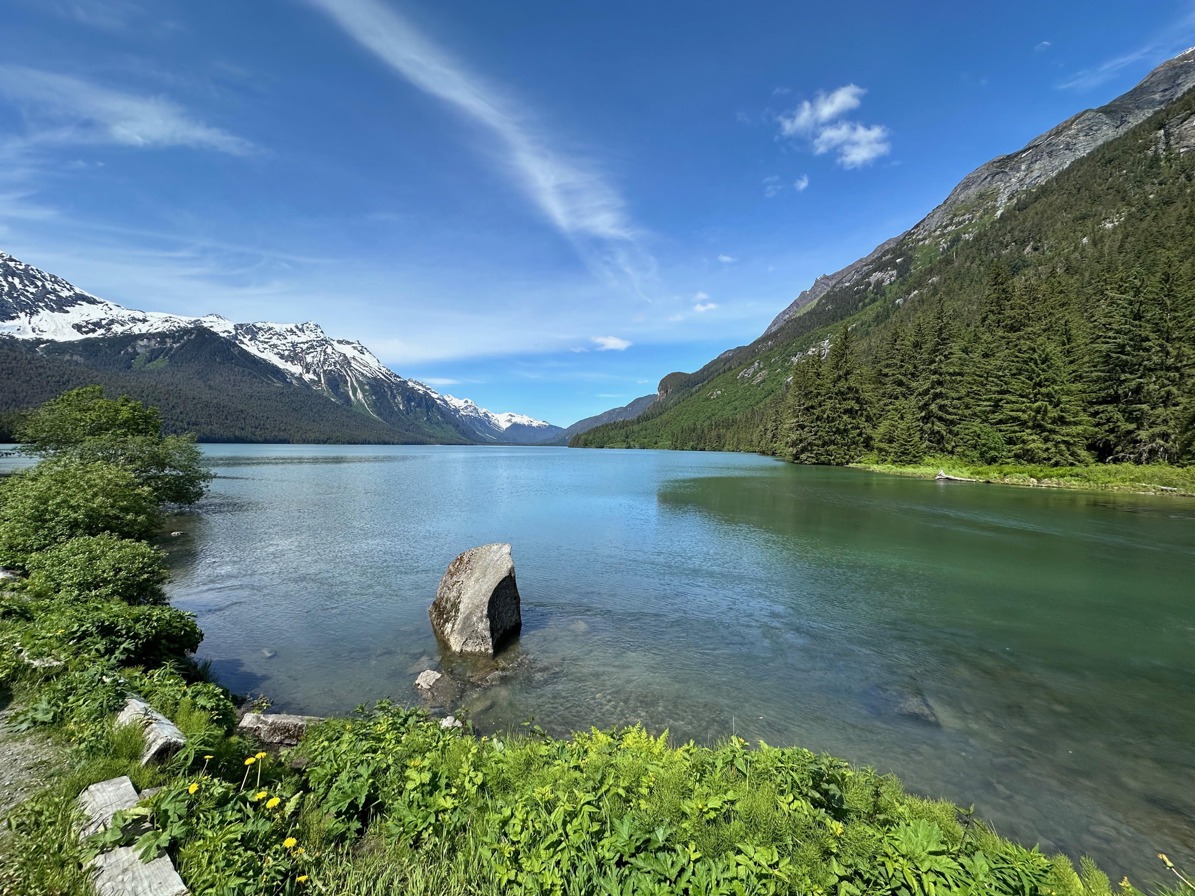
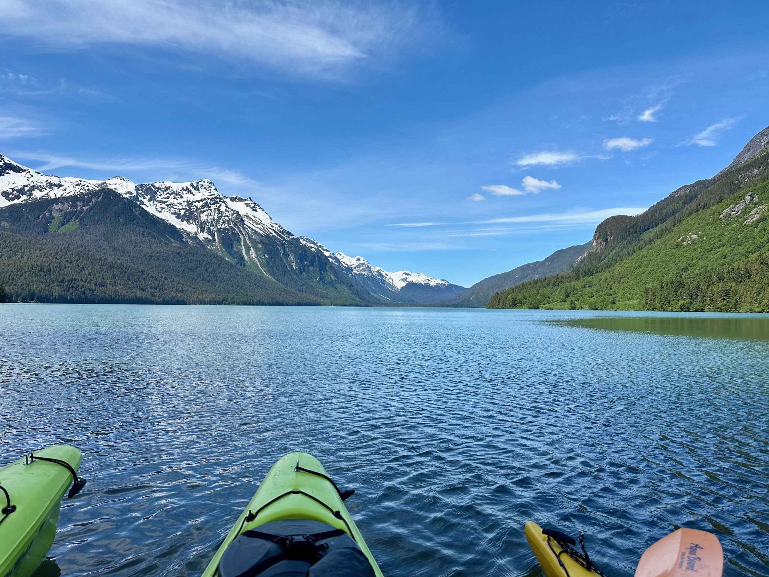
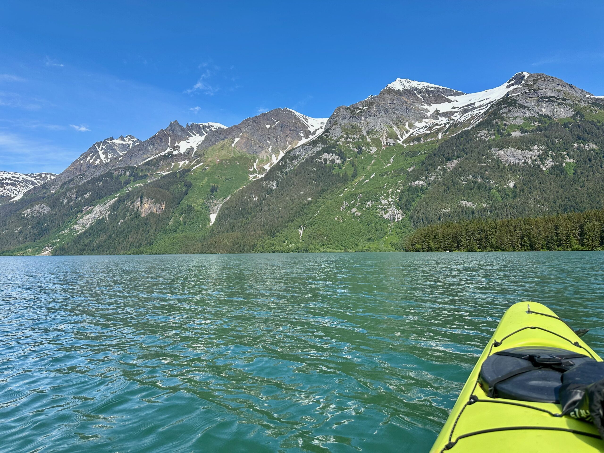
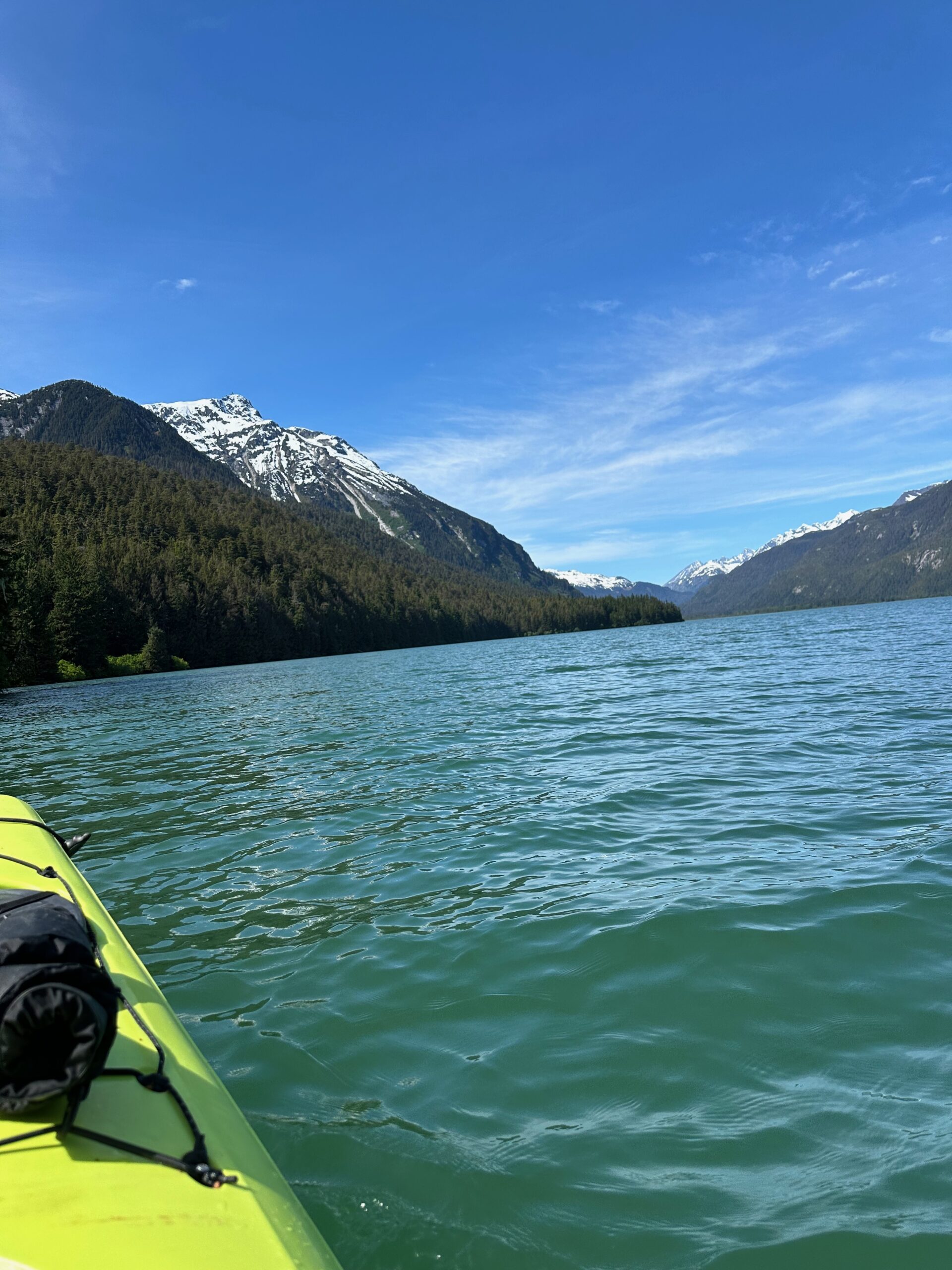
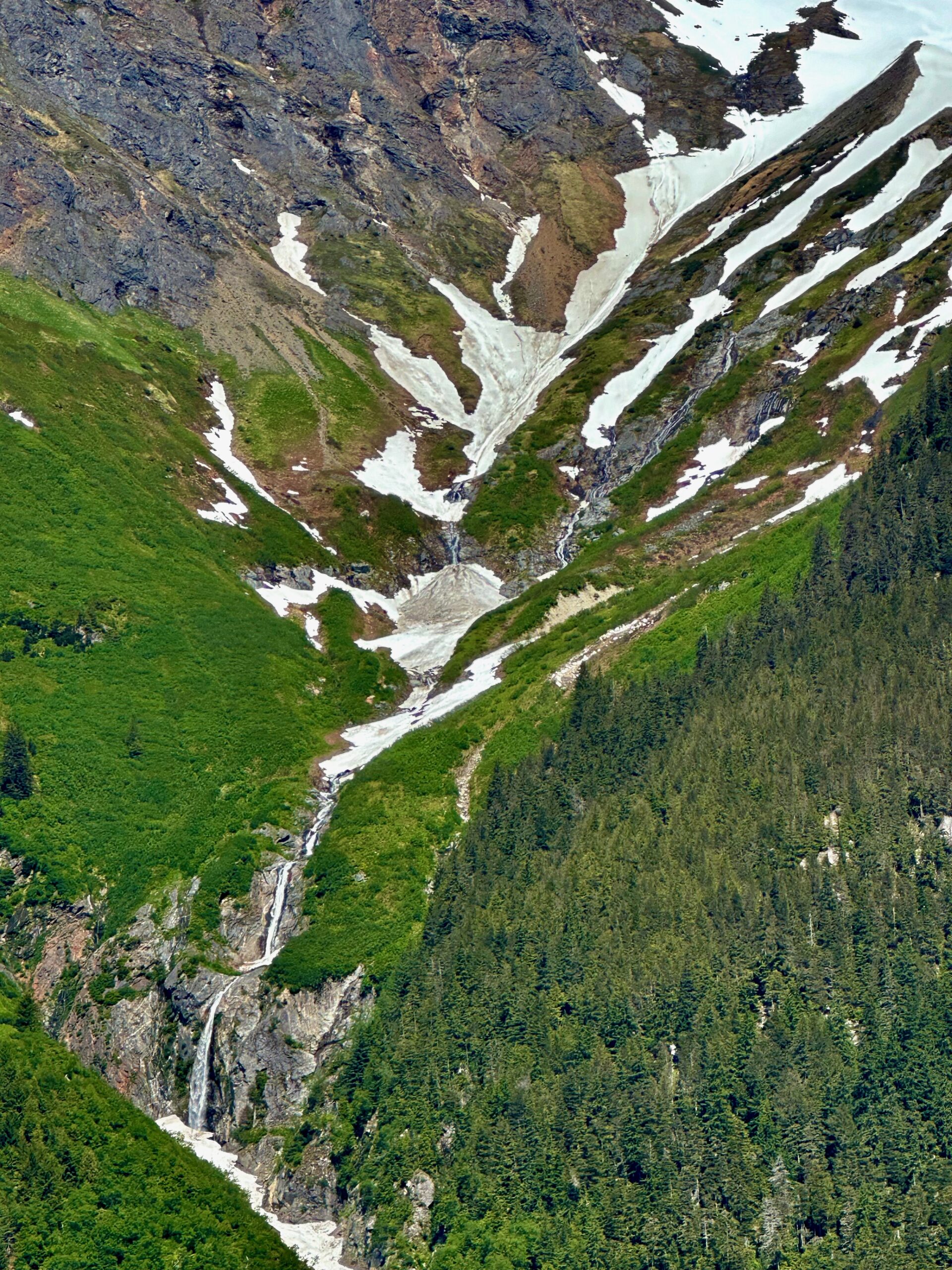
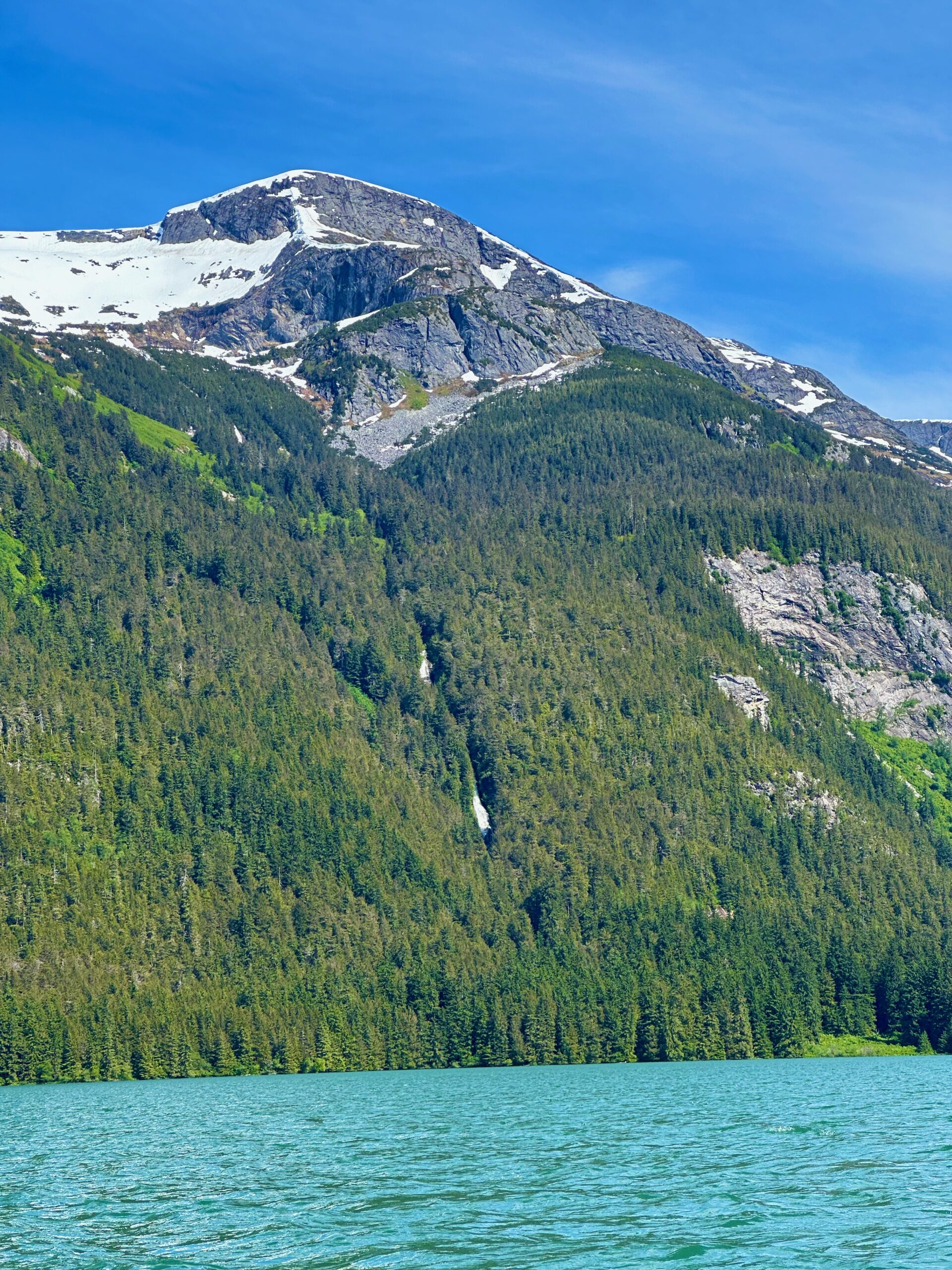
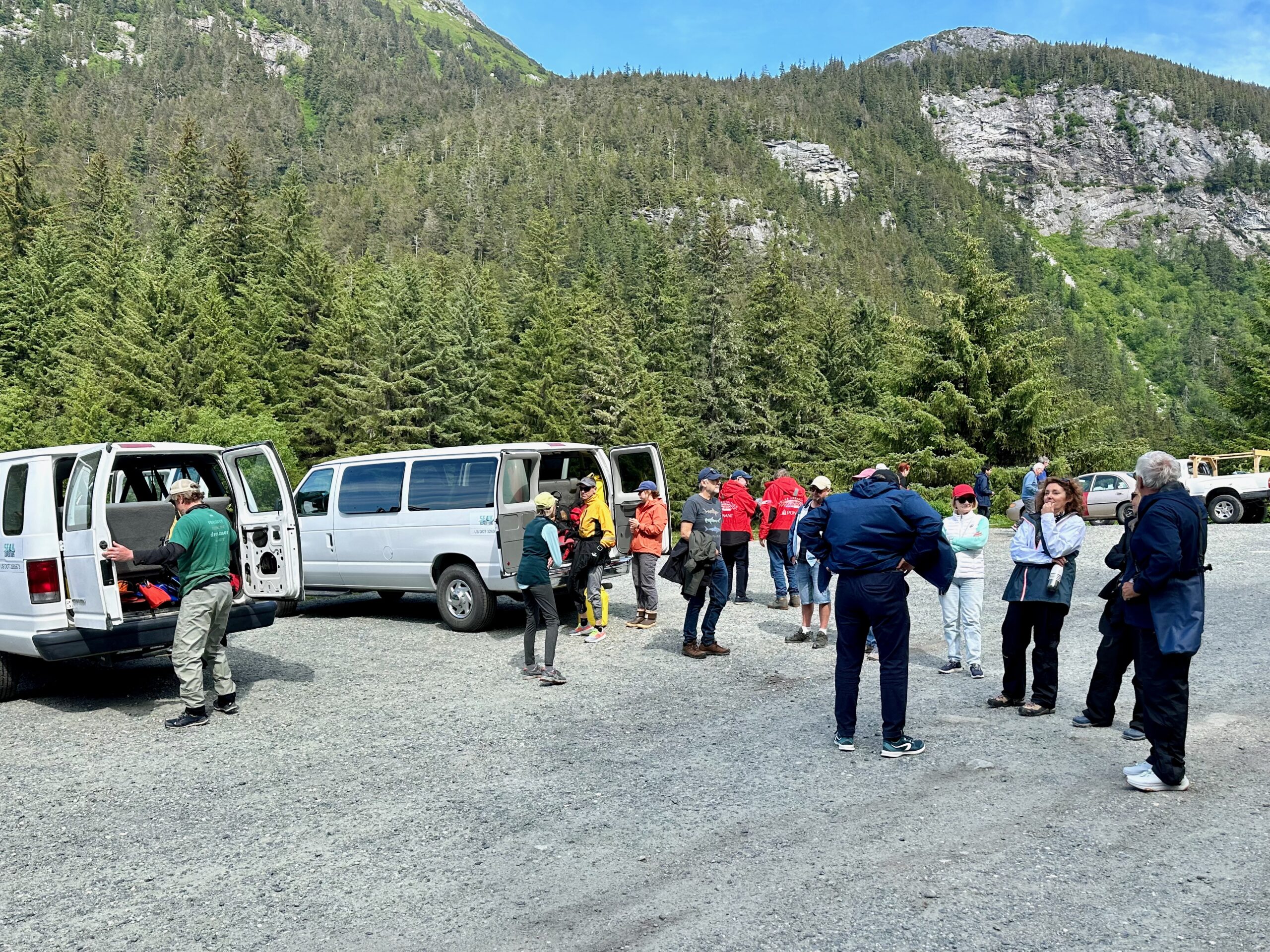
The main event of the day was exploring Chilkoot Lake. There were an array of expeditions afforded, bus tours, river rafting, and kayaking. I chose the kayaking. After taking the tender to the harbor, we boarded a van for the drive to the lake. I sat shotgun and spotted four Bald Eagles on the short trip. We unloaded near the boat ramp and had our quick safety overview. We were all assigned a “splash skirt” to keep the water out of the kayak and a life vest. The kayaks were tandem, so two to a boat. We were a party of 11, 10 of which were couples, so I was odd man out and assigned to share with the wonderful Erin. She is a junior at Haines High School (mascot: Glacier Bears, colors: White, Green). As she said, “I’ve lived in Haines all my life, but no one is born in Haines. We don’t have health services to deliver a baby, so moms must go to Juneau for their last month of pregnancy until delivery.” She plays volleyball and is the state champion in shotput. Their out-of-town games and meets are quite an ordeal, involving boats, float planes, bunking in classrooms, and sometimes two travel days to reach their competitors. Needless to say, she kept me paddling in the right direction.
One shore of the lake is a sheer mountain drop with glacial waterfalls cascading down. The other shore features some flora and fauna nestled between the lake and more mountains. It was a breathtaking and serene experience.
Here’s our motley crew after our trip around the lake. Everyone survived although some got a little wet.
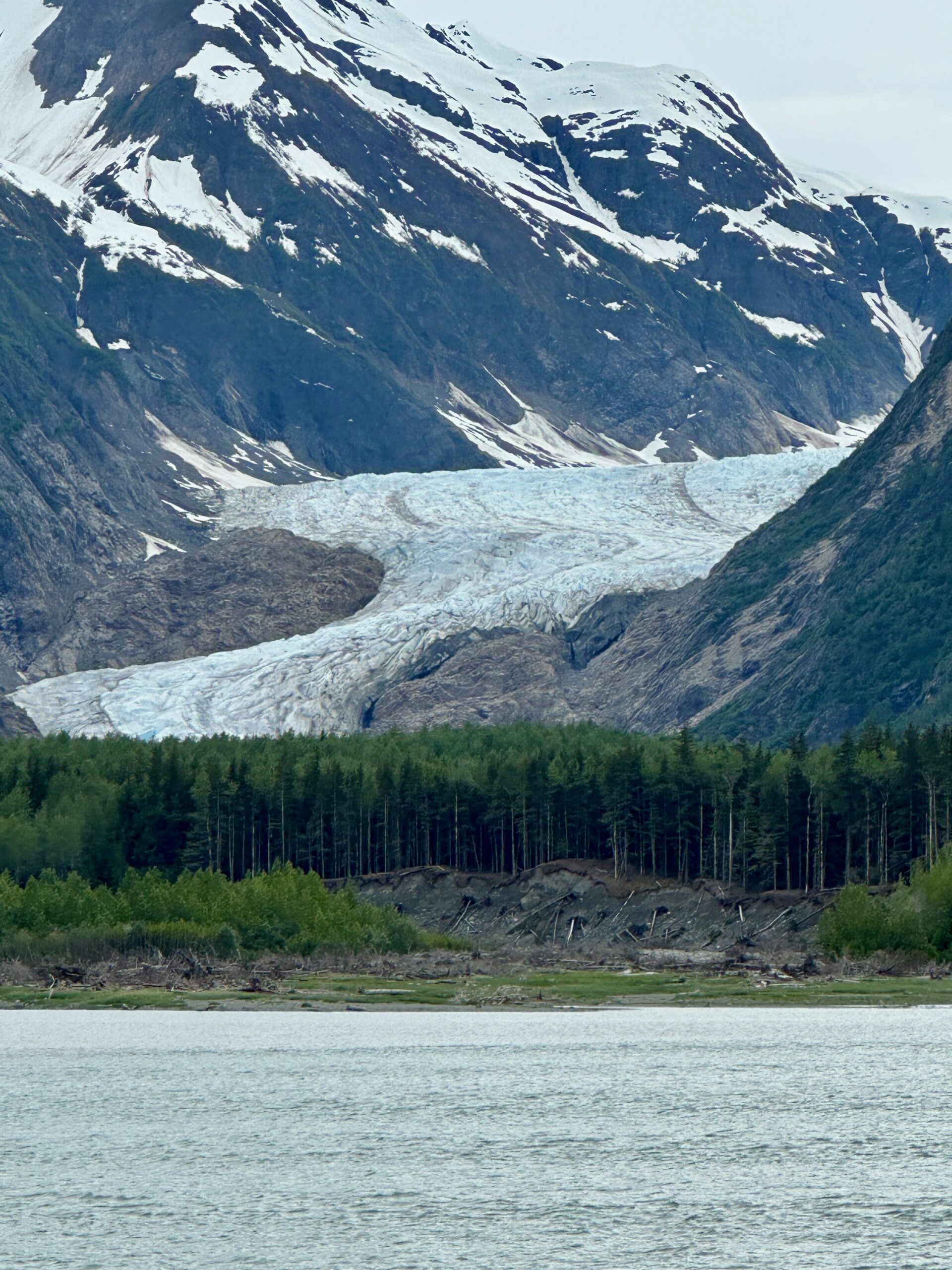
Oh, and one more glacier to end the day as we cruise throughout the night to land in Kake tomorrow morning.
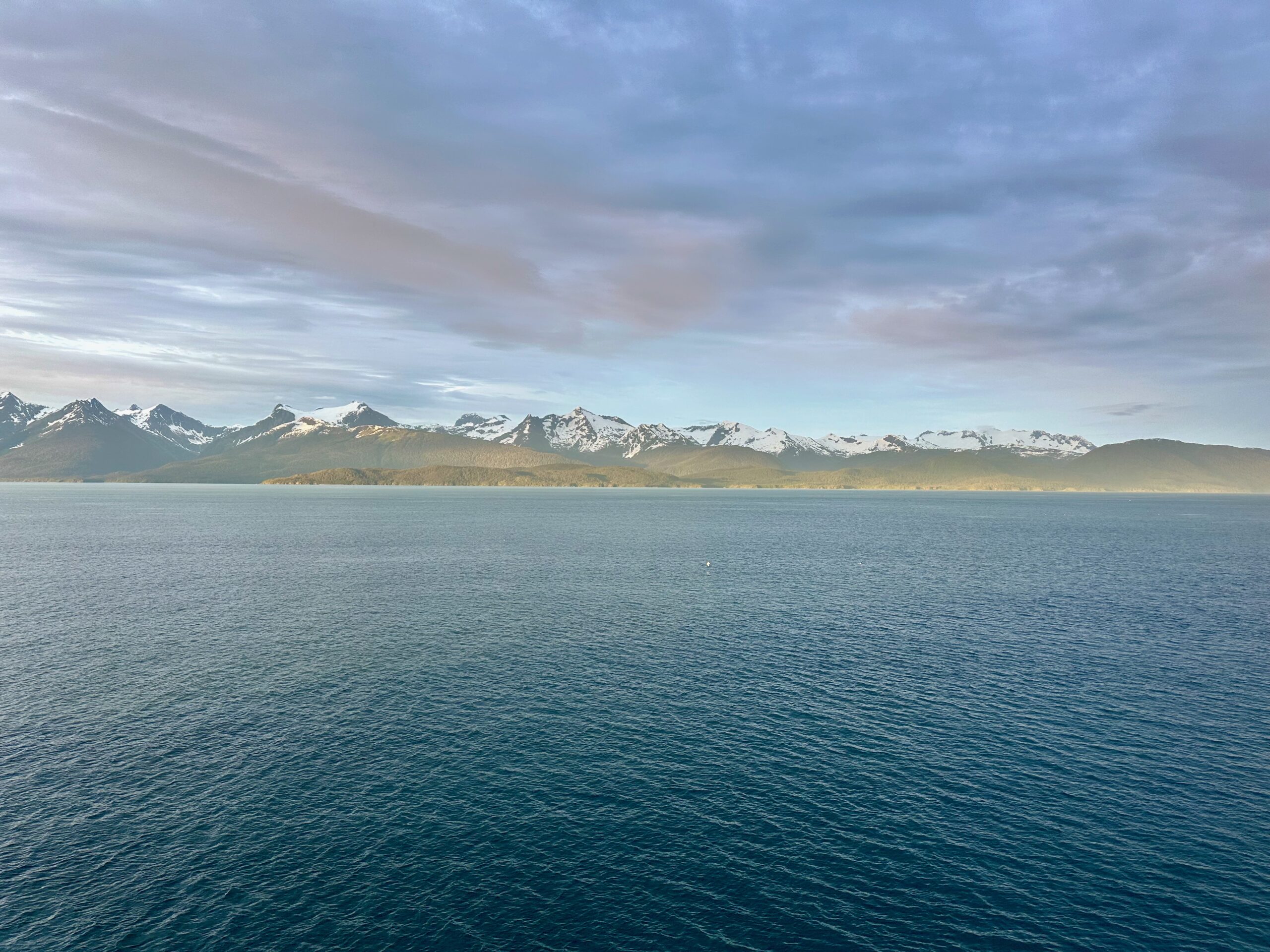
We woke up to the kind of day that makes one thankful to be where they are. Stunning blue skies and sunlight in Alaska air that crisps the edges of everything.
You may want to click on photos to enlarge
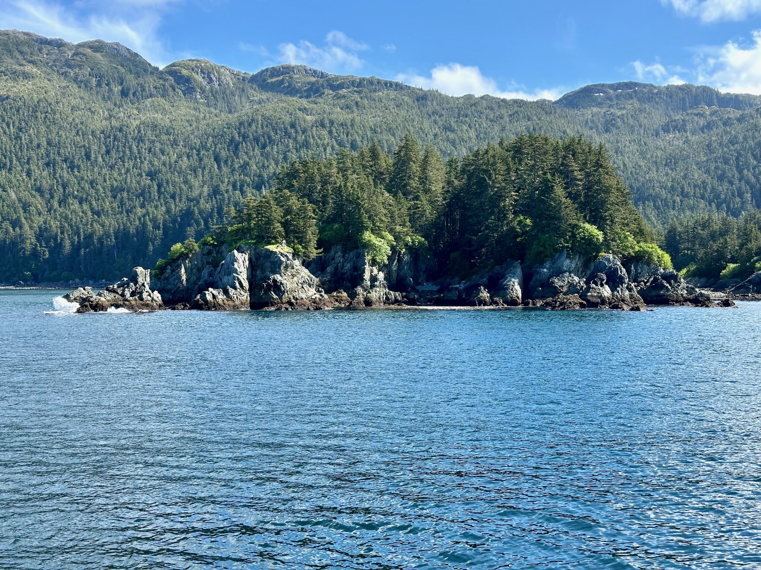
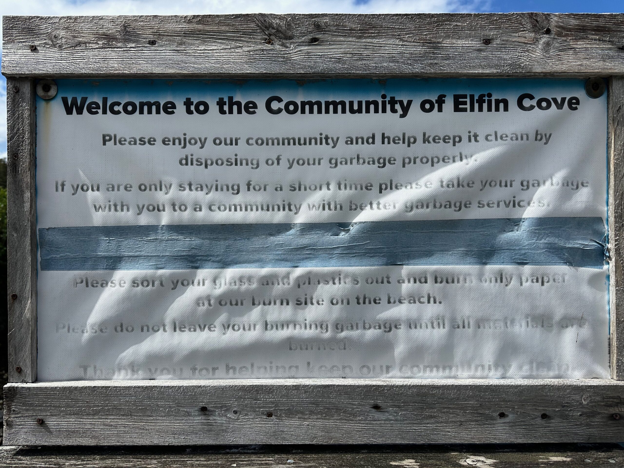
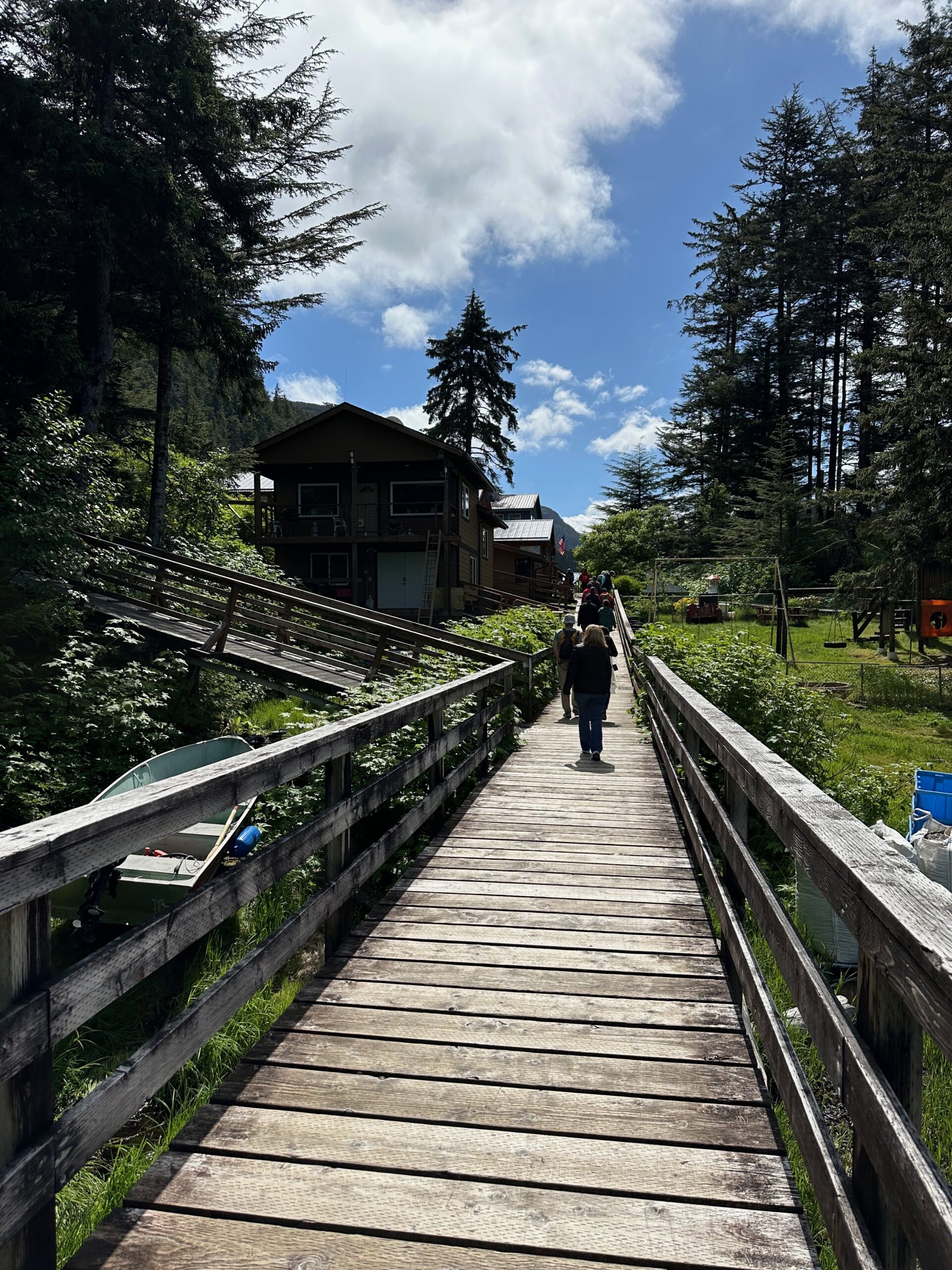
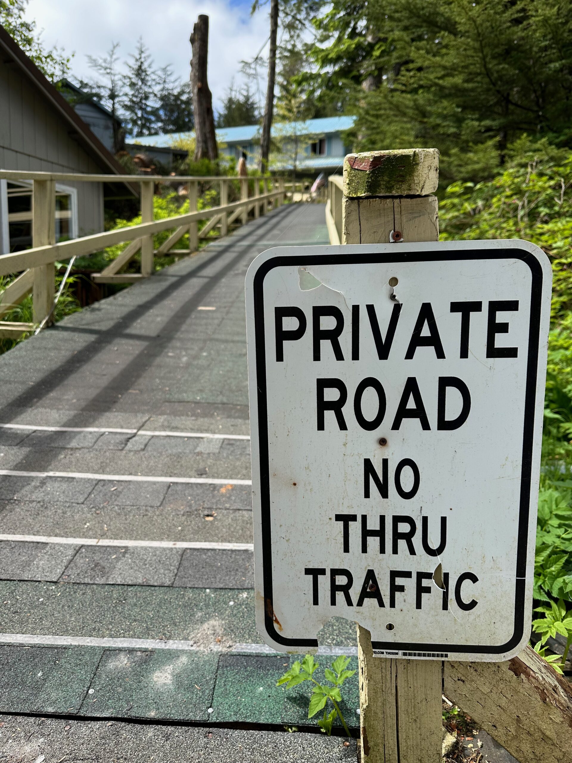
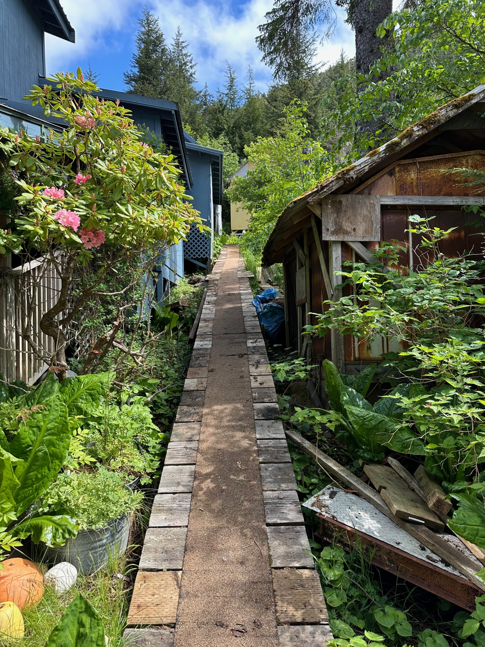
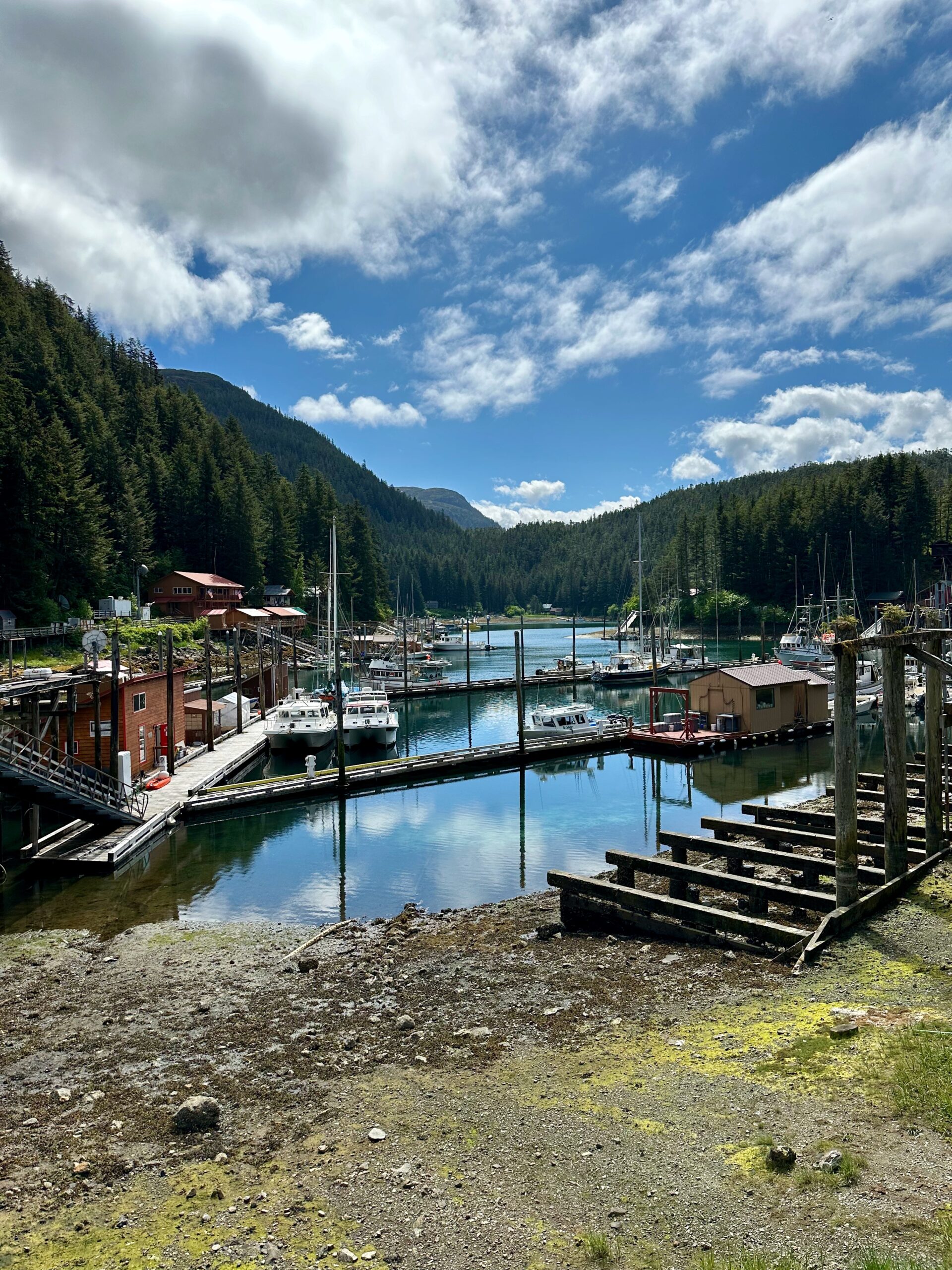
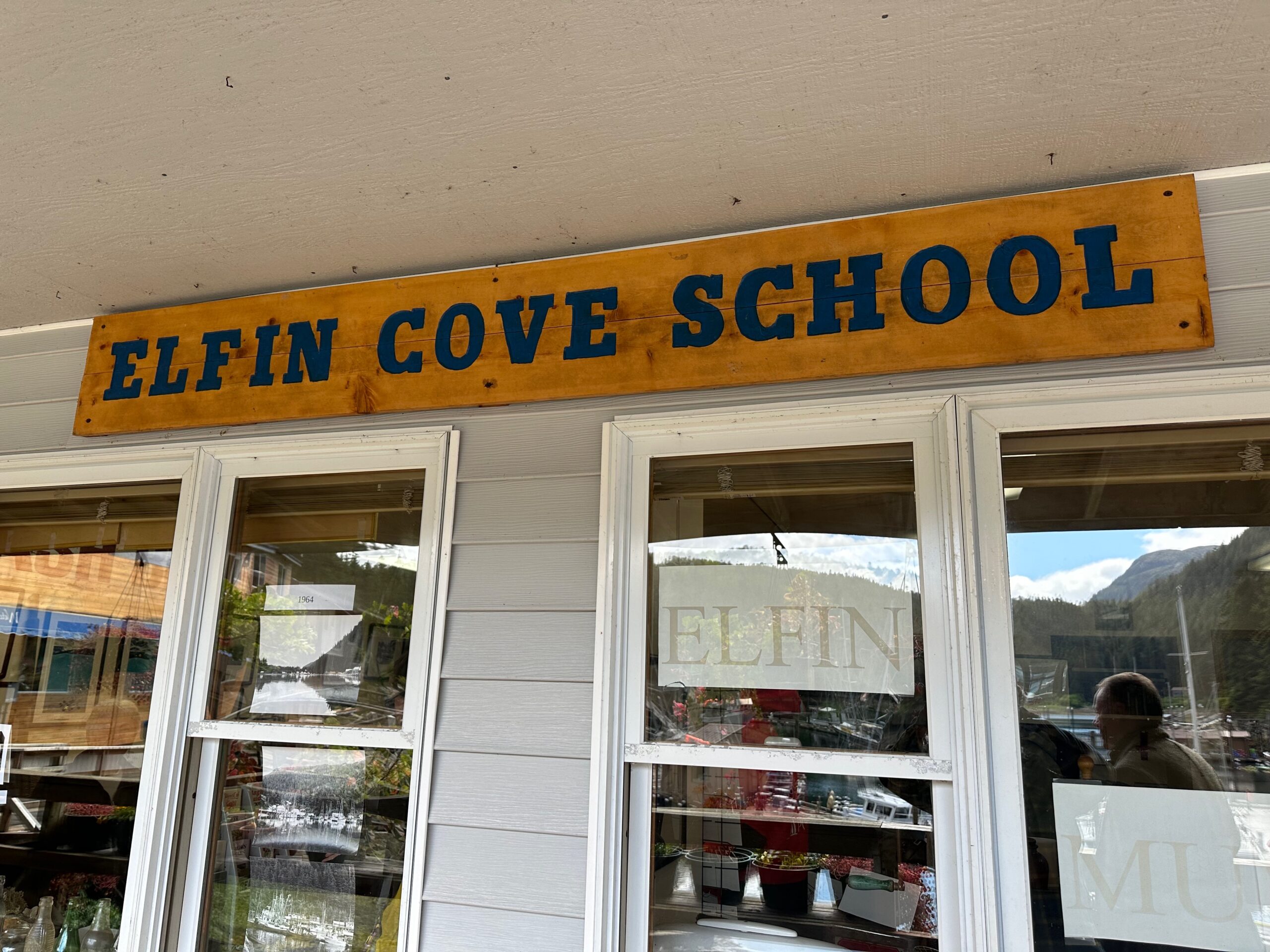
The major activity today was visiting the town of Elfin Cove.
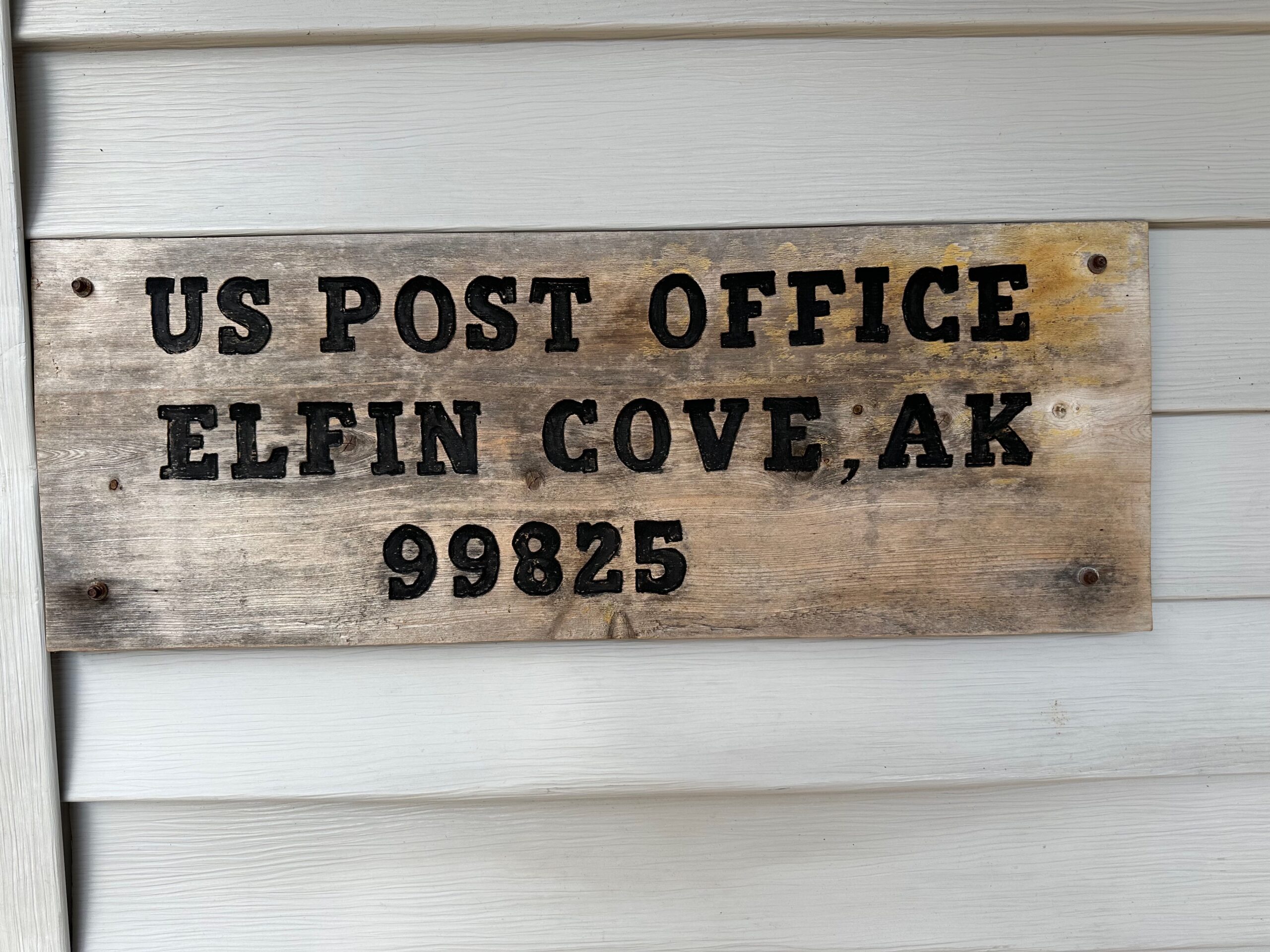
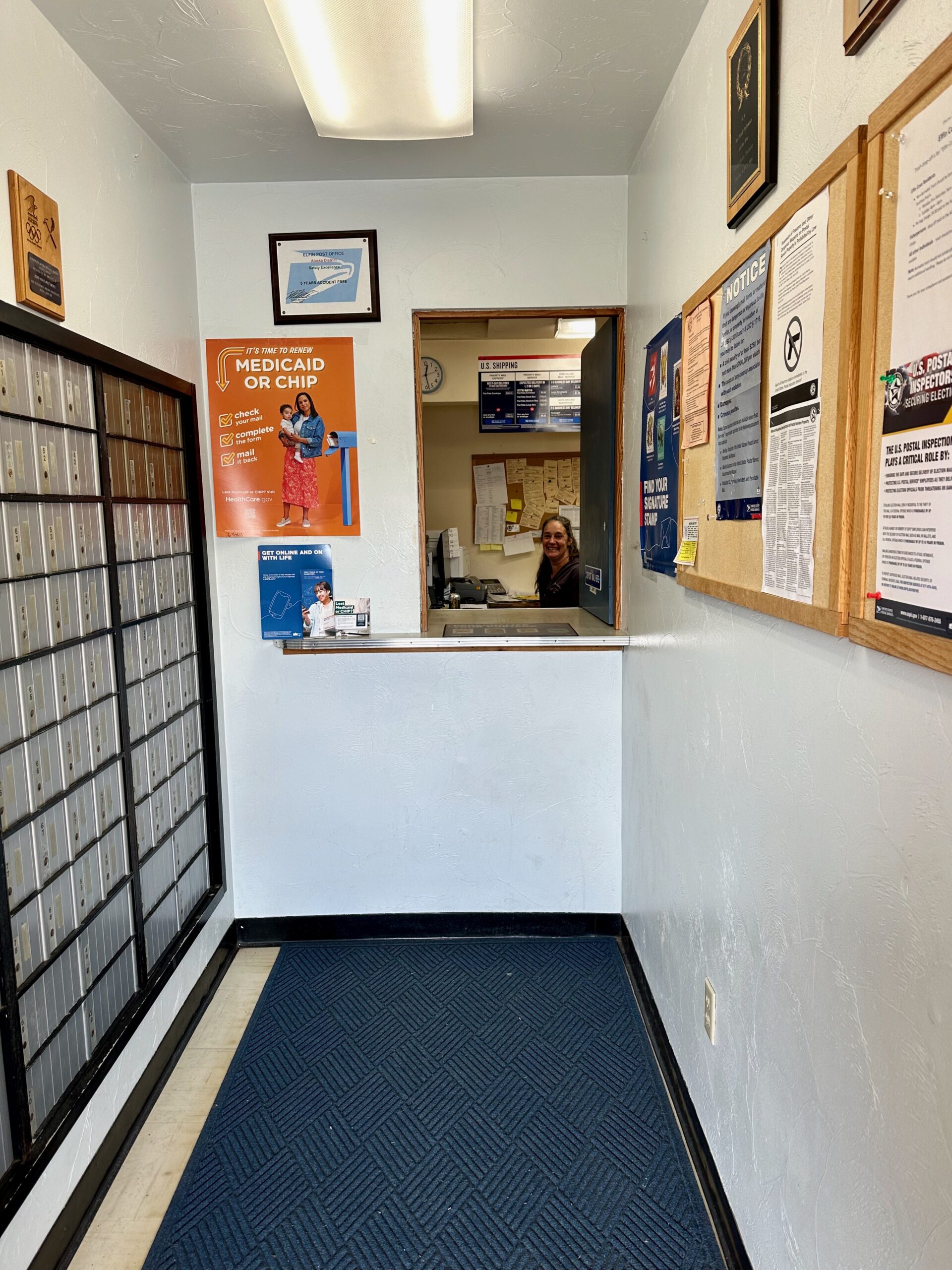
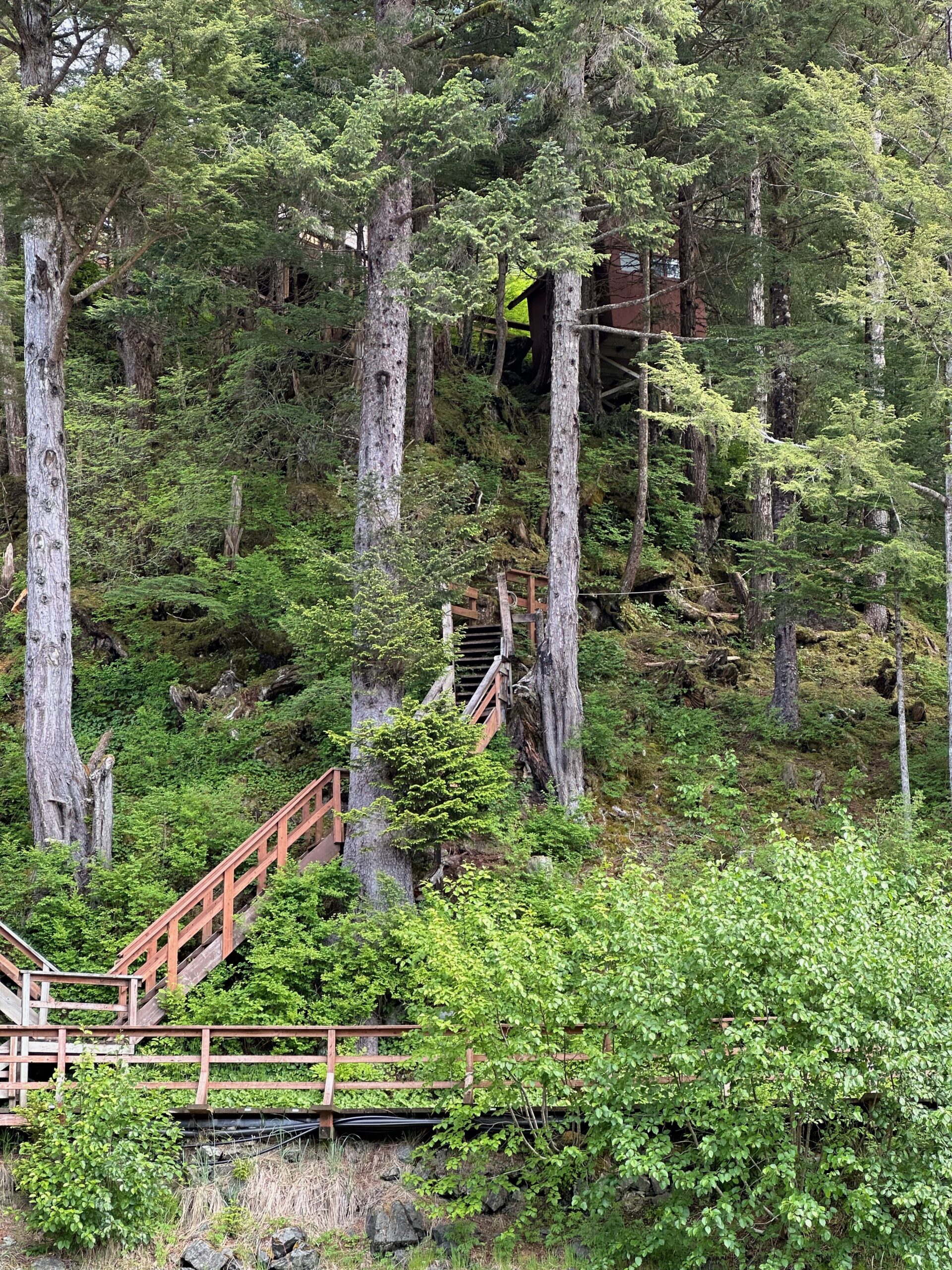
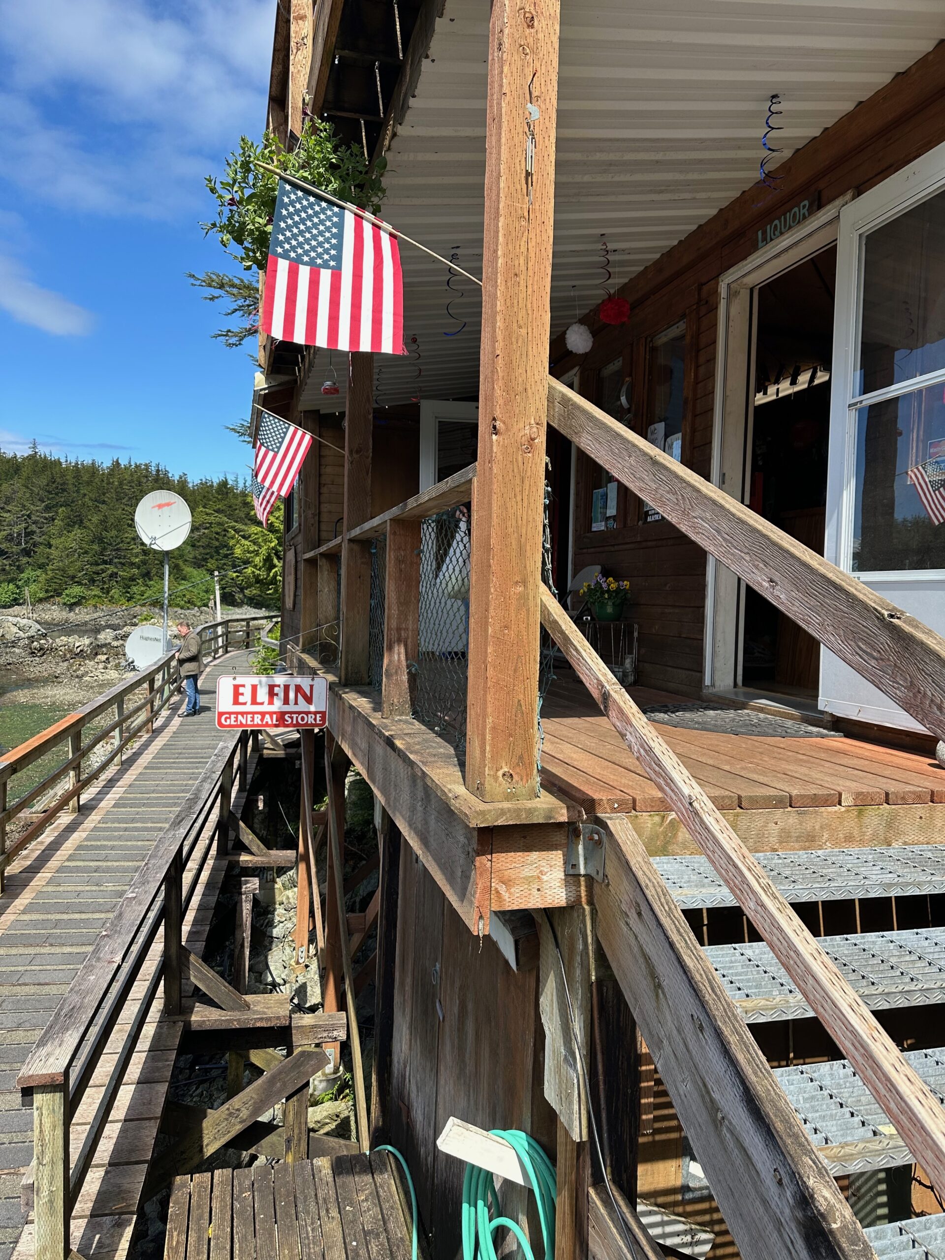
Elfin Cove is a small, remote census-designated place located on the northern end of Chichagof Island in Southeast Alaska. Here are some key facts: It is situated in a protected, flask-shaped harbor originally called “Gunkhole” by fishermen. The current name “Elfin Cove” was given in 1935 when a post office was established. As of the 2020 census, Elfin Cove had a population of just 24 people. The population is highly seasonal, swelling to around 200 during the summer fishing months. Elfin Cove is only accessible by boat or floatplane, with no roads connecting it to other communities. A boardwalk runs through the small village. It has a maritime climate with cool summers and mild winters. Average summer temperatures range from 52-63°F, and winters are 26-39°F. The economy is heavily reliant on commercial fishing, sport fishing lodges/charters, and tourism. Elfin Cove has historically been a fish-buying and supply center for the fishing fleet. Amenities include a post office, general store, liquor store, and a few other buildings, but no health care facilities. Elfin Cove is located about 85 air miles west of Juneau, with floatplane service connecting it to Alaska’s capital city. The remote location provides access to pristine fishing grounds with low fishing pressure, attracting anglers seeking salmon, halibut, lingcod and more.
It is a true treasure. Before we left the boat we had to attend a mandatory information session that was led by Mary Jo, a resident of Elfin Cove since 1974. She came to visit a friend and never left. When she came here there was no electricity, running water, or telephone service save the WWII wind up radios. Now the village has water 24 hours per day, electricity and even satellite internet service.
Because the town is so small they don’t allow more than 60 visitors at a time. We had to wait our turn but the scenery was delicious. Two bald eagles kept playing around circling the tress on this small island.
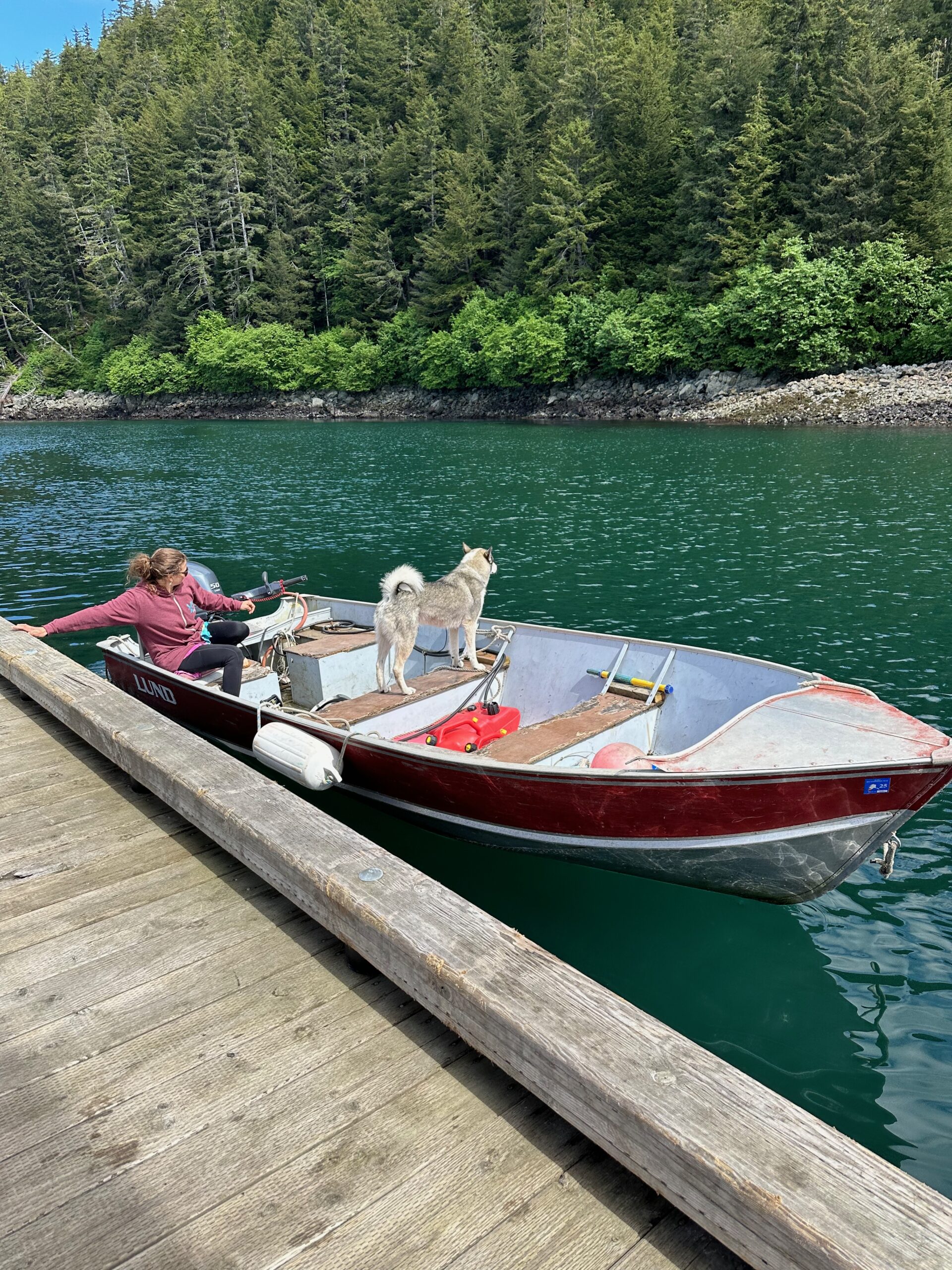
This is one happy dog.
I’ll let the pictures speak now.
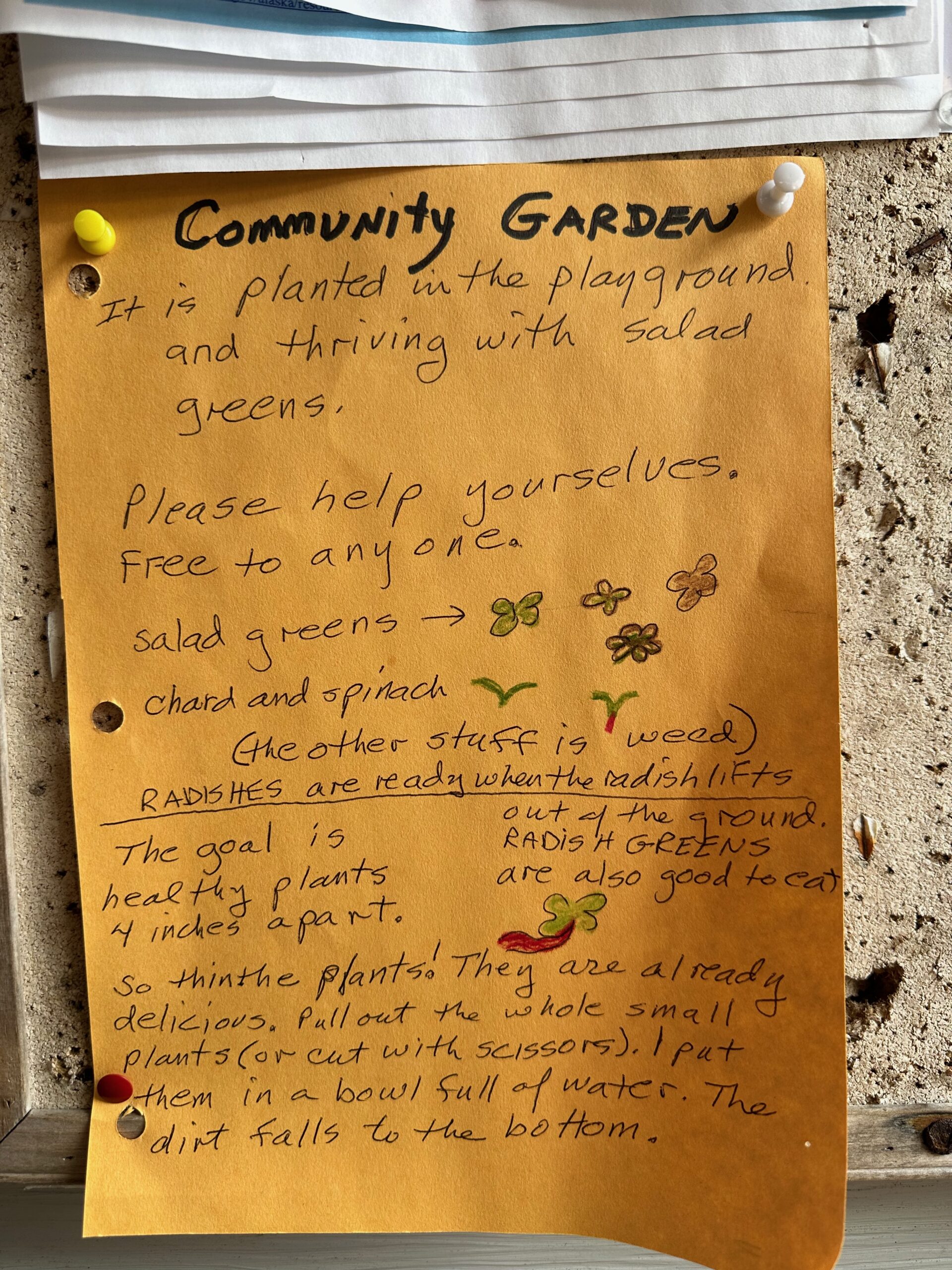
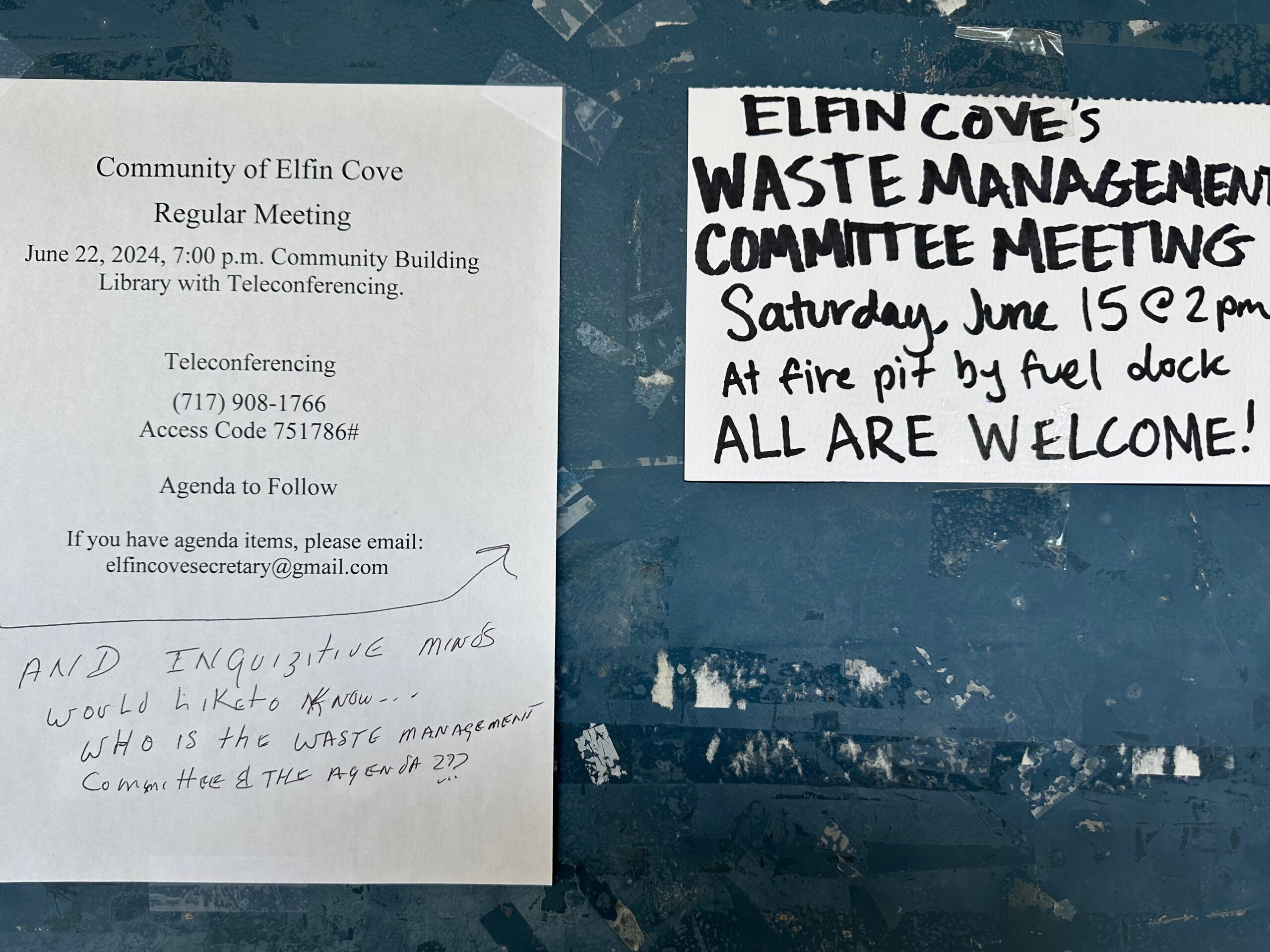
Notices were posted on buildings at random.
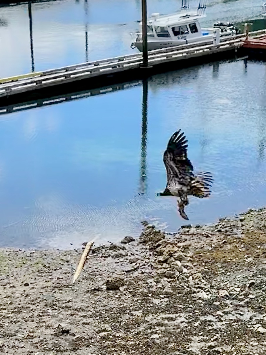
I caught a young bald eagle (you can tell by the mottled feathers) stealing a fish from the harbor.
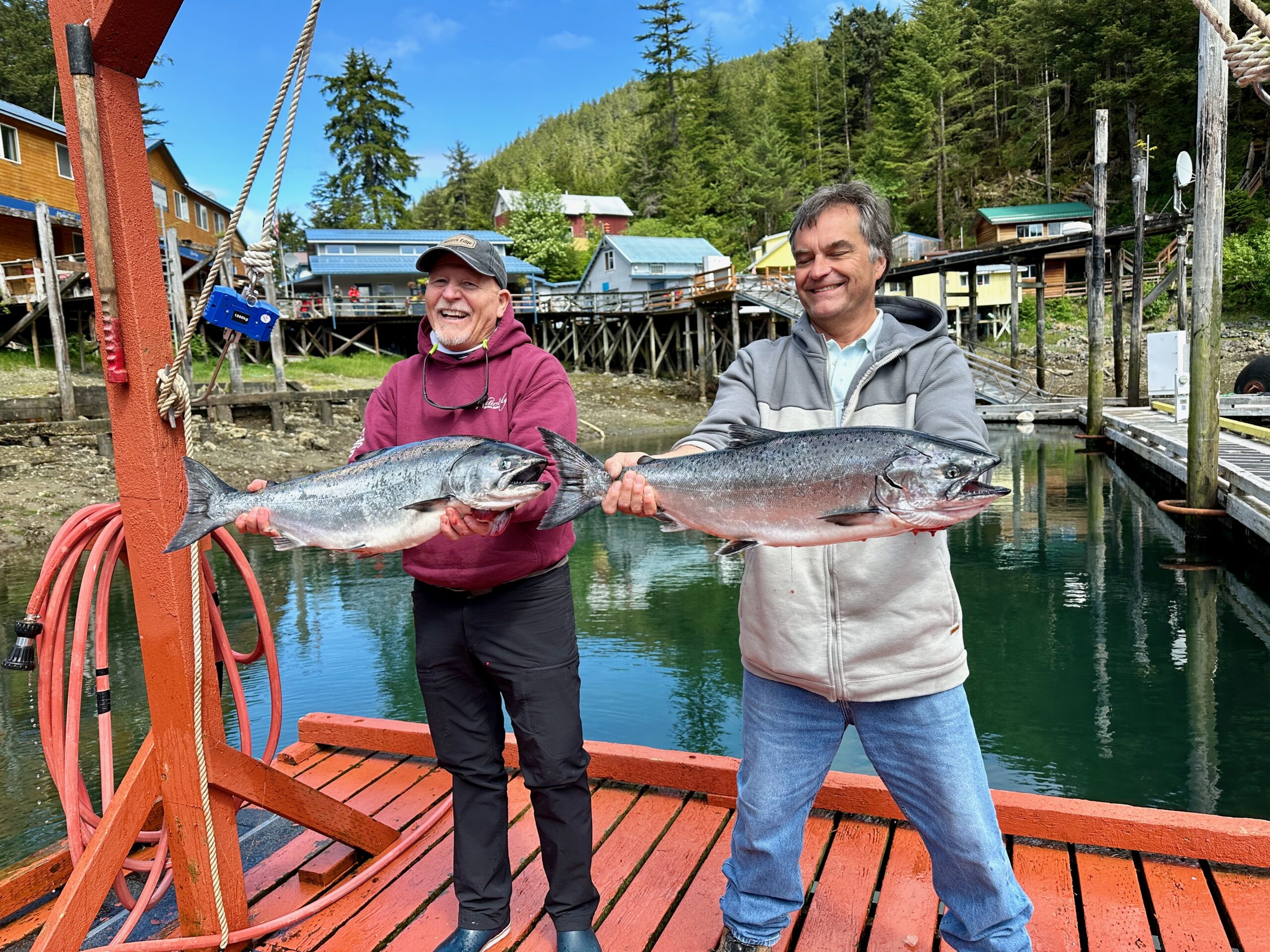
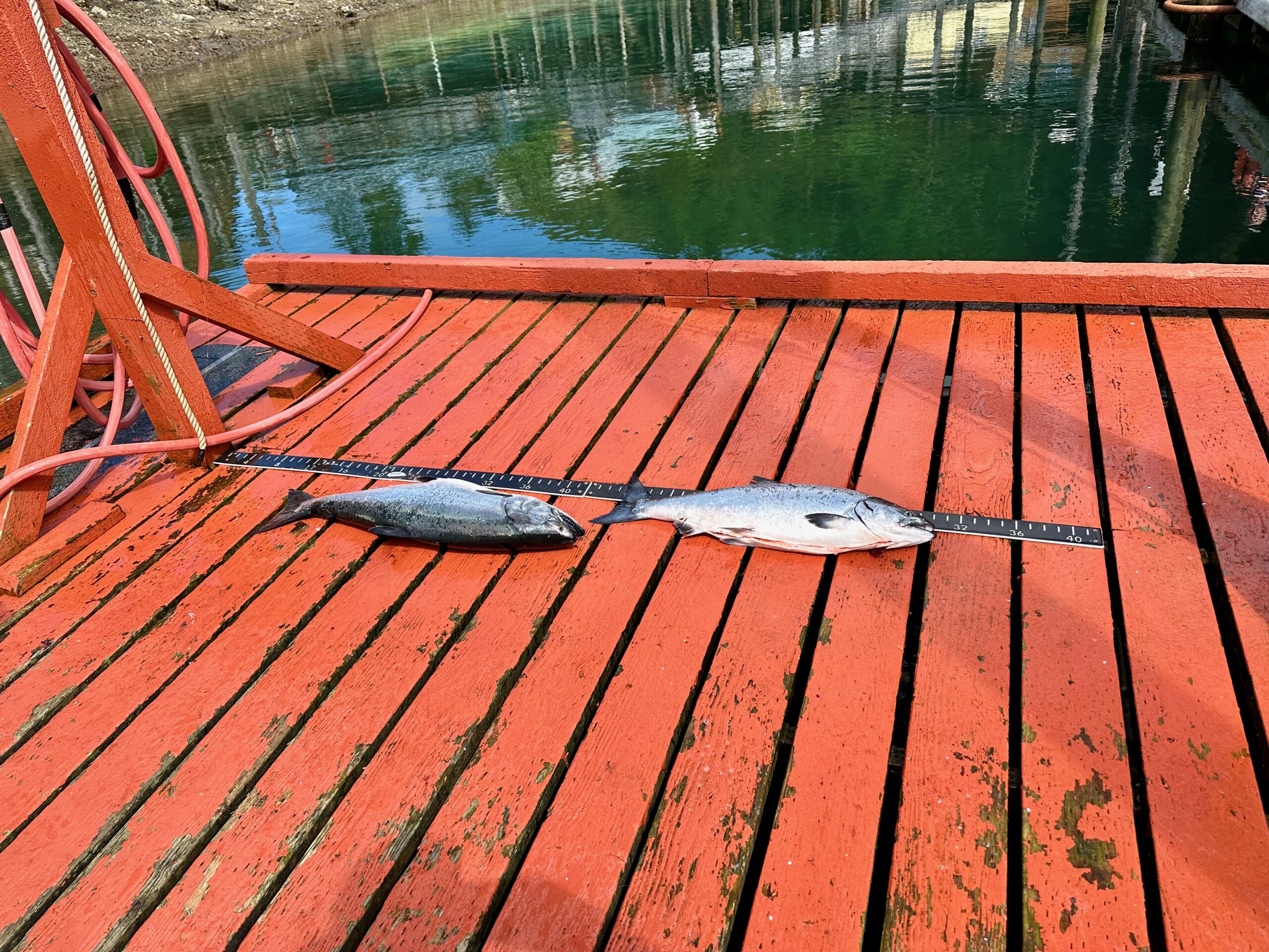
These two fisherman caught King Salmon.
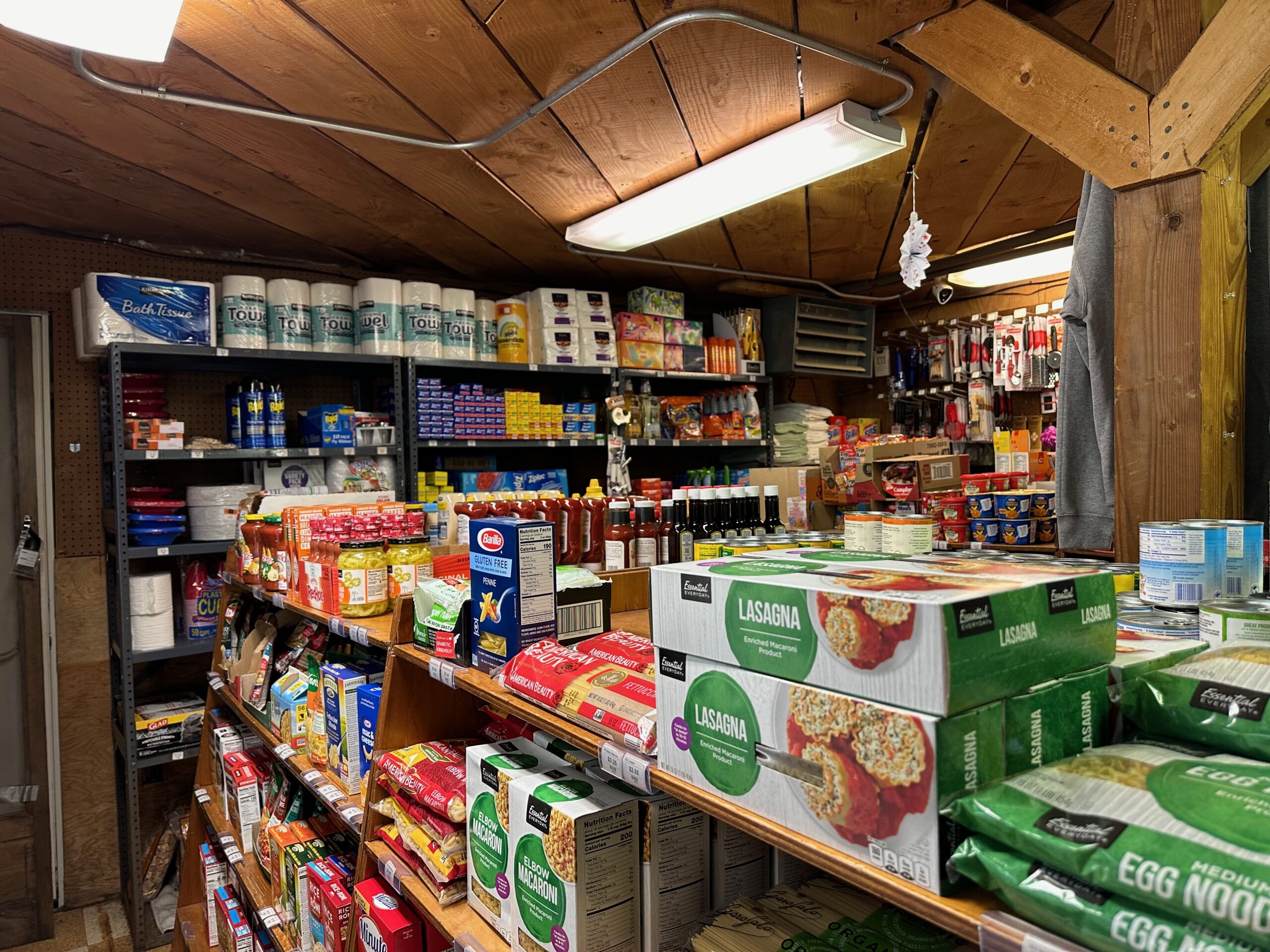
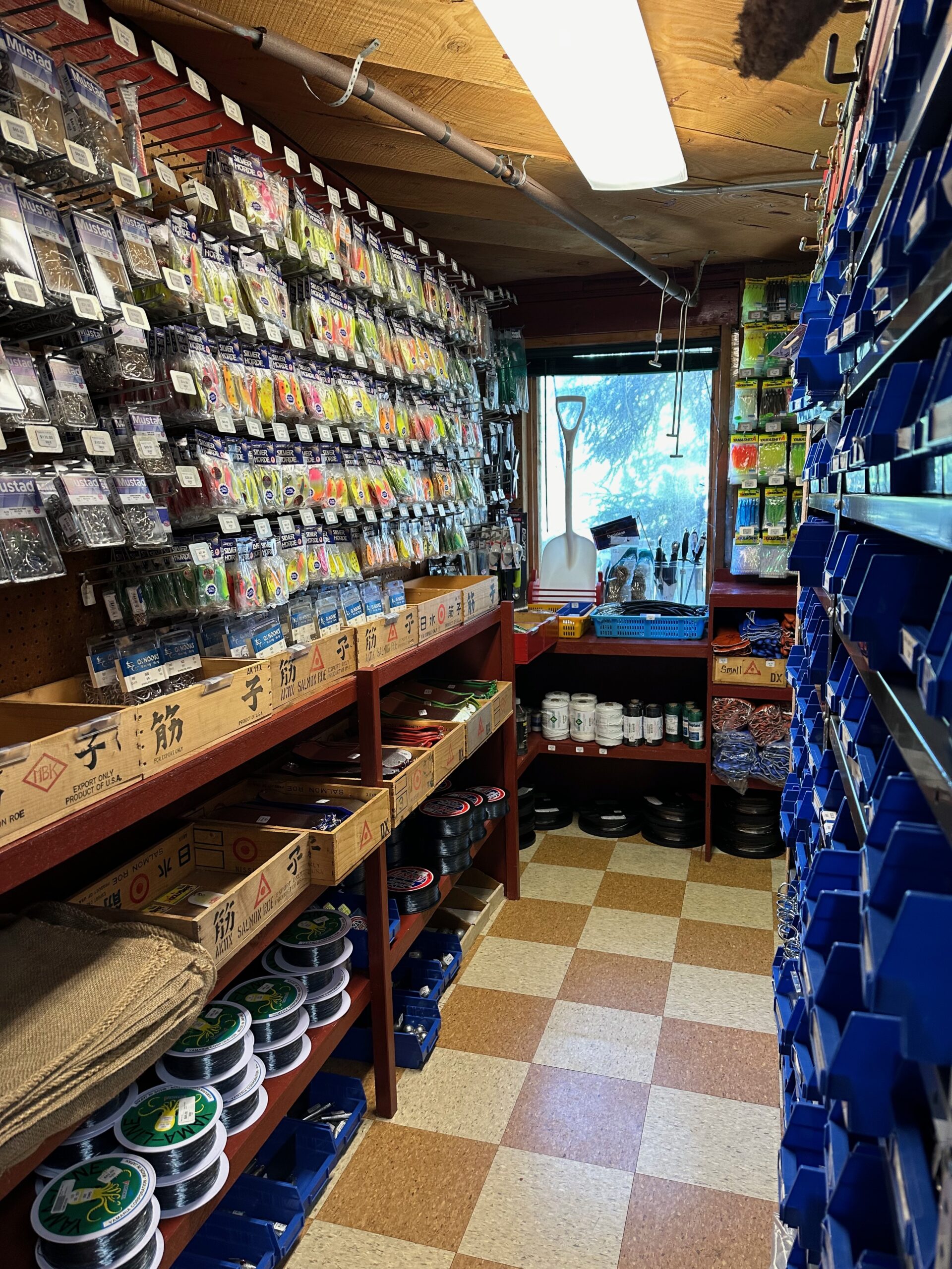
The ever so important general store. Everything from pasta to shovels.
According to Mary Jo, orders from Amazon do get here, eventually.
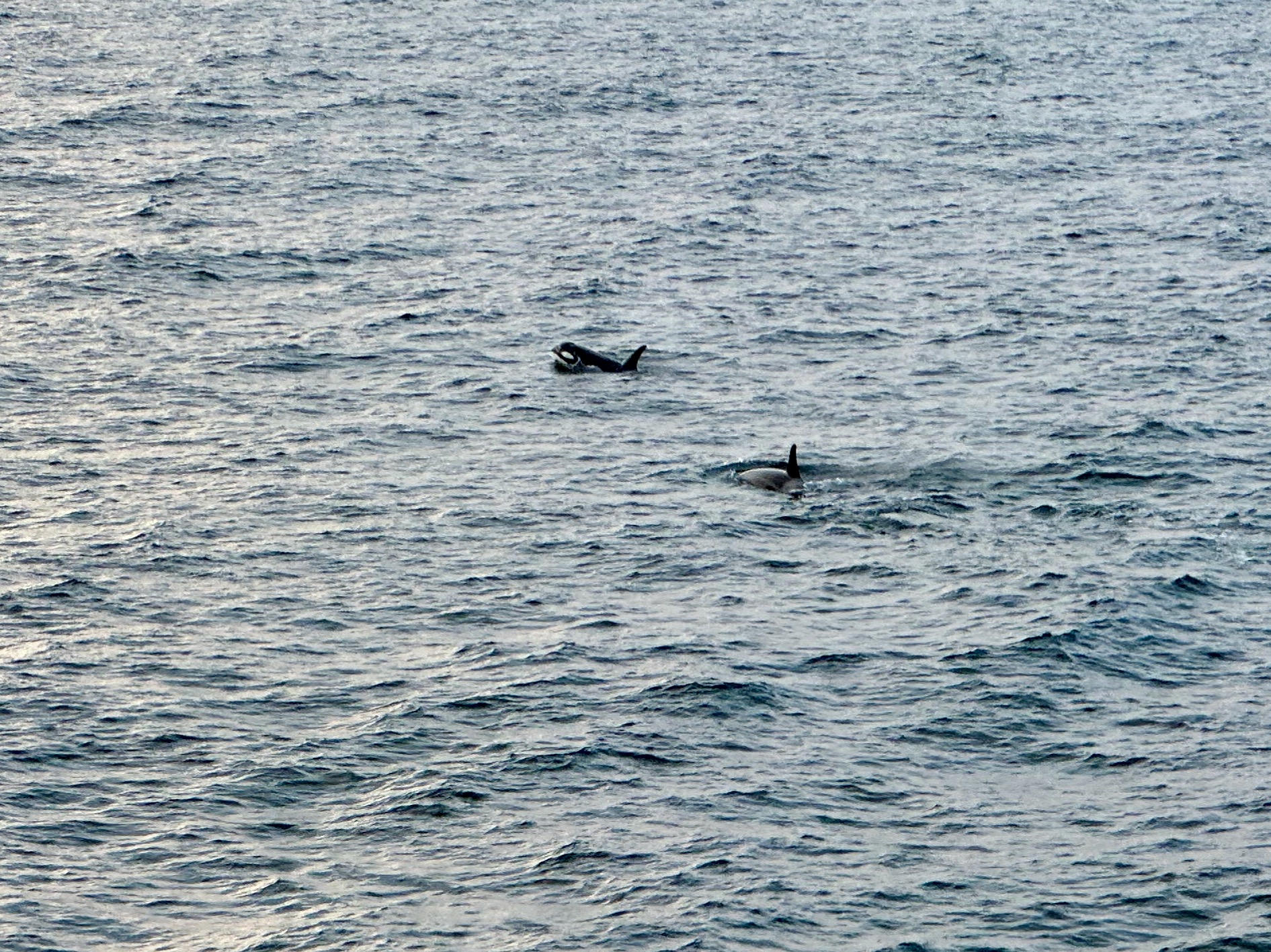
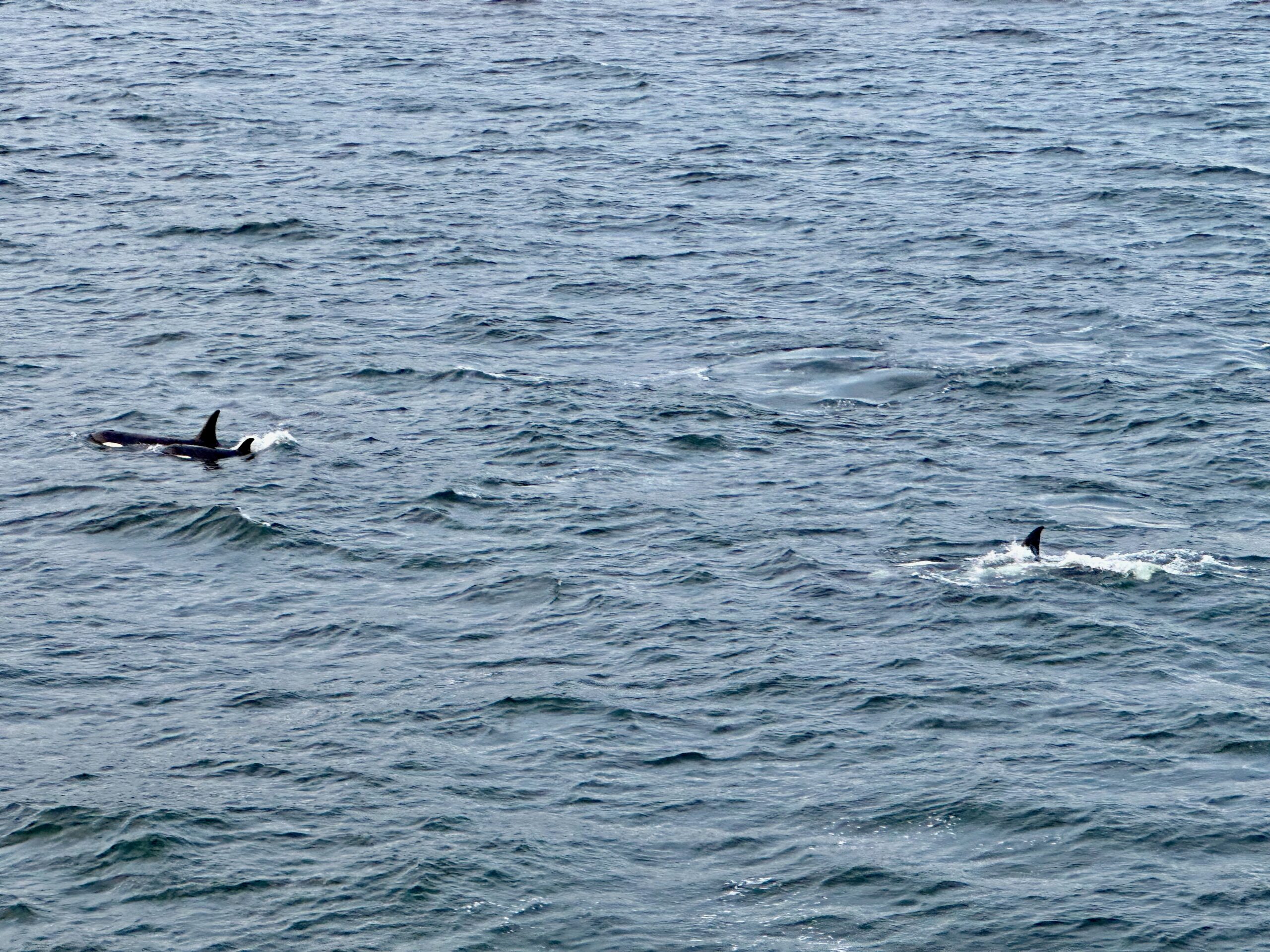
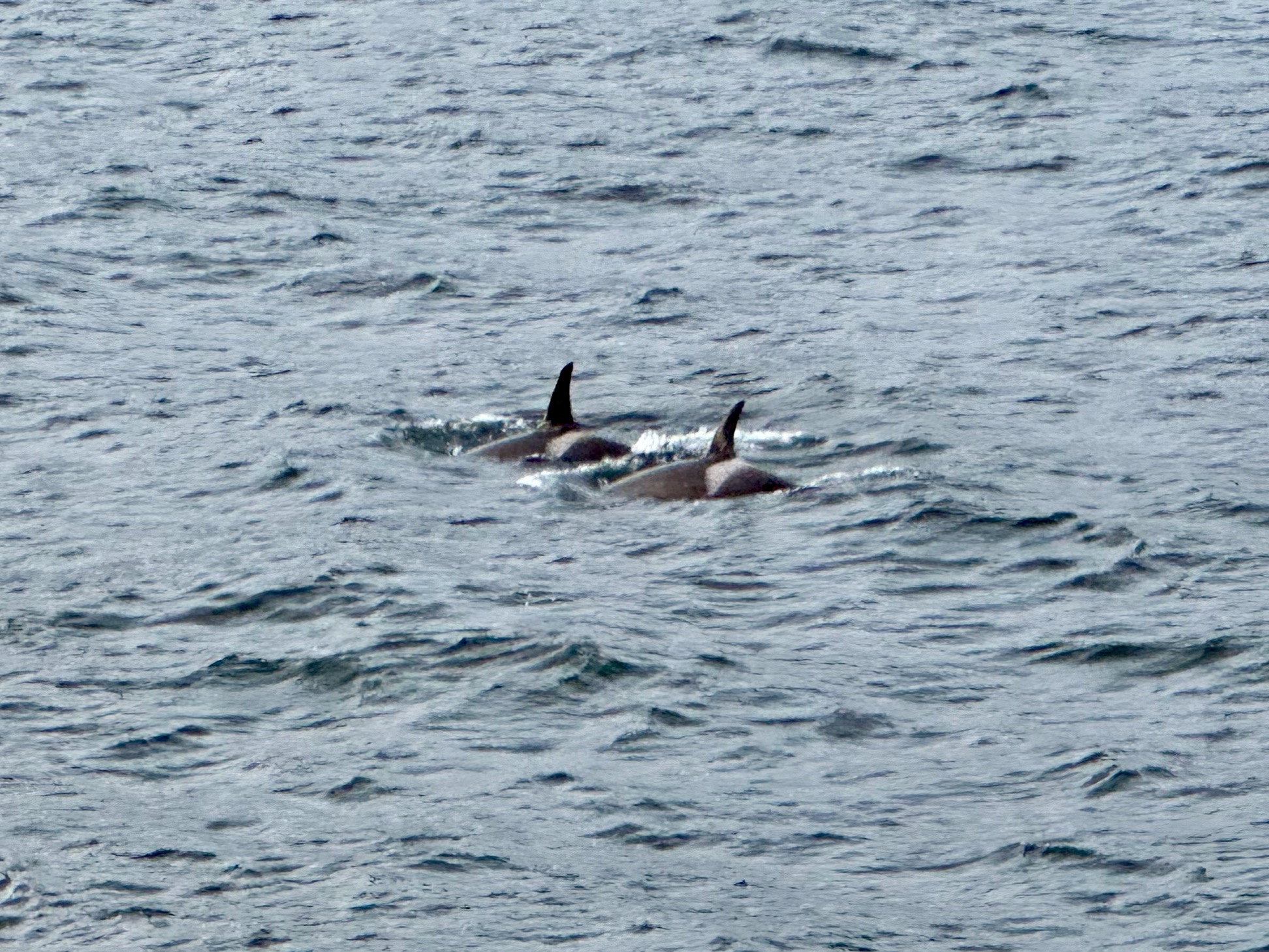
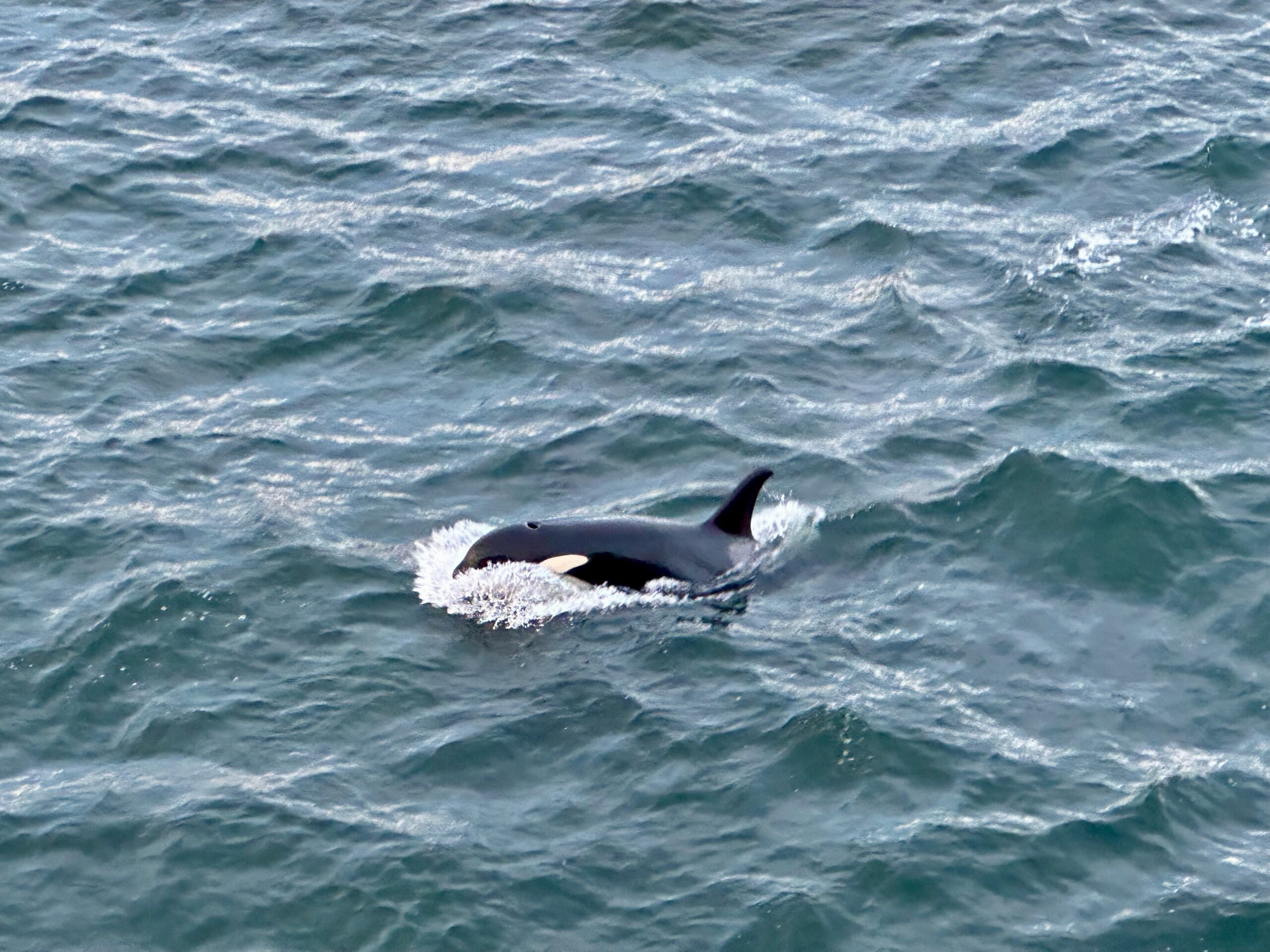
I was just about to post this at 9:30 PM when a pod of Orcas decided to show off on the starboard side.
Late morning, we arrived in Sitka, ready to spend the day exploring. Sitka is often called the birthplace of Alaska as we know it today. On October 18, 1867, the Alaska Purchase took place when the land was transferred from the Russian Empire to the United States for $7.2 million. The ceremony occurred in Sitka in front of the Governor’s House, where the Russian flag was lowered, and the American flag was raised.
Our first adventure was a wildlife tour, so we boarded a tender to the pier to catch a small boat.
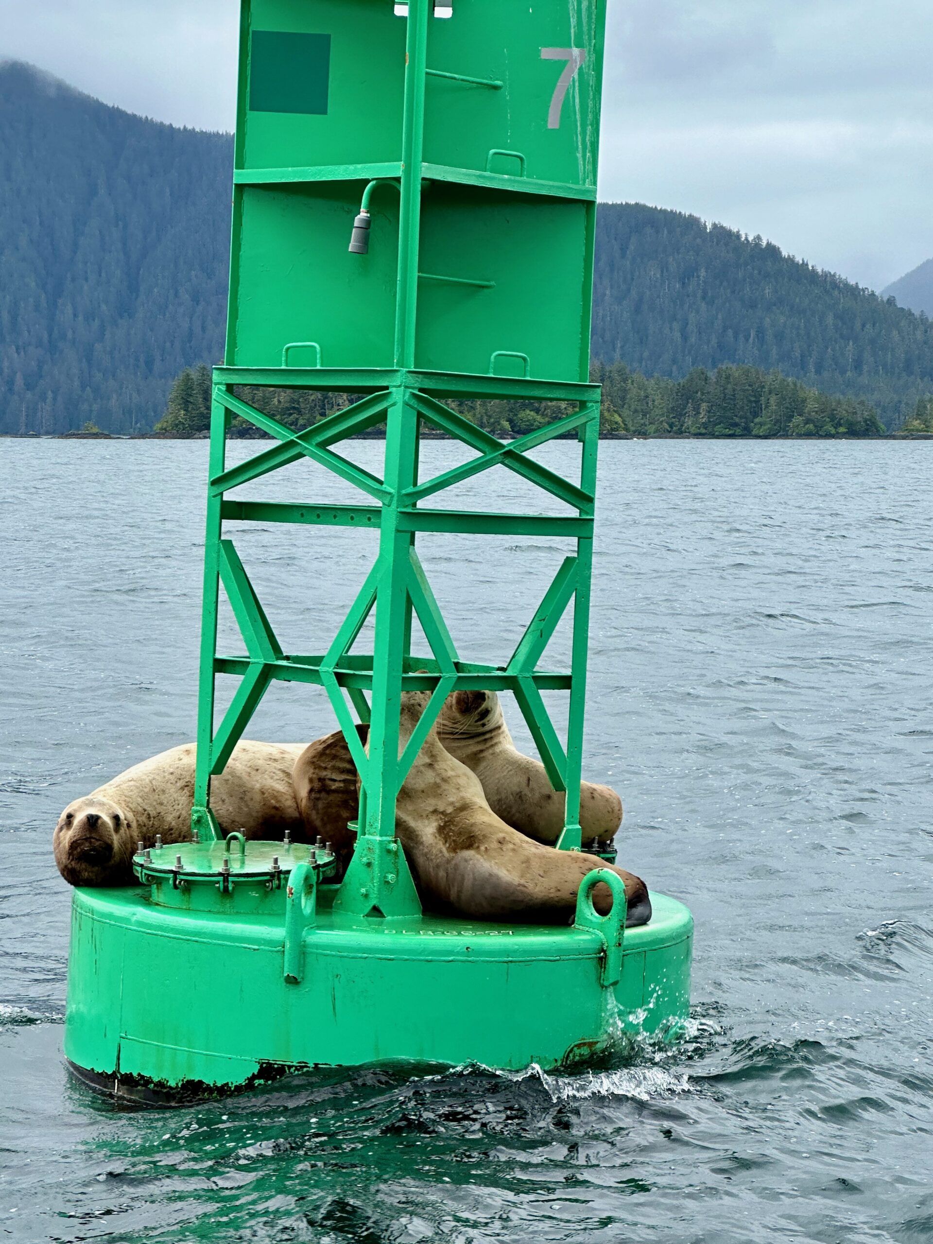
We wound through several coves without spotting any wildlife, which seemed to worry our pilot. Determined to show us some marine life, he sped to a buoy known for its reliable sightings. Sure enough, we found sea lions lounging on the buoy—always a sure bet.
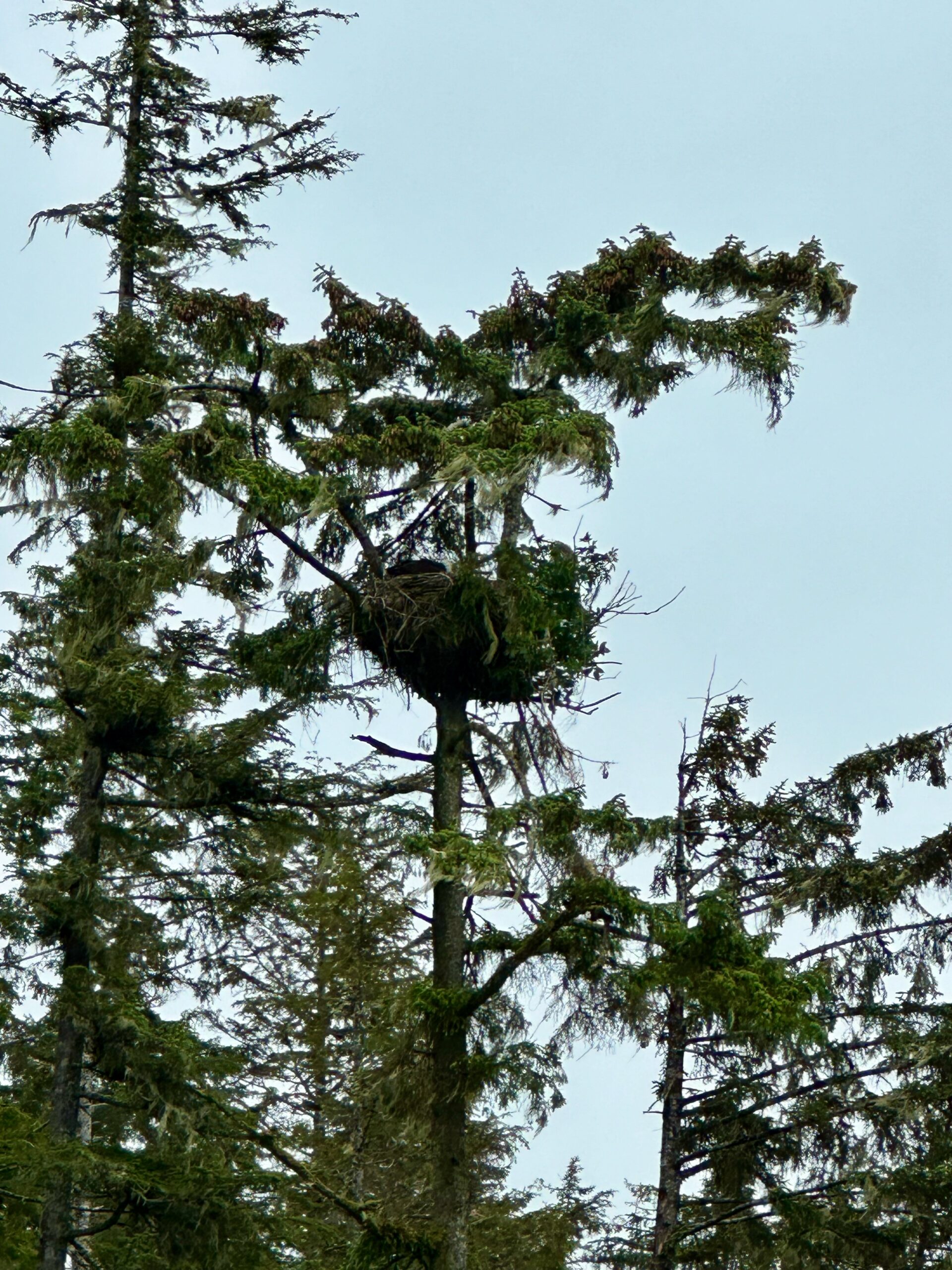
Several bald eagles circled overhead, and we came across a nest. Just as I was about to take a photo, the mother eagle performed a dramatic flight out of the nest.
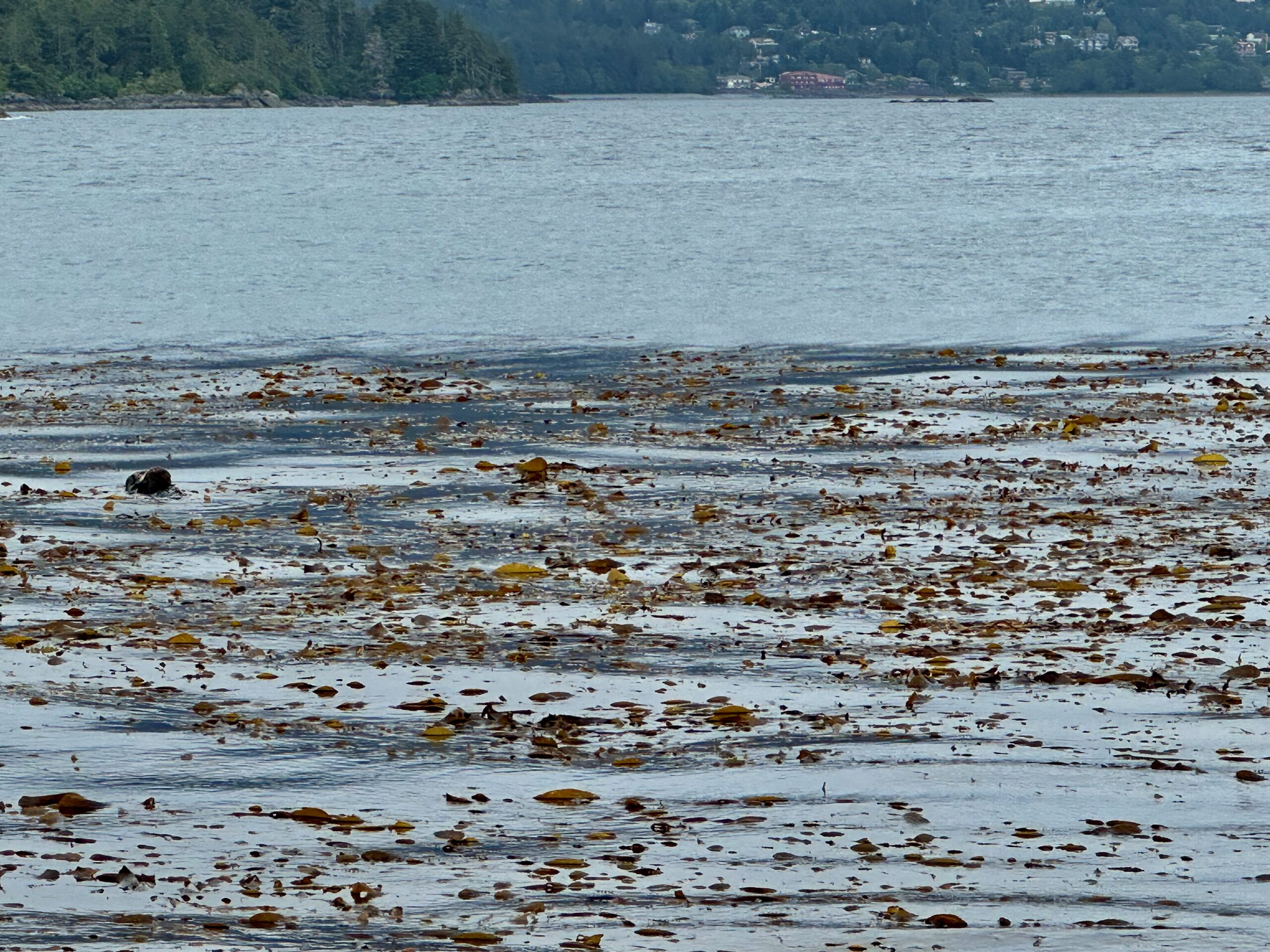
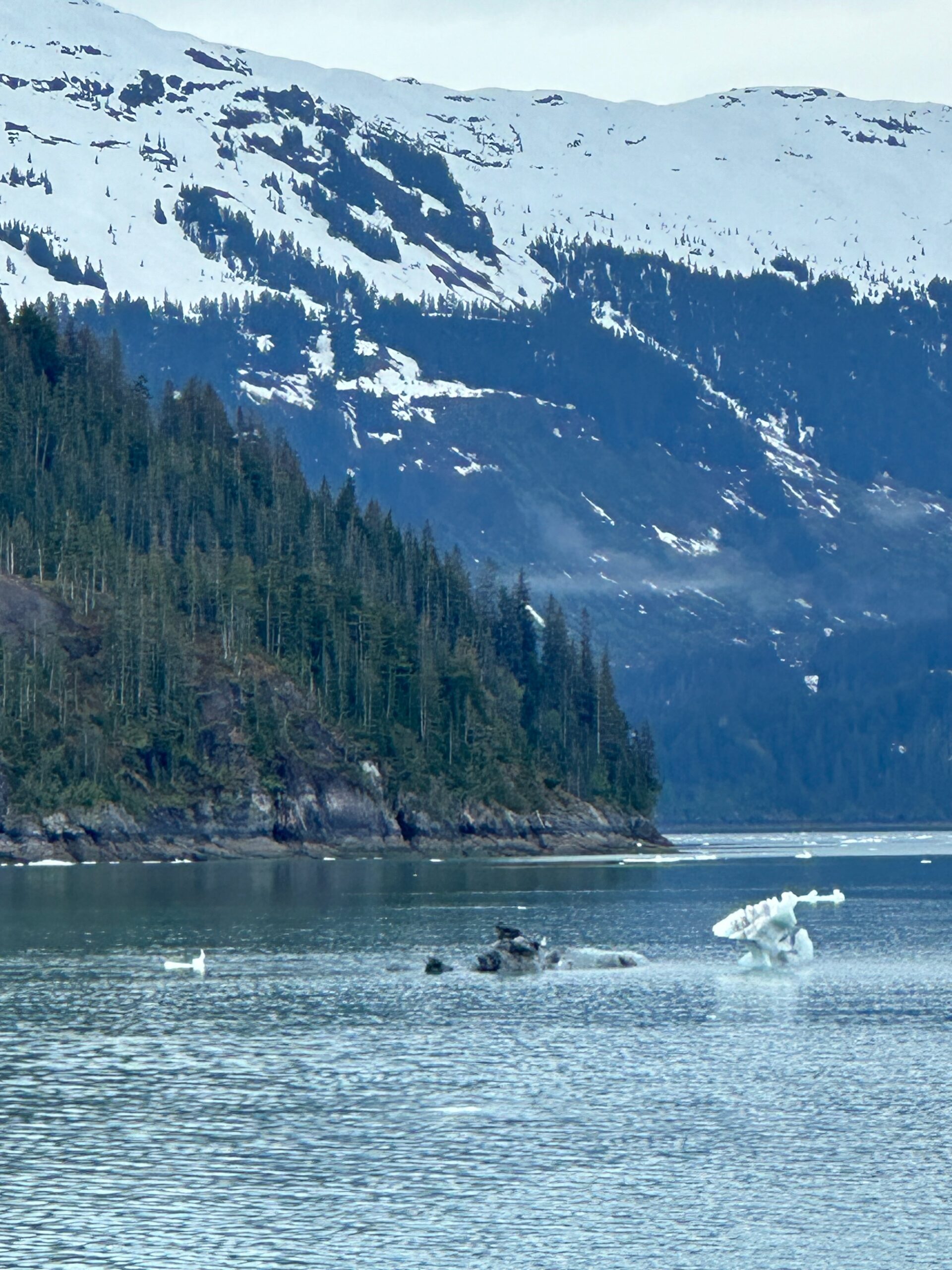
Next, we searched for sea otters. We discovered a kelp bay and, as expected, there they were. Though hard to photograph due to their constant movement, you can see a head popping out of the water in the middle left of the picture.
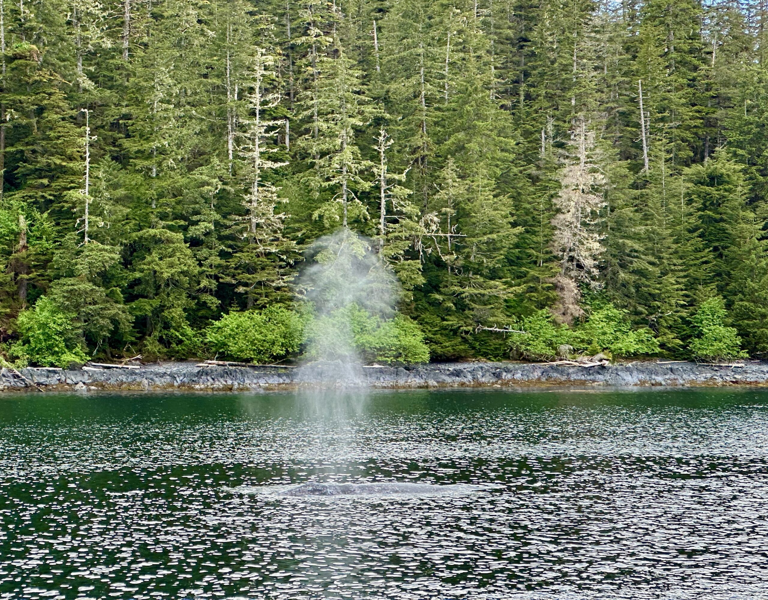
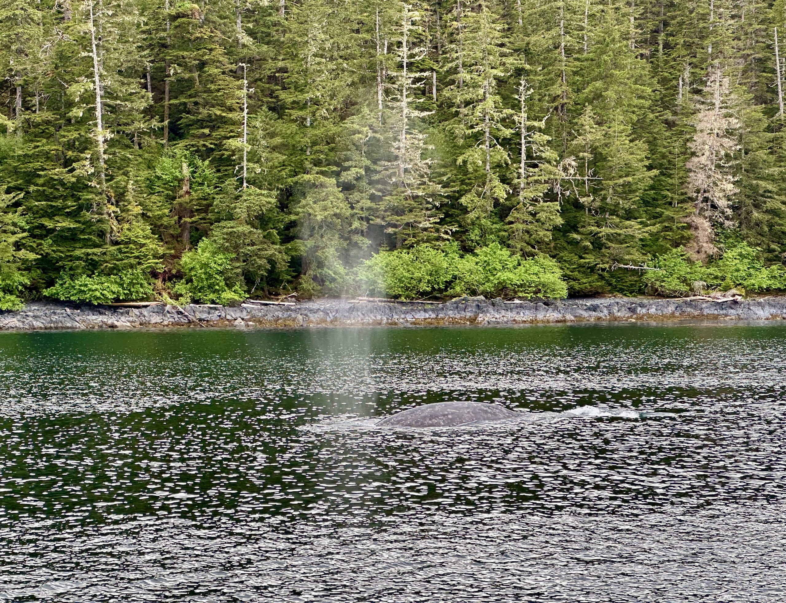
As we meandered between small islands, we entered a cove and, “Bingo!”, a pod of gray whales appeared. It was the moment every tourist hopes for. Whales breached all around us. Each time I tried to point my camera at one, another would breach with a “whoosh” sound. I managed to capture this sequence using rapid burst. Our guide recognized this whale from previous sightings and named it “Patches” due to the white spot from detached barnacles.
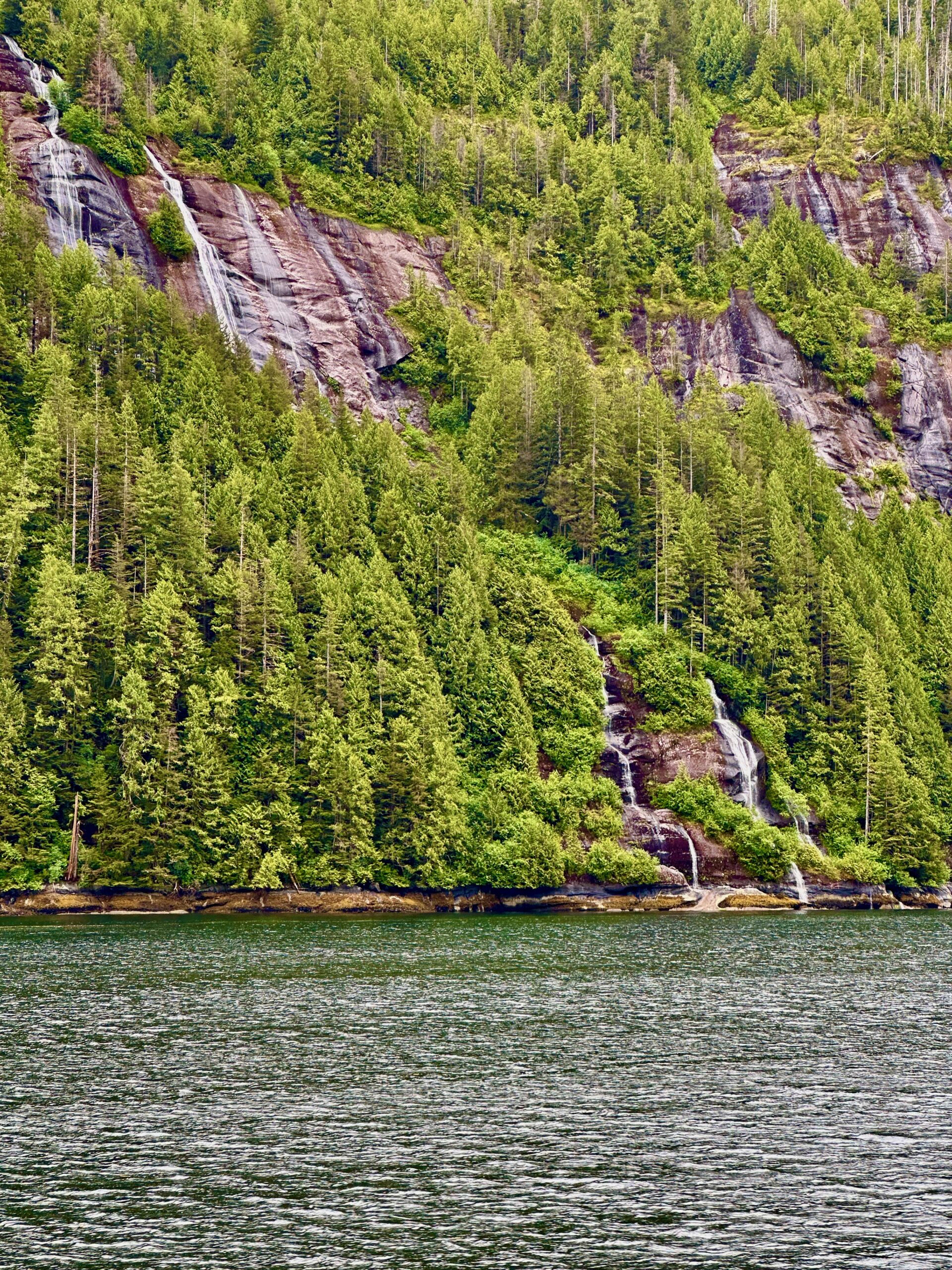
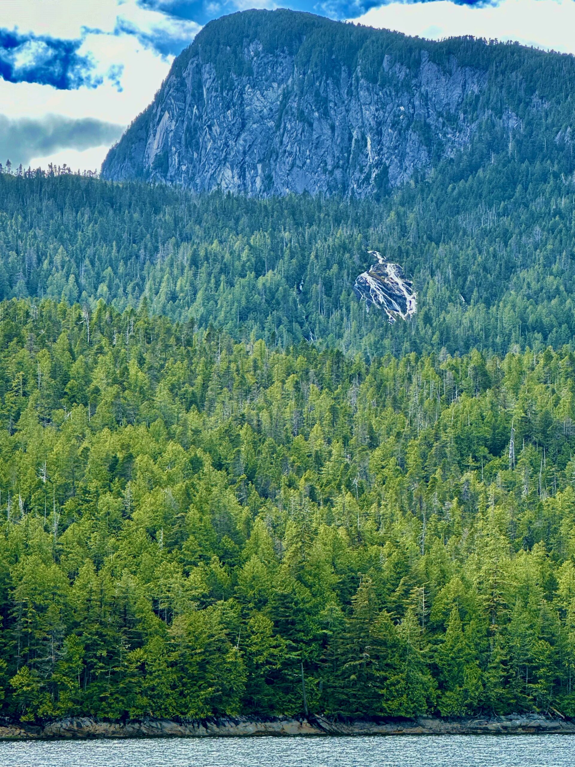
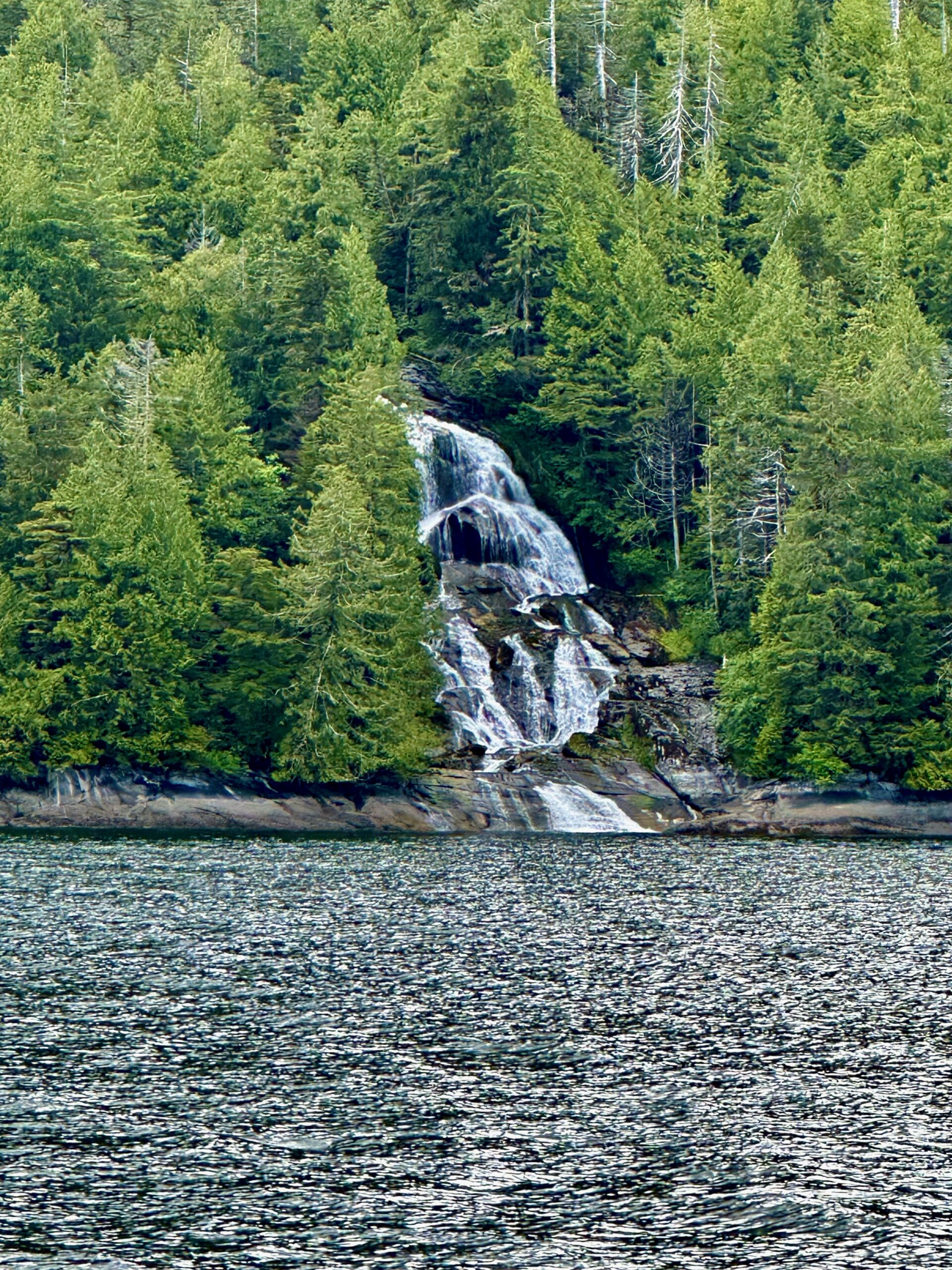
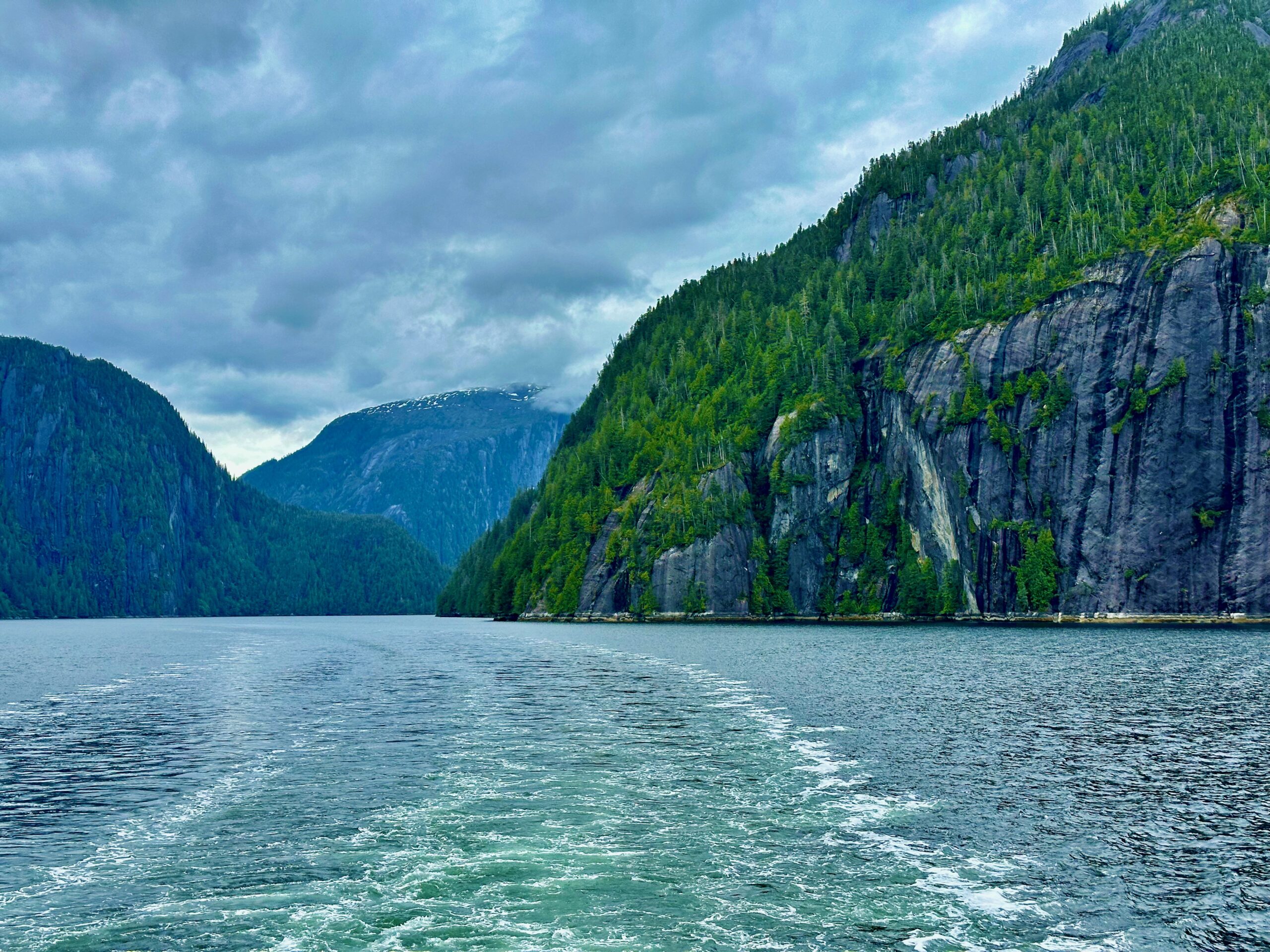
The other feature of the day was winding through the Tongass National Forest, one of the largest contiguous temperate rainforests in the world.
Finally, a bald eagle perched long enough for a picture
Final tender back to the mother ship for the night. See you tomorrow.
Today didn’t quite go as planned. Overcast skies, a bit of rain, a changed itinerary, and rough seas all contributed to a less-than-ideal day. I found solace in a cozy corner of the grand lounge, curling up with a good book.
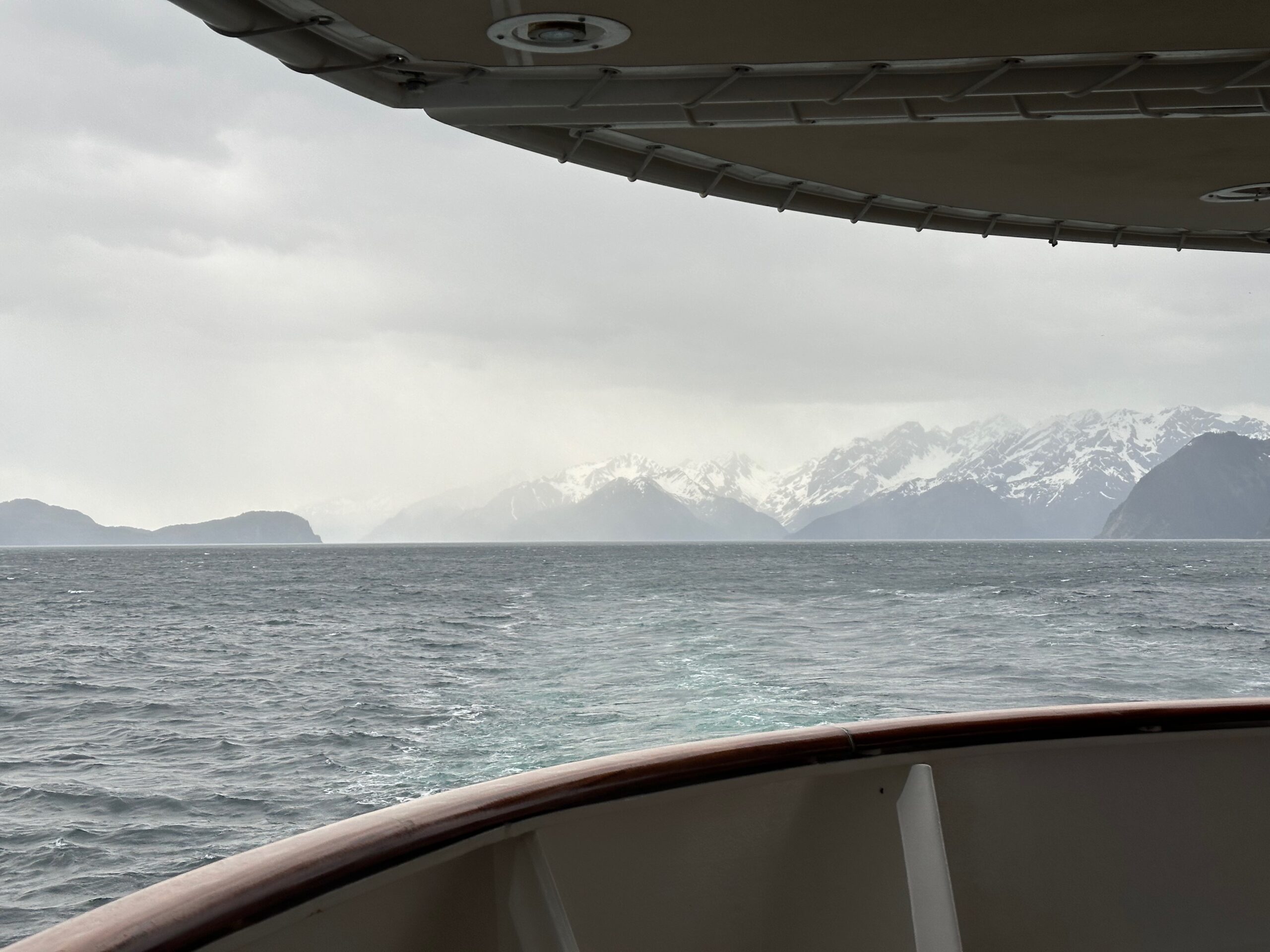
Originally, our itinerary had us cruising to Icy Bay before proceeding to Tsaa Fjord. However, as we approached Icy Bay and neared the fjord, the captain announced “No Joy” due to heavier than expected ice fields. Although our ship is built to navigate ice fields, the speed at which we can travel depends on the density of the icebergs. According to the captain’s assessment, we would have had to move at a snail’s pace, taking approximately five hours to enter and exit the fjord. Unfortunately, we didn’t have that much time, so we cruised slowly around Icy Bay before heading back out to the Gulf of Alaska, making our way toward Sitka.
A Little About Icy Bay According to Wikipedia: Icy Bay (Tlingit: Lig̲aasi Áa) is a body of water in the borough of Yakutat, Alaska, formed in the last 100 years by the rapid retreat of the Guyot, Yahtse, and Tyndall Glaciers. It is part of the Wrangell-Saint Elias Wilderness. At the beginning of the 20th century, the bay entrance was permanently blocked by a giant tidewater glacier face that calved icebergs directly into the Gulf of Alaska. A century-long glacial retreat has opened a multi-armed bay more than 30 miles (48 km) long. Icy Bay is a popular destination for sea kayakers and is reachable by bush plane from Yakutat, Alaska.
And it’s cold on the bay. I noticed a considerable temperature drop when we made our way into the bay. It’s like our ship was the garnish in a “on the rocks” cocktail. And the ice made the same noise as the little bergs bumped into each other and the ship.
view full screen with sound on
Thank goodness that instead of a swag bag every passenger was issued their own “expedition” parka. They were needed today.
Rough seas all night until our mid-morning arrival in Sitka.
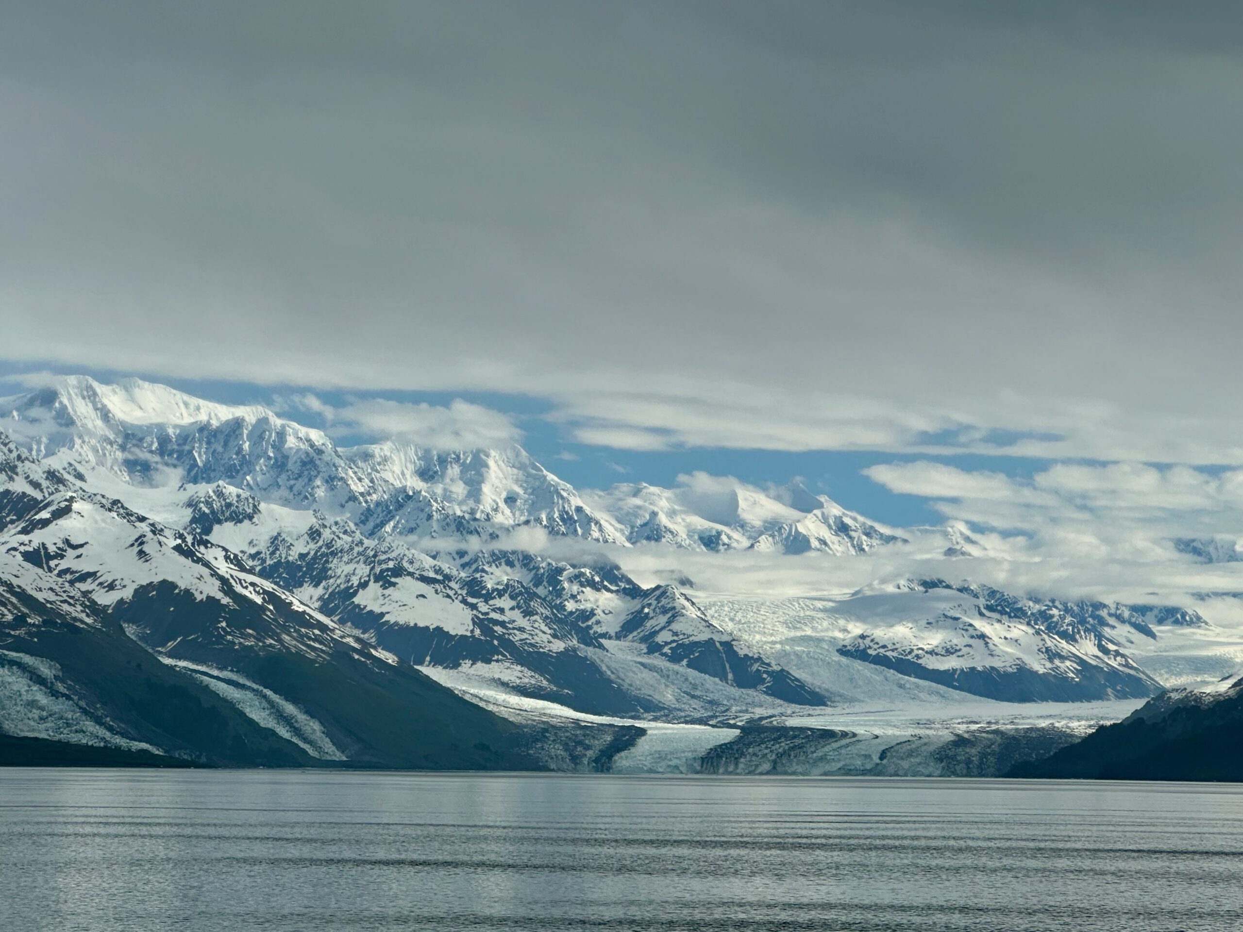
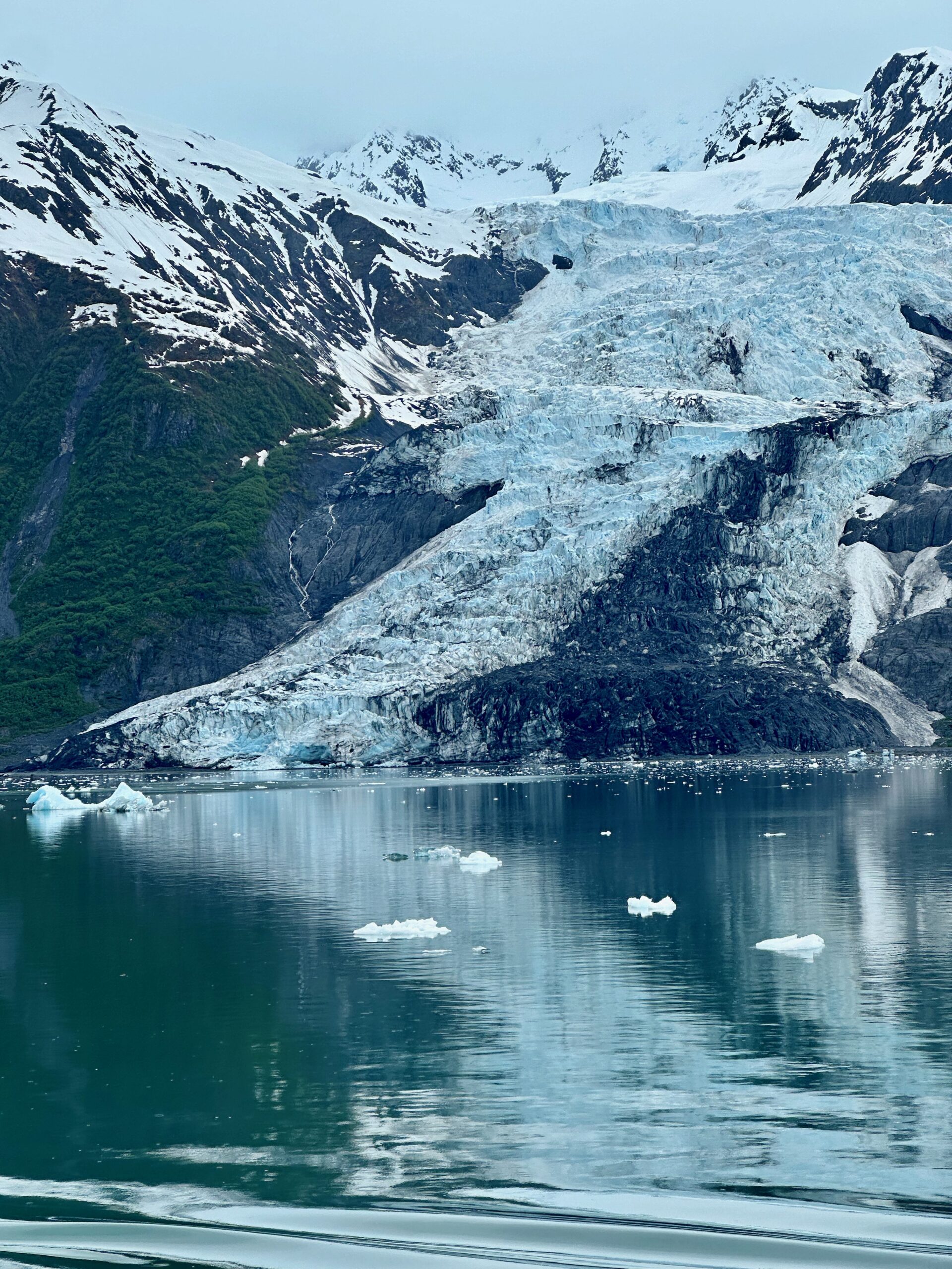
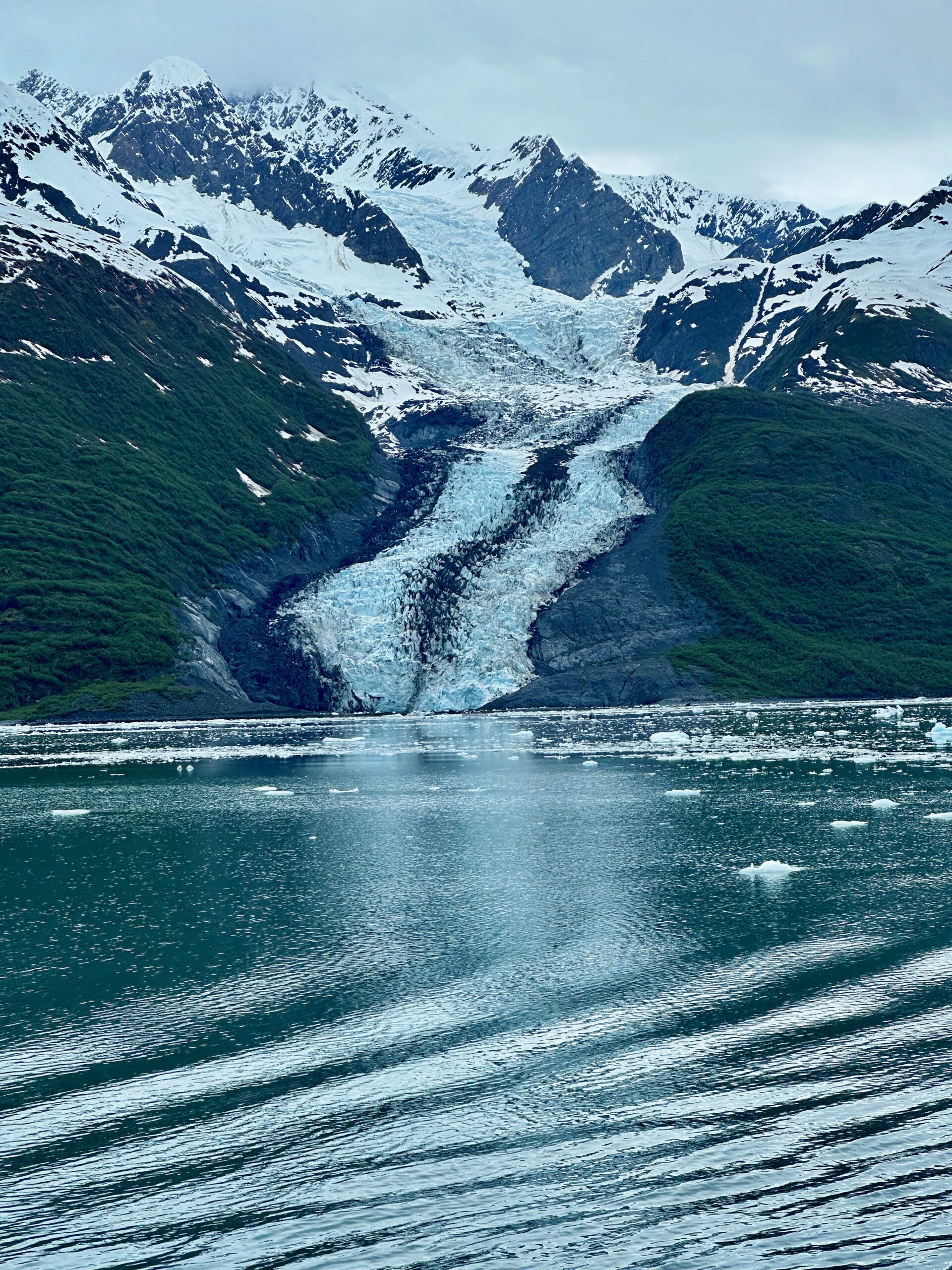
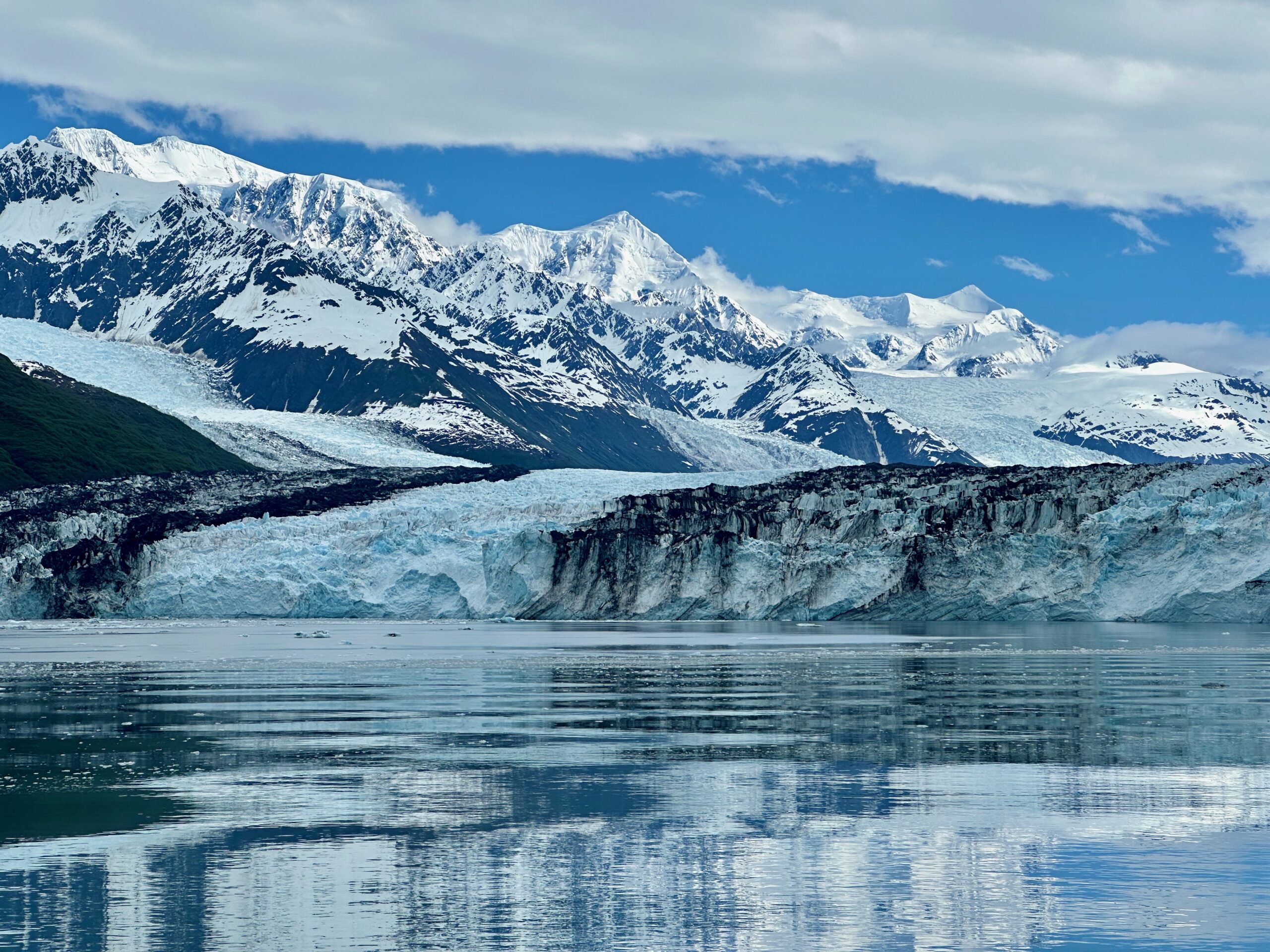
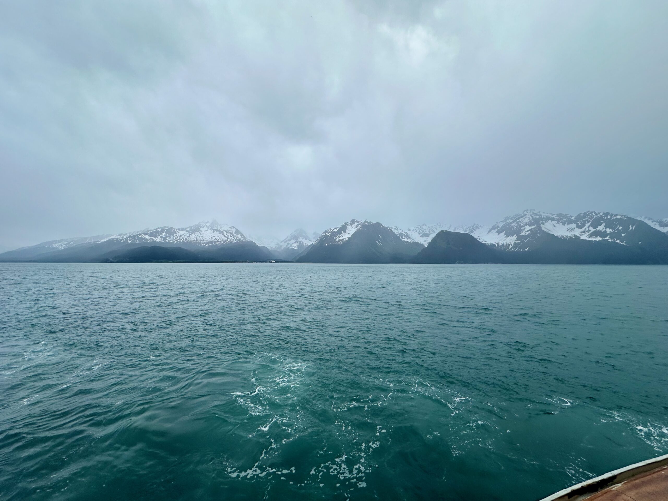
We left Seward last night, and after experiencing calm seas in Resurrection Sound, we entered the Gulf of Alaska for a rough night. Despite the turbulent conditions, we slept through most of it and woke up the next morning in Prince William Sound. What a way to wake up!
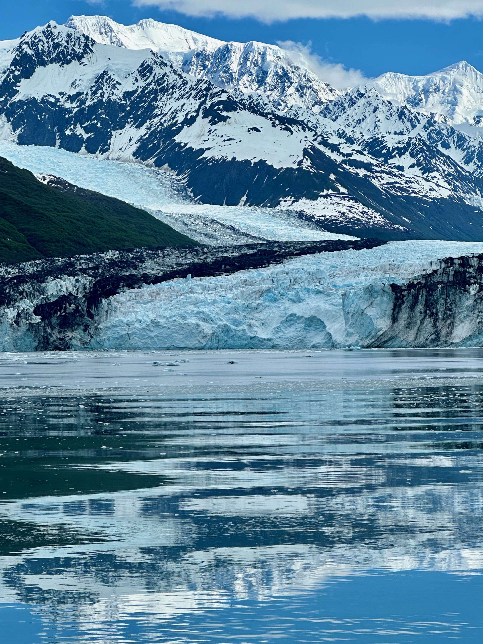
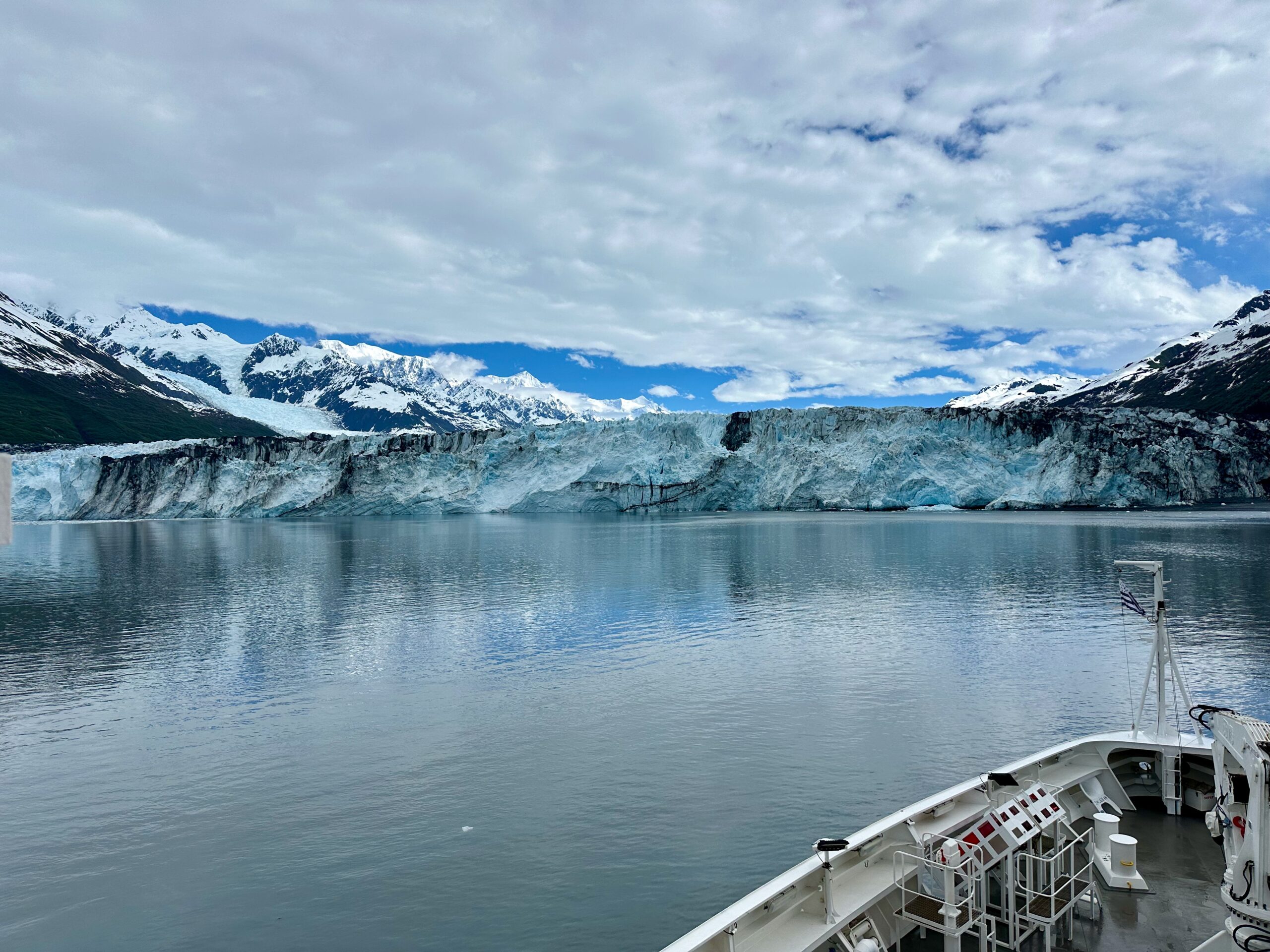
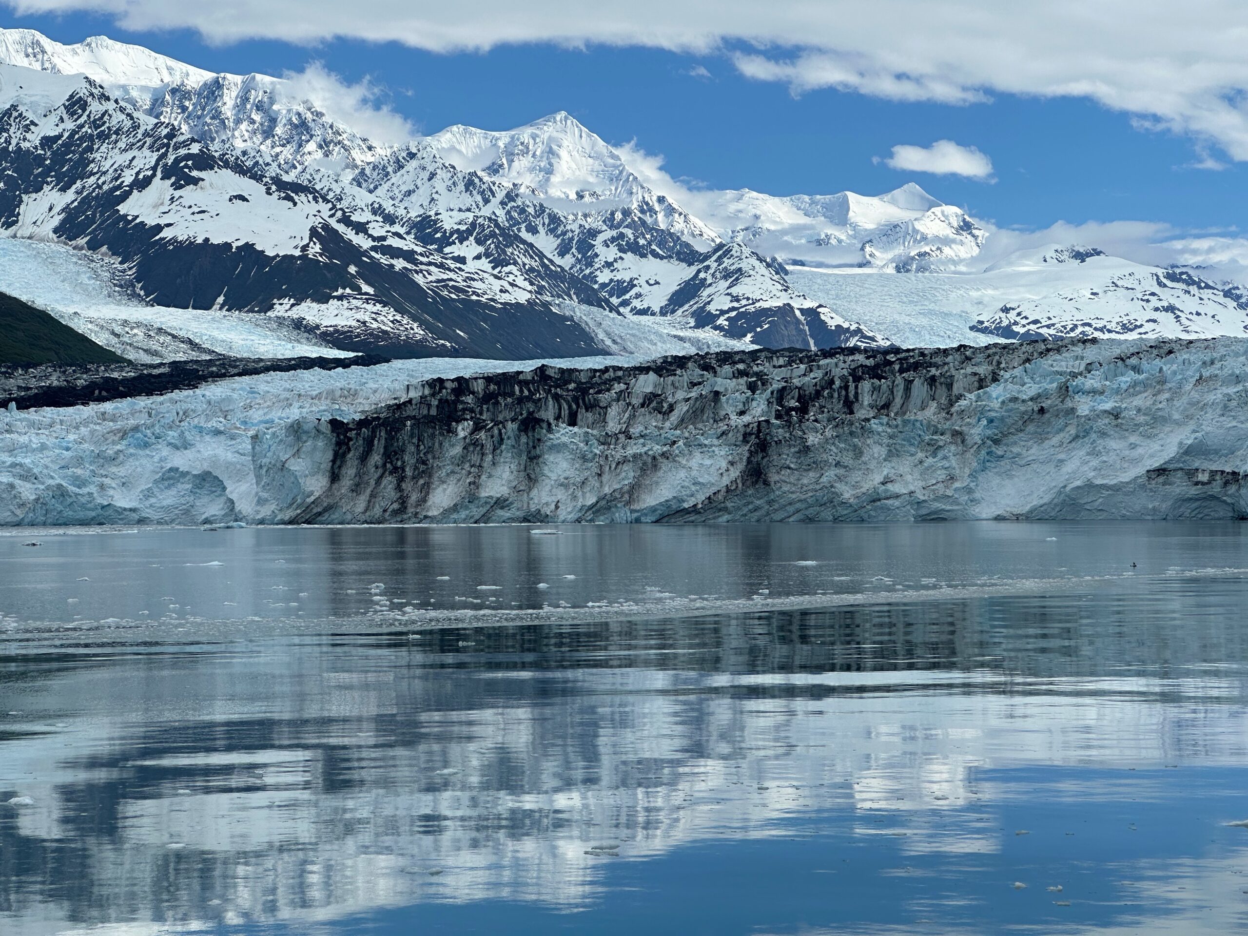
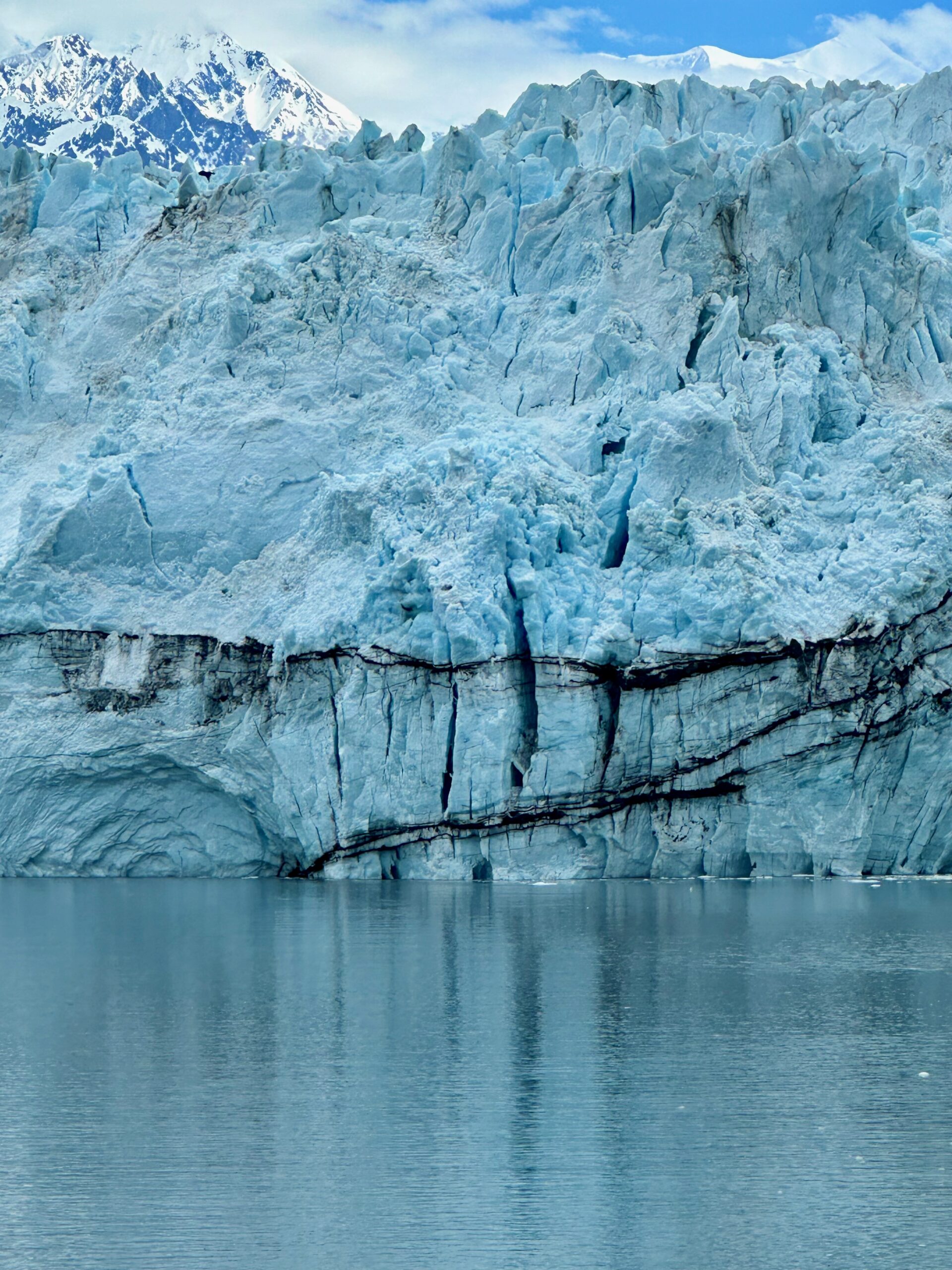
We slowly made our way to College Fjord.
College Fjord is a stunning fjord located in the northern sector of Prince William Sound, Alaska. It contains five tidewater glaciers (glaciers that terminate in water), five large valley glaciers, and dozens of smaller glaciers. The glaciers were named after renowned East Coast colleges during the 1899 Harriman Expedition, with women’s colleges on the northwest side and men’s colleges on the southeast side. This was the first time white people saw the glaciers and named them, of course separating the sexes and giving Harvard to the largest. Notable Glaciers • Harvard Glacier: The largest glacier in College Fjord, measuring 1.5 miles wide and around 300 feet thick. It is slowly advancing and calving tons of ice into the fjord daily. • Yale Glacier: Another prominent tidewater glacier originating from the same snowfield as Harvard but retreating over the last century. • Columbia Glacier: The largest and second-fastest moving glacier in the world, traveling about 80 feet per day and discharging 2 cubic miles of ice annually. • Other glaciers named after colleges include Amherst, Barnard, Bryn Mawr, Smith, Vassar, and Williams. Unique Features • College Fjord is the only spot in Alaska with three neighboring slopes containing glaciers, five of which end at the water. • At one point, visitors can see eight glaciers simultaneously. • Factors like fjord depth, buoyancy, ice thickness, and calving rates influence tidewater glacier positions more than climate change. • The fjord offers incredible opportunities to witness calving glaciers and abundant wildlife like whales, seals, sea otters, bears, and birds. Seeing this up close was truly remarkable. Our ship came within 350 yards of the glaciers’ faces. It felt as if we could reach out and touch them. The glaciers were dynamic, constantly moving and emitting groans, crackling sounds, and occasional claps or long roars of thunder. The energy was electric.
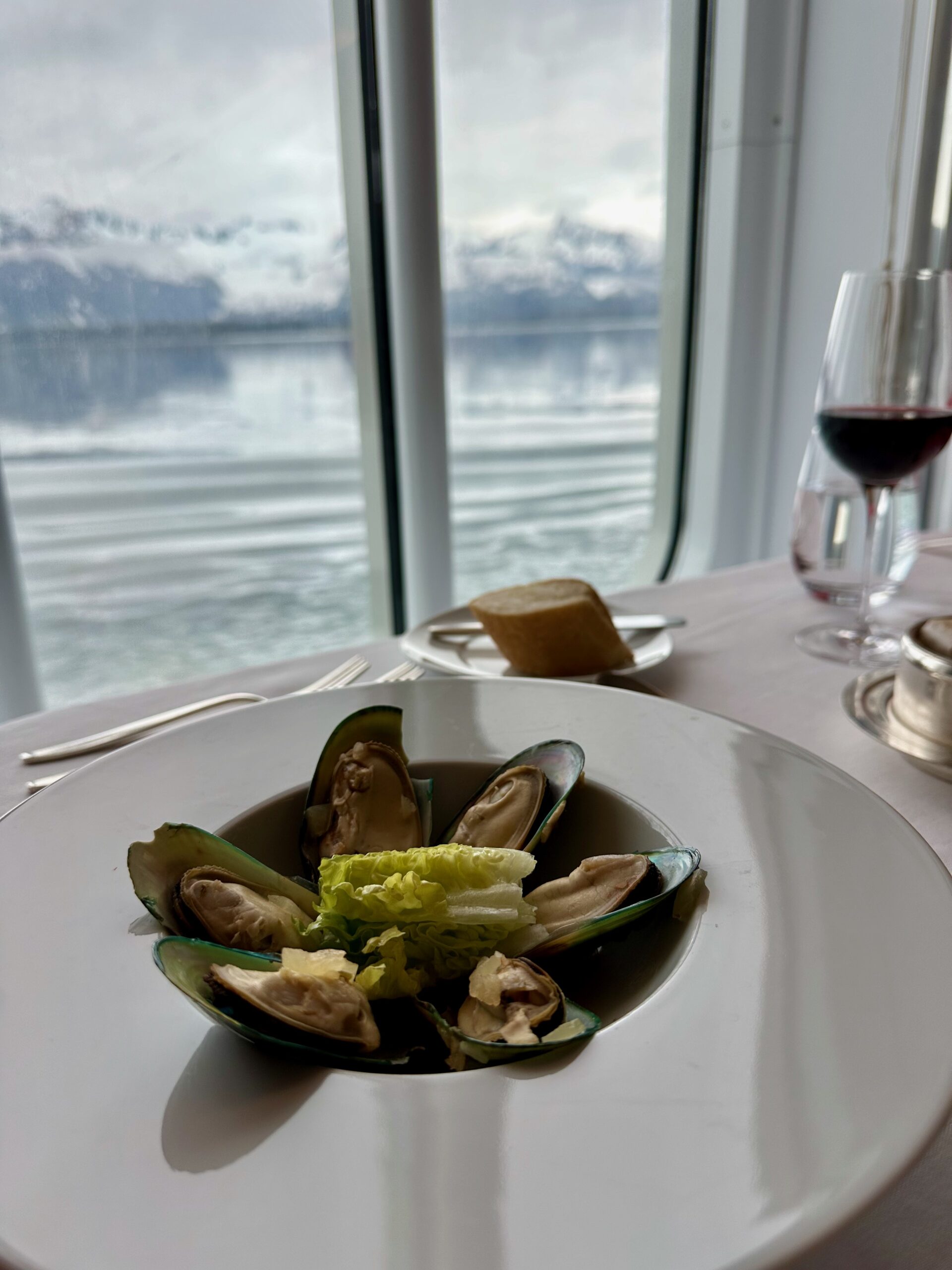
I had mussels with a view for lunch.
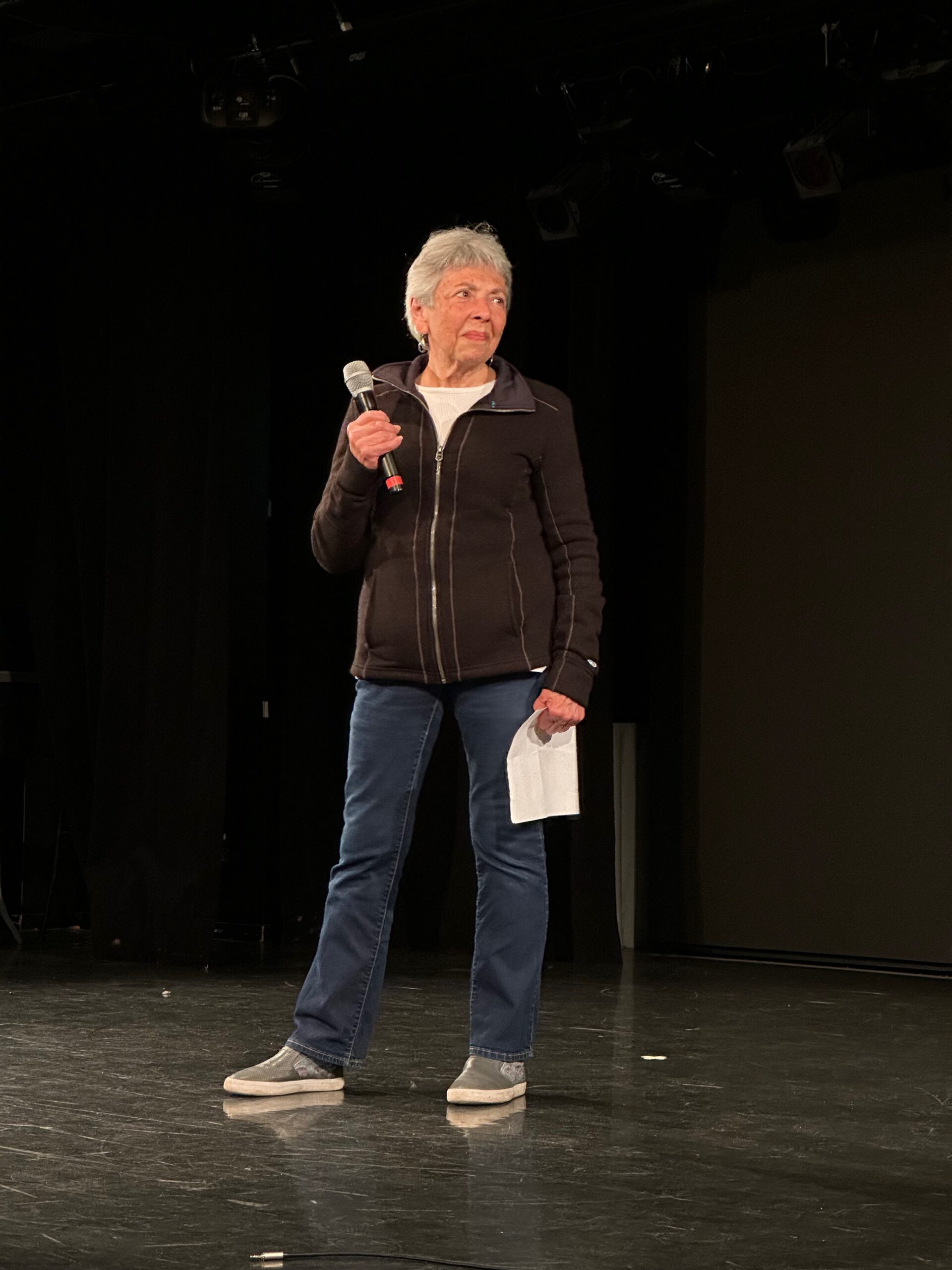
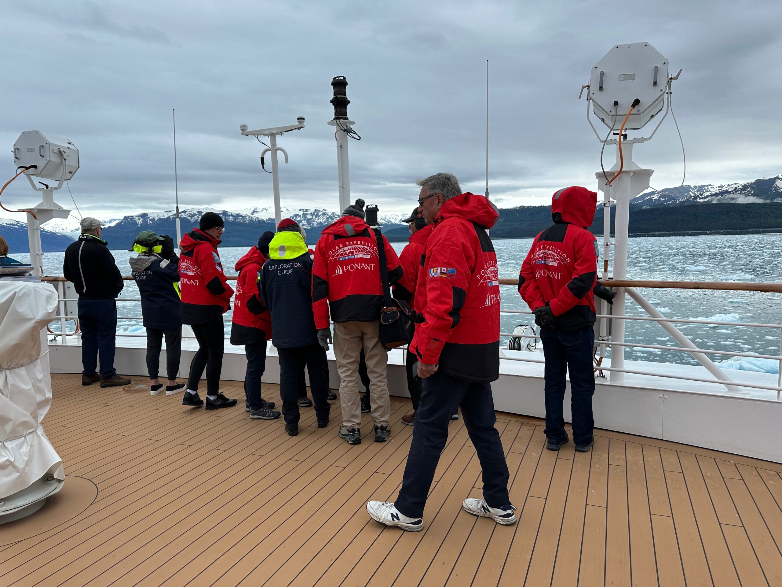
This is the team of exploration guides traveling with us to answer every question. Their backgrounds are diverse, some PhD trained scientists, others from education, and others life long travelers. I asked them how they came to this job, the best answer was, “I just continued to say yes to life.”
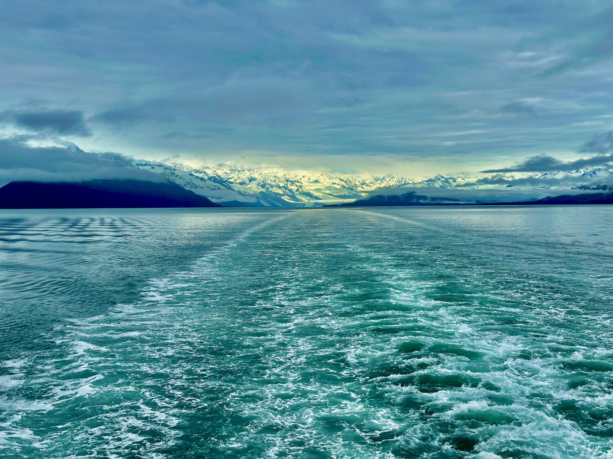
As we headed out back to the Gulf of Alaska I took this last shot. Seems nature is better at lighting than Steven Spielberg.
We started the day in Anchorage and boarded a coach to take us to Seward. At breakfast we met several of our crew mates many coming from various places around the world. The different accents and experiences make for a very diverse group. Many are avid travelers and selected this line in particular for the up close and personal attention while providing interesting exploration. Everyone was super nice and eager to chat. The staff are polite to the extreme and eager to meet our every need.
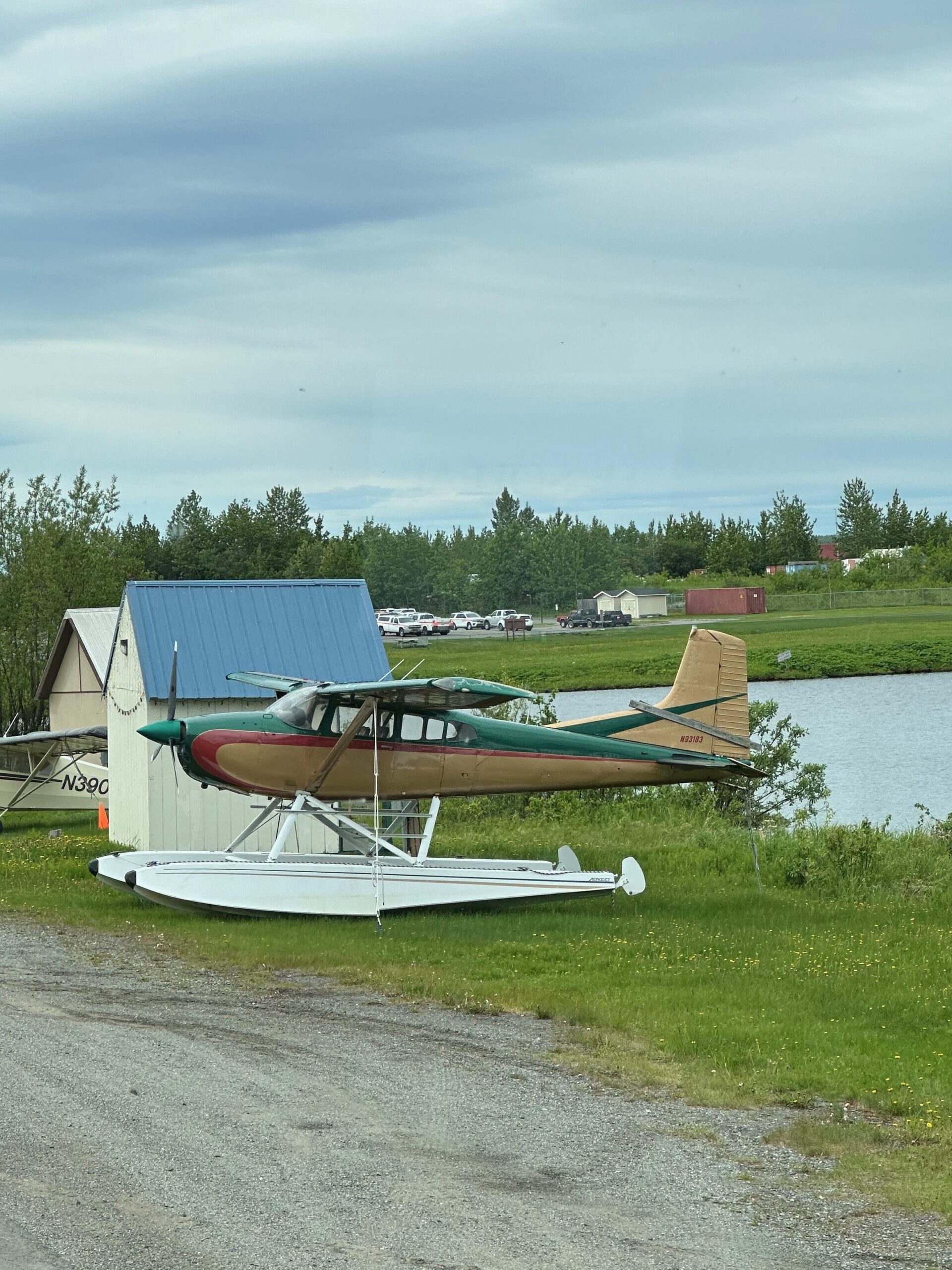
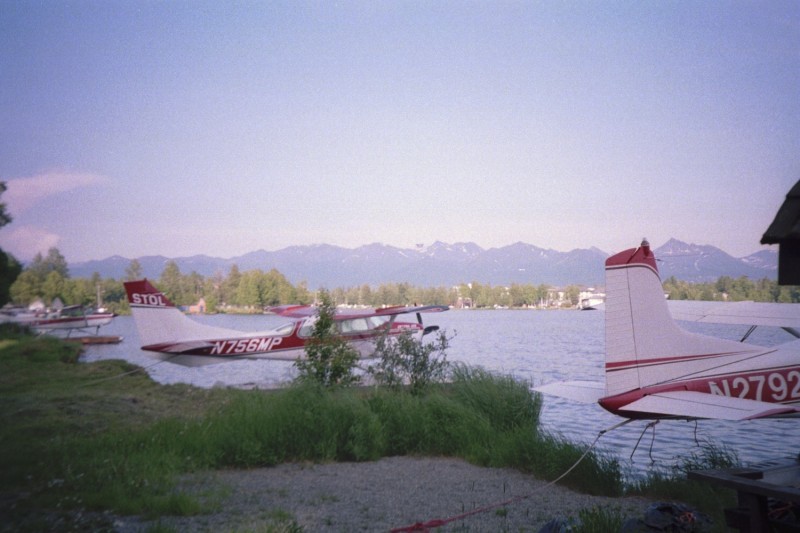
Before hitting the road we tooled around Anchorage in a repeat of some sites we saw just a few days before. We drove by the Lake Hood Seaplane Base and this time I was able to get a decent picture. It is the largest seaplane base in the world and little huts like this one with the plane surround the shore.
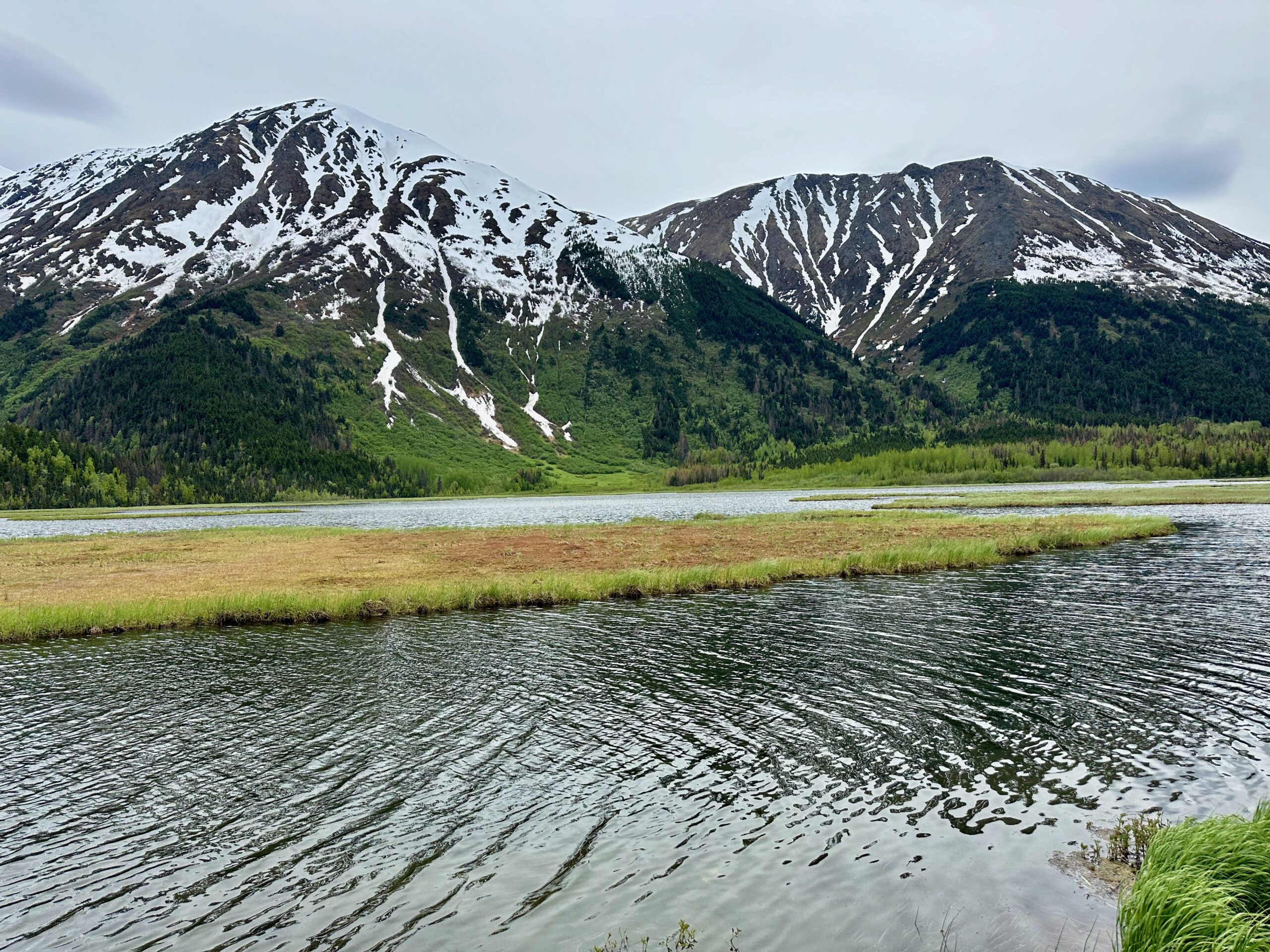
After a sit down lunch we hit the road to the port at Seward, with incredible scenery along the way.
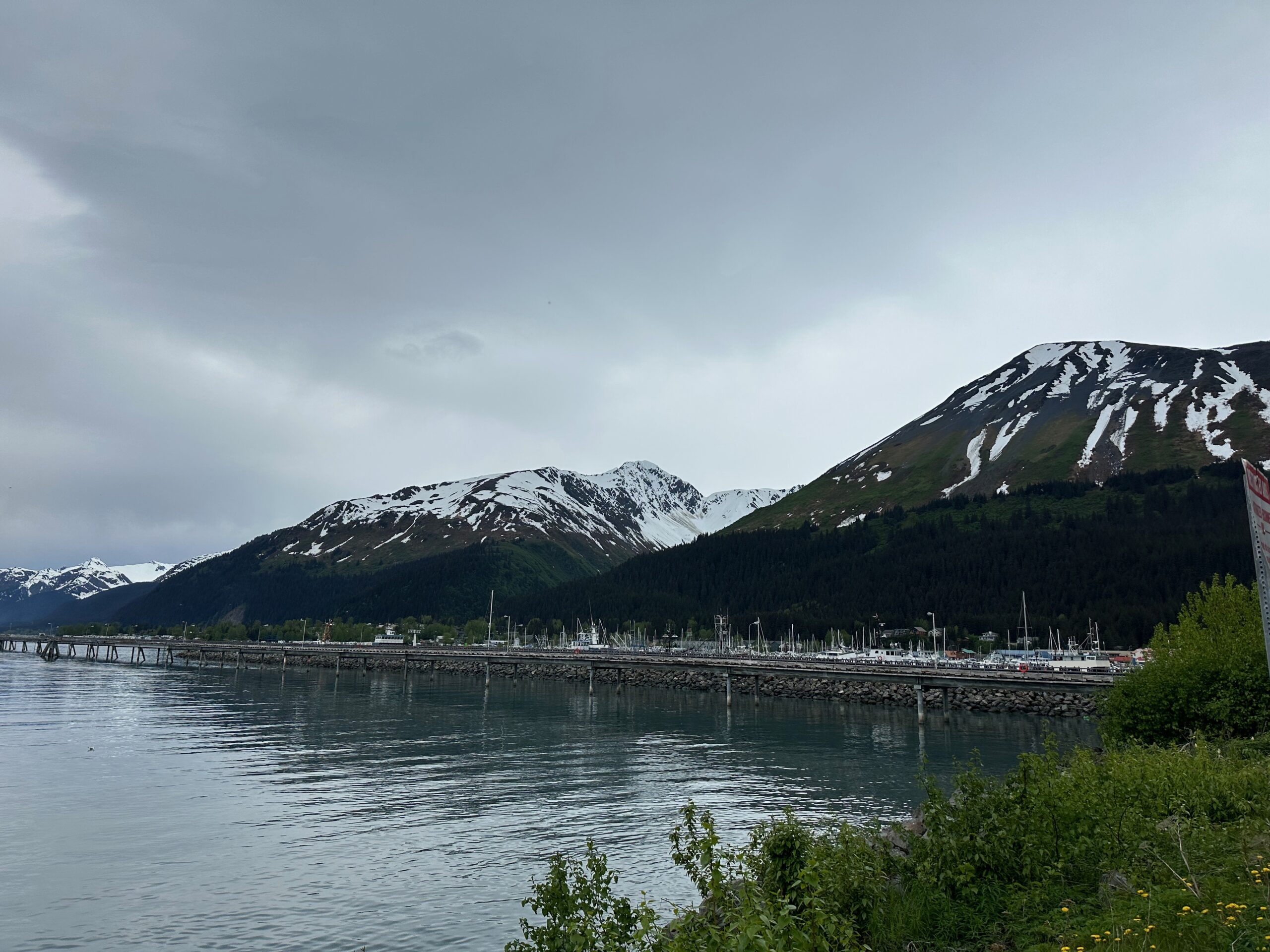
Two hours of driving and we were at the Seward Port. Tucked up against the mountains, it is very small and our was the only cruise ship docked. This is the very beginning of the cruise season in Alaska so in a few weeks it will be busier.
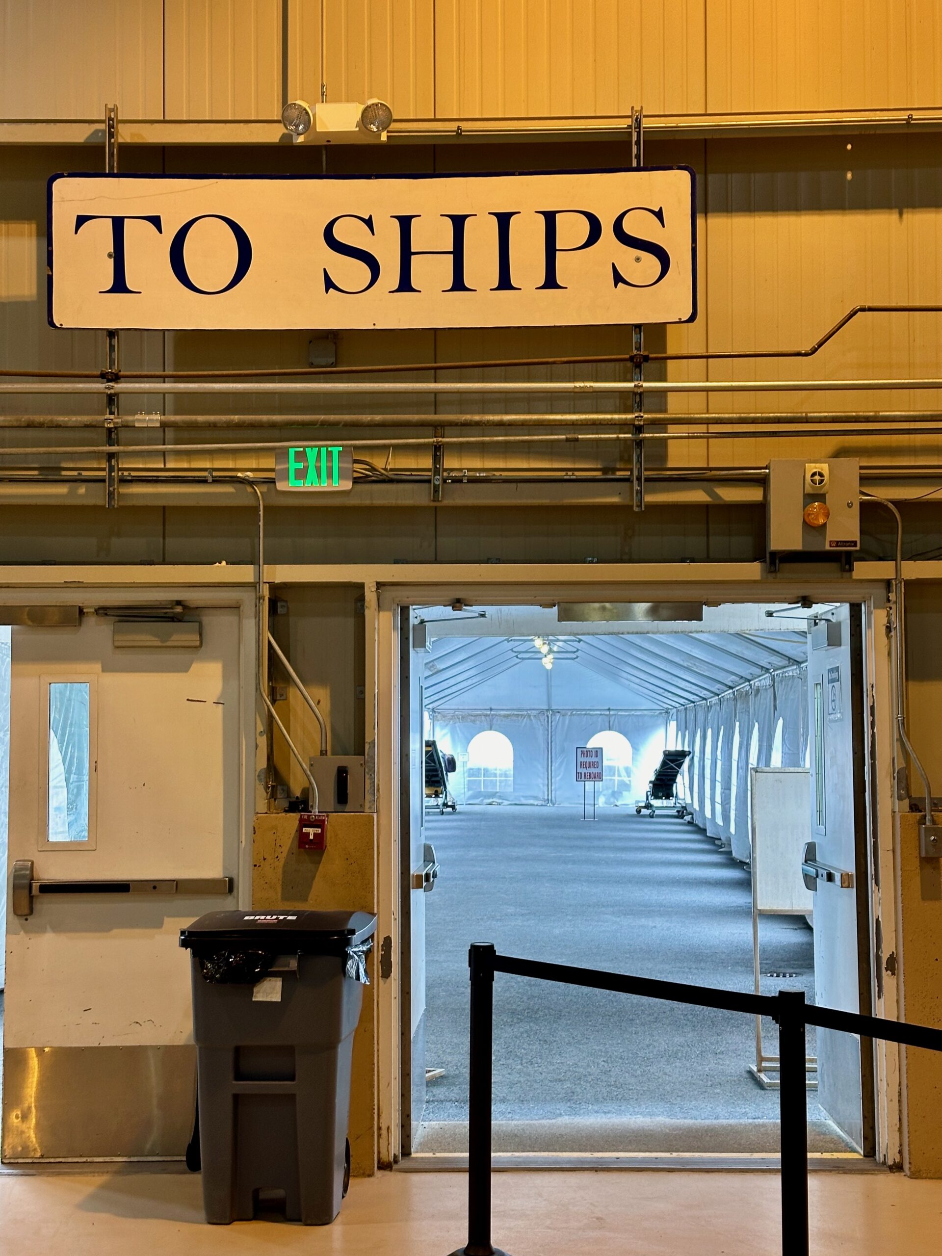
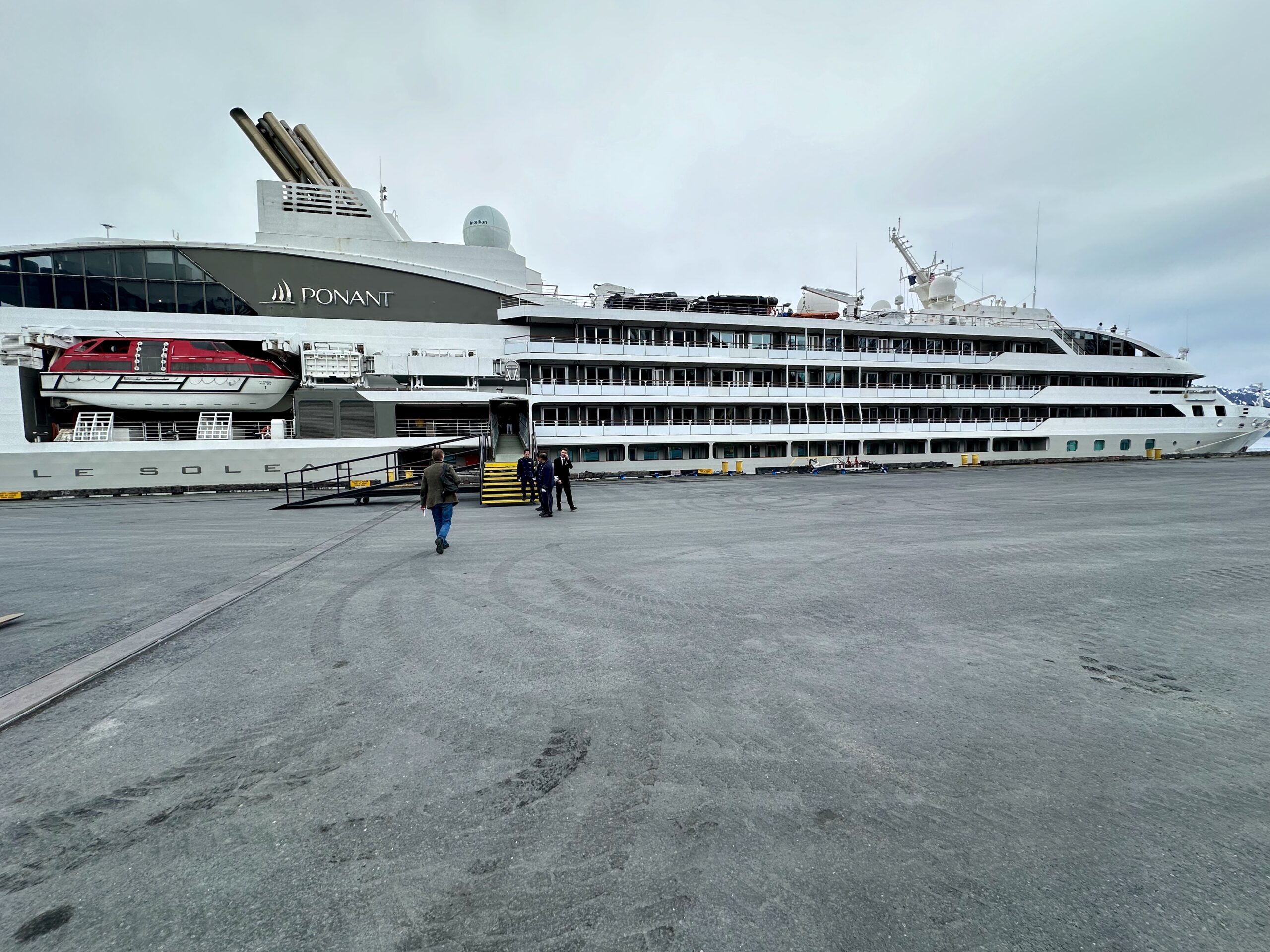
And we had a hassle free boarding on our home for the next eleven days.
The life boat drill was very thorough and soon the horn sounded and we moved out to sea. Tonight we will be sailing some rough waters in the Alaska Gulf. Sea sickness pills were being handed out like candy.
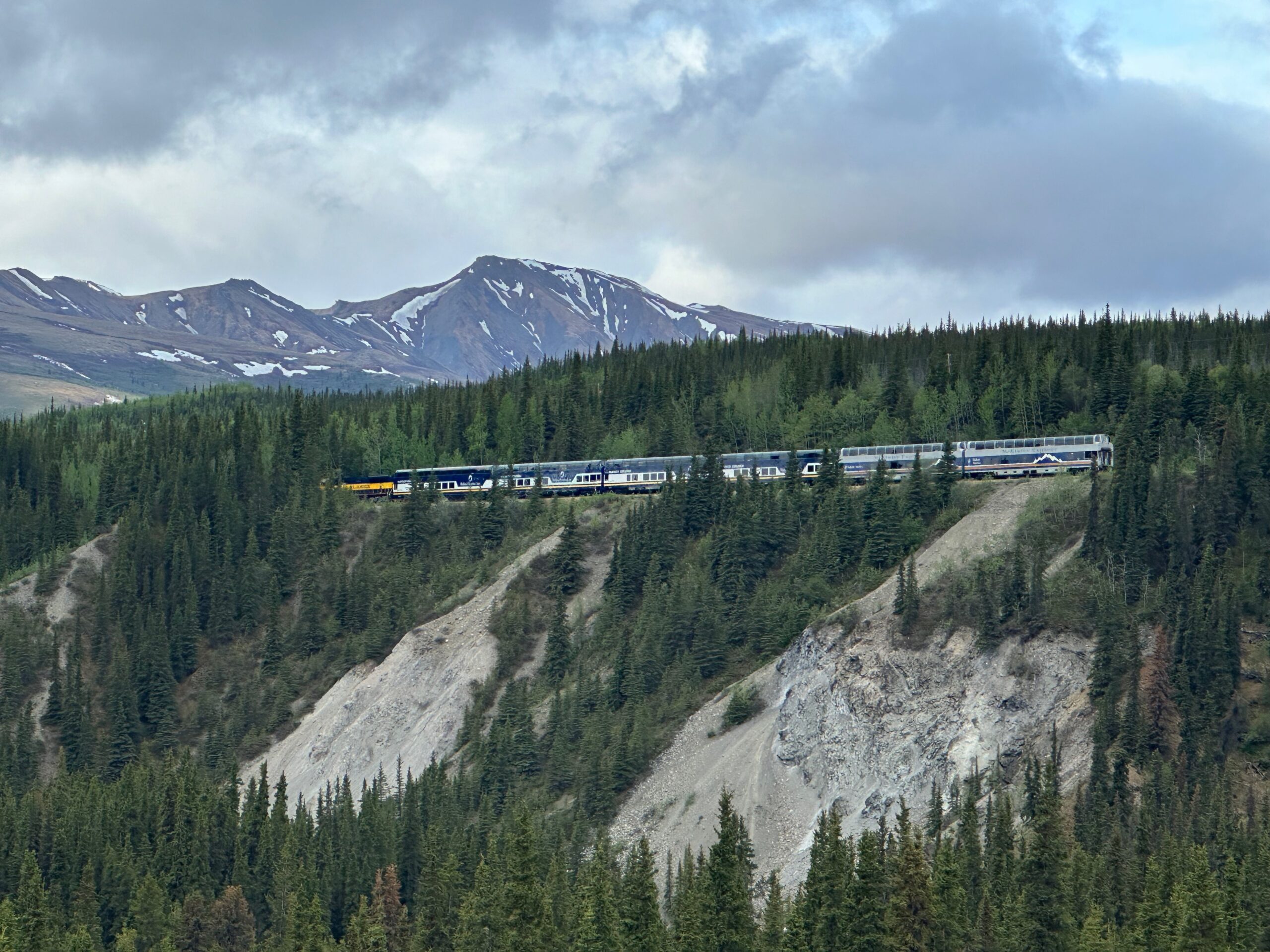
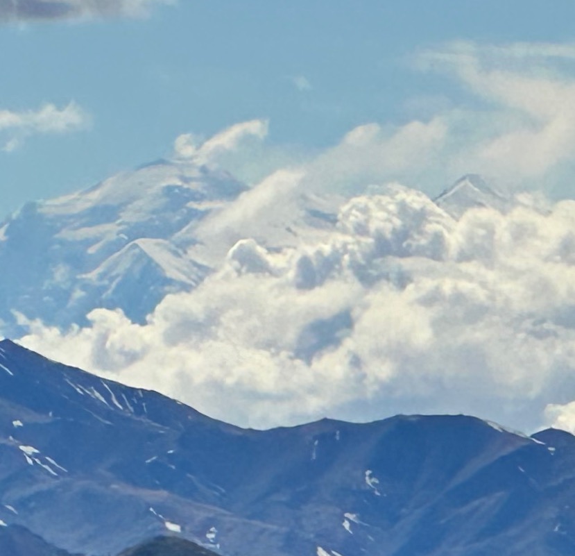
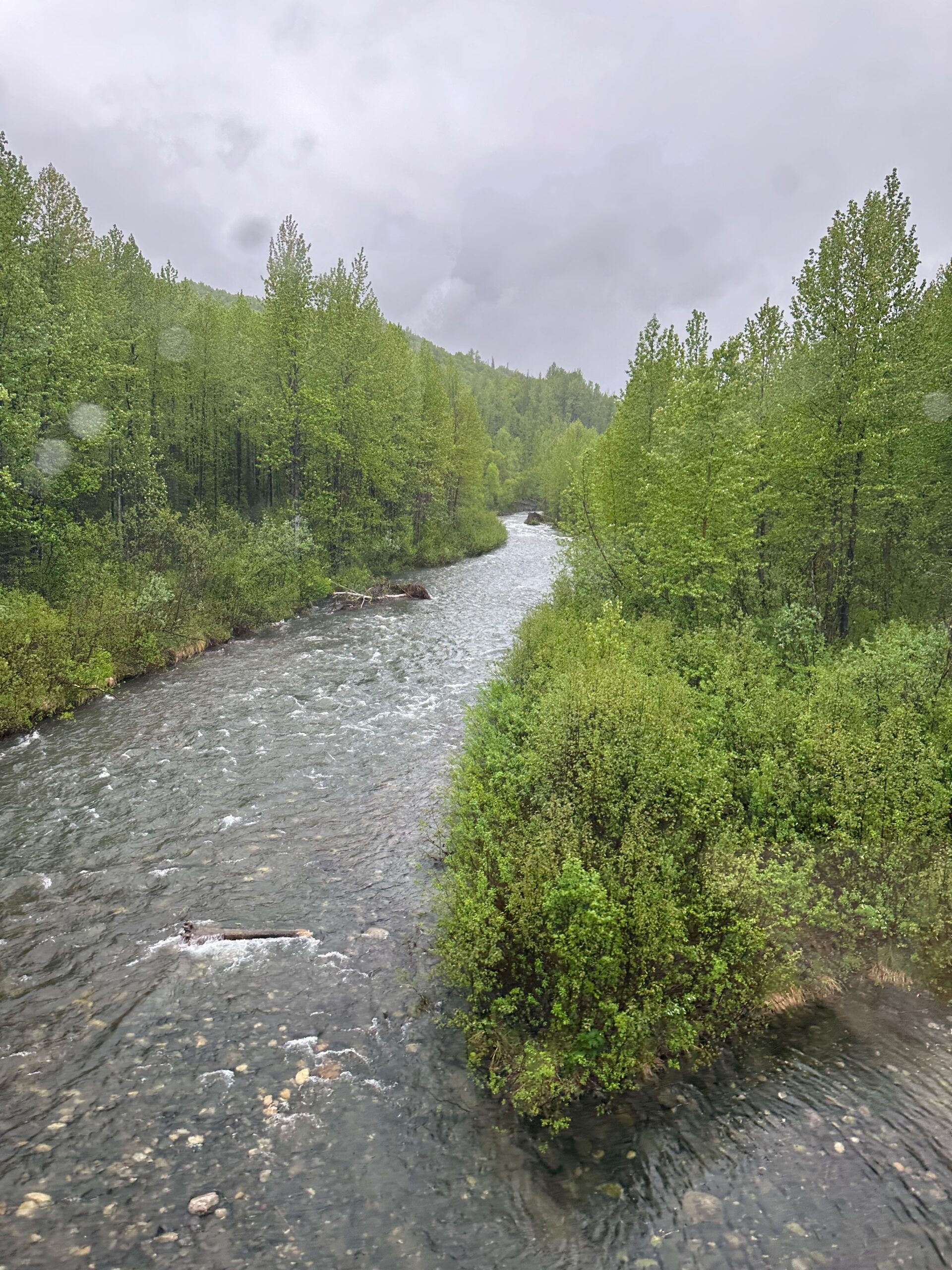
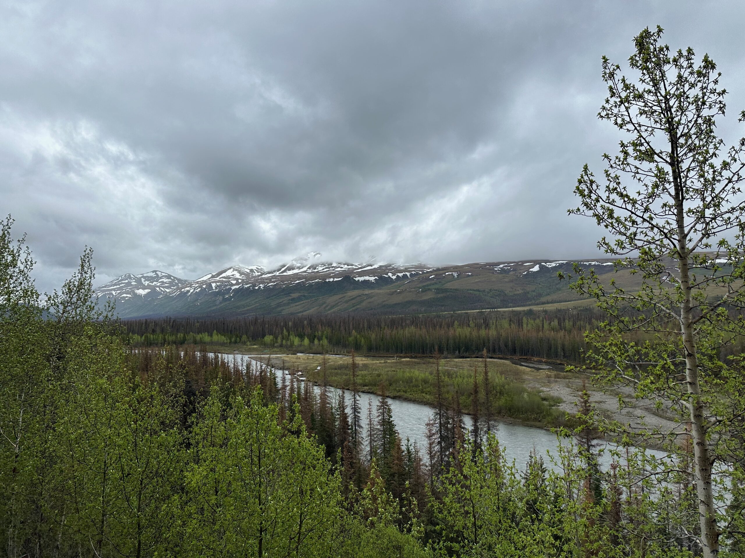
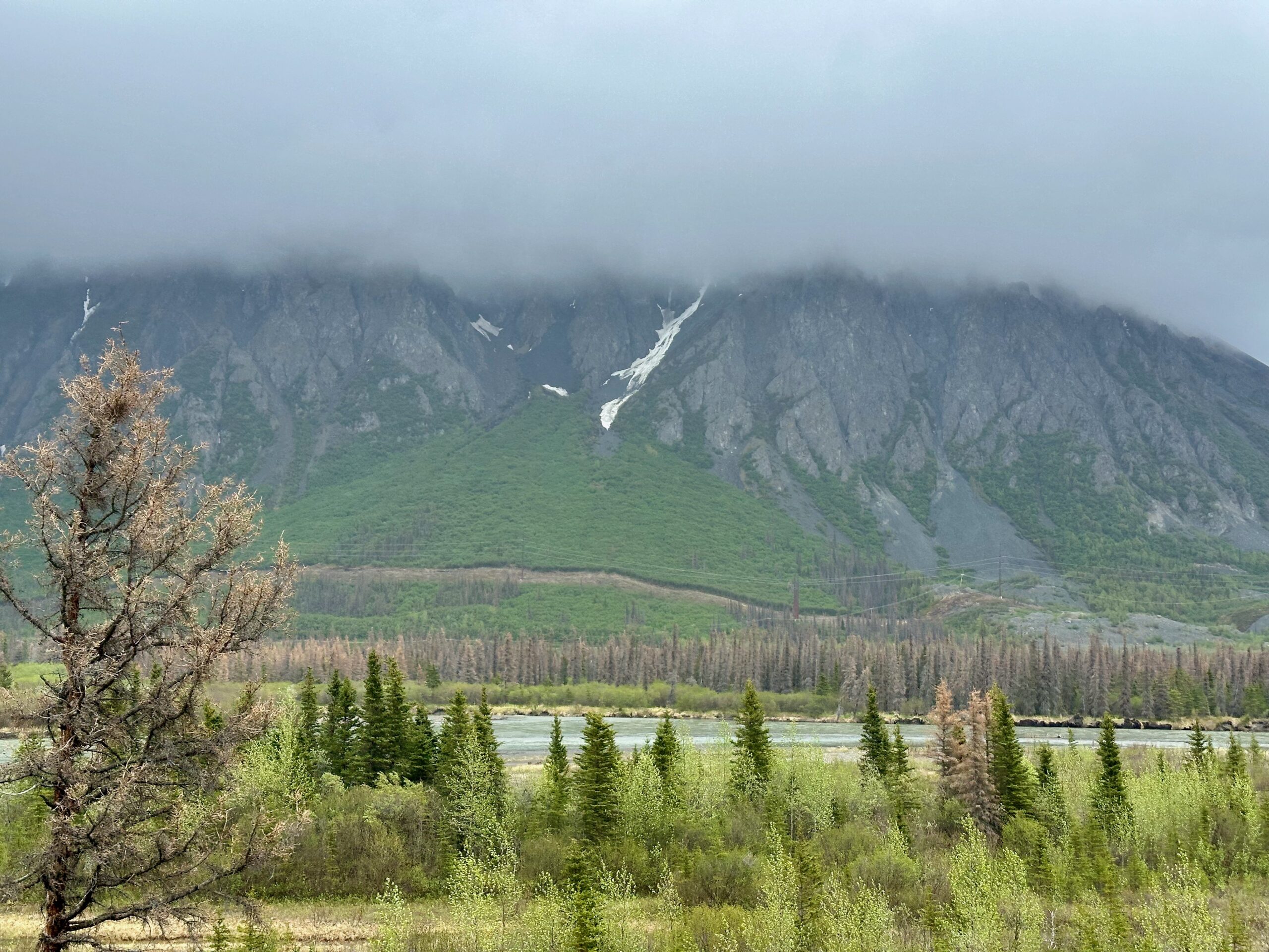
It’s midnight as I write this. We woke to a glorious day in Denali with crystal blue skies. We met the train at the Denali Rail Depot and boarded for an incredible trip to Anchorage. However, there was a “broken rail” down the line that needed fixing before our train could pass. We moved slowly for a couple of hours and then sat still for another. As a result, we arrived in Anchorage an hour and a half late. The train had not only a domed car but also an outdoor platform, allowing me to capture stunning shots of Mount Denali in full splendor, shooting south to north. What a day. Come along for the ride! Definately click to full screen.
This morning, we woke up at the Denali Princess Wilderness Lodge. Owned by the same company that operates Princess Cruises, the lodge aims to cater to a broad audience, often attempting to meet the expectations of the lowest common denominator. Unfortunately, it rarely hits that mark. My skepticism is always piqued when a lodge features a “village” of gift shops, including a year-round Christmas store.
There are skads of fresh, young, new employees from all over the world. None of them have been trained. So, ordering a cup of coffee with a shot of espresso turned into a 10-minute ordeal. However, it is on a beautiful piece of property. Here is the view from the terrace just down a set of stairs from our room.
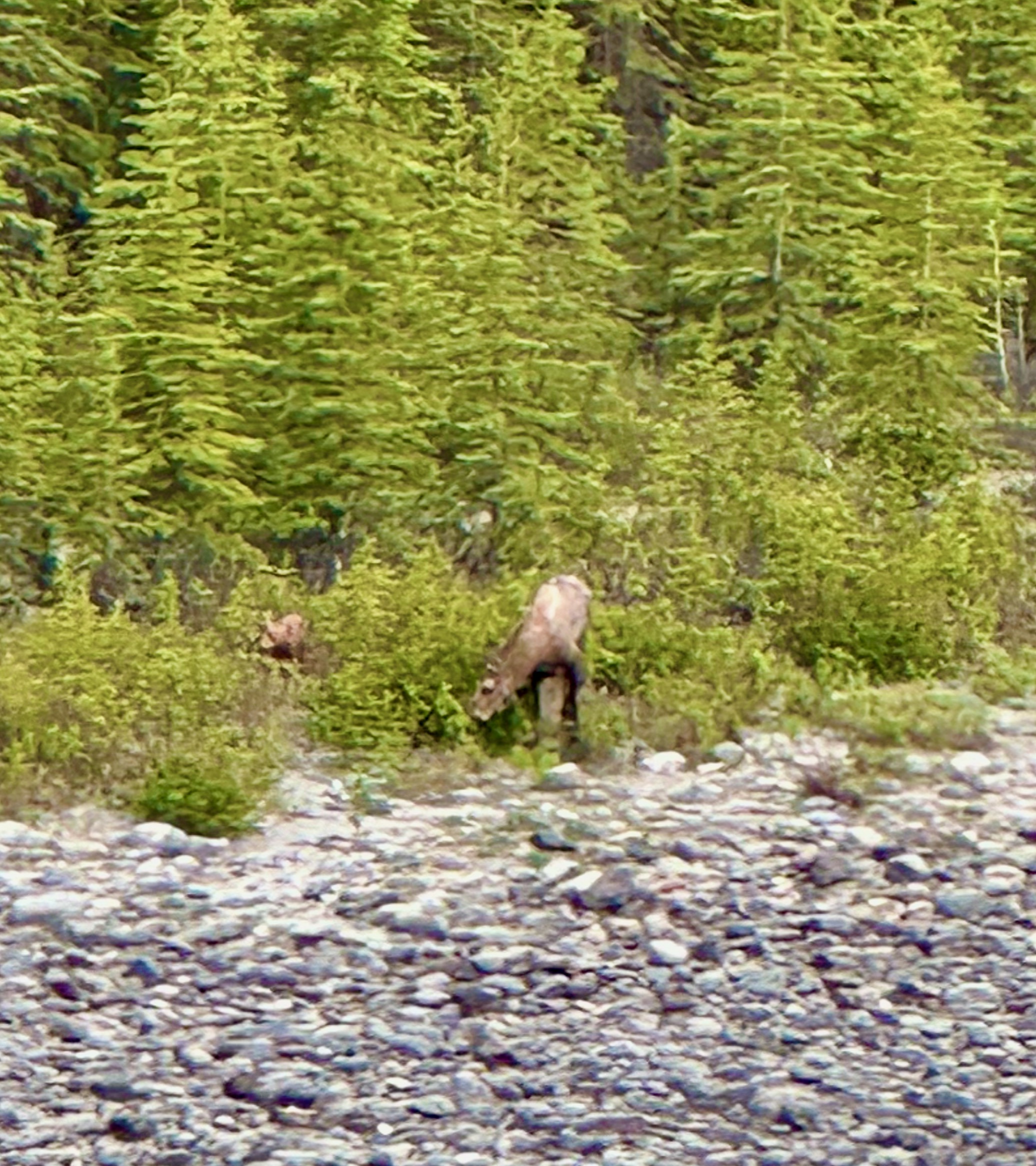
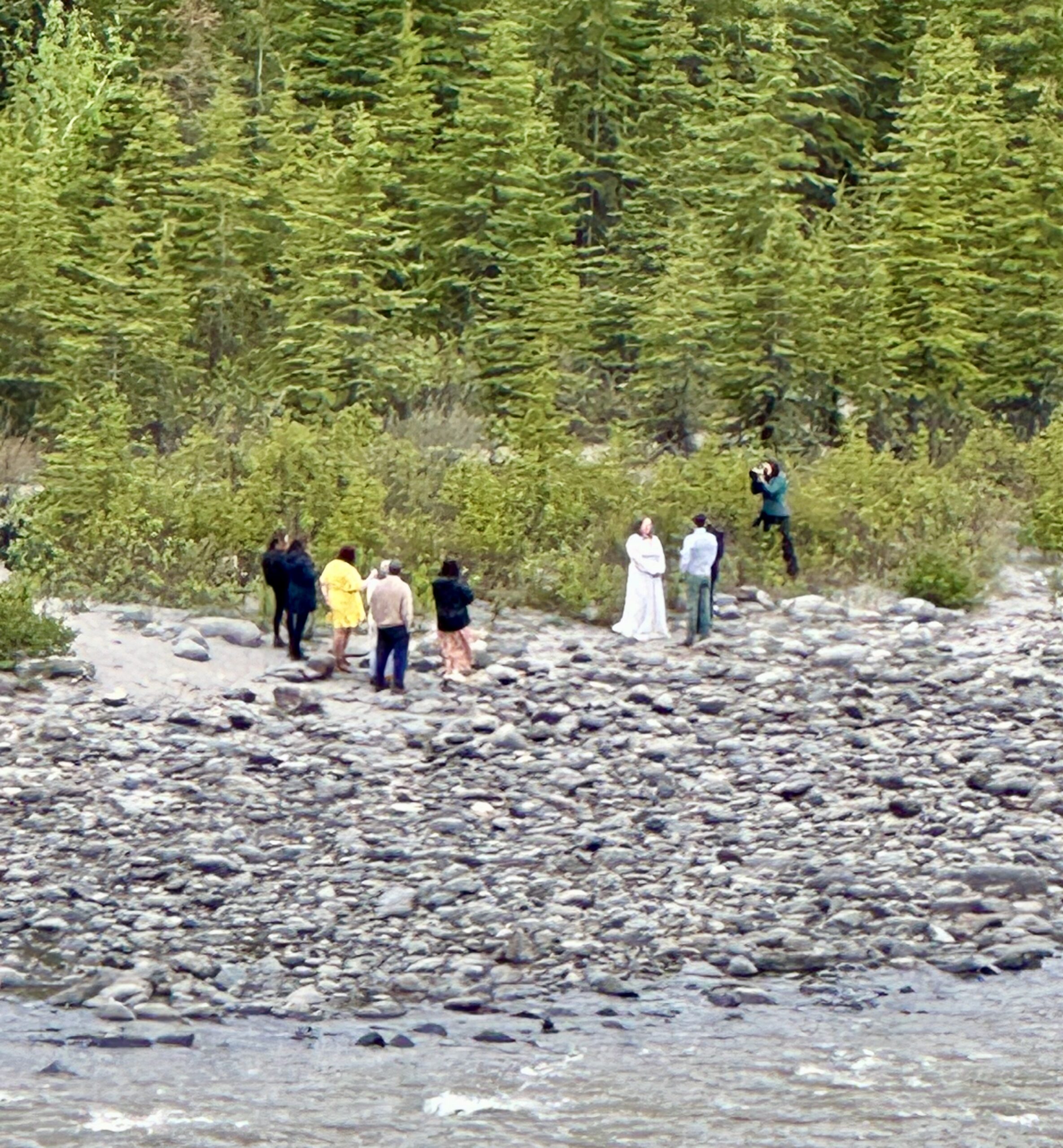
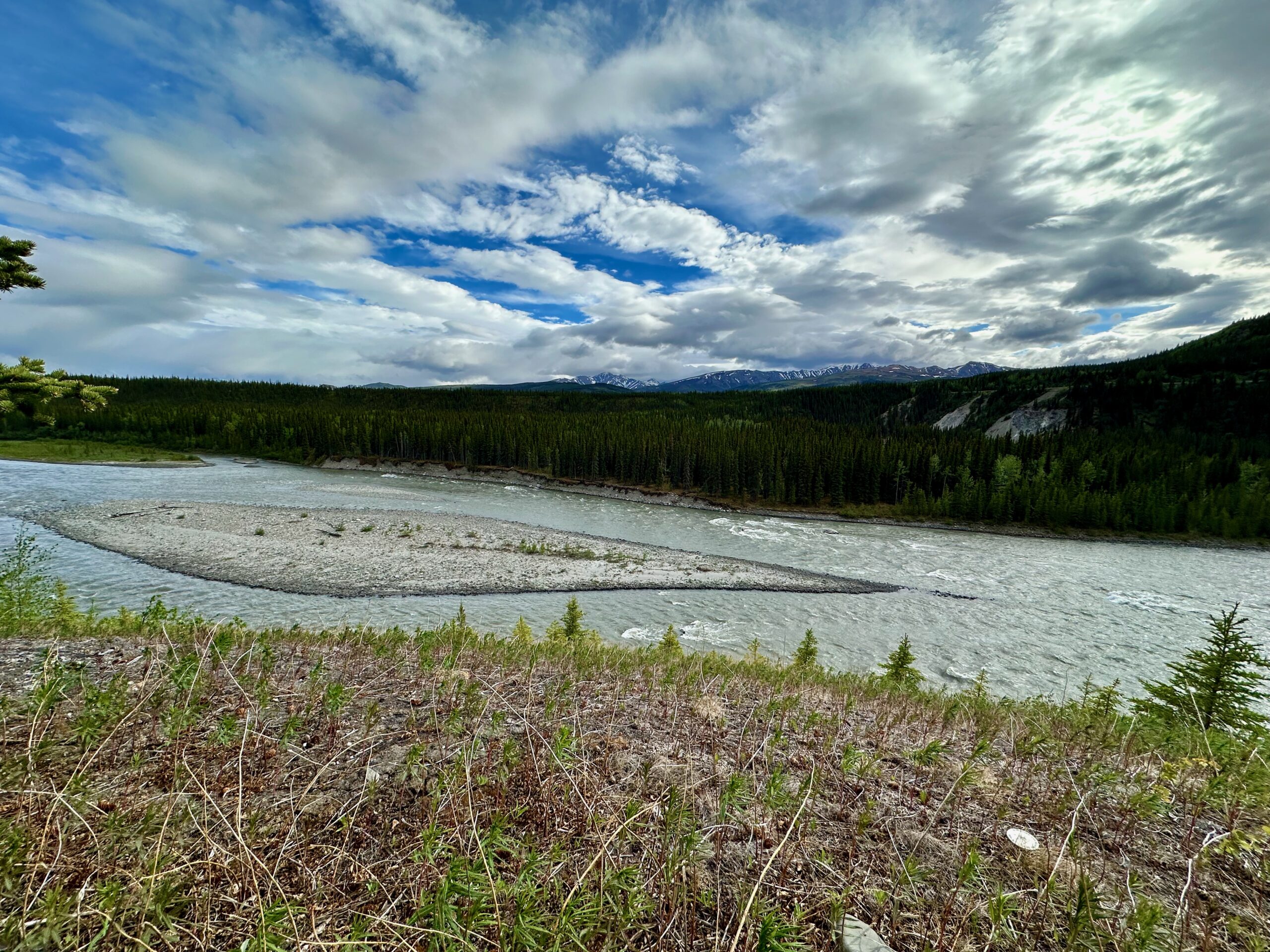
Here’s a close up of Mama Moose and Baby Moose eating breakfast on the opposite bank of the Nenana River, just minutes before the ultimate destination wedding occurred in the same spot. Sorry for the fuzzy zoom pics.
The river flows south from the Nenana Glacier, then turns west and north, forming the eastern boundary of Denali National Park and Preserve before joining the Tanana River and the waters ultimately end up in the Bering Sea.
A snowshoe hare hopped over to join me while I finished my coffee.
I even caught the morning train from Denali to Anchorage.
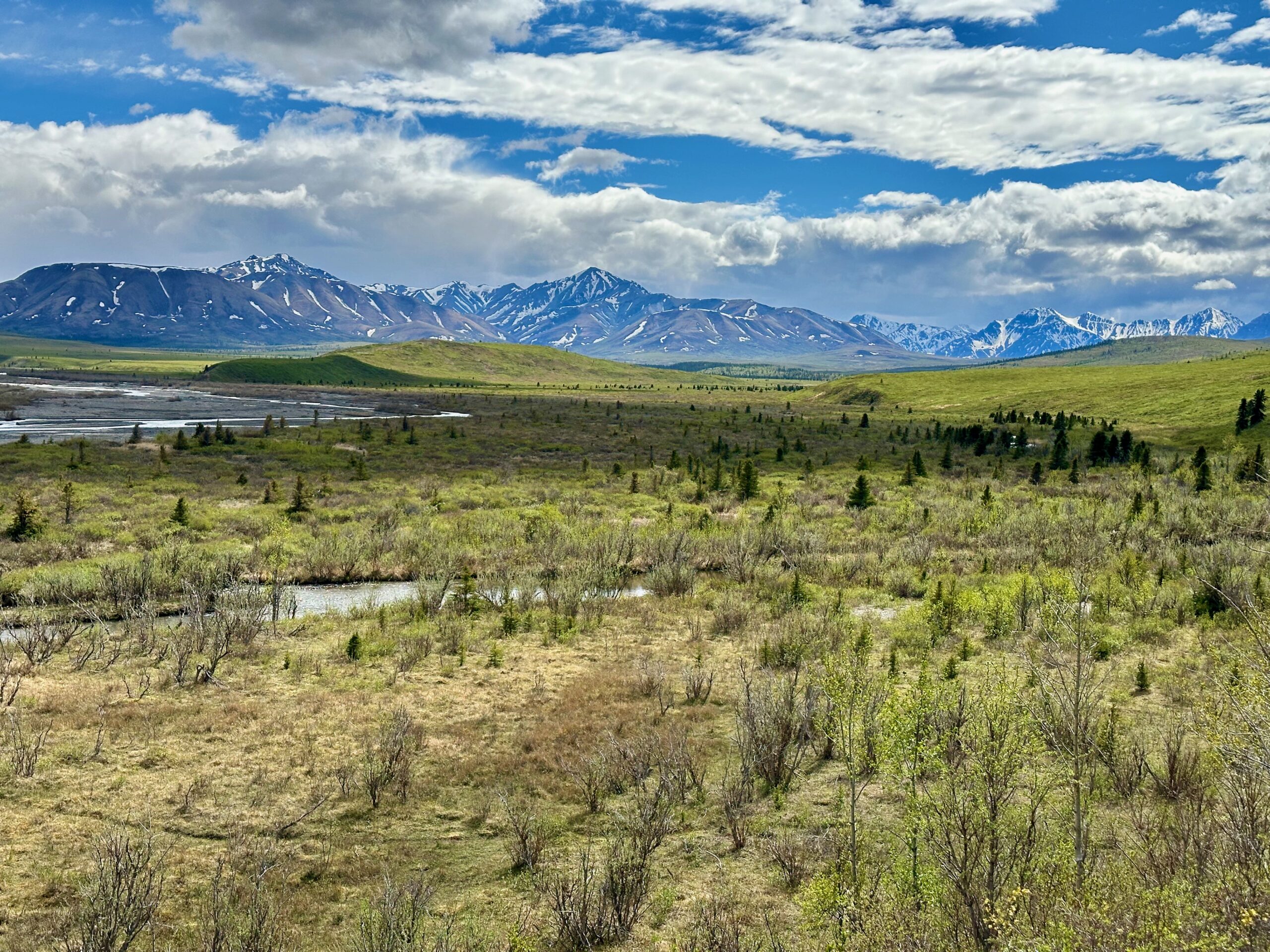
The main activity today was the Tundra Wilderness Tour. I thought the name was a marketing slogan, but I soon learned the difference between a national park and a designated national wilderness. Denali National Park contains a designated national wilderness area known as the Denali Wilderness. This wilderness area was established on December 2, 1980, and encompasses approximately 2,146,580 acres (3,354 square miles; 8,687 square kilometers) within the park. The Denali Wilderness protects the higher elevations of the central Alaska Range, including Denali, the highest mountain in North America.
National parks are highly managed to accommodate large numbers of visitors while preserving the environment. This includes designated campgrounds, educational programs, and amenities to make outdoor recreation accessible to people of all ages and abilities.
Wilderness areas are designated to preserve their “primeval character and influence,” remaining largely untouched by human activity. They are meant to maintain their natural conditions without permanent improvements or human habitation. Wilderness areas are managed to minimize human impact. This includes prohibitions on motorized vehicles, bicycles, and permanent structures. The goal is to keep these areas as pristine as possible.
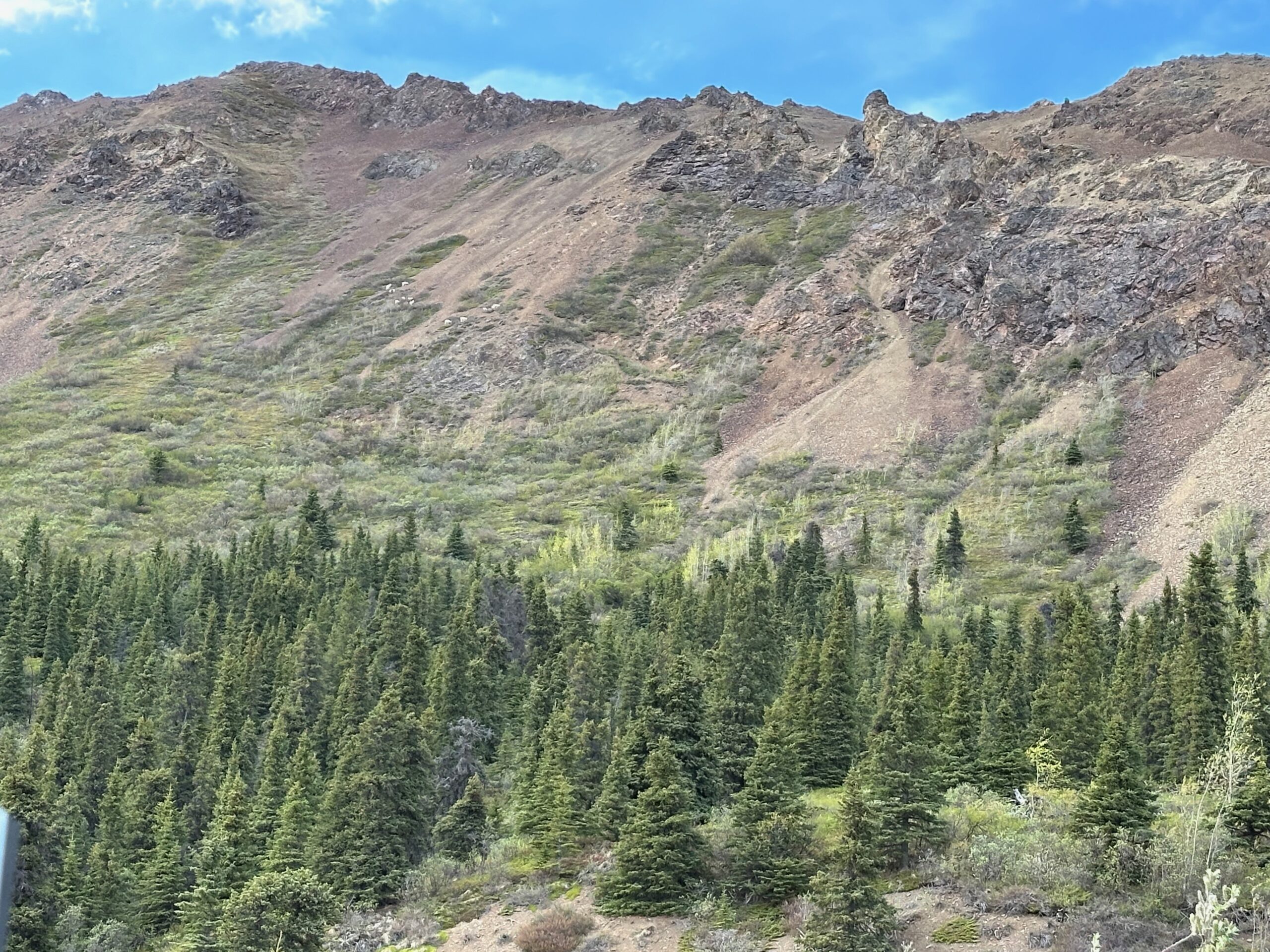
The tour travels from the initial boreal forests through tundra to Sable Pass, then turns around at mile 43. It used to travel the full 92 miles, but the road has been closed due to the Pretty Rocks Landslide. Several portions of the road run alongside sheer cliffs that drop hundreds of feet at the edges. There are no guardrails, and the topography is vast.
We were very fortunate that the clouds broke, and we got the rare view of Mount Denali’s two peaks.
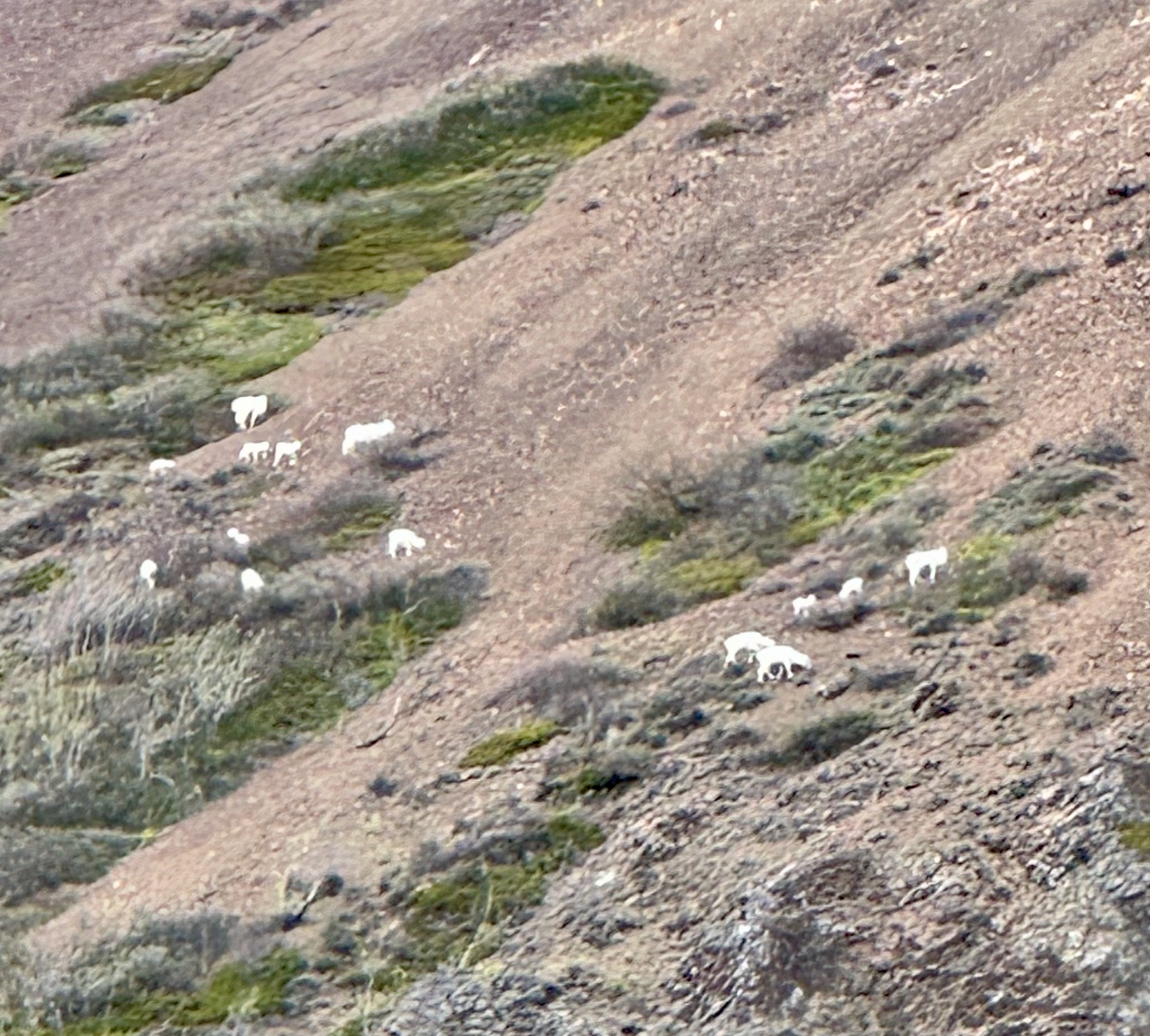
See if you can spot the little herd of Dall Sheep on the mountainside.
Today started early—so early, in fact, that the coffee shop wasn’t even open yet. We had to resort to the horror found in most hotel rooms: the dreaded Keurig machine.
These gadgets don’t even attempt to brew coffee. They just pass water through a “K” cup, turning it into water that is brown. And the hotel stocks decaf. What? Why is it so difficult to provide a small Mr. Coffee machine that makes real coffee?
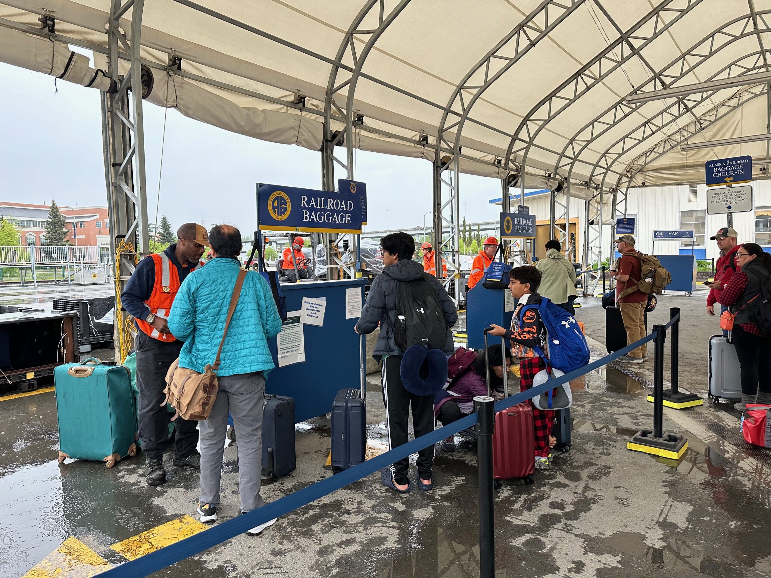
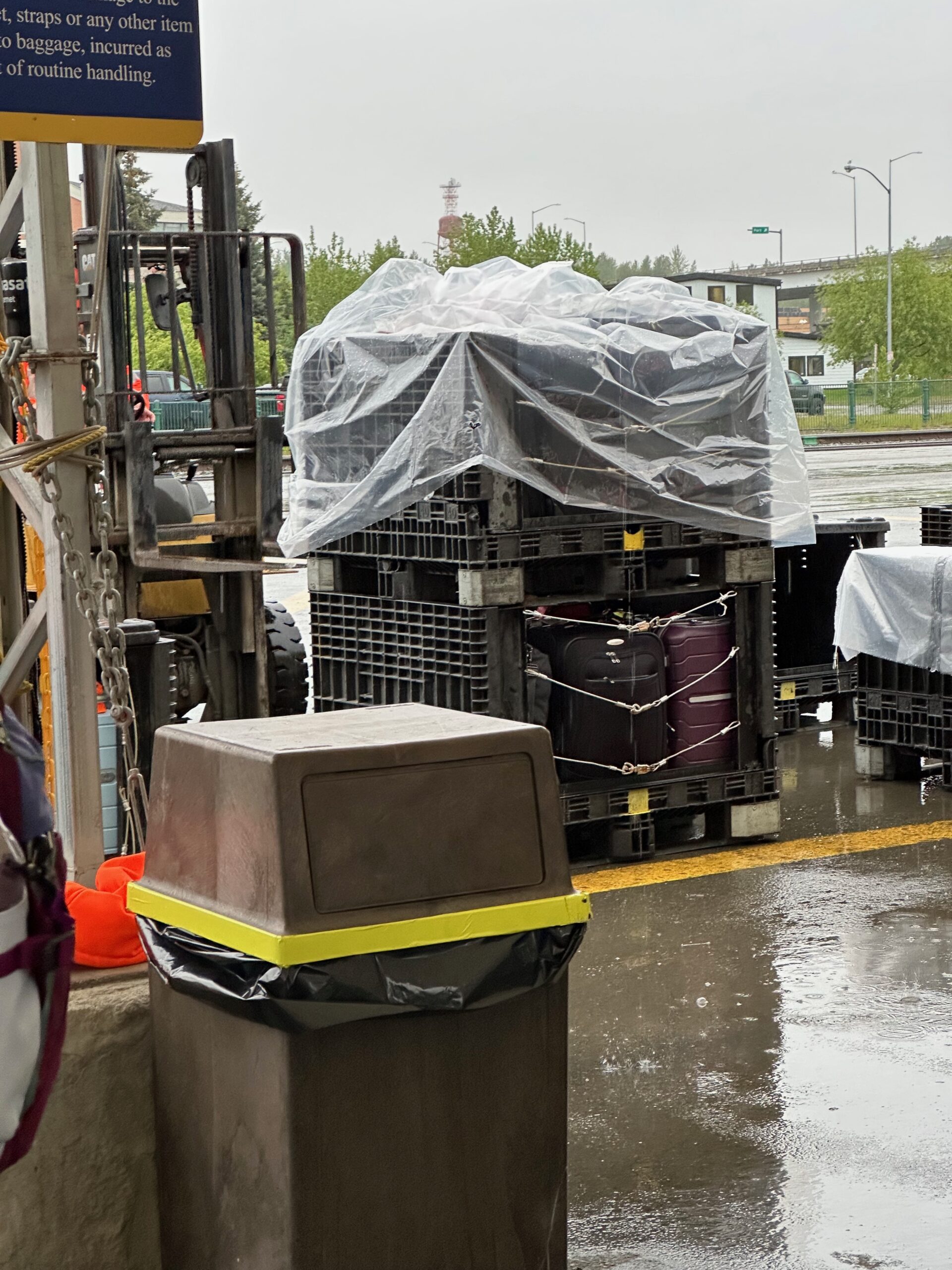
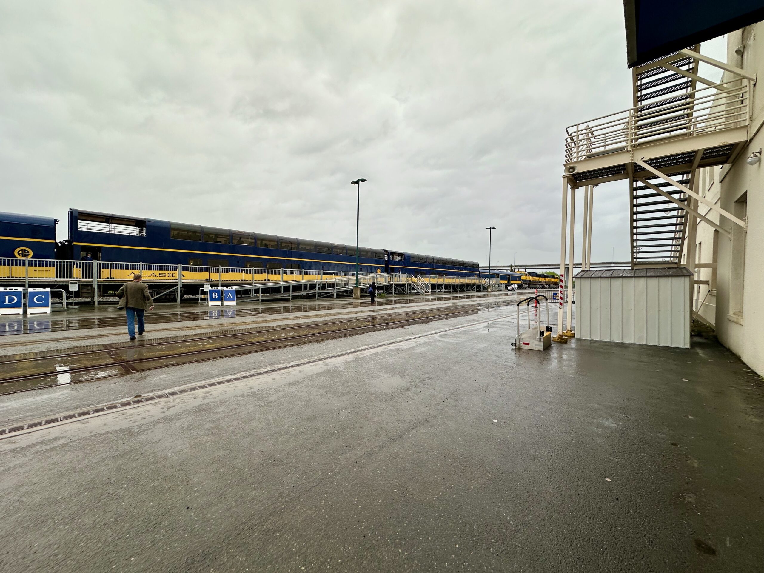
We arrived at the Alaska Railroad depot at 7:30 AM, with a steady drizzle drenching everyone. Our first stop was the luggage check-in tent. The incredibly friendly staff loaded our bags into crates, which were then forklifted into the luggage car.
If you want, click on pics to enlarge.
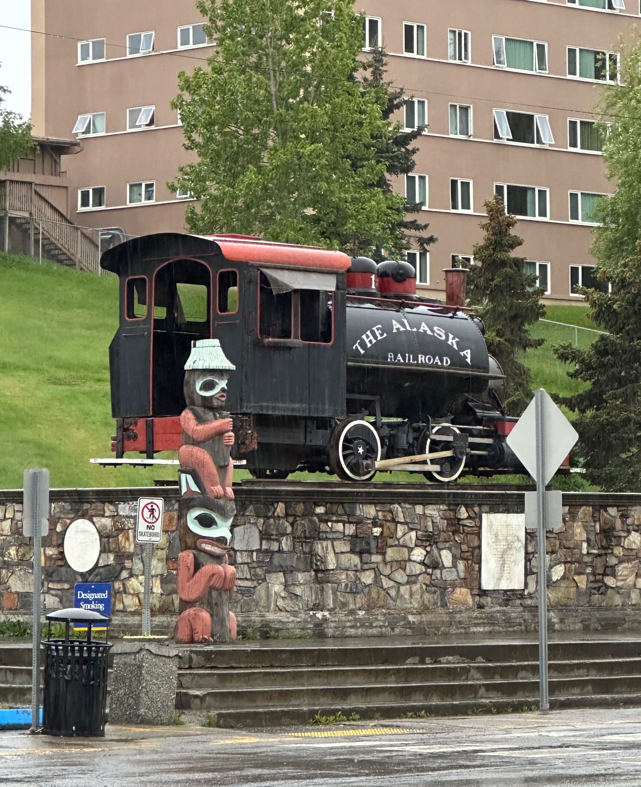
The walk from the luggage tent to the reservation desk took us past Alaska Engine #1, complete with a wooden bumper affectionately known as the “Moose Gooser”.
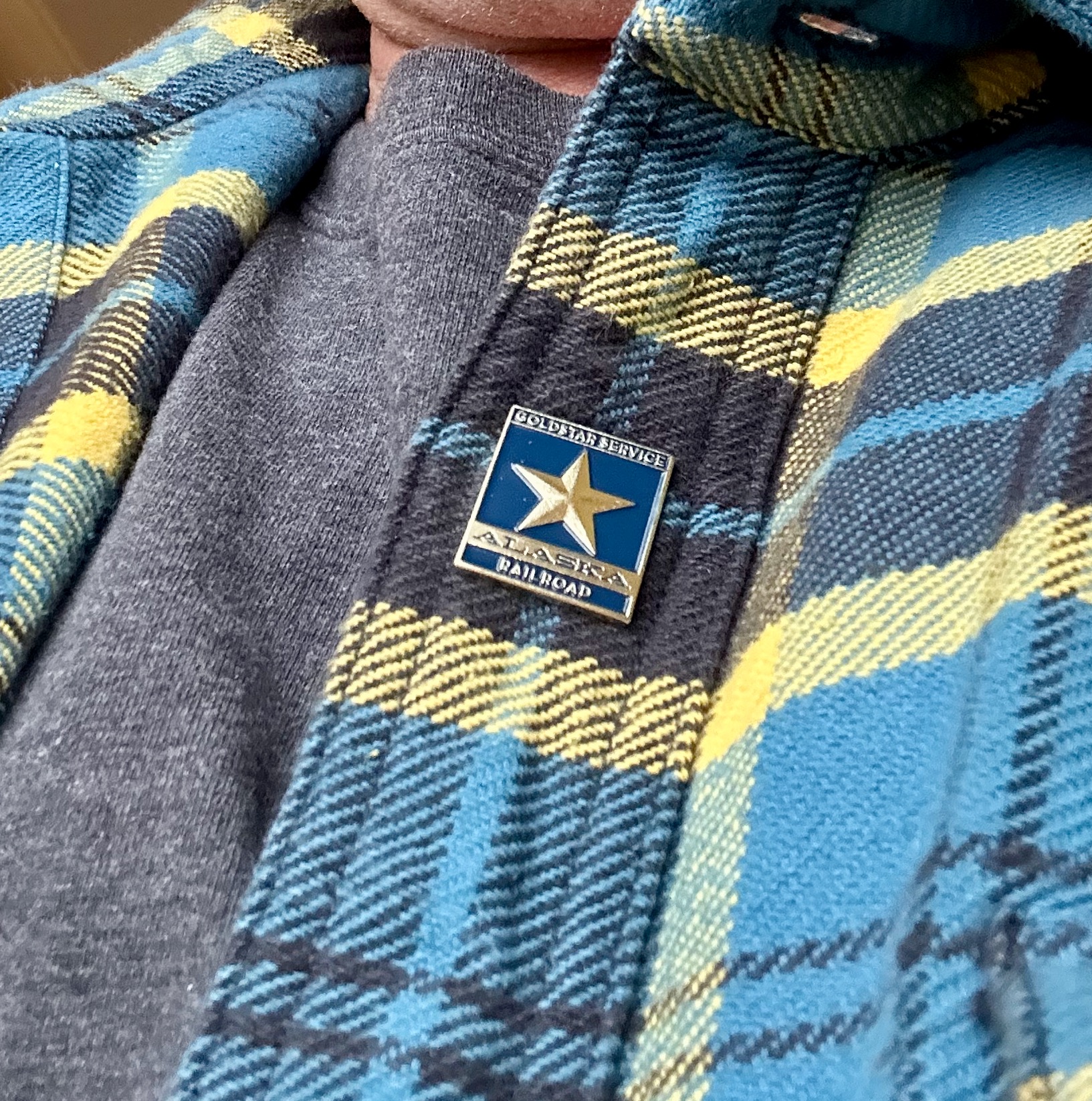
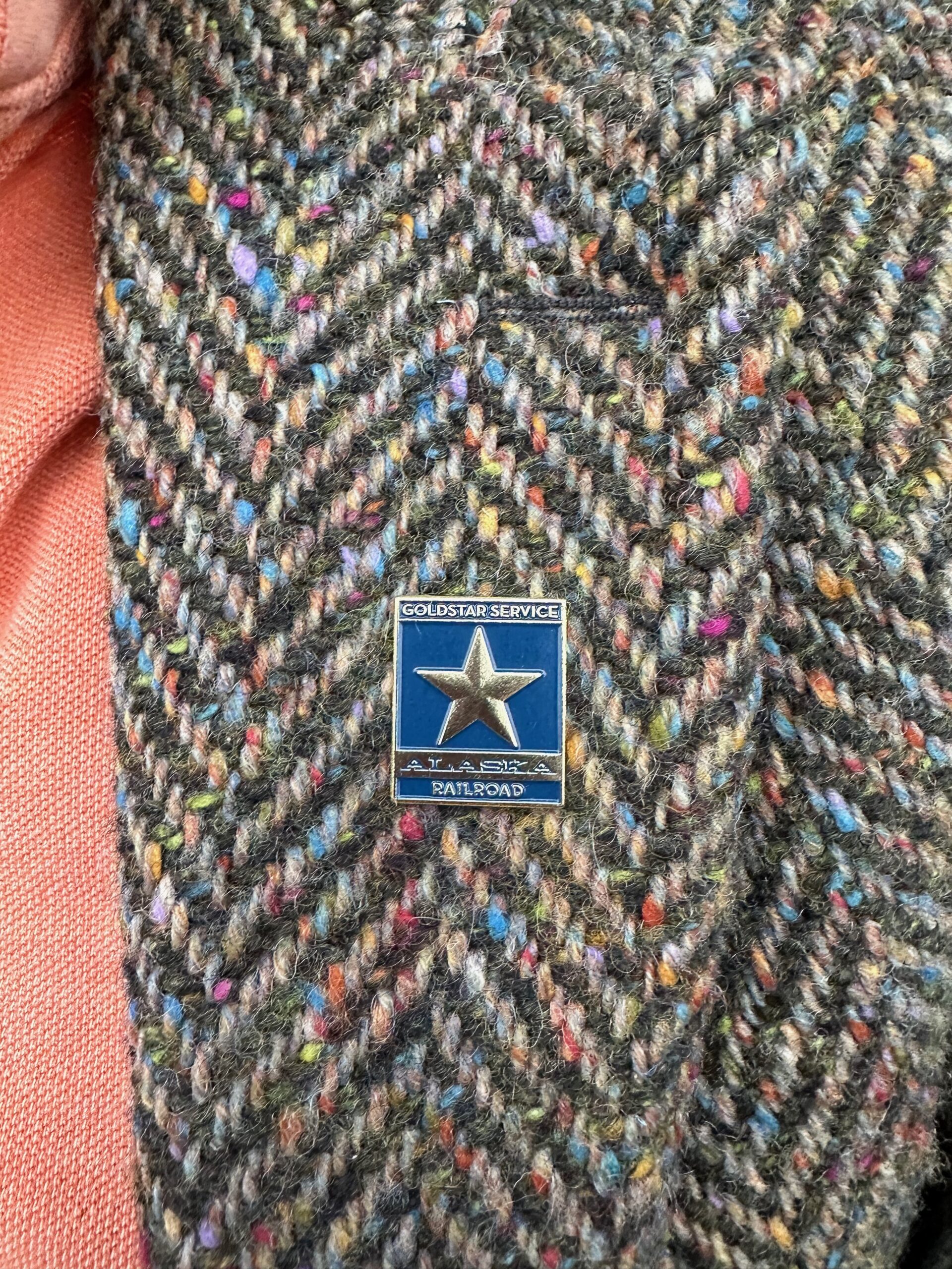
We reserved “Gold Star Service” so we could ride in the dome car, and each of us received a “gold star pin.” I was hoping for a more formal pin ceremony, something akin to a medal ceremony, but alas, they were just handed across the counter.
Construction of the railroad started in 1903 when the Alaska Central Railroad built a line starting in Seward and extending 50 miles (80 km) north. The Alaska Central went bankrupt in 1907 and was reorganized as the Alaska Northern Railroad Company in 1911, which extended the line another 21 miles (34 km) northward. On March 12, 1914, the U.S. Congress agreed to fund construction and operation of an all-weather railroad from Seward to Fairbanks and purchased the rail line from the financially struggling Alaska Northern.
Isn’t this train a beauty?
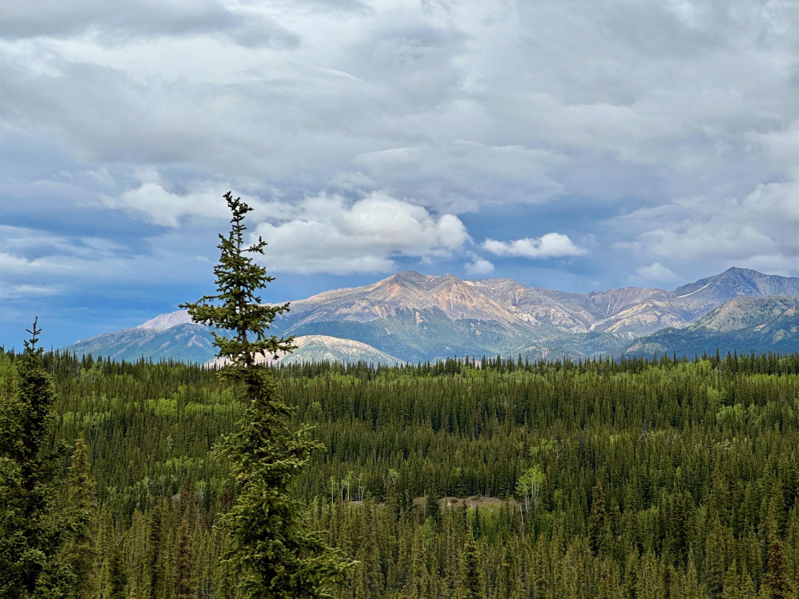
The overcast and drizzle continued for most of the journey but still, there was incredible scenery.
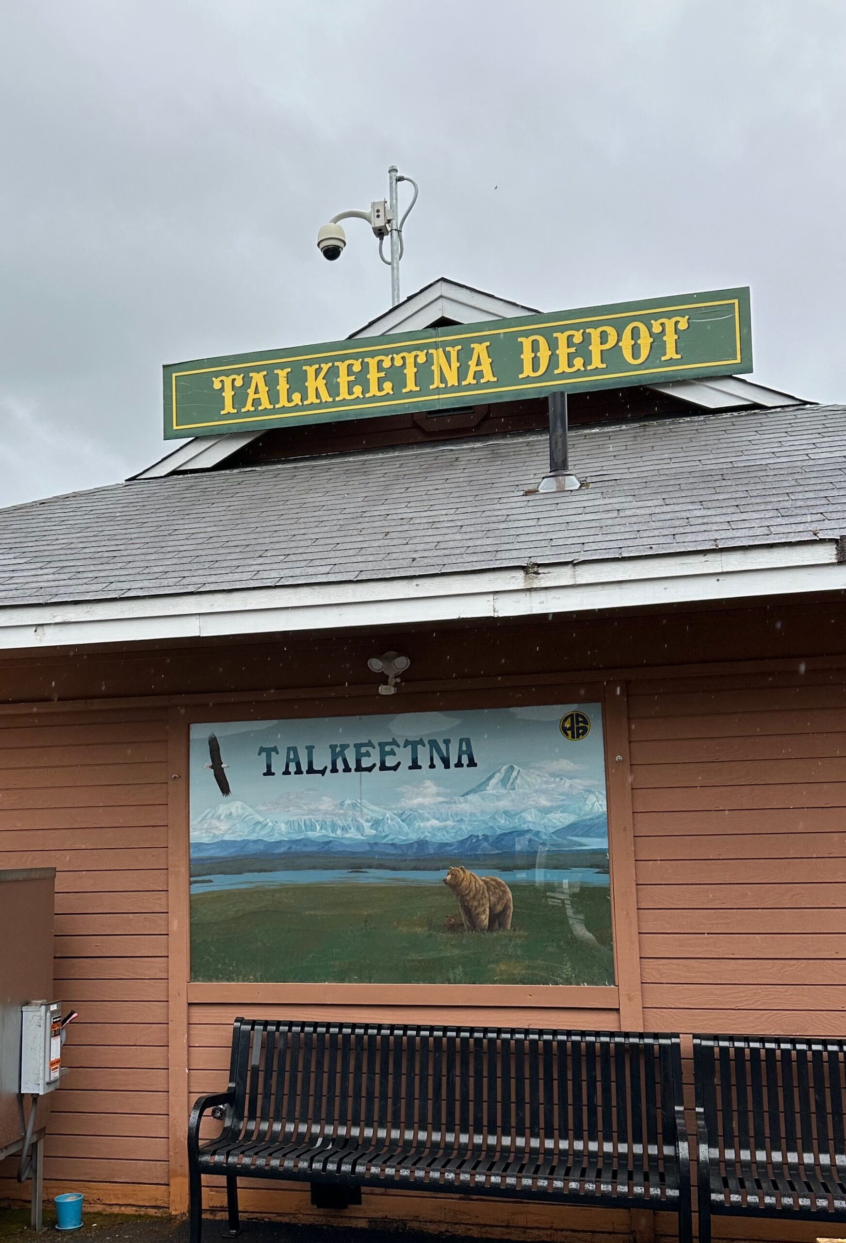
We had a quick stop at the Talkeetna Depot.
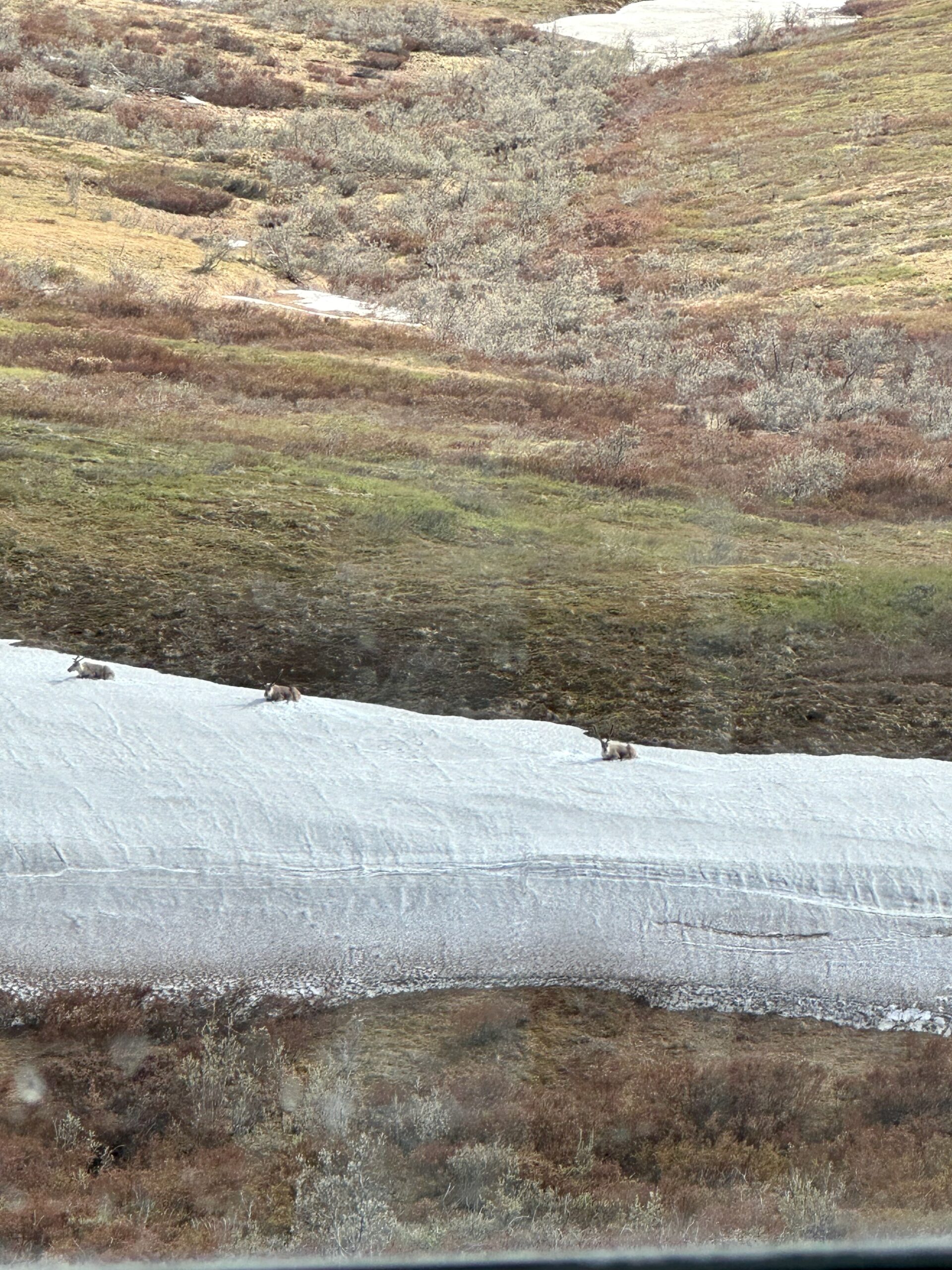
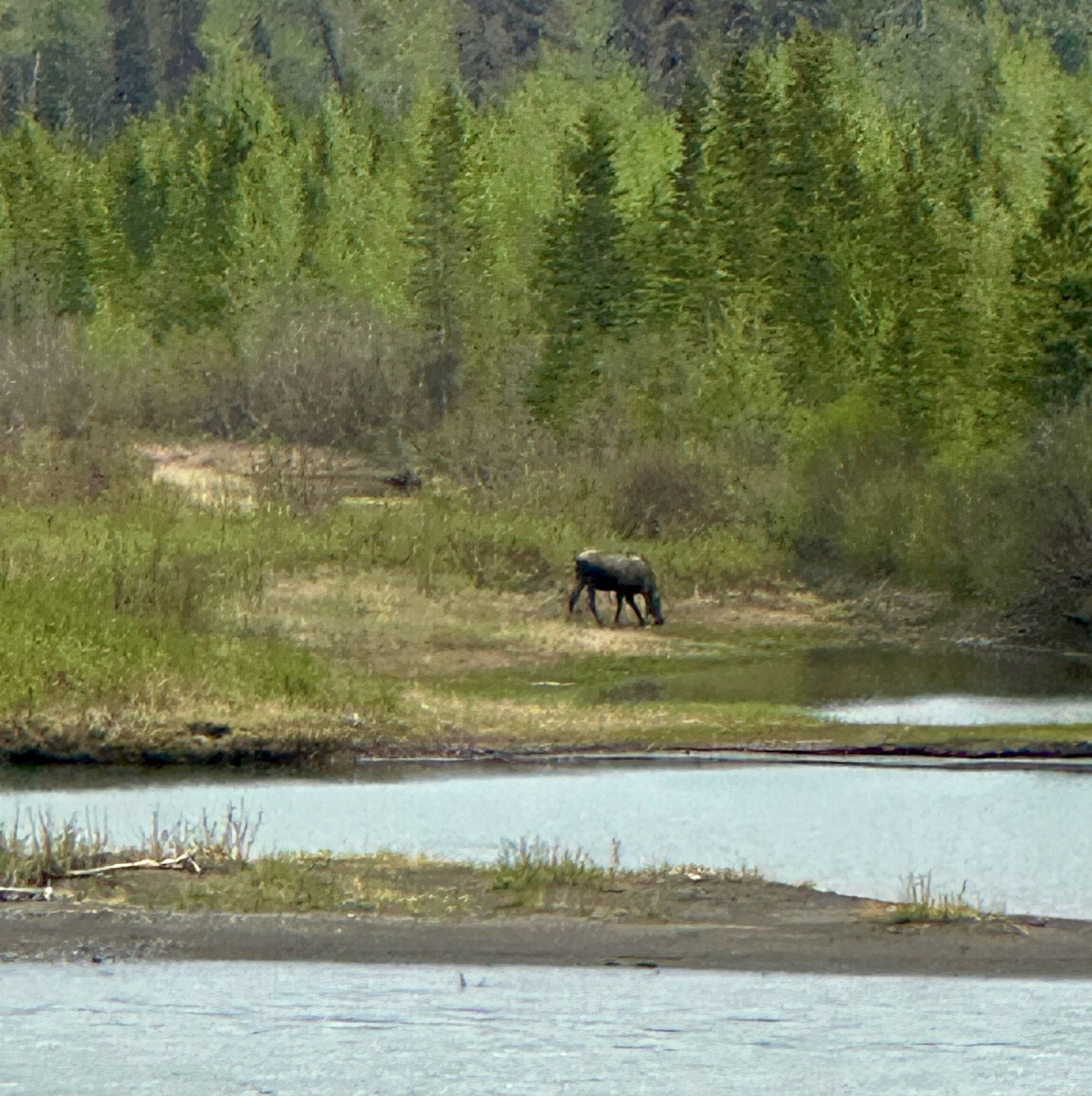
My goals on this trip are to spot a moose and see whales. I caught this shot from the train.
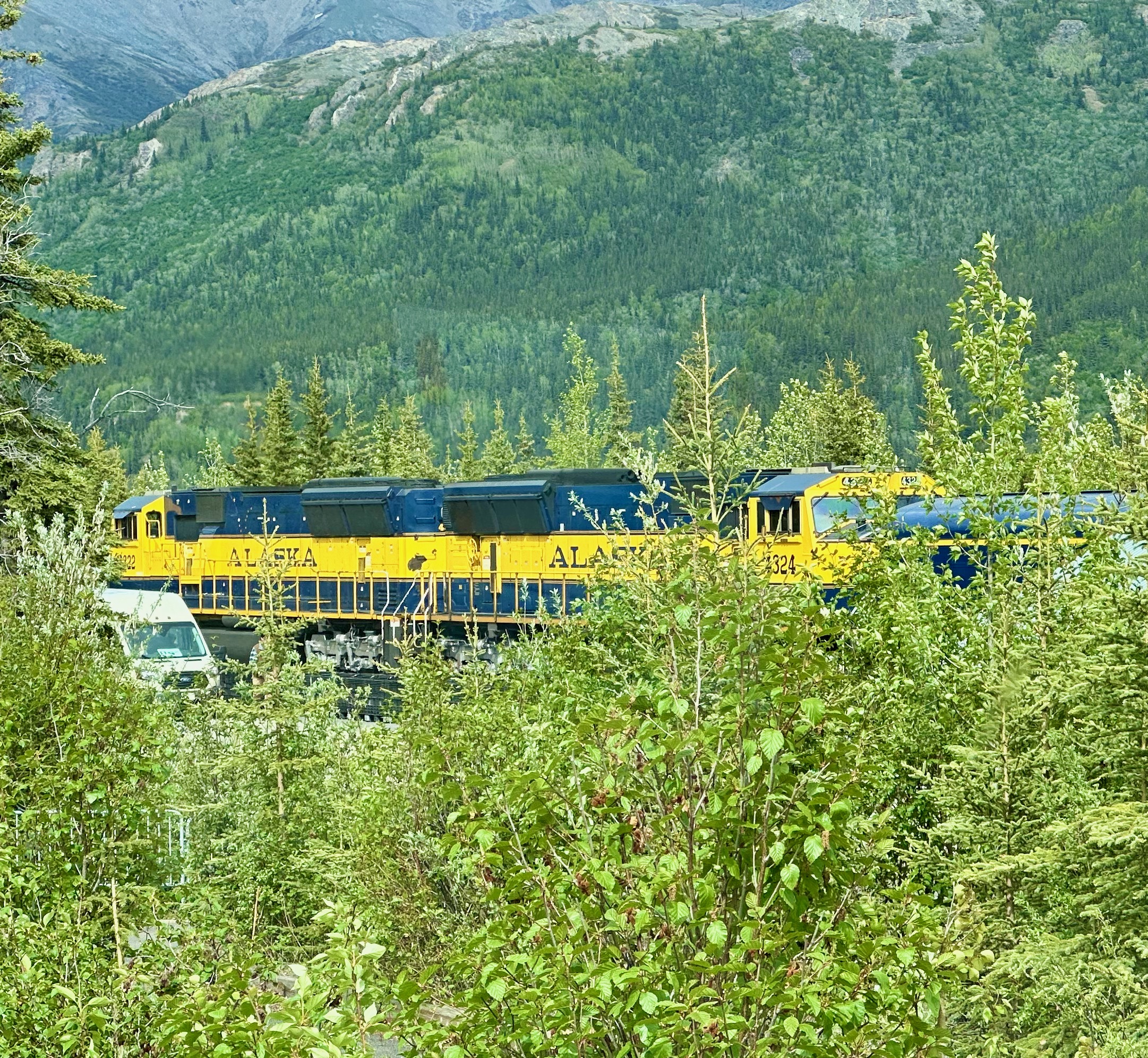
One last shot of the engines while we disembarked in Denali.
Here’s the view we have from the terrace below our room for the next two nights.
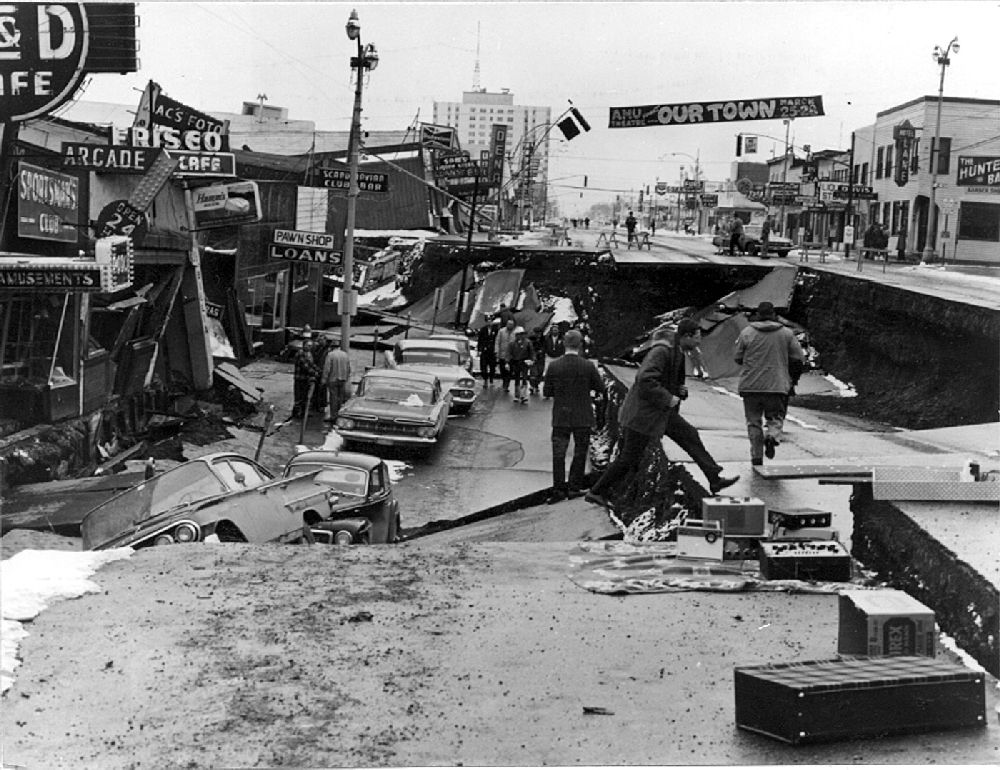
We took a trolley tour of Anchorage today. Sure, it’s touristy, but if you only have one day in a city, it’s a great way to get a general sense of the place. The only downside? Everything went by so fast, there was NO TIME TO SNAP A PIC. The trolley whisked us through several neighborhoods, showcasing Anchorage’s economic diversity, from trailer parks to mansions. As we trundled down 4th Avenue, our guide explained how the street was dramatically altered by the 1964 earthquake. This 9.2 magnitude quake still holds the record for the largest in U.S. history and the second largest in the world. The North American Plate and the Pacific Plate run right down the middle of the road, splitting it in half. During the quake, the Pacific Plate side sank a full story. Today, some buildings have their original second floors at street level.
Next, we visited Earthquake Park, which used to be a neighborhood of elegant homes. During the quake, the ground liquefied, washing all the homes out to sea. It’s a sobering reminder of nature’s power. The highlight of the tour was the Lake Hood Seaplane Base, the busiest seaplane base in the world. The road winds around the natural shore of the lake, with slips for planes and little storage huts dotting the landscape. In total, there are 781 aircraft here. The 500 float slips cost just $105 per month, but there’s a catch—the wait time to get one is 3,352 days (that’s over nine years!).
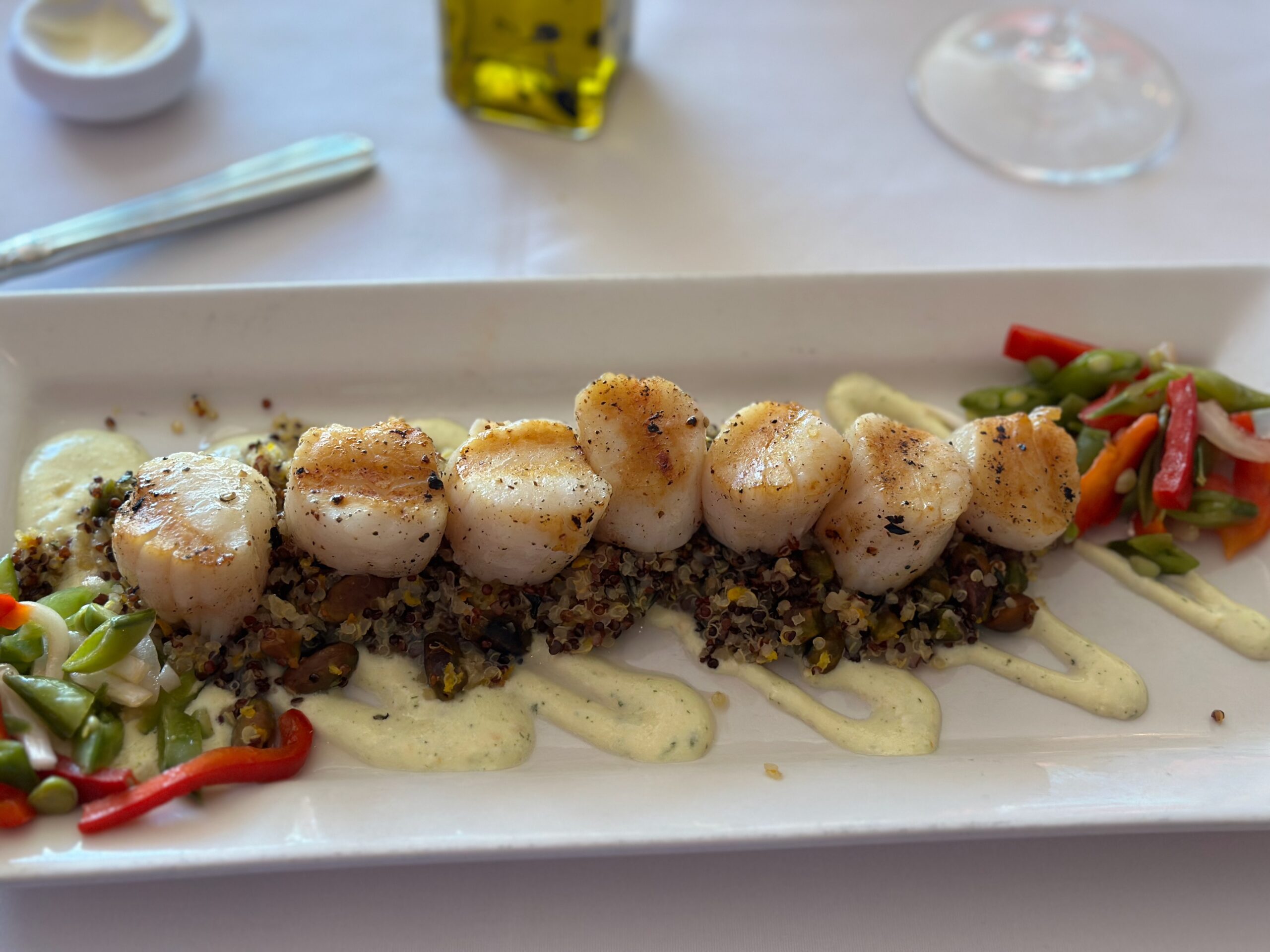
Jen’s Restaurant did not disappoint.
Grilled Kodiak Scallops Citrus and pistachio quinoa, whipped feta, sugar snap pea and red bell pepper salad.
We’re up early tomorrow (at the crack of dawn?) to catch the train to Denali.
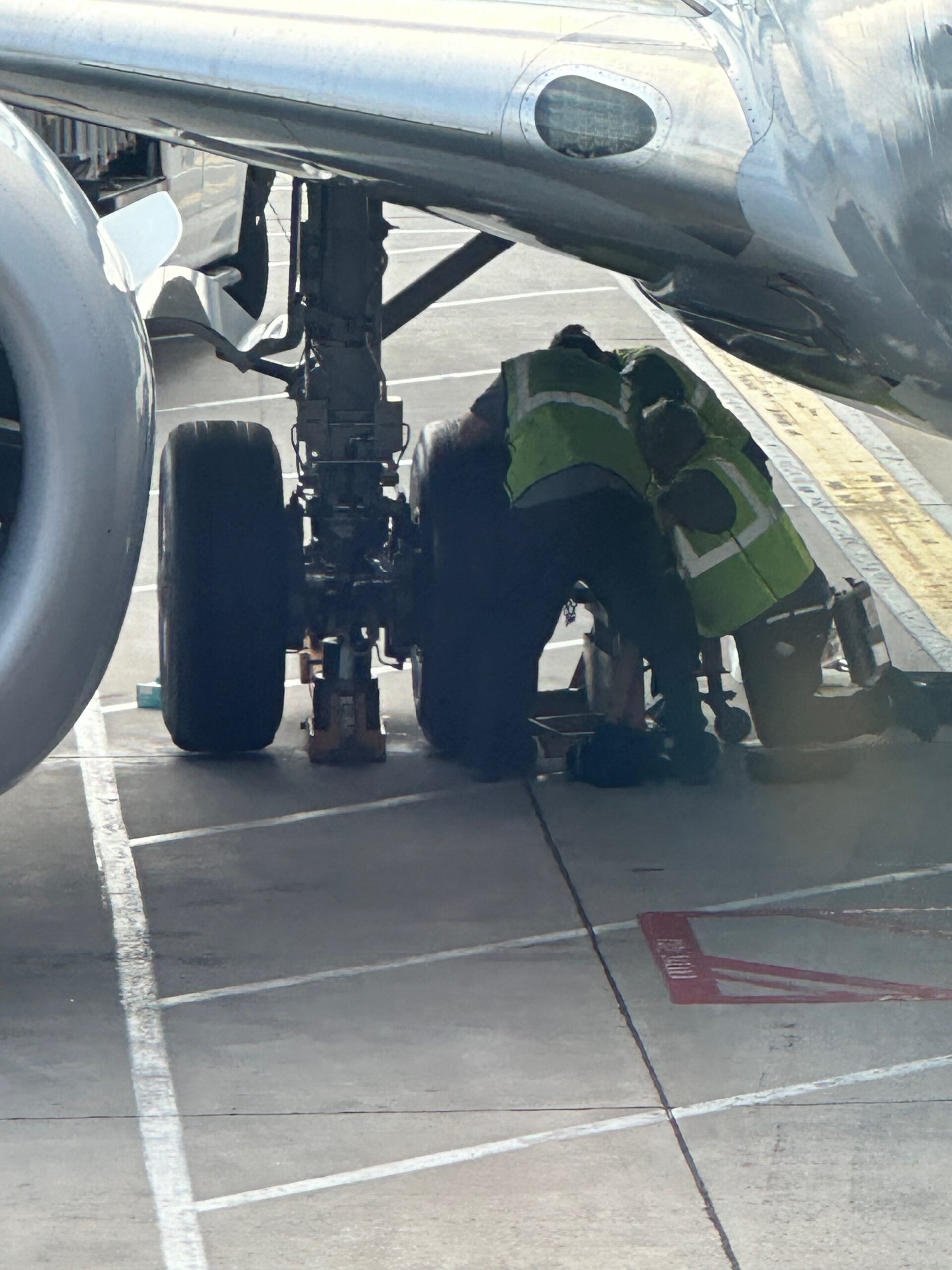
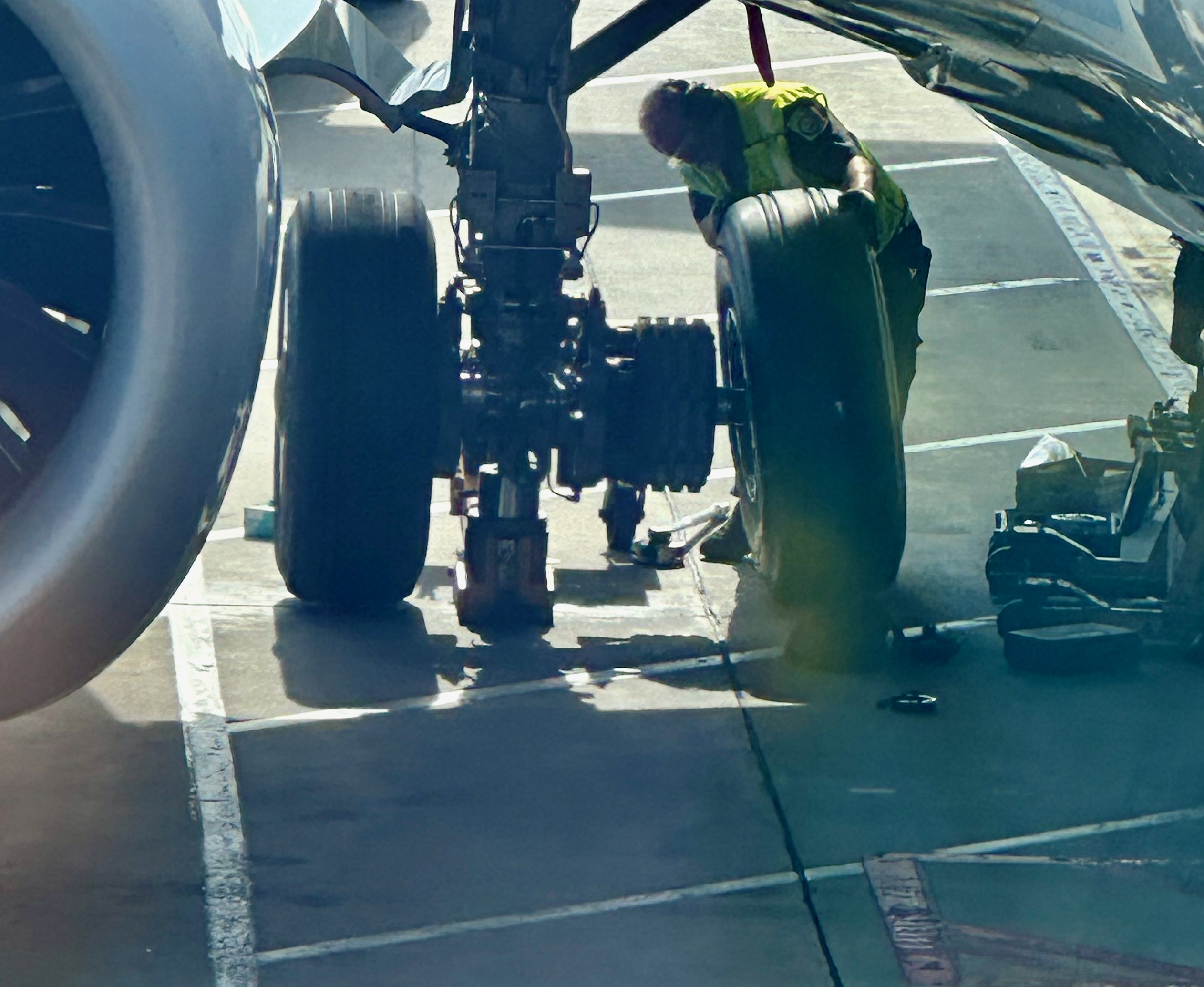
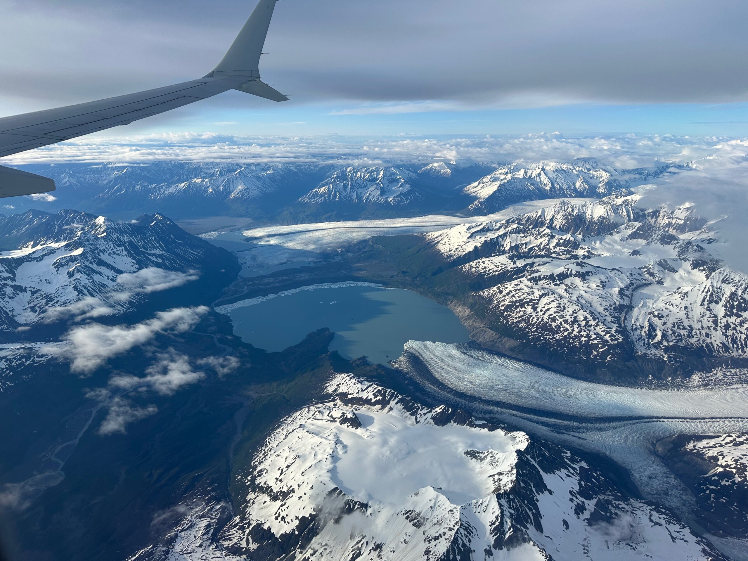
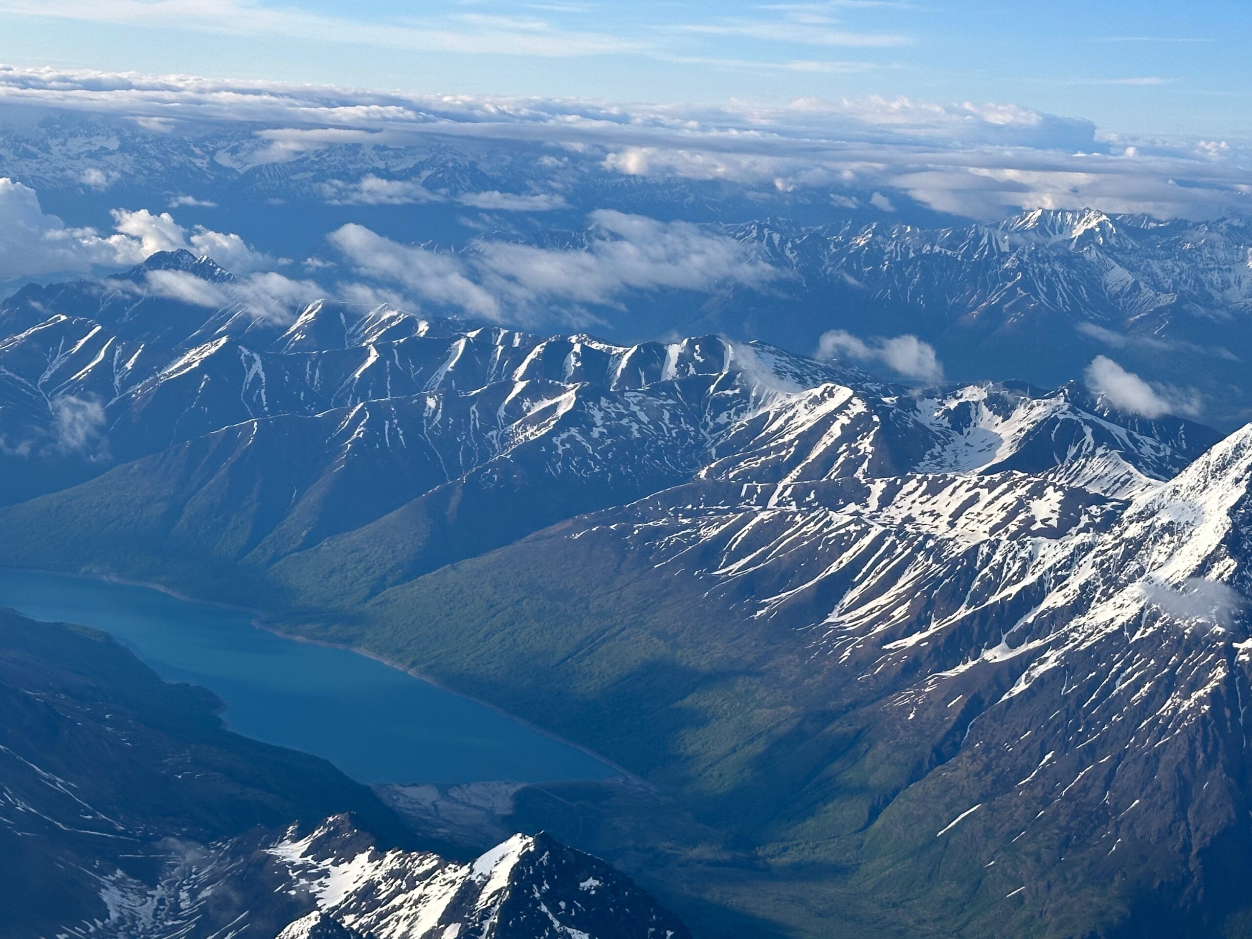
So we flew out yesterday on a 737 Max 8, so you know there had to be some bad parts on the plane. Ours turned out to be a wheel. Once we got going the flight was uneventful. It was a 6 1/2 hour flight, overcast most of the way. And while they found a new wheel for the plane they weren’t able to find any food for those in steerage class so that little bag of pretzels had to tide us over. Once the clouds cleared as we got closer to Anchorage we were treated to some incredible views, including glaciers.
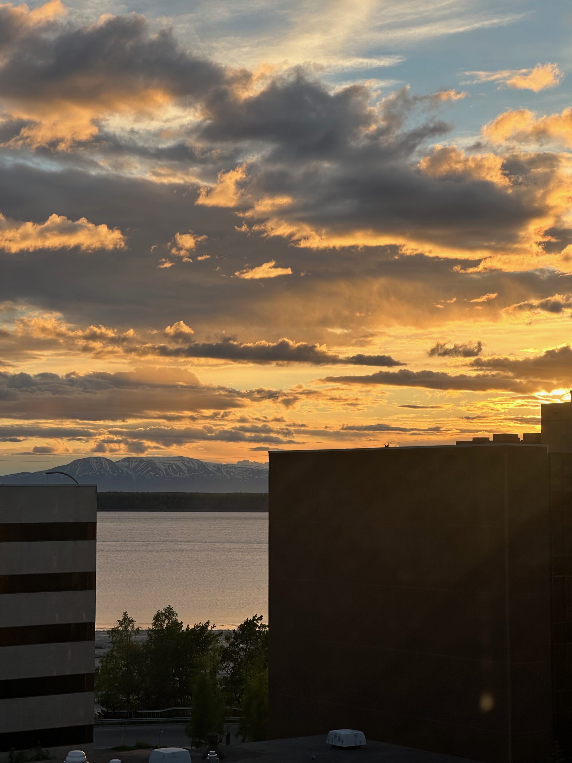
After a long and tiring day, you’d think sleep would come easily. However, that wasn’t the case. We had read about the sun rising at 3:30 AM and not setting until 11:00 PM, but reading about it is quite different from experiencing it firsthand. It turns out it never really gets dark. Here’s a shot of the view from our hotel at 10:45 PM.
Tonight we are dining at Jen’s Restaurant for some local cuisine. I found out about it from a UPS pilot who I follow on Twitter. She flies all around the world and always posts comments about food. Tomorrow will be an early rise (shouldn’t be difficult with dawn at 3:30 AM) to catch the train to Denali.